The 18 Most Amazing Peaks around Vilaller
Best mountain peaks around Vilaller are found in the Pyrenees, with the town situated in the Vall de Barravés within the province of Lleida. This location provides access to the Catalan Pyrenees and the Aigüestortes i Estany de Sant Maurici National Park. The average elevation of Vilaller is 1,845 meters, with surrounding peaks reaching up to 3,207 meters. The area offers a range of mountainous terrain for outdoor enthusiasts.
Best mountain peaks around Vilaller
- The most popular mountain peaks is Pico de Aneto Summit, a summit that is the highest peak in the Pyrenees. At its top, visitors will find a metal cross, a statue of the Virgen del Pilar, and a bust of San Marsial.
- Another must-see spot is Collet de Contraix, a mountain pass that is the highest point on the Carros de Foc route at 2748 meters. It serves as a key step to link the refuges of Estany Llong and Joan Ventosa and Calvell.
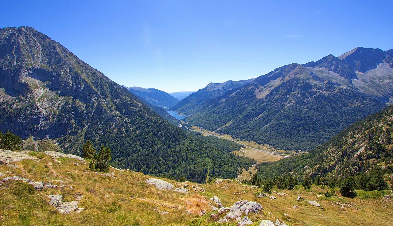
- Visitors also love Artiga de Lin Valley, a viewpoint considered one of the most beautiful areas of the Aran Valley. This wild landscape is surrounded by rugged mountains.
- Vilaller is known for summits, mountain passes, and viewpoints. The variety of mountain peaks to see and explore offers options for different levels of challenge and scenic experiences.
- The mountain peaks around Vilaller are appreciated by the komoot community, with 16 upvotes and 18 photos shared across the highlights.
Last updated: July 6, 2026
Pico de Aneto Summit
Highlight • Summit
At the top you will find a gigantic metal cross, a statue of the Virgen del Pilar and a small bust of San Marsial, patron saint of Benasque. Each of them installed by different groups that want to make their own a piece of this colossus that, although it is difficult to believe, went unnoticed for centuries in the shadow of the apparently more prominent Tuca de la Maladeta (from the Occitan "Mall Hita", the 'high peak').
Translated by Google •
Tip by

Bonansa Pass
Highlight • Mountain Pass
Translated by Google •
Tip by

Sign up now to discover places like this
Get recommendations on the best single tracks, peaks, & plenty of other exciting outdoor places.
Sign up for free
Mahoma Pass
Highlight • Climb
Albert de Franqueville, one of the first men to summit the Aneto, was the one who gave this name to this part of the mountain: "Fineer than a hair and sharper than a saber", that is the bridge of Muhammad according to the legend: the entrance to Paradise, at the top of the Aneto, for the eyes of Franqueville.
The factors for which this step is dangerous are:
- The verticality on both sides of the step and the inevitable feeling of vertigo. A fall is fatal.
- In some sections you have to use your hands to move forward.
- The possible density of people crossing the pass. All mountaineers who climb Aneto must cross this pass twice: to go there and to return. There are points on the Muhammad Bridge where two people cannot cross. Be patient.
- The possible presence of water, ice and snow, which can make the passage slippery.
- Vulnerability to lightning strikes in the event of a storm.
For these reasons, it is not necessary to do this section of the ascent if it is not completely safe, nor to force anyone to go through it. Accumulated fatigue and nerves are a bad combination that can end in fatality.
Translated by Google •
Tip by

Artiga de Lin Valley
Highlight • Viewpoint
Translated by Google •
Tip by

Collet de Contraix
Highlight • Mountain Pass
Tip by

Sign up for free to discover even more peaks around Vilaller.
Sign up for free
Already have an account?
Start today with a free account
Your next adventure awaits.
Login or Signup


Other adventures around Vilaller

Tips from the Community

Very difficult passage, you have to be careful
0
0

The highest peak in the Pyrenees mountaineering region.
1
0

The highest peak in the Pyrenees and the one everyone wants to climb. Its demands are more physical than technical, with the exception of the Mahoma Pass, not suitable for those with vertigo, and the Aneto Glacier, which is recommended to avoid in the middle of summer when the hard centuries-old ice is exposed and landslides increase due to melting. At the top you will find a gigantic metal cross, a statue of the Virgen del Pilar and a small bust of San Marsial, patron saint of Benasque. Each of them installed by different groups that want to make their own a piece of this colossus that, although it is difficult to believe, went unnoticed for centuries in the shadow of the apparently more prominent Tuca de la Maladeta (from the Occitan "Mall Hita", the 'high peak').
1
0

A table-bench combination in the shade of the forest.
1
0

This port connects the Noguera Ribagorzana river basin with the Sis valley and the Isábena basin, right on the border between Catalonia and Aragon. From Bonansa, the pass is a little over six kilometers long, with a fairly constant average drop of around 7%. Its other slope, the one that follows the Obarra gorge until it crowns the port, is much longer. It is 15 kilometers long, but it is very flat, with percentages around 3%, until it practically reaches the top, where the last two kilometers present considerable unevenness, with ramps of more than 15%.
0
0

The port of Bonansa is located at an altitude of 1,380 meters, in an open area from which you can see the panorama of the surrounding mountains. The climb is demanding, but worth it.
1
0

The port of Bonansa is located at an altitude of 1,380 meters. On one side of the pass is the town of Bonansa, and on the other, an extensive pine forest that marks the beginning of the descent to the Obarra gorge.
0
0

Aneto is the highest peak in the Pyrenees and the second highest in the Iberian Peninsula, with an altitude of 3,404 meters above sea level. It is located in the Posets-Maladeta Natural Park, in the Spanish municipality of Benasque, province of Huesca, autonomous community of Aragon. It is part of the Maladeta massif and, located in the Benasque valley, is made up of Paleozoic terrain of granitic nature and Mesozoic materials. On its northern face, starting at approximately 2810 m, is the largest glacier in the Pyrenees, with about 100 hectares of surface, which is, like many in the world, in clear regression as a consequence of climate change (it is estimates that in the last 100 years it has lost more than half of its surface, and that in 30 or 40 years it may disappear).
2
0
Frequently Asked Questions
What are some of the most notable mountain peaks to explore around Vilaller?
Vilaller offers access to several impressive peaks. The most popular is Pico de Aneto Summit, the highest peak in the Pyrenees. Another significant point is Collet de Contraix, a mountain pass that is the highest point on the Carros de Foc route. Additionally, the Artiga de Lin Valley offers a beautiful wild landscape surrounded by rugged mountains.
What are some challenging mountain routes for experienced hikers near Vilaller?
For experienced hikers seeking a challenge, the ascent to Pico de Aneto Summit is primarily a physical demand, though it includes the notable Mahoma Pass, which requires careful navigation. Pico Mulleres also presents a difficult 11.0-mile trail with a significant elevation gain. Besiberri Sud, located within Aigüestortes National Park, is an 8.6-mile route requiring very good physical fitness and alpine experience.
Are there any less technical or easier mountain passes to explore around Vilaller?
Yes, the Bonansa Pass, located at 1,380 meters, offers a demanding but rewarding climb with panoramic views of the surrounding mountains. While the climb is considered intermediate, it provides a more accessible mountain experience compared to the higher peaks.
What unique natural features or landmarks can I expect to see on the mountain peaks around Vilaller?
On Pico de Aneto Summit, you'll find a large metal cross, a statue of the Virgen del Pilar, and a bust of San Marsial. The Besiberri Sud area is known for its stunning mountain environment, including the picturesque Besiberri lakes set amidst towering granite cliffs. The Artiga de Lin Valley is celebrated for its wild landscape and rugged mountains.
Where can I find panoramic views of the Pyrenees near Vilaller?
Many peaks offer breathtaking vistas. The summit of Pico de Aneto provides unparalleled views as the highest point in the Pyrenees. Pico Mulleres also promises extensive panoramic views after its arduous hike. The Bonansa Pass and Artiga de Lin Valley are also excellent spots for scenic mountain views.
What is the typical elevation range of mountain peaks around Vilaller?
Vilaller itself has an average elevation of 1,845 meters. The surrounding mountain peaks reach significant heights, with maximum elevations in the area going up to 3,207 meters, offering a dramatic mountainous terrain.
What outdoor activities can I do near these mountain peaks around Vilaller?
Beyond peak bagging, the region around Vilaller is excellent for various outdoor activities. You can find numerous gravel biking routes, such as the 'Bonansa – El Pont de Suert loop', and road cycling routes like the 'Bonansa Pass – Mirador de Montanuy climb loop'. There are also running trails, including the 'Besiberri Lake Trail' and 'Cap de Gelada - Ramat de Camins Loop'. For more details, explore the Gravel biking around Vilaller, Running Trails around Vilaller, and Road Cycling Routes around Vilaller guides.
Are there specific permits required for hiking certain peaks or areas, especially within Aigüestortes National Park?
The region research mentions Besiberri Sud is within Aigüestortes National Park. While specific permit details are not provided here, it is generally advisable to check with the park authorities for any required permits or regulations, especially for challenging routes or overnight stays within national parks.
What is the best time to visit the mountain peaks around Vilaller?
The region research suggests that the Aneto Glacier is best avoided in mid-summer due to exposed ice and increased landslide risks from melting. Generally, late spring to early autumn offers more favorable weather conditions for hiking and climbing in the Pyrenees, though specific peak conditions can vary. Always check local weather and trail conditions before heading out.
What do visitors enjoy most about the mountain peaks around Vilaller?
Visitors appreciate the variety of mountain peaks, passes, and viewpoints that offer options for different levels of challenge and scenic experiences. The prestige of summiting the highest peak in the Pyrenees, the breathtaking views, and the sense of accomplishment are frequently highlighted. The wild landscapes and natural beauty, such as those found in the Artiga de Lin Valley, are also highly valued.
Is the Mahoma Pass on Pico de Aneto suitable for everyone?
The Mahoma Pass is a horizontal passage of 40 meters with considerable verticality on both sides, separating the summit of Aneto. It is explicitly noted as not suitable for those with vertigo due to the inevitable feeling of exposure. It can also be dangerous due to potential crowds, slippery conditions from water/ice, and vulnerability to lightning. It's recommended not to attempt this section if it's not completely safe or if you're not comfortable with the conditions.
Most popular routes around Vilaller
Most popular attractions around Vilaller

Get inspired with the komoot mobile app


Explore more
See even more amazing summits around Vilaller with these guides:
