The best running trails around El Campillo
5.0
(1)
326
runners
16
runs
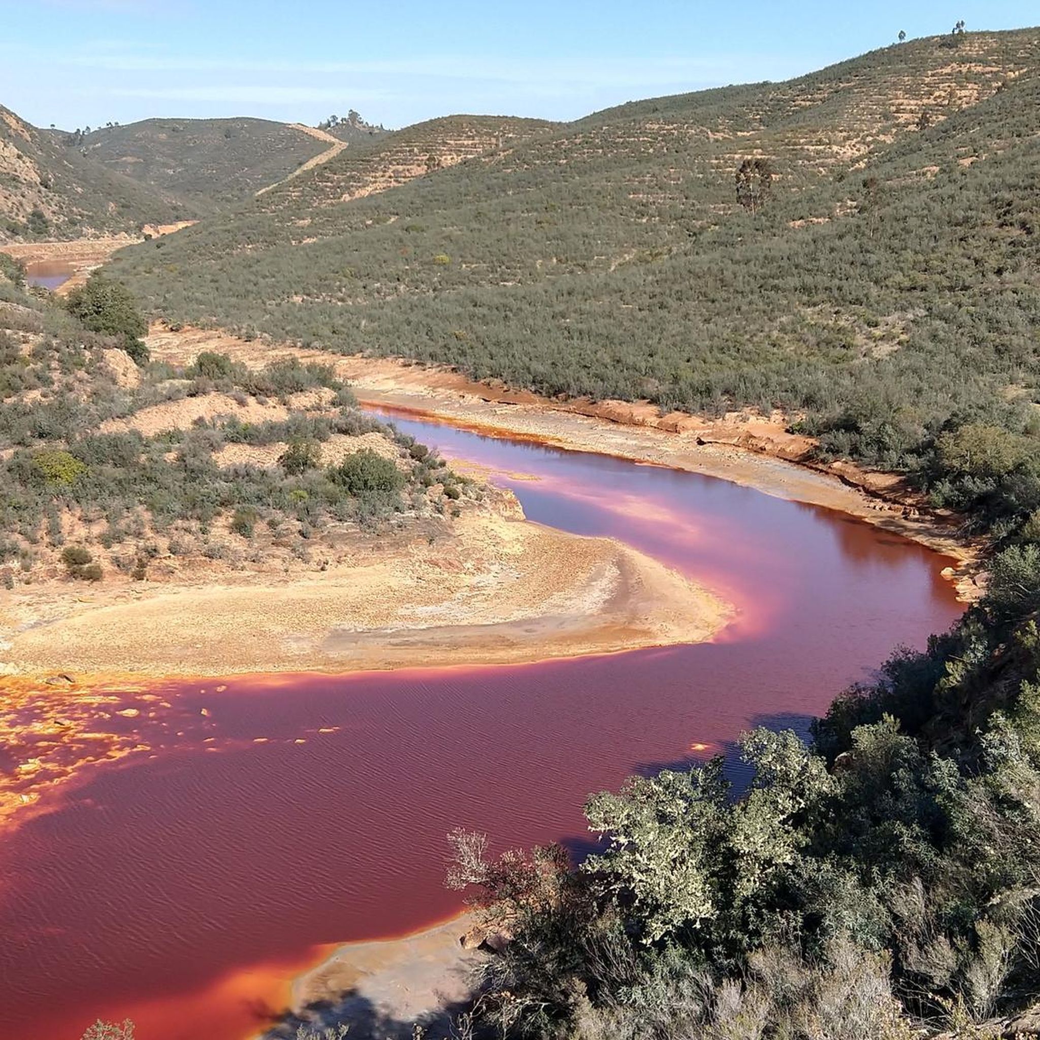
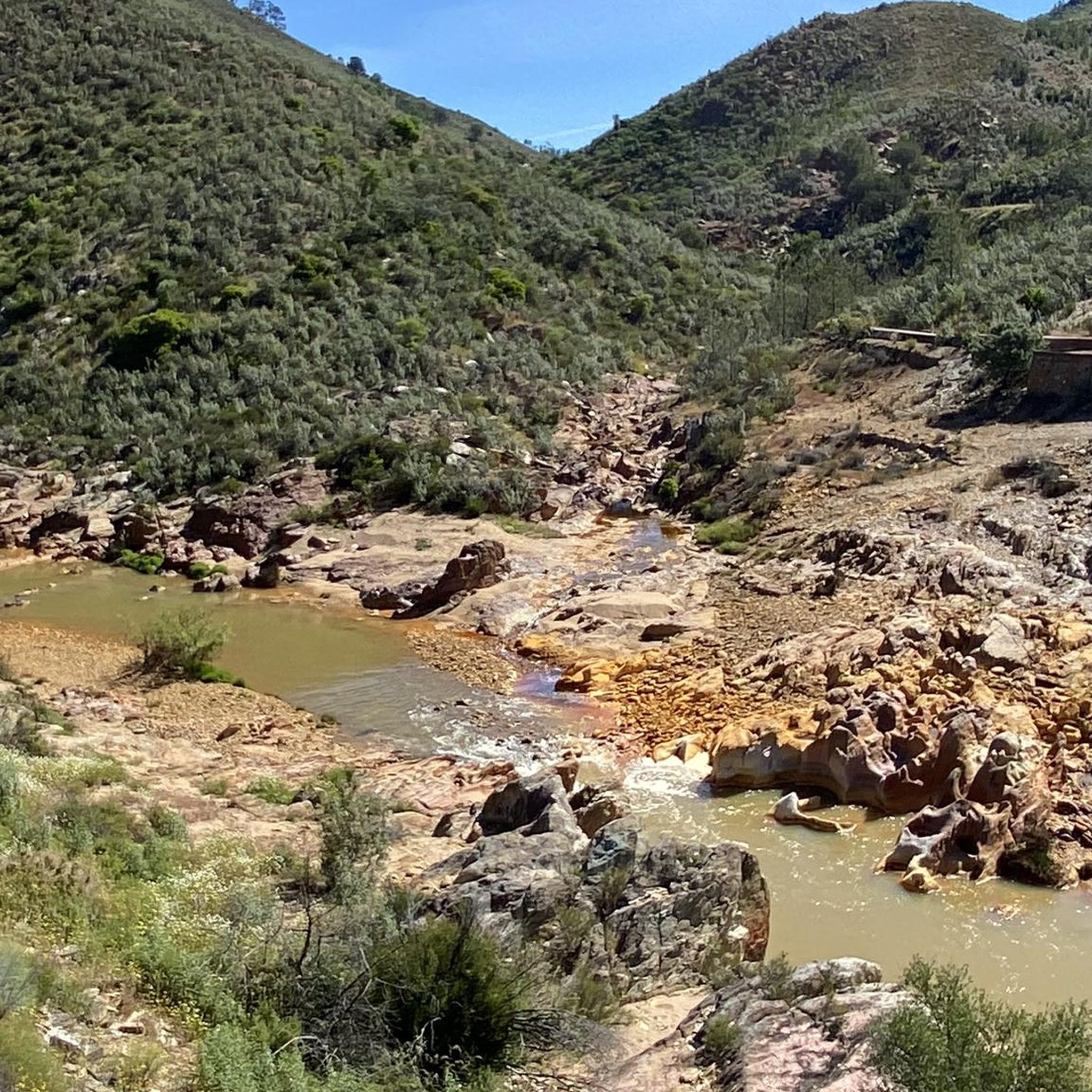
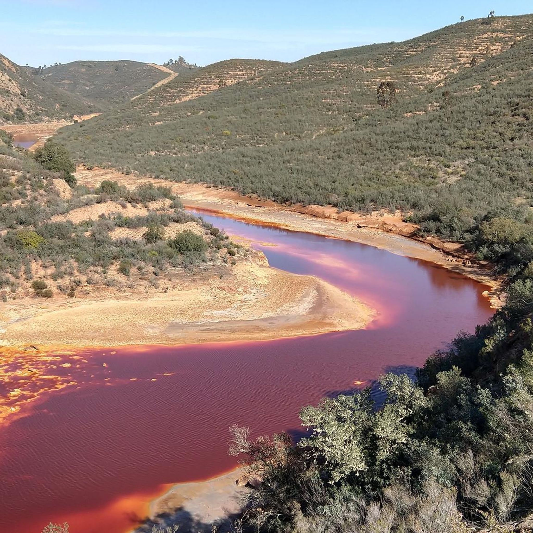
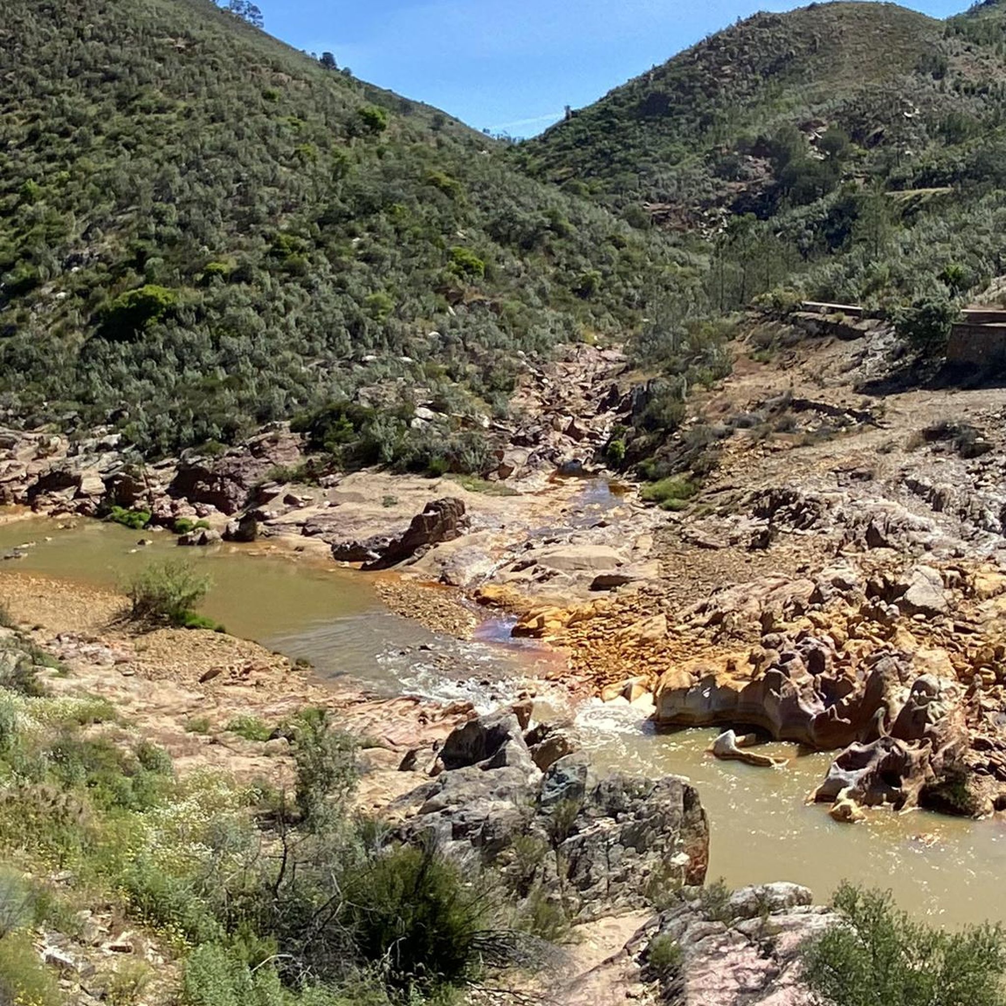
Jogging routes around El Campillo are set within the initial elevations of the Sierra Morena, transitioning into El Andévalo. The region is characterized by its unique landscapes shaped by the Río Tinto, known for its distinctive reddish coloration due to high iron content. Runners will encounter varied terrain, from the banks of the Tinto and Odiel rivers to the gentle mountains with altitudes ranging from 150 meters to 580 meters. This area also features a rich mining heritage, which has…
Last updated: June 26, 2026
2
runners
15.4km
01:52
260m
260m
Hard run. Very good fitness required. Mostly paved surfaces. Suitable for all skill levels.
15.3km
02:00
420m
420m
Jog a difficult 9.5-mile (15.3 km) circular route from Berrocal, exploring the unique red landscapes of the Rio Tinto.

Sign up for free
15.4km
02:02
430m
430m
This difficult 9.5-mile (15.4 km) trail run near Berrocal offers challenging terrain, river views, and panoramic vistas from Río Tinto Viewp
65
runners
33.7km
04:43
1,300m
1,300m
Hard run. Very good fitness required. Mostly paved surfaces. Suitable for all skill levels.
5.0
(1)
48
runners
17.6km
02:30
790m
790m
Hard run. Very good fitness required. Mostly paved surfaces. Suitable for all skill levels.
Get access to more routes and recommendations from other explorers.
Sign up for free
Already have an account?
Our route recommendations are based on thousands of hikes, rides, and runs completed by other people on komoot.
Start today with a free account
Your next adventure awaits.
Login or Signup
Tips from the Community

The Peña del Hierro Viewpoint, located in Nerva (Huelva), is part of the Riotinto Mining Park and offers one of the most impressive views of the source of the Tinto River, as well as the mining crater of the old pyrite mine.
1
0
The source of the Tinto River is located in the municipality of Nerva, in the province of Huelva, Andalusia, and is one of the most unique landscapes in Europe due to its reddish color and its scientific and geological value.
1
0

An approximately 3 kilometer long circular route leads around the natural monument Montera de Gossan. Don't miss it because of the beautiful views.
0
0

Also known as the Padre Caro mountain range, it indicates the source of the Río Tinto which runs through the interior of Huelva for about 100 km until it reaches the Odiel River. Its name is due to the reddish color of its waters, caused by the weathering of minerals with a high content of heavy metal sulfides that were found and exploited in various deposits along the riverbed.
0
0

Views of one of the meanders formed by the Rio Tinto as it passes through the municipality of Berrocal.
1
1
Religious sanctuary of the town of Berrocal. Said congregation was divided into two buildings that represented two sides, the one above and the one below. That is why we still find the Hermitage of the Brotherhood of the Santa Cruz de Abajo and the one above.
1
1

Very nice vantage point with picnic area.
1
0

Bridge that crosses the Río Tinto in its red colors and unusual waters with these dyes. The pedestrian-only bridge crosses both sides of the river.
0
1
Frequently Asked Questions
What kind of terrain can I expect on running routes around El Campillo?
Running routes in El Campillo offer a diverse landscape, characterized by the initial elevations of the Sierra Morena and the transition into El Andévalo. You'll encounter varied gradients, with altitudes ranging from 150 meters to 580 meters. A prominent feature is the unique Río Tinto, known for its reddish coloration, which many routes follow. The area also boasts a rich mining heritage, adding distinctive visual elements to the trails.
Are there running routes suitable for beginners in El Campillo?
While El Campillo is known for its more challenging trails, there are several moderate options available. The guide lists 5 moderate routes, which could be suitable for runners with some experience looking for a less strenuous run than the difficult trails. Currently, there are no routes specifically categorized as 'easy' in this guide.
What natural features or landmarks can I see while jogging in El Campillo?
El Campillo's running routes are rich in natural beauty and historical landmarks. You can experience the visually striking Source of the Río Tinto, known for its unique reddish waters. Other notable sights include the Peña del Hierro and remnants of the region's mining past, such as the Corta Atalaya Mine and the Cachán Bridge. The area's mining heritage has created unique visual elements and pathways, offering a 'natural museum' experience.
Are there any circular running routes in El Campillo?
Yes, several running routes around El Campillo are circular, allowing you to start and end in the same location. For example, the route Peña del Hierro y nacimiento del Río Tinto - running circular desde Nerva is a popular circular option, offering views of the unique Río Tinto.
What do other runners enjoy most about jogging in El Campillo?
The running routes in El Campillo are highly rated by the komoot community, with an average score of 5.0 stars. Runners often praise the unique landscapes shaped by the Río Tinto, the varied terrain, and the opportunity to explore the region's rich mining heritage. The challenging nature of many trails also appeals to those seeking a more demanding run.
Are there any family-friendly running trails in El Campillo?
While many routes in El Campillo are categorized as moderate to difficult due to the mountainous terrain and elevation changes, some sections or shorter loops might be suitable for families with older children who are accustomed to outdoor activities. It's advisable to check the specific route details for distance and elevation before heading out with younger family members.
Can I bring my dog on the running routes in El Campillo?
The natural landscapes around El Campillo generally welcome dogs, but it's always best to check local regulations for specific trails or protected areas. When running with your dog, ensure they are well-behaved, kept on a leash where required, and that you carry bags to clean up after them. Be mindful of other trail users and wildlife.
What is the best time of year to go running in El Campillo?
El Campillo offers good running conditions for much of the year. Spring and autumn generally provide pleasant temperatures, making them ideal for longer runs. Summers can be hot, so early morning or late evening runs are recommended during these months. Winters are typically mild, but it's always wise to check the weather forecast and wear appropriate gear for any season.
Are there any long-distance running options in El Campillo?
Yes, El Campillo offers several longer running routes for those seeking a challenge. For instance, the Cachán Bridge – Riscos Altos Viewpoint loop from Los Frailes is a difficult route spanning approximately 33.7 km, with significant elevation gain, providing a substantial workout for experienced runners.
How many running routes are available around El Campillo?
There are 11 running routes detailed in this guide for the El Campillo area. These routes offer a variety of distances and difficulties, from moderate to difficult, allowing runners to choose an option that best suits their fitness level and preferences.
Is public transport or parking available near the running trails in El Campillo?
El Campillo is a municipality in Huelva, Spain, and while specific public transport links directly to trailheads might be limited, the town itself is accessible. For most trails, driving and parking would be the most convenient option. Many routes start from or pass through towns like El Campillo or Berrocal, where parking facilities are generally available. It's advisable to check the starting point of your chosen route for specific parking information.
Are there any routes that explore the historical mining areas?
Absolutely. The region's rich mining heritage is a defining characteristic, and many running routes incorporate elements of this history. You might encounter remnants of historical mining operations, such as old train stations from the Riotinto railway, or mines like Mimbrera and Mina Poderosa. The unique landscape shaped by mining, including old mining-metallurgical reservoirs, adds a fascinating historical dimension to your run.
Most popular attractions around El Campillo

Get inspired with the komoot mobile app


Explore more
Browse the best Running Trails & Routes in other regions.
