The best cycling routes around La Codosera
5.0
(2)
23
riders
6
rides
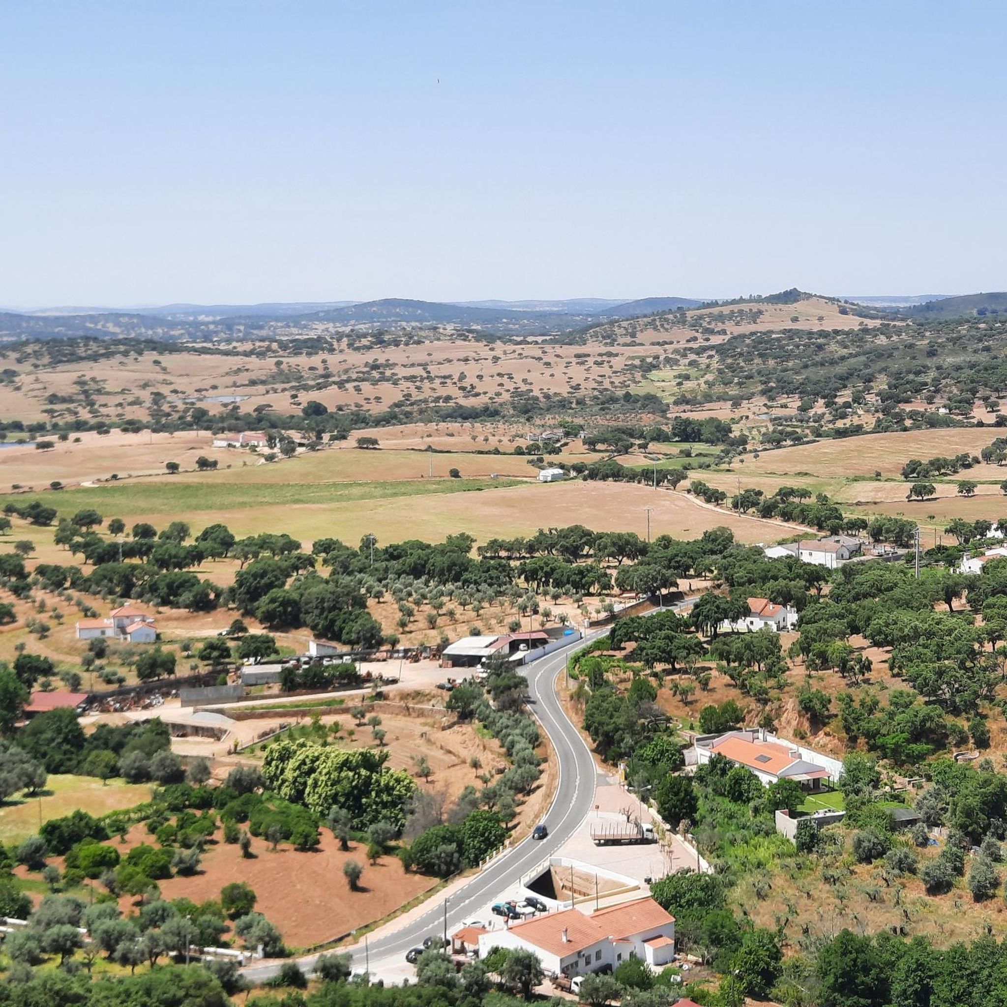
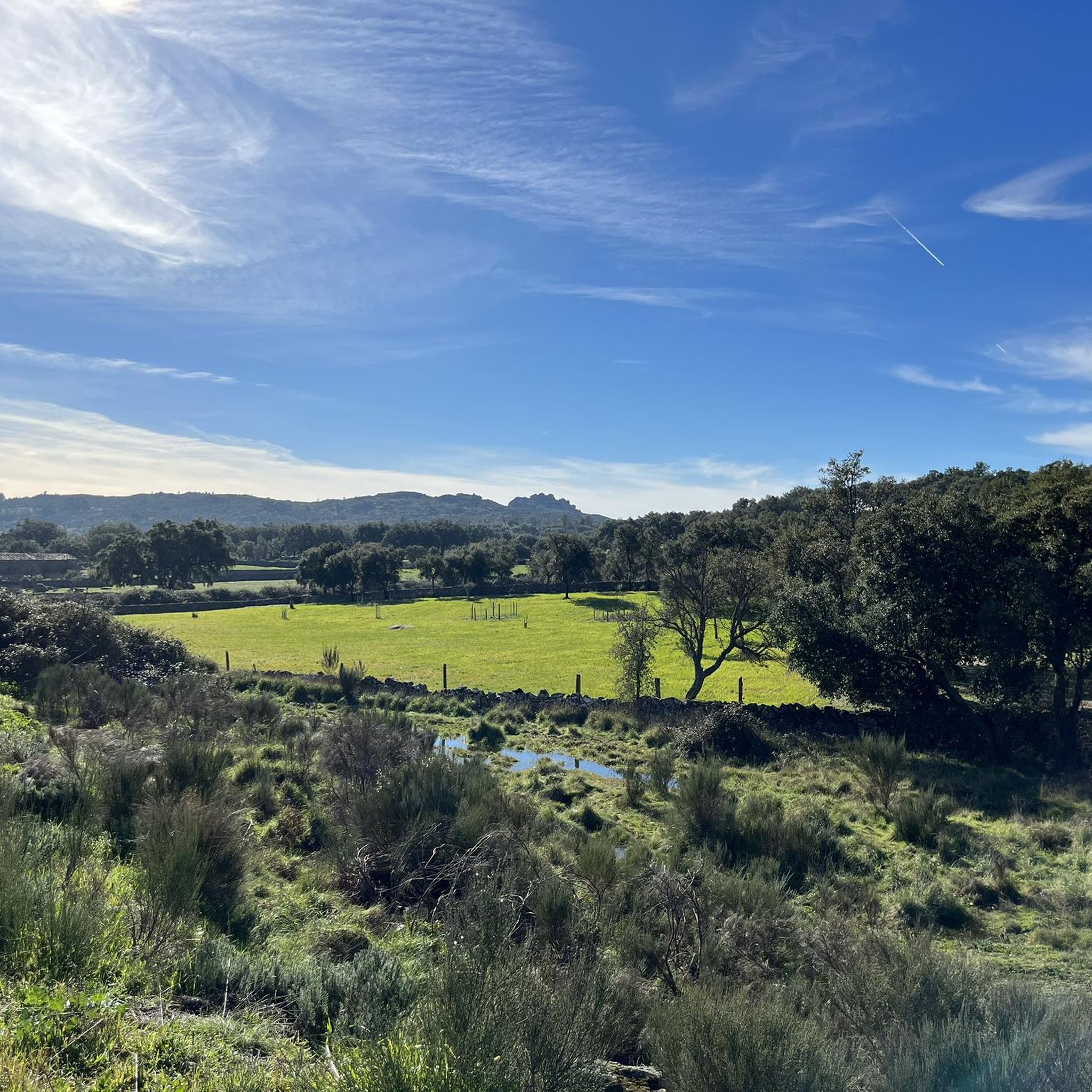
Touring cycling routes around La Codosera traverse a varied landscape of rolling hills, river valleys, and extensive forests. The region is characterized by dense woodlands of holm oak, cork oak, and chestnut, alongside olive groves and the distinctive "dehesa" agroforestry system. The Gévora River carves through the area, creating lush riverbanks and supporting a rich ecosystem. Cyclists encounter undulating topography, with routes ranging from gentle paths through valleys to more demanding ascents and descents in the surrounding mountain ranges like…
Last updated: June 27, 2026
5.0
(1)
3
riders
20.0km
01:14
220m
220m
Moderate bike ride. Good fitness required. Mostly paved surfaces. Suitable for all skill levels.
5
riders
31.0km
02:10
540m
540m
Hard bike ride. Very good fitness required. Mostly paved surfaces. Suitable for all skill levels.

Sign up for free
5
riders
45.5km
04:45
1,240m
1,240m
Hard bike ride. Very good fitness required. You may need to push your bike for some segments of this route.
2
riders
25.9km
02:06
350m
350m
Moderate bike ride. Good fitness required. Mostly paved surfaces. Suitable for all skill levels.
2
riders
Hard bike ride. Very good fitness required. Mostly paved surfaces. Suitable for all skill levels.
Our route recommendations are based on thousands of hikes, rides, and runs completed by other people on komoot.
Start today with a free account
Your next adventure awaits.
Login or Signup


Tips from the Community

If you're traveling from Marvão or Castelo de Vide to Spain, this is the highlight, so stop and enjoy it!
0
0


The City of Ammaia is the most important Roman ruin in the Northern Alentejo region. Set in the Natural Park of Serra de São Mamede, in São Salvador de Aramenha, near the town of Marvão, the ruins cover almost 25 metric acres. The Roman City of Ammaia was only rediscovered in the last century. It has since been excavated and investigated by scientists from around the world. It is now a museum site. For years the Roman remains were thought to be a villa, but only at the beginning of the last century did one begin to realize that what was buried in the Valley of Aramanha was an actual lost Roman city. Built from scratch in the first century AD, it was a city with a forum, baths and temples over the next three hundred years. The city suffered after the collapse of Rome on the Peninsula in the 3rd century. By the time of the Moorish invasion the 9th century, the remaining residents fled to high hills of Marvão - easy to defend in a time of chaos. Ammaia's stones served to build other places, walls and monuments. The bridge would stand until the 1980s. Pillaged, looted for stone, and buried until at the beginning of the twentieth century the existence of a large city in that area was forgotten. In the 1950s the first excavations were carried out and in recent decades the scope was also intensified, which also was helped by new technologies.
2
0
Located very close to the pretty town of Marvão, in the heart of the Alentejo, in the heart of the Serra de S. Mamede Natural Park, the ruins of the Roman city of Ammaia are located in an area of great beauty, attesting to its great heritage. In 1995, archaeological excavations began on the site, uncovering around 3,000 m2, although it is believed that the original area of the city was around twenty hectares. The curious thing about these ruins is that in the 5th and 9th centuries they suffered the effects of a cataclysm that buried the lower part of the urban area, thus belonging to one of the few cities of the empire that, probably due to natural effects, remained preserved and on which no other urban developments were developed throughout history. It is thus possible to study the entire urban fabric of a Roman city, highlighting important structures such as the “podium” of a temple probably from the 1st century, and the existence of public baths, as well as other domestic structures. There is a “site museum” on site, the Ammaia City Monographic Museum, which shows the daily life of the population that lived here, as well as the various objects found and inventoried here, including one of the most important collections of Roman glass in the Iberian Peninsula. A large part of the area occupied by the ruins is located on land owned by the Ammaia City Foundation, whose primary objective is to study, restore and preserve this important National Monument.
3
0

The Alpotrel Reservoir in San Vicente de Alcántara, located in the province of Badajoz, Extremadura, is a hydraulic infrastructure used primarily for irrigation and water supply. It is also a popular place for recreational activities such as fishing and hiking.
2
0

Fantastic view over the towering Marvão castle. River pool, outdoor pool, magnificent leisure area and excellent restaurants in the area. A privileged starting point for walks, runs and bike rides. "A 16th century bridge reusing materials from a primitive Roman bridge, with a ramped deck, resting on round arches, covered by a medium to large facing and with well-squared stones in the voussoirs. It stands out for its excellent state of conservation, having not undergone any notable alterations in at least the last three centuries. The issue of the bridge's dating is controversial; certain authors such as Keil, Laranjo Coelho, Alarcão, Jorge de Almeida, Josefa Neves and Afonso do Paço consider it to be from the period of Roman occupation, from the early years of the Christian era, forming part of the Roman road that linked Lisbon to Mérida; other authors such as Jorge de Oliveira, based on information from the Treaty of the city of Portalegre de Sotto Maior, a priest in the municipality of Marvão and born in the parish of Alegrete in the mid-16th century, place its construction in the 16th or 17th century, assuming that stonework from the old Roman bridge was reused. which, together with the bridges of Madalena (see IPA.00020704) and Ribeira das Trutas (see IPA.00020703) served the inhabitants of the Roman city of Ammaia (see IPA.00001844) and travelers traveling to Mérida, thus having a prominent importance from a geopolitical point of view at the time." in http://www.monumentos.gov.pt/Site/APP_PagesUser/SIPA.aspx?id=20702
4
0

In the beautiful Alpotrel reservoir we can take the opportunity to take a break and/or recover energy in the shade of the trees. It is also an ideal place for lovers of fishing, for sure we will see fishermen.
1
0
Precious prints that we will find rolling along the picturesque path of Las Naves. An ideal place with magnificent views for sports and nature lovers.
2
0
Frequently Asked Questions
How many touring cycling routes are available around La Codosera?
There are 6 touring cycling routes available around La Codosera on komoot, offering a range of experiences from moderate to difficult. These routes allow you to explore the diverse landscapes of the region, from river valleys to mountain foothills.
What is the best time of year for touring cycling in La Codosera?
La Codosera benefits from a microclimate, offering cooler temperatures compared to the provincial capital. The spring and autumn months are generally ideal for touring cycling, providing pleasant weather to enjoy the holm oak, cork oak, and chestnut forests without the intense heat of summer. Winter can also be suitable for cycling, though some routes might be affected by rain.
Are there any challenging touring cycling routes in La Codosera?
Yes, La Codosera offers several challenging routes for experienced touring cyclists. For example, the Peña Encina Dirt Trails – Camino de las Naves loop from Alcorneo is a difficult route spanning over 45 km with significant elevation gain. Another demanding option is the View of Castelo de Vide – 16th century bridge of Portagem loop from Alegrete, covering over 60 km with substantial climbs.
Can I find family-friendly cycling routes in La Codosera?
While the komoot guide currently lists routes of moderate to difficult grades, the region itself offers easier options. The "Corredor Ecofluvial" (Ecofluvial Corridor) along the Gévora River, for instance, is an 11 km route that is generally flat and suitable for families, offering opportunities to observe local flora and fauna. You can also find natural swimming pools along the Gévora River, which are great for a family stop.
Are there any circular touring cycling routes in the area?
Yes, all the touring cycling routes listed in this guide are circular, allowing you to start and end at the same point. For example, you can try the Telephone Booth of L'Espérance – Serra de Monte Novo loop from Mosteiros, a moderate 20 km ride, or the more challenging Bike loop from Reguengo e São Julião, which covers over 30 km.
What natural attractions can I see along the touring cycling routes?
The routes around La Codosera offer access to beautiful natural features. You can explore the pristine Gévora River and its tributaries, which are vital for local biodiversity. Highlights include the Alpotrel Reservoir, and the lush riverbanks with extensive alder groves. You might also encounter the Cabroeira Waterfall or the Ribeira de Arronches Waterfall.
Are there any historical landmarks or points of interest to visit?
Absolutely. The region is rich in history. You can find ancient megalithic structures like the Dolmen del Mellizo-Anta de la Marquesa and the Dolmen Datas 1 and 2. The medieval Castillo de La Codosera and the unique Puente sobre el río Abrilongo, reputedly the world's smallest international bridge, are also notable. The Santuario de Nuestra Señora de Chandavila is another important pilgrimage destination.
What do other touring cyclists enjoy most about cycling in La Codosera?
The area is highly rated by the komoot community, with an average score of 5.0 stars. Reviewers often praise the quiet woodlands, the diverse terrain ranging from river valleys to mountain ranges, and the opportunity to discover both natural beauty and historical sites. The well-preserved fluvial ecosystems and the unique 'rayana' culture are also frequently mentioned.
Are there options for parking when cycling in La Codosera?
Yes, La Codosera is generally well-equipped for visitors. While specific parking areas for each route are not detailed in this guide, the town and its hamlets like El Marco typically offer public parking facilities. Many routes start from villages where parking is usually available, making it convenient for cyclists arriving by car.
Can I access La Codosera by public transport with my bike?
Public transport options to La Codosera, especially those accommodating bicycles, can be limited. It's advisable to check local bus services (e.g., from Badajoz) for their specific policies regarding bike transport. For more flexibility, driving to the region and utilizing local parking is often the most practical option for cyclists.
Are there any natural swimming pools along the routes?
Yes, the Gévora River is known for its natural swimming pools, which are popular attractions, especially during warmer months. These clean, spring-fed pools offer a refreshing stop amidst nature and often come with facilities like bar-restaurants and picnic areas. They are a perfect amenity for cyclists looking to cool down after a ride.
What kind of terrain can I expect on the touring cycling routes?
The terrain around La Codosera is varied, characterized by rolling hills, picturesque river valleys, and a mosaic of forests including holm oak, cork oak, and chestnut. You'll find both well-paved surfaces for easier rides and more challenging trails with unpaved sections and significant elevation changes, particularly in the Sierra de Matasiete and Sierra de San Pedro mountain ranges.
Most popular attractions around La Codosera

Get inspired with the komoot mobile app


Explore more
Browse the best Cycling routes in other regions.
