The best walks and hikes around Gargantilla
4.6
(366)
2,343
hikers
71
hikes
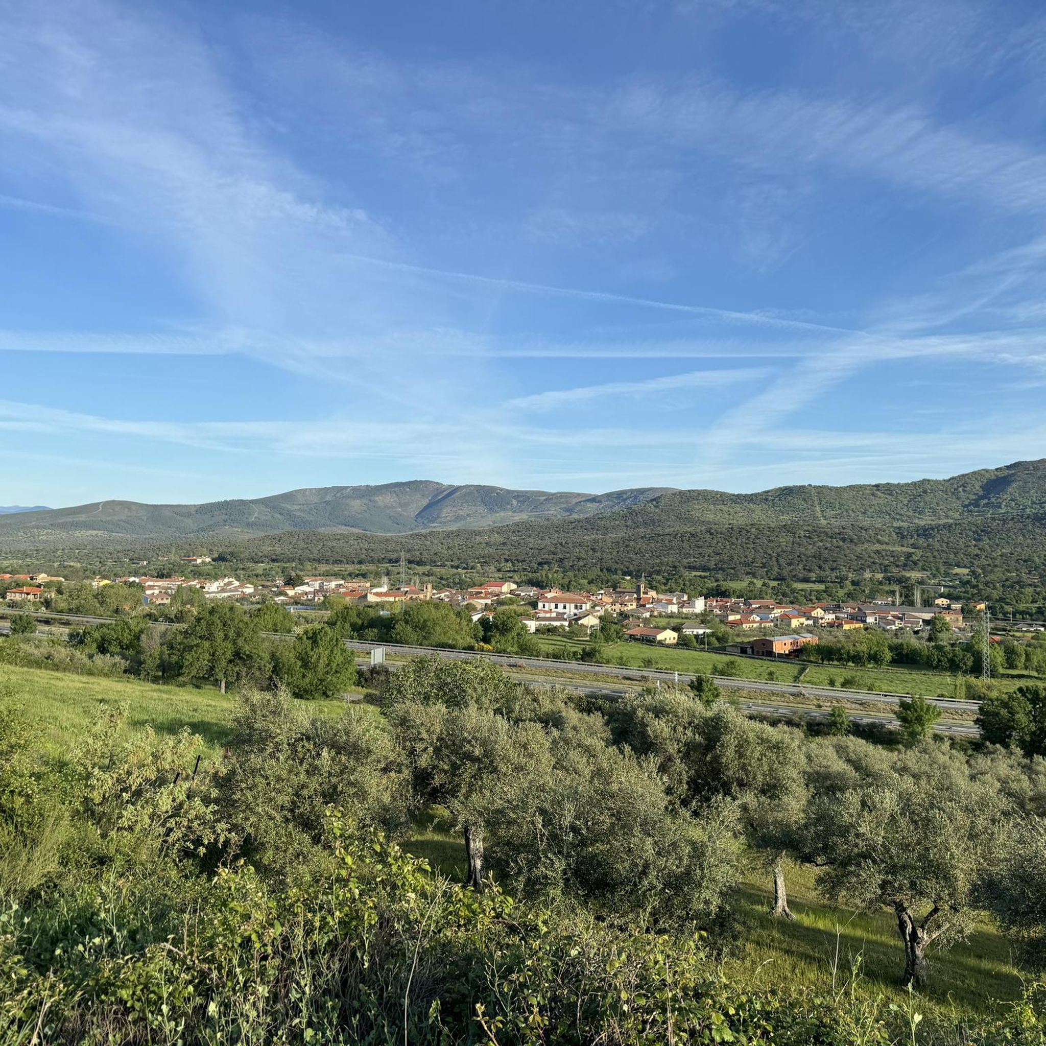
Hiking around Gargantilla offers a diverse landscape for outdoor enthusiasts. The region features varied terrain, including forested areas, stream valleys, and paths with moderate elevation changes. These natural elements provide a range of hiking experiences, from gentle walks to more challenging ascents. The area's trails often follow natural watercourses and wind through local woodlands.
Best hiking trails around Gargantilla
- The most popular hiking route is Stream loop from Pedregoso, a 7.3 mile (11.8 km) trail that takes 3 hours…
Last updated: July 8, 2026
4.5
(15)
128
hikers
12.7km
04:02
420m
420m
Moderate hike. Good fitness required. Mostly accessible paths. Sure-footedness required.
4.2
(6)
30
hikers
15.4km
04:36
490m
490m
Moderate hike. Good fitness required. Easily-accessible paths. Suitable for all skill levels.

Sign up for free
4.8
(4)
22
hikers
11.8km
03:41
380m
380m
Moderate hike. Good fitness required. Mostly accessible paths. Sure-footedness required.
4.6
(5)
18
hikers
13.7km
04:13
490m
500m
Moderate hike. Good fitness required. Easily-accessible paths. Suitable for all skill levels.
15
hikers
21.1km
05:42
280m
280m
Hard hike. Very good fitness required. Easily-accessible paths. Suitable for all skill levels.
Get access to more routes and recommendations from other explorers.
Sign up for free
Already have an account?
Our route recommendations are based on thousands of hikes, rides, and runs completed by other people on komoot.
Start today with a free account
Your next adventure awaits.
Login or Signup


Tips from the Community

Hervás is one of the founders of the Network of Jewish Quarters of the Sephardic Route and is also part of the Cooperation Network of the Silver Route.
17
0
Hervás has beautiful architectural heritage such as the Davila palace, a parish church, the convent of the Trinitarian fathers etc. The largest collection of classic motorcycles in Europe!
14
0
The 65 km Via Verde route runs from Plasencia, the capital of the Jerte Valley, through the Ambroz Valley with its verdant meadows, past grasslands and deciduous forests, to the foot of the Sierra de Béjar, a protected biosphere reserve.
8
0

Incredible views from the Vía Verde de la Plata cycling route with views of the valley and the Baños Reservoir.
2
0

From the town two hours of ascent
0
0
the route continues through the 35 curves but the GPS fails but it is well marked by white and yellow continue along the water channel until the so-called chorrerra
0
0
Hervás is a small regional town to the north of Cásares in the Ambroz Valley. Surrounded by mountains, the town is located on the Ambroz river. It has one of the best preserved Jewish quarters in Spain.
4
0
Frequently Asked Questions
How many hiking trails are available around Gargantilla?
There are over 75 hiking trails around Gargantilla, offering a diverse range of experiences for outdoor enthusiasts. These include paths through forested areas, along stream valleys, and routes with varying elevation changes.
What kind of terrain can I expect on hikes around Gargantilla?
The terrain around Gargantilla is diverse, featuring forested areas, stream valleys, and paths with moderate elevation changes. Many trails follow natural watercourses and wind through local woodlands, providing a mix of gentle walks and more challenging ascents.
Are there any easy hiking trails suitable for beginners in Gargantilla?
Yes, Gargantilla offers several easy hiking trails. For example, the Forest Trail loop from Pedregoso is an easy 2.5-mile (4.1 km) route through forested areas, typically completed in about 1 hour 14 minutes.
What are some notable natural attractions or landmarks to see while hiking in Gargantilla?
While hiking around Gargantilla, you can explore several natural attractions. Highlights include the beautiful Nogaleas Waterfalls, the serene Caozo Waterfall, and the Los Pilones Natural Pools. You might also encounter the Honduras Pass and the Jerte River.
Are there any circular hiking routes in the Gargantilla area?
Yes, many routes around Gargantilla are designed as loops. An example is the Stream loop from Pedregoso, which is a 7.3-mile (11.8 km) trail featuring varied terrain alongside streams and through woodlands.
What do other hikers say about the trails in Gargantilla?
The routes in Gargantilla are highly rated by the komoot community, with an average score of 4.7 stars from over 300 reviews. Hikers often praise the varied terrain, the presence of stream valleys, and the well-maintained paths that wind through local woodlands.
Are there any challenging hikes for experienced hikers in Gargantilla?
Yes, for experienced hikers seeking a challenge, there are difficult routes available. The Puerto de Honduras loop from Gargantilla is a difficult 7.7-mile (12.3 km) trail with significant elevation gain, taking approximately 5 hours 8 minutes to complete.
Can I find trails that feature waterfalls around Gargantilla?
Absolutely. The region is known for its beautiful waterfalls. You can visit the Nogaleas Waterfalls, Caozo Waterfall, and La Chorrera Waterfall, among others. Some trails will lead you directly to these natural wonders.
What is the best time of year to go hiking in Gargantilla?
While specific seasonal details are not provided, the diverse landscape of Gargantilla, with its woodlands and stream valleys, suggests that spring and autumn would offer pleasant temperatures and vibrant scenery. Summer might be suitable for higher elevation trails, and winter for those prepared for cooler conditions.
Are there any trails suitable for families with children in Gargantilla?
Yes, Gargantilla offers trails that are suitable for families. The varied terrain includes easier paths that are less strenuous, such as the Forest Trail loop from Pedregoso, which is an easy and relatively short option through woodlands.
Are there any historical or man-made points of interest near the hiking trails?
Yes, you can find historical points of interest. For example, the area features "La Cruz" on the ancient Roman road Calzada Baños de Montemayor, offering a glimpse into the region's past.
How long do hikes typically take in Gargantilla?
Hike durations vary significantly depending on the trail's length and difficulty. You can find shorter walks like the Forest Trail loop from Pedregoso, which takes about 1 hour 14 minutes, to longer, more challenging routes such as the Puerto de Honduras loop from Gargantilla, which can take over 5 hours.
Most popular routes around Gargantilla
Most popular attractions around Gargantilla

Get inspired with the komoot mobile app


Explore more
Browse the best Hikes in other regions.
