The best walks and hikes around Mugardos
4.3
(599)
4,117
hikers
155
hikes
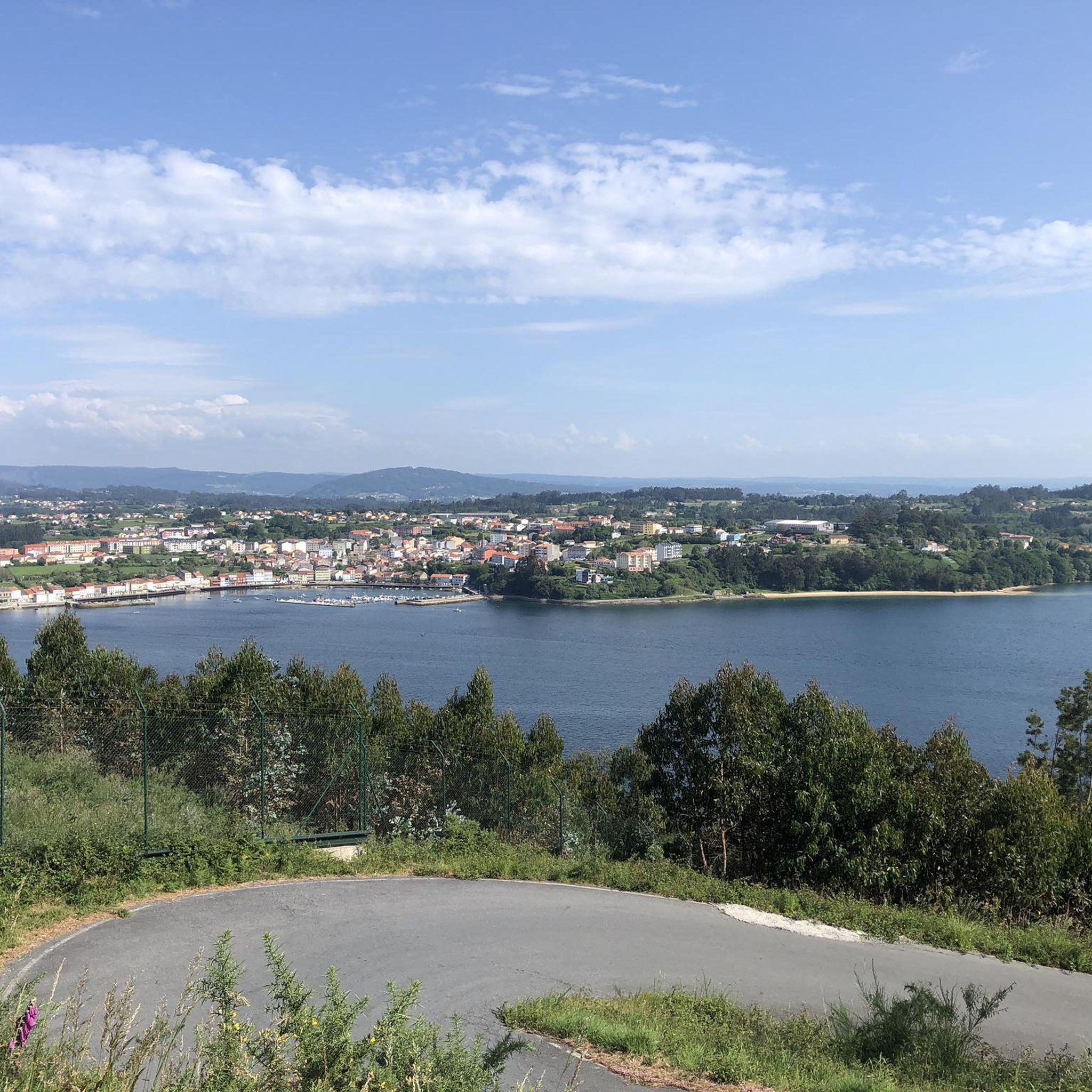
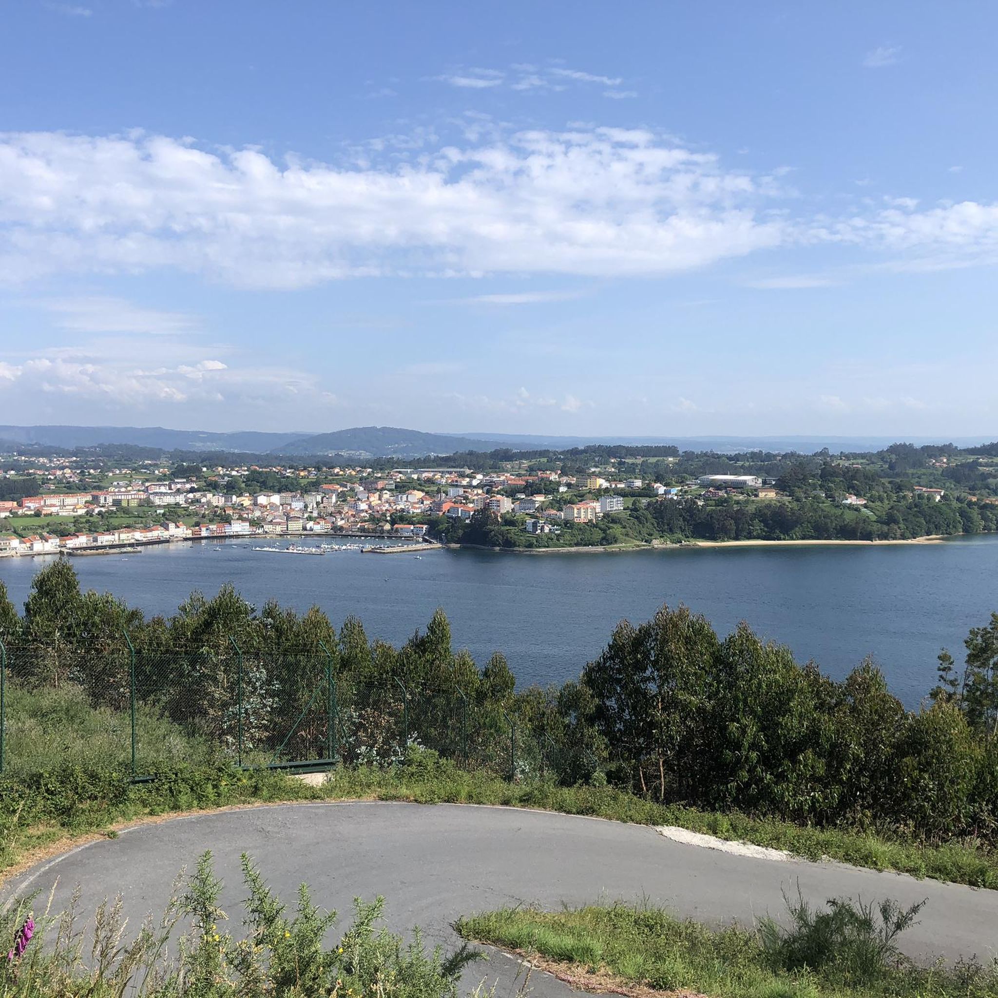
Hiking around Mugardos offers a diverse landscape characterized by its coastal position along the Ría de Ferrol, featuring varied elevations and green areas. The region includes paths that traverse woodlands, connect to beaches, and provide viewpoints over the estuary. Mugardos hiking trail distances range from short, easy walks to longer, more challenging routes, catering to different preferences.
Best hiking trails around Mugardos
- The most popular hiking route is Ares Green Route, a 4.2 miles (6.8 km) trail that takes…
Last updated: July 3, 2026
4.3
(7)
17
hikers
6.80km
01:47
60m
60m
Easy 4.2-mile circular hike along the Ares coast, featuring beaches, diverse landscapes, and views of the Tower of Hercules.
6
hikers
24.1km
06:54
540m
540m
Hike the difficult 15.0-mile Peña Bailadora from Ares circular trail, gaining 1770 feet with stunning coastal views and historic sites.

Sign up for free
5.0
(3)
22
hikers
15.4km
04:30
380m
380m
Moderate hike. Good fitness required. Easily-accessible paths. Suitable for all skill levels.
4.6
(10)
30
hikers
Moderate hike. Good fitness required. Easily-accessible paths. Suitable for all skill levels.
4.0
(4)
47
hikers
5.38km
01:26
50m
50m
Easy hike. Great for any fitness level. Easily-accessible paths. Suitable for all skill levels.
Get access to more routes and recommendations from other explorers.
Sign up for free
Already have an account?
Our route recommendations are based on thousands of hikes, rides, and runs completed by other people on komoot.
Start today with a free account
Your next adventure awaits.
Login or Signup

Tips from the Community

+ The first viewpoint (South) is the most spectacular, although the path requires some caution and you will probably have to endure some scratches from plants on your legs. + The second point is easily accessible and offers views of the Enseada de Santa Mariña, among others. + A third path descends very steeply at the end towards Praia da Ribeira de Santa Mariña. With a taut rope, you can climb down and back up.
0
0
Idyllic viewpoint, accessible with some caution. The different paths (not all visible on the map) always lead approximately to the same point to continue the route.
0
0
Here you can turn right towards a beautiful viewpoint. Afterwards, instead of going up to the main path, you can carefully continue a few hundred meters along the coastal path to the ‘Punta Coitelada’ sign. From there you should continue a stretch of the main path.
0
0
To reach the circular part from the village you can follow the signposted route or shorten it via the beach, if the tide allows.
0
0
From the main path, you can take a small path that runs over the rocks. It is easy to access, but caution is recommended.
0
0

Beautiful beach surrounded by a cliff, where you can go down some wooden stairs.
1
0
Beautiful golden sand beach, quite quiet. Next to the seafront.
0
0

The start of the Camino Ingles is located directly at the port of Ferrol, next to a bar with very good drinks. Marked with a large stone/monument. Opposite is the tourist information in a pavilion, where there is the first stamp. If this is closed, there is a large tourist information center in the center of the Plaza de Europa, which is open at normal times and in which there is also a stamp for the pilgrim's pass.
7
1
Frequently Asked Questions
How many hiking trails are available around Mugardos?
There are over 150 hiking trails in the Mugardos area, offering a wide range of options. You'll find approximately 65 easy routes, nearly 80 moderate trails, and about 10 more challenging paths to explore.
Are there easy hiking trails suitable for beginners in Mugardos?
Yes, Mugardos offers many easy trails perfect for beginners or those looking for a relaxed walk. A great option is the Ares Green Route, which is 4.2 miles (6.8 km) long and takes about 1 hour 47 minutes to complete, offering pleasant coastal scenery.
What kind of views can I expect on hikes around Mugardos?
Hiking around Mugardos provides diverse views, including coastal paths along the Ría de Ferrol, estuary vistas, and green woodlands. You can find specific viewpoints like The White Pebble, offering panoramic scenes of the surrounding landscape.
Are there any circular hiking routes in Mugardos?
Yes, Mugardos features several circular routes. A popular choice is the View of O Segaño Beach – Punta Coitelada loop from Mugardos, a moderate 9.8 miles (15.7 km) path that provides excellent coastal views and passes O Segaño Beach.
What do other hikers say about the trails in Mugardos?
The hiking trails in Mugardos are highly regarded by the komoot community, with an average rating of 4.4 stars from over 500 reviews. Hikers often praise the varied terrain, from coastal paths to green woodlands, and the well-maintained routes.
Are there any family-friendly hiking options in Mugardos?
Many of the easier trails around Mugardos are suitable for families. The View of Ferrol Marina – Modern Sculpture in Park loop from Ferrol is an easy 3.4 miles (5.4 km) route through urban parks, offering a gentle walk that can be enjoyed by all ages.
Can I find any waterfalls on hikes near Mugardos?
Yes, for those interested in natural features, the Belelle River Waterfall is located near Mugardos and can be incorporated into a hiking plan. It's a notable natural attraction in the region.
What are some interesting landmarks or attractions to see while hiking in Mugardos?
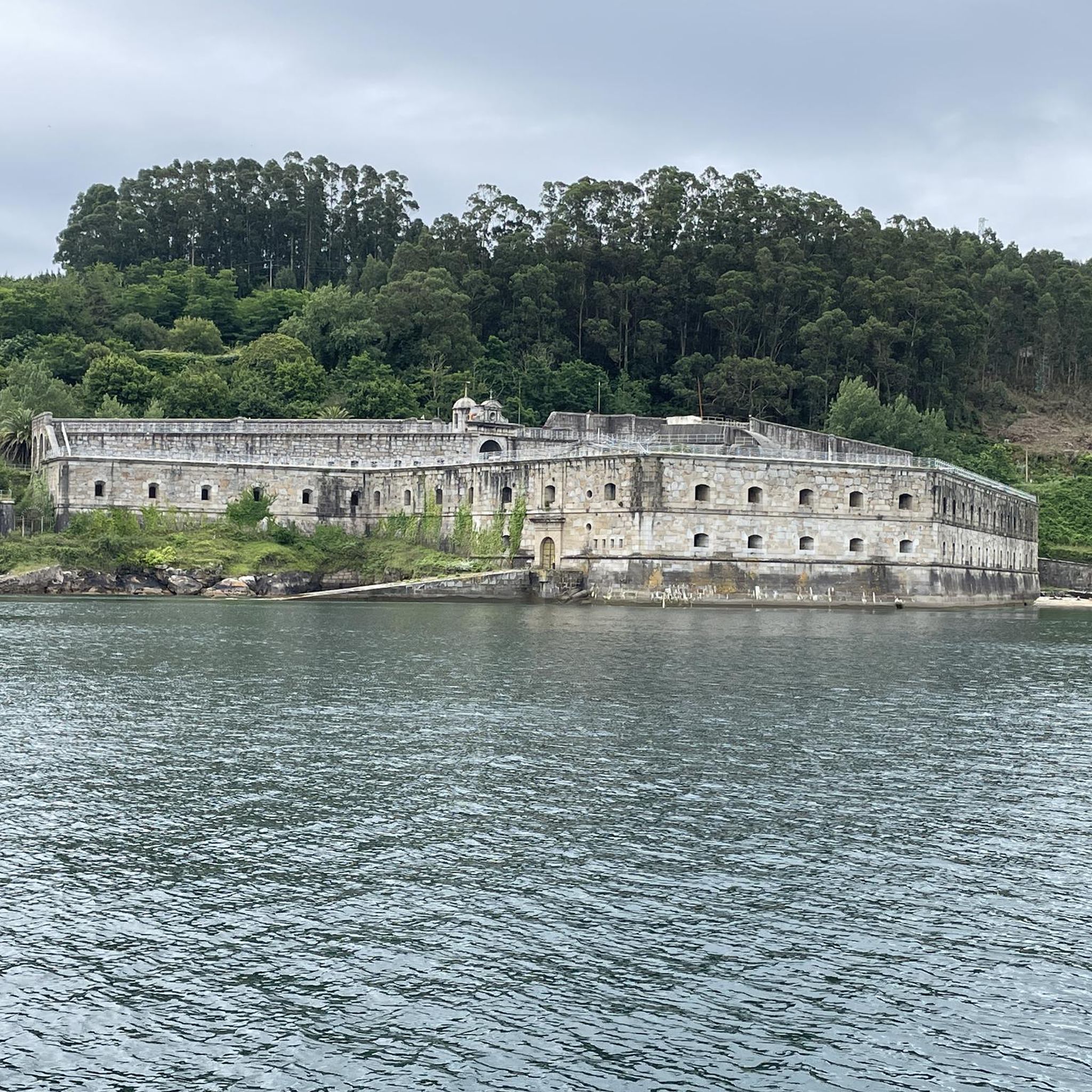
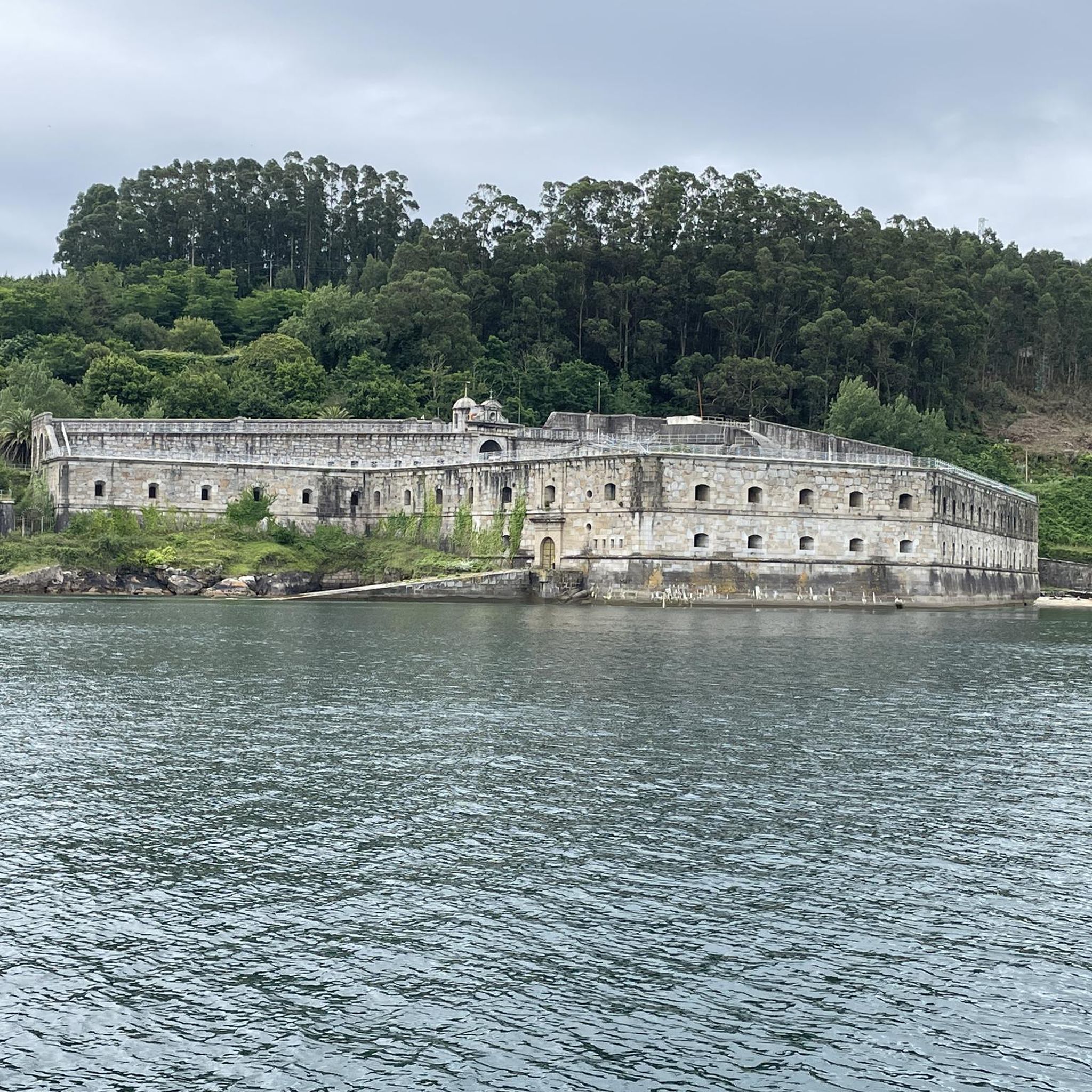
Beyond the natural beauty, you can explore historical and cultural landmarks. Consider visiting the Monastery of San Martiño de Xuvia or the Parish Church of St James in Pontedeume. The Pontedeume Bridge is also a significant historical structure in the vicinity.
Are there any long-distance or challenging hikes in the Mugardos area?
For experienced hikers seeking a challenge, Mugardos offers more demanding routes. The Between the Two Rías Trail is a difficult 15 miles (24.1 km) route that provides a substantial adventure with significant elevation changes.
What is the best time of year to go hiking in Mugardos?
Mugardos, with its coastal climate, offers pleasant hiking conditions for much of the year. Spring and autumn generally provide mild temperatures and beautiful scenery, ideal for exploring. Even winter can be suitable for hiking, though some trails might be wetter.
Are there any beaches accessible via hiking trails in Mugardos?
Yes, some trails lead to or offer views of local beaches. The View of O Segaño Beach – Punta Coitelada loop from Mugardos passes by O Segaño Beach, and the Praia da Barrosa – Punta de Santa Mariña loop from Ares provides access to Praia da Barrosa.
Is it possible to hike through natural parks or forests near Mugardos?
Absolutely. The region is home to natural areas like the Parque Natural das Fragas do Eume, a significant forest area that offers opportunities for immersive nature walks and a different kind of hiking experience away from the coast.
Most popular attractions around Mugardos

Get inspired with the komoot mobile app


Explore more
Browse the best Hikes in other regions.
