The best walks and hikes around Navalpino
4.3
(44)
228
hikers
13
hikes
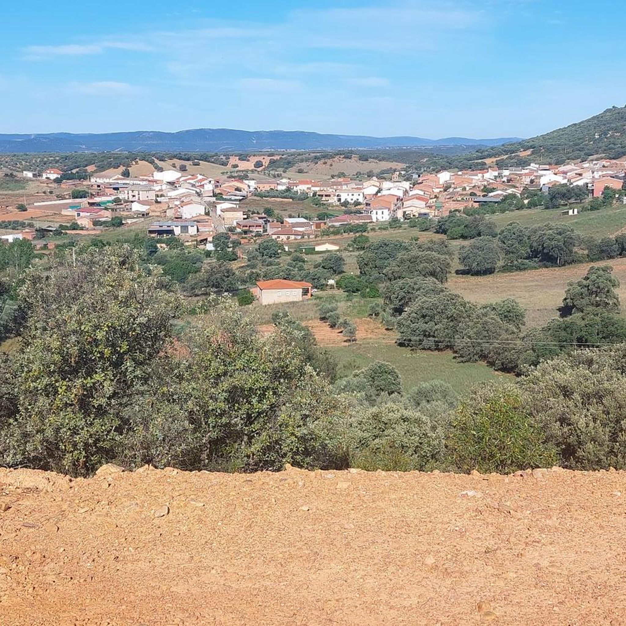
Hiking around Navalpino, located in the Montes de Toledo area of Spain, offers access to diverse landscapes. The region is characterized by hills, valleys, and Mediterranean forests, providing varied terrain for outdoor activities. It borders the Parque Nacional de Cabañeros, known for its well-preserved ecosystems and open plains. The elevation gains on routes are generally moderate, with many trails featuring climbs under 200 meters.
Best hiking trails around Navalpino
- The most popular hiking route is Route of La Viñuela and…
Last updated: July 11, 2026
3.9
(9)
52
hikers
12.9km
03:31
200m
200m
Moderate hike. Good fitness required. Easily-accessible paths. Suitable for all skill levels.
3.9
(9)
52
hikers
12.1km
03:18
180m
180m
Moderate hike. Good fitness required. Easily-accessible paths. Suitable for all skill levels.

Sign up for free
4.1
(8)
26
hikers
15.6km
04:12
190m
190m
Moderate hike. Good fitness required. Easily-accessible paths. Suitable for all skill levels.
4.1
(8)
27
hikers
11.4km
03:03
140m
140m
Moderate hike. Good fitness required. Easily-accessible paths. Suitable for all skill levels.
5.0
(2)
19
hikers
3.68km
01:04
100m
100m
Easy hike. Great for any fitness level. Easily-accessible paths. Suitable for all skill levels.
Get access to more routes and recommendations from other explorers.
Sign up for free
Already have an account?
Our route recommendations are based on thousands of hikes, rides, and runs completed by other people on komoot.
Start today with a free account
Your next adventure awaits.
Login or Signup
Popular around Navalpino
Tips from the Community

At the end of the road is a picnic area and parking. From here, a path leads down the riverbed to the waterfall, a total distance of 6.5 km (4 miles) round trip. In October, the waterfall had dried up.
18
1

The trail passes through a lush, cool forest, ideal for hot days. At the top are archaeological remains known as the Plaza de los Moros, which gives the route its alternative name. It's a very peaceful area, although caution should be exercised during the hunts, as hunting is sometimes permitted in the park, which may temporarily restrict access.
1
0
The Umbría Peak, also known as Pico Umbría or Plaza de los Moros, is one of the most notable routes in the area surrounding Horcajo de los Montes, within the Cabañeros National Park.
1
0
Rest point on a route (La Viñuela) to be done exclusively on foot through the heart of the Mediterranean forest, which here breaks its apparent uniformity into different slopes. Along the way it is easy to come across wild boars and deer, or see vultures and eagles in the sky. 13 km (circular)
9
0
A route to be followed exclusively on foot through the heart of the Mediterranean forest, which here breaks its apparent uniformity into different slopes. Along the way it is easy to come across wild boars and deer, or see vultures and eagles in the sky. 13 km (circular)
4
0

The outward journey is over coarse gravel and is easy. The way back over frequent steps and boulders is tedious with S2 and pushing points for about 1 km.
5
0

This section is called the Ruta de los Alcornoques and is part of one of the routes in the Cabañeros National Park. A viewpoint appears that lets us see beautiful views of the park.
1
0

The highest point of the Plaza de los Moros path, where there is a geodesic vertex. Going up you will enjoy a typically Mediterranean forest and as soon as you are at the peak, you will be able to see excellent panoramic views of the Montes de Toledo. The summit stones are the remains of a rectangular structure from a Bronze Age village. Route without much unevenness, but it is advisable to wear suitable footwear, because there are stony sections. Remember that smoking is totally prohibited on the route between 06/01 and 09/30.
1
1
Frequently Asked Questions
How many hiking trails are available around Navalpino?
There are 13 hiking trails around Navalpino, offering a variety of experiences. These include 4 easy routes, 8 moderate routes, and 1 difficult route, catering to different fitness levels.
Are there any easy or short hikes suitable for beginners or families?
Yes, Navalpino offers several easy routes perfect for beginners or families. One excellent option is the Path of the Plaza de los Moros — circular, which is 2.3 miles (3.7 km) long and typically takes just over an hour to complete, leading through pleasant local scenery.
What kind of natural features or landmarks can I expect to see on hikes near Navalpino?
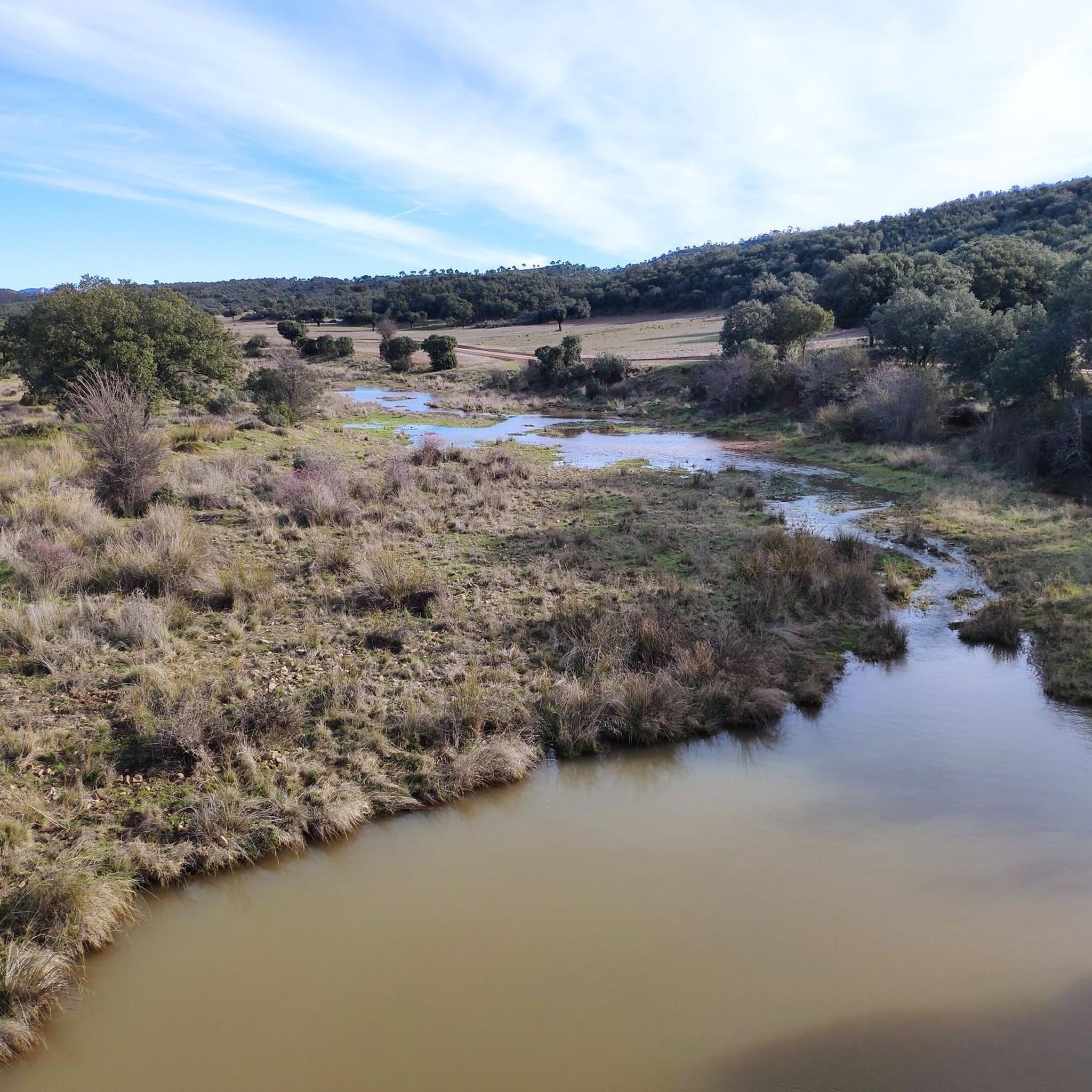
Hiking around Navalpino allows you to explore diverse natural features. You can discover the impressive La Chorrera de Horcajo Waterfall, the tranquil El Rubial Stream, or enjoy panoramic views from the Cañada Real Viewpoint. The area is also home to unique natural monuments like The Grandfather Cork Oak and the serene Laguna de la Raña.
Are there any circular hiking routes in the Navalpino area?
Yes, there are circular routes available. A popular choice among local hikers is the Path of the Plaza de los Moros — circular, which offers a convenient loop through the local landscape.
What is the terrain like for hiking in Navalpino?
The terrain around Navalpino is varied, characterized by rolling hills, valleys, and Mediterranean forests. It borders the Parque Nacional de Cabañeros, known for its well-preserved ecosystems and open plains, offering a mix of landscapes. Elevation gains on routes are generally moderate, with many trails featuring climbs under 200 meters.
What do other hikers enjoy most about hiking in Navalpino?
The hiking routes in Navalpino are highly rated by the komoot community, with an average score of 4.3 stars from over 30 reviews. Hikers often praise the diverse landscapes, from Mediterranean forests to open plains, and the opportunity to explore the natural beauty of the Montes de Toledo.
Can I find trails that lead to waterfalls in Navalpino?
Yes, you can! The La Chorrera de Horcajo Trail is a moderate 9.7-mile (15.6 km) path that leads through varied landscapes and offers the chance to visit the beautiful La Chorrera de Horcajo Waterfall.
What kind of wildlife might I encounter while hiking in the region?
Given Navalpino's proximity to the Parque Nacional de Cabañeros, you have a good chance of observing a rich variety of flora and fauna. The park is known for species such as deer, wild boar, and various bird species, especially in its well-preserved Mediterranean forests and open 'rañas' (plains).
Are there any longer, more challenging hikes for experienced hikers?
For those seeking a longer exploration, the La Chorrera de Horcajo Trail is a moderate 9.7-mile (15.6 km) path that leads through the varied landscapes of the Montes de Toledo, offering a more extensive experience. There is also one difficult route among the 13 available for those looking for a significant challenge.
What is the best time of year to go hiking in Navalpino?
While specific seasonal recommendations depend on personal preference, the diverse landscapes of Navalpino, with its Mediterranean forests and open plains, generally offer pleasant hiking conditions during spring and autumn when temperatures are milder. Summers can be hot, and winters are typically mild but can have cooler, wetter periods.
Are there any trails that offer scenic viewpoints?
Yes, several trails provide scenic views of the surrounding area. You can find excellent vistas from the Cañada Real Viewpoint, which is a highlight in the region and offers expansive views of the landscape.
Most popular routes around Navalpino
Most popular attractions around Navalpino

Get inspired with the komoot mobile app


Explore more
Browse the best Hikes in other regions.
