The best road cycling routes around la Vall de Gallinera
4.6
(105)
4,402
riders
38
rides
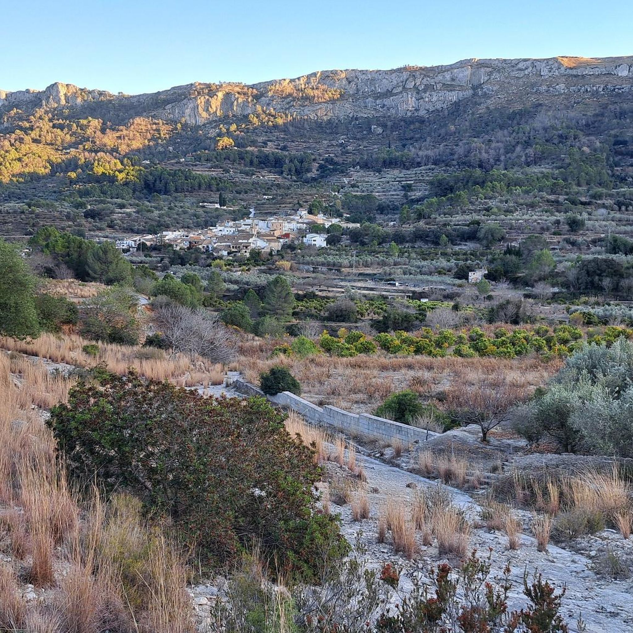
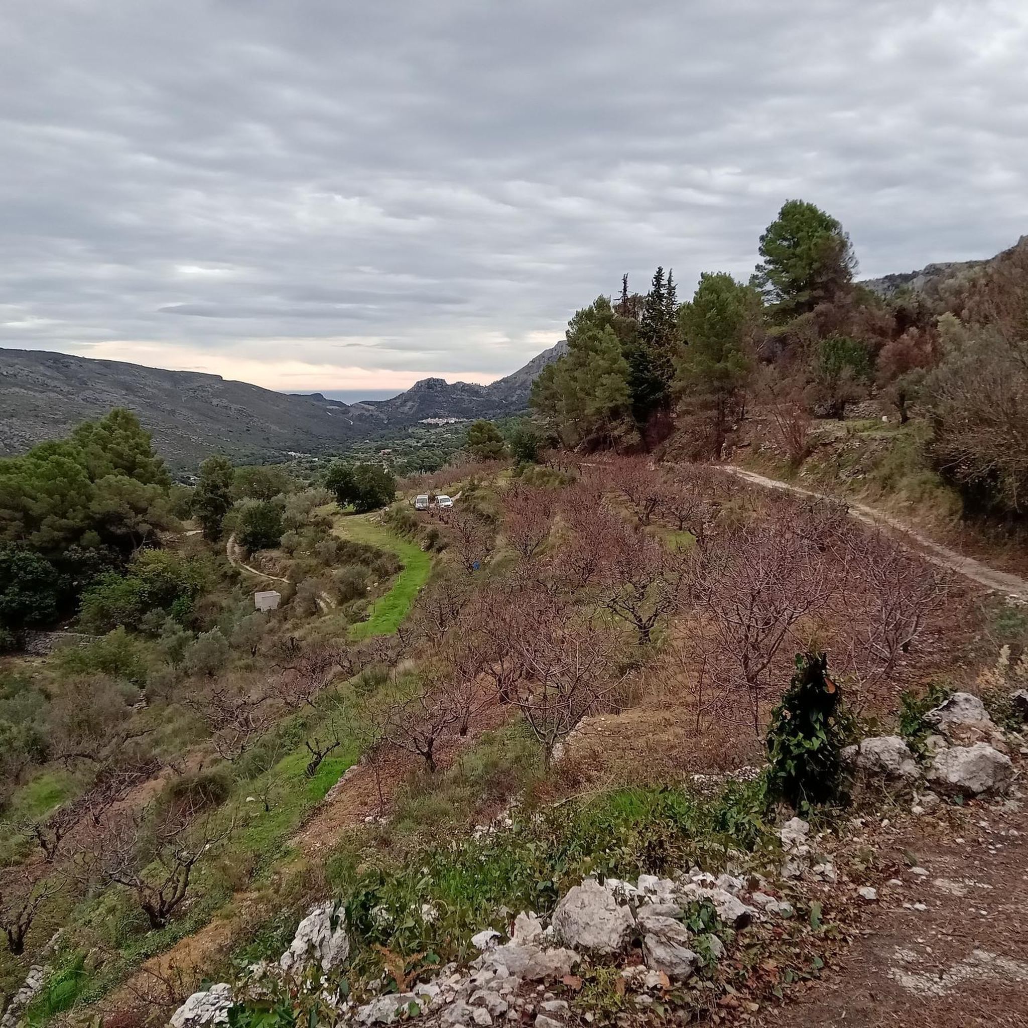
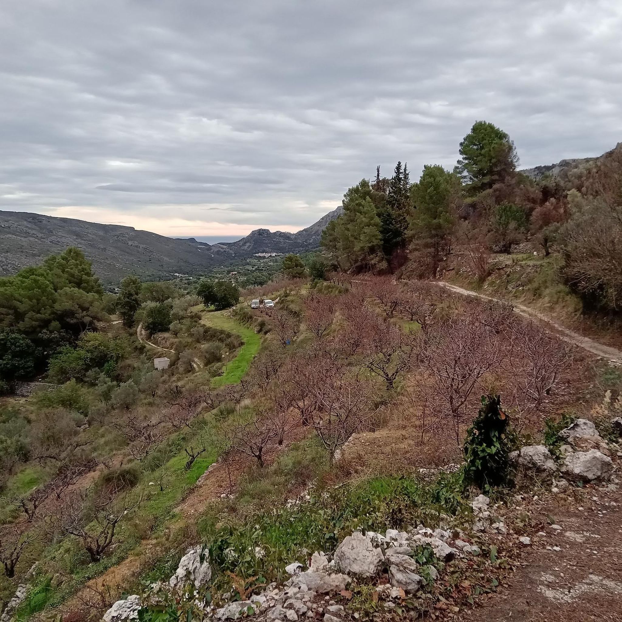
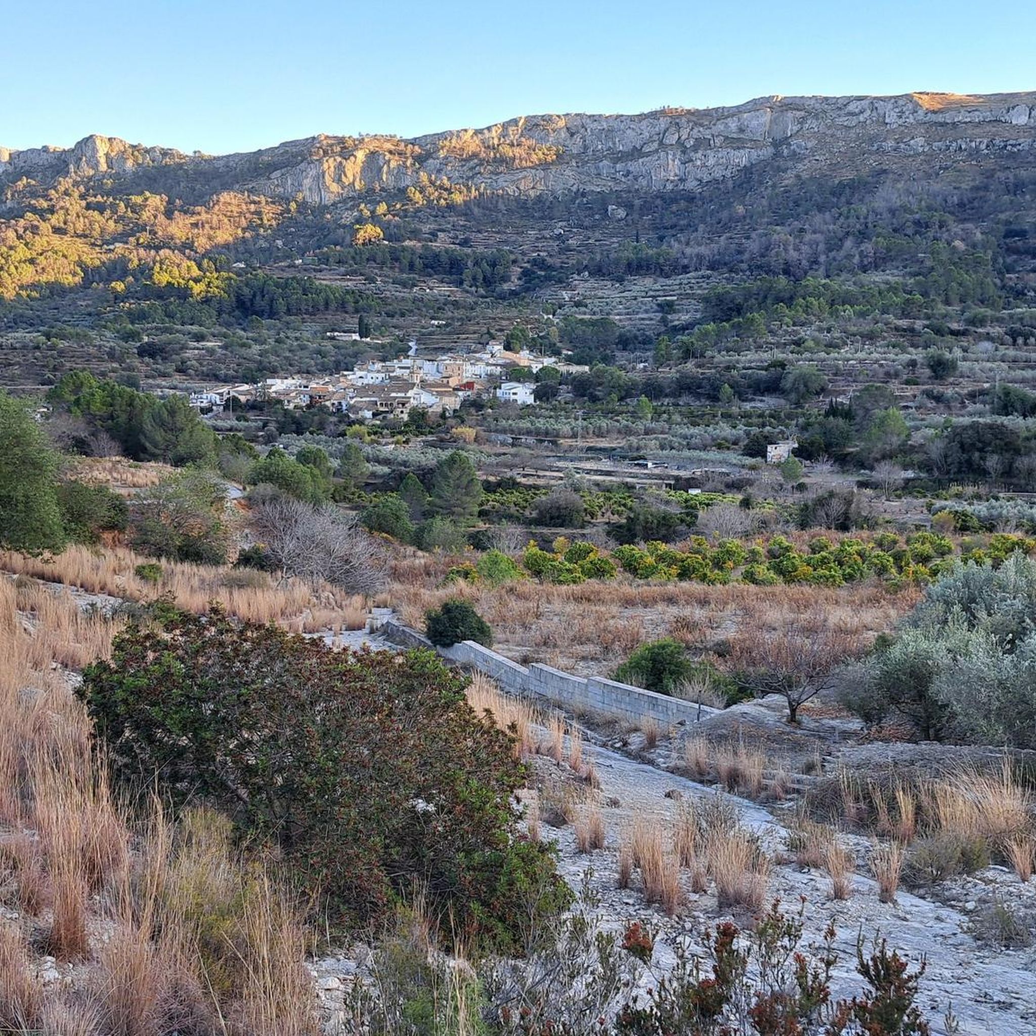
Road cycling around La Vall de Gallinera is characterized by its mountainous terrain, nestled between the Sierra de Foradada and Serra de L'Almirant. The region features winding roads that traverse valleys and agricultural landscapes, including extensive cherry, almond, and olive groves. Terraced fields supported by dry stone walls are common, alongside the River Gallinera which contributes to the lush environment. This varied topography offers a range of road cycling experiences.
Best road cycling routes around la Vall de Gallinera
- The most popular road cycling route is La Vall de la Gallinera — Circular from Pego to the top of Miserat, a 37.2 miles (60.0 km) trail that takes 3 hours 48 minutes to complete. This challenging route features a significant ascent to the top of Miserat.
- Another top favourite among local road cyclists is View of the Sierra de Segària – Pego–Sagra Road loop from Pego, a moderate 29.2 miles (47.1 km) path. This route offers panoramic views of the Sierra de Segària.
- Local road cyclists also love the Dénia to Gandía Greenway – Les Magazinos, Dénia loop from Pego, a 26.9 miles (43.3 km) trail leading through coastal areas, often completed in about 1 hour 43 minutes.
- Road cycling around la Vall de Gallinera is defined by mountainous terrain, deep valleys, and agricultural groves. The network offers options for different ability levels, from easier greenway sections to challenging climbs.
- The routes in la Vall de Gallinera are highly rated by the komoot community with an average score of 4.5 stars from over 60 reviews. More than 2,000 road cyclists have used komoot to explore la Vall de Gallinera's varied terrain.
Last updated: August 22, 2026
4.7
(3)
59
riders
59.8km
03:48
1,300m
1,300m
Hard road ride. Very good fitness required. Mostly well-paved surfaces and easy to ride.
4.6
(14)
284
riders
46.3km
02:02
380m
380m
Moderate road ride. Good fitness required. Some segments of this route may be unpaved and difficult to ride.

Sign up for free
4.8
(4)
232
riders
78.8km
04:10
1,320m
1,320m
Hard road ride. Very good fitness required. Some segments of this route may be unpaved and difficult to ride.
64
riders
34.0km
01:52
710m
710m
Moderate road ride. Good fitness required. Mostly well-paved surfaces and easy to ride.
4.0
(1)
75
riders
30.7km
01:39
590m
590m
Moderate road ride. Good fitness required. Some segments of this route may be unpaved and difficult to ride.
Get access to more routes and recommendations from other explorers.
Sign up for free
Already have an account?
Our route recommendations are based on thousands of hikes, rides, and runs completed by other people on komoot.
Start today with a free account
Your next adventure awaits.
Login or Signup

Tips from the Community

In the lower part of L’Atzúbia is Carrer Nou, which is nothing more than the concreted Barranc de Mostalla. In fact, with heavy rain it becomes a torrent again. There is no signage, but there is only one road that starts upwards. At the turn-off towards the antennas, it is closed due to "works". At the moment, no works are visible, and you can pass by the side of the "gate". The path to the summit is in perfect condition. aspect : ADSUBIA Altitude: 753 Elevation gain: 663 Length: 6.26 Average %: 10.60 Max %: 22
0
0

Elevation 320 m is a perfect height—cool air, great views, and just enough climb for a rewarding hike without being exhausting. <a href="https://pips-game.com">pips</a> Truly a sweet spot!
0
0

Look out for the small fountain at the entrance of the village – a refreshing stop to fill your water bottle on hot days.
2
1
Benissivá is one of the eight small villages of the Vall de Gallinera, a quiet valley in the mountains of the Costa Blanca known for its cherry orchards, almond trees and Moorish heritage. The village is set on a gentle slope with narrow streets and traditional whitewashed houses, offering cyclists and hikers a peaceful stop along their route. From Benissivá you can enjoy beautiful views of the valley and the surrounding peaks, with easy access to both road and gravel routes that link the neighbouring villages. In spring, the cherry blossom transforms the landscape into a colourful spectacle, while the rest of the year the calm atmosphere and local charm make it a perfect place to pause, refuel and take in the scenery. A coffee on the terrace of the village bar is the ideal reward before continuing your ride or hike deeper into the Vall de Gallinera.
2
1
Stop in Beniali at a local bar or restaurant to try a dish with 🍒 from the valley – a true seasonal highlight.
2
1
Beniali is the central village of the Vall de Gallinera, a hidden valley in the Costa Blanca surrounded by almond and cherry orchards. This picturesque spot is rich in Moorish history and traditional Mediterranean charm, with narrow streets and whitewashed houses that reflect the authentic character of inland Spain. The Vall de Gallinera is a true paradise for cyclists and hikers, offering winding roads, quiet gravel tracks and breathtaking views of the surrounding mountains, including the Serra de la Foradà. In spring the valley transforms into a sea of blossoms as the cherry trees bloom, making it one of the most spectacular natural sights in the region. Starting from Beniali, you can easily explore the other small villages of the valley, enjoy panoramic climbs and descents, and discover peaceful landscapes far from the coast. With its tranquil atmosphere, local cafés and traditional restaurants, Beniali is both a perfect base and a memorable stop on any cycling or hiking adventure through the Costa Blanca.
2
1

Long port from Ebo, little shade, every curve is worth it
1
0
The Puerto de Sorell is a quiet and under-the-radar ridge climb in the northern Costa Blanca, linking Pego and Ràfol d’Almúnia via the CV‑728. It’s not long, not high — but it’s a perfect connector on a peaceful inland loop. From Ràfol d’Almúnia, the climb is 2.7 km long at an average gradient of 3.1%. It’s a smooth, steady ascent through olive groves and farmland, ideal for keeping a light rhythm and soaking up the rural scenery. The road surface is good and traffic is almost nonexistent. From the Pego side, the climb is roughly the same length but considerably steeper, with sections reaching 6 to 8%. It’s a short but honest effort, and a nice little test when coming up from the coastal plain. The views are wide and open — toward the Segària range, the valley below, and even the sea in the distance. At the summit, you'll spot the blue "Puerto de Sorell – 170 m" sign, a modest but official col marker that makes the climb feel just a bit more special. From here, you can descend either way or continue inland toward Vall de Gallinera, Vall d’Ebo, or Coll de Rates. Puerto de Sorell is a local favourite: short, scenic, quiet — and perfect for linking bigger climbs on a longer ride.
2
1
Frequently Asked Questions
How many road cycling routes are available in La Vall de Gallinera?
La Vall de Gallinera offers a diverse network of over 25 road cycling routes. These routes cater to various skill levels, with 6 easy, 13 moderate, and 6 difficult options, ensuring there's something for every cyclist.
What is the best time of year for road cycling in La Vall de Gallinera?
The spring months are particularly beautiful for road cycling in La Vall de Gallinera, especially when the cherry blossoms blanket the slopes in a pink hue. The region's agricultural landscapes, including extensive cherry, almond, and olive groves, are vibrant during this time. The weather is generally pleasant, making it ideal for exploring the winding roads and varied terrain.
Are there any circular road cycling routes in La Vall de Gallinera?
Yes, La Vall de Gallinera features several circular routes. A notable one is the approximately 14 km "Route of the 8 Villages" (Ruta dels 8 Pobles), which connects all eight picturesque villages of the valley. For a longer challenge, consider the La Vall de la Gallinera — Circular from Pego to the top of Miserat, a 60 km route with significant ascent.
What kind of scenery can I expect while road cycling in La Vall de Gallinera?
You can expect stunning natural landscapes, from the soaring peaks of the Sierra de Foradada and Serra de L'Almirant to lush valleys. The routes traverse extensive cherry, almond, and olive groves, especially picturesque in spring. You'll also encounter terraced fields supported by dry stone walls and the tranquil River Gallinera, all contributing to a scenic and rewarding cycling experience.
Are there family-friendly road cycling routes in La Vall de Gallinera?
Yes, there are easier road cycling options suitable for families. For example, the Dénia to Gandía Greenway – Les Magazinos, Dénia loop from Pego is an easy 43.3 km trail that leads through coastal areas, offering a less challenging ride with minimal elevation gain.
What historical sites or landmarks can I explore along the cycling routes?
La Vall de Gallinera is rich in history. You can discover remnants of a storied past, including Moorish watchtowers and medieval castles like Castillo de Benirrama and Castillo de Benissili. Near Benirrama and Benialí, you can also find prehistoric cave paintings. For a unique natural landmark, the Camino de Petracos – Remote Beauty & Ancient Rock Art highlight offers a glimpse into ancient history.
Are there any unique natural features to see while cycling in the region?
Absolutely. A prominent natural feature is the spectacular Penya Foradada, a natural stone arch on a mountain peak. The valley also benefits from numerous natural springs, known as "fonts," many converted into traditional washhouses, providing refreshing stops. You might also encounter the The Salty Spring or the Natural area of the "Font Salà".
What do other cyclists say about road cycling in La Vall de Gallinera?
The road cycling routes in La Vall de Gallinera are highly rated by the komoot community, with an average score of 4.5 stars from over 60 reviews. Cyclists often praise the region's low traffic, good road conditions, and the tranquil rural charm that allows for a deep connection with the landscape.
Is there parking available for cyclists in La Vall de Gallinera?
While specific parking areas for cyclists are not explicitly detailed, the region's rural nature and smaller villages often provide general parking options. It's advisable to check local village parking facilities upon arrival, especially in starting points like Pego, which serves as a common base for many routes.
Are there places to eat or stay for cyclists in La Vall de Gallinera?
The eight picturesque villages within La Vall de Gallinera—Benirrama, Benialí, Benissivà, Benitaia, La Carroja, Alpatró, Llombai, and Benissili—offer a tranquil rural charm. While not bustling resorts, these villages typically have local cafes or small eateries where cyclists can refuel. Accommodation options, such as rural guesthouses or small hotels, can also be found within or near these villages, providing a peaceful base for your cycling adventures.
Are there any particularly scenic viewpoints along the routes?
Yes, the mountainous terrain between the Sierra de Foradada and Serra de L'Almirant offers numerous scenic viewpoints. Routes like the View of the Sierra de Segària – Pego–Sagra Road loop from Pego provide panoramic vistas. The Penya Foradada itself is a spectacular landmark, offering unique views, especially during the solar alignment in March and October.
Can I bring my dog on road cycling routes in La Vall de Gallinera?
While road cycling routes are generally on paved roads, which are not typically restricted for dogs, it's important to consider your dog's safety and comfort. The routes can involve significant distances and elevation changes. Always ensure your dog is accustomed to cycling alongside you and that you have provisions for water and rest. Check local regulations for specific areas or natural parks you might pass through.
Most popular routes around la Vall de Gallinera
Most popular attractions around la Vall de Gallinera

Get inspired with the komoot mobile app


Explore more
Browse the best Road cycling routes in other regions.
