The best MTB trails around Miranda Del Castañar
3.9
(13)
288
riders
28
rides
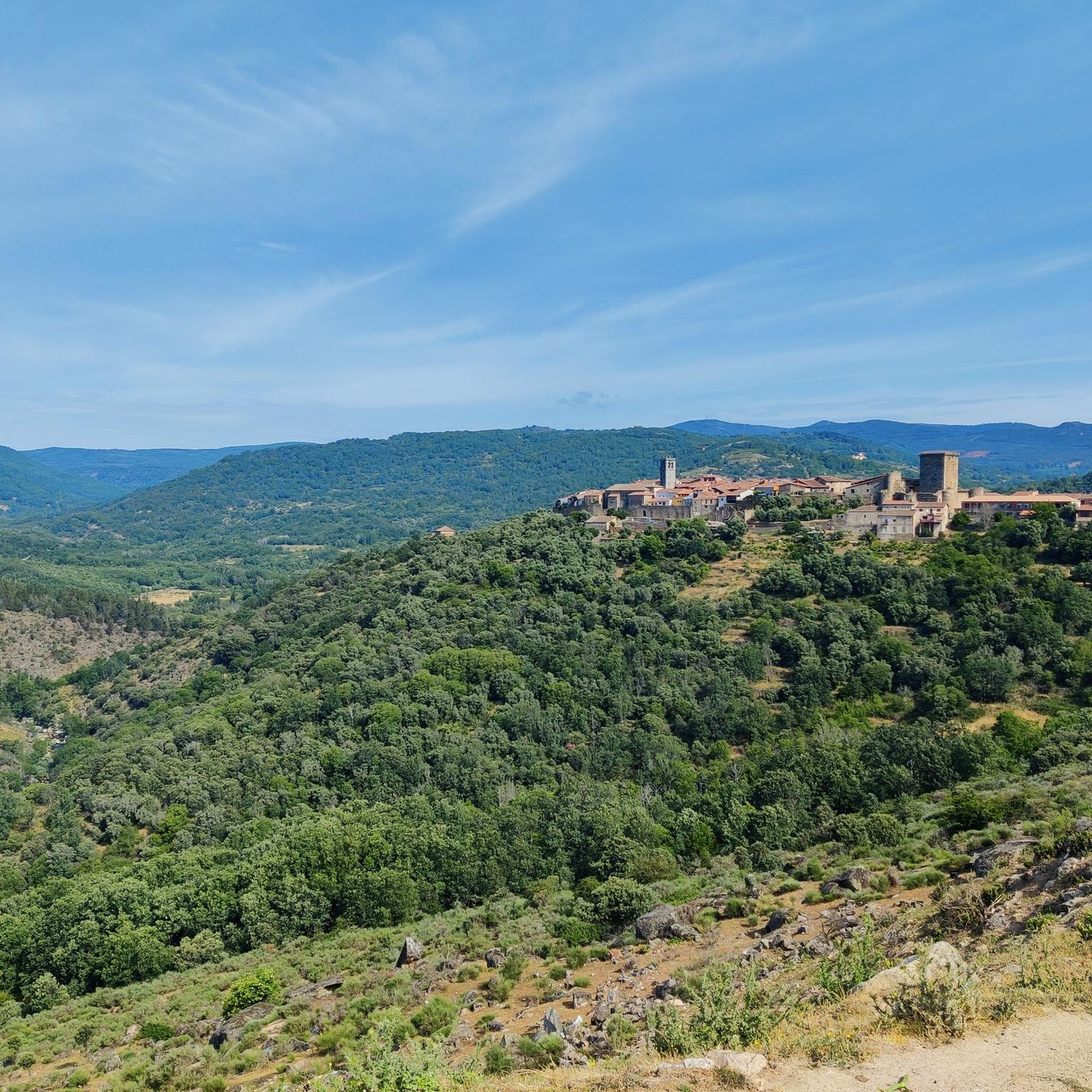
Mountain biking around Miranda Del Castañar offers routes through the Sierra de Francia region in Salamanca, Spain. The area features mountainous landscapes, deep river valleys, and extensive woodlands dominated by oak and chestnut trees. Terraced cultivations, vineyards, and olive groves also characterize the terrain, providing varied scenery. This region is part of the Las Batuecas-Sierra de Francia Natural Park, a UNESCO Biosphere Reserve.
Best mountain bike trails around Miranda Del Castañar
- The most popular mountain bike trail is Pico Cervero…
Last updated: July 11, 2026
5.0
(2)
19
riders
Hard mountain bike ride. Very good fitness required. Advanced riding skills necessary. Some portions of the route may require you to push your bike.
5.0
(1)
31
riders
48.0km
04:50
1,330m
1,330m
Hard mountain bike ride. Very good fitness required. Advanced riding skills necessary.

Sign up for free
15
riders
61.4km
05:44
1,530m
1,530m
Hard mountain bike ride. Very good fitness required. Advanced riding skills necessary. Some portions of the route may require you to push your bike.
3.0
(1)
17
riders
56.8km
04:40
990m
990m
Hard mountain bike ride. Very good fitness required. Suitable for all skill levels.
3.0
(1)
10
riders
32.2km
03:13
800m
800m
Moderate mountain bike ride. Good fitness required. Advanced riding skills necessary.
Get access to more routes and recommendations from other explorers.
Sign up for free
Already have an account?
Our route recommendations are based on thousands of hikes, rides, and runs completed by other people on komoot.
Start today with a free account
Your next adventure awaits.
Login or Signup

Tips from the Community

At the village's social meeting point, the Plaza Mayor with its arcades, stands a beautiful granite pilgrim's cross.
11
0
Striking about the houses are the stone support beams above the doorposts. Religious texts are engraved on them and there are dates from the 1700s and 1800s. After the reconquista, when the area was repopulated, many Jews came to live in the village. Because the church forbade the Jews to practice their religion, they had to prove that they had joined the Catholic church by engraving biblical texts above their houses.
10
0

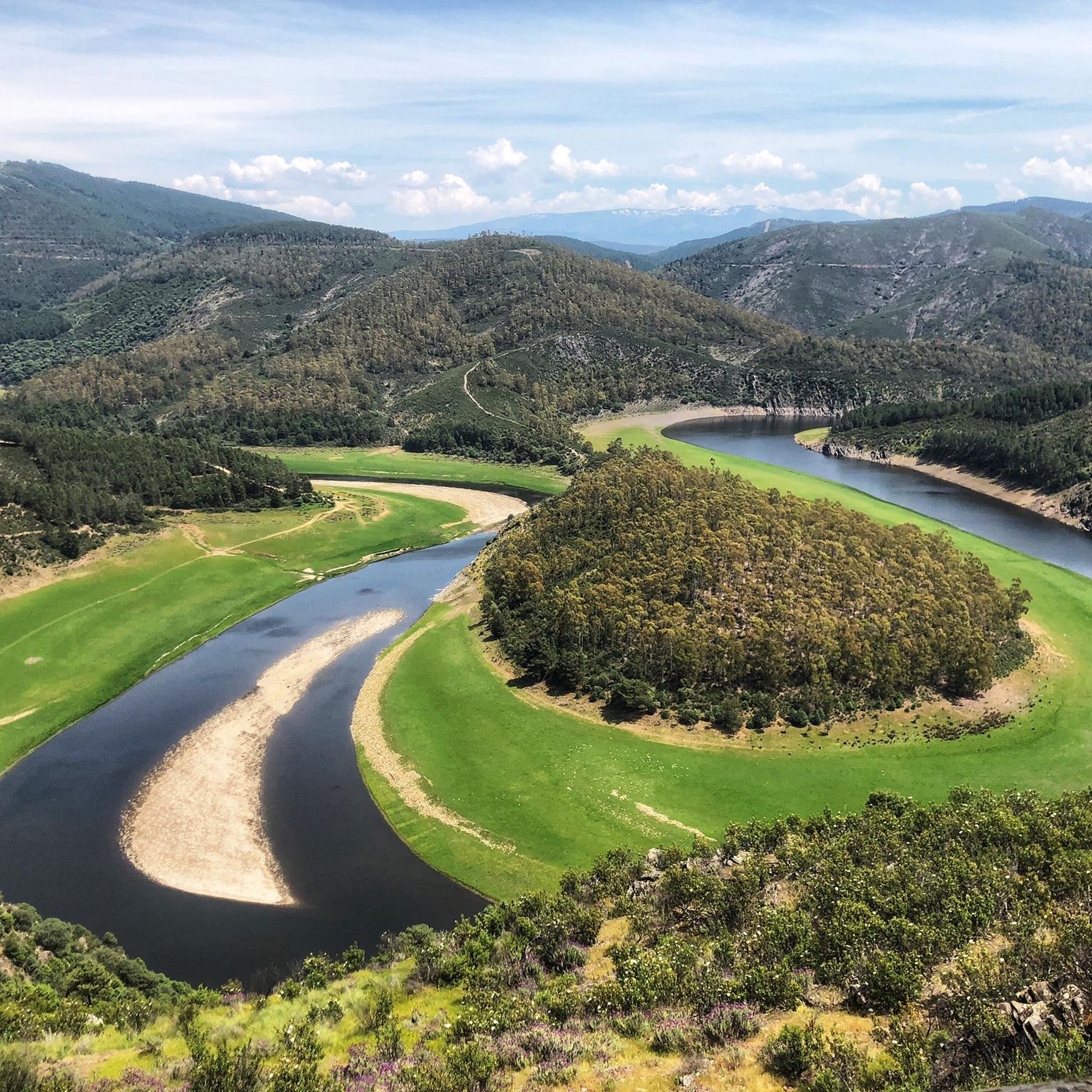
On the SA-205 highway, just outside San Esteban de la Sierra heading towards Santibáñez de la Sierra, you'll find the entrance to the Sierra Viewpoints Route, which includes several spectacular panoramic viewpoints. Views: The Alagón River Valley and its meanders. The Sierra de Francia mountain range with the Peña de Francia peak in the background. The Sierra de Béjar mountain range and the Las Quilamas Natural Area. This viewpoint is a magnificent natural balcony, perfect for photography and birdwatching (vultures, eagles, black storks).
2
0
The Plaza Mayor of Mogarraz is the heart of the village and one of its most picturesque spots. Oval shape: Unlike other Castilian squares, Mogarraz's has an irregular, enclosed shape, surrounded by traditional mountain houses with timber framing and stone walls. Traditional architecture: Flower-filled balconies, arcades, and facades adorned with the famous portraits from the "Faces of Mogarraz" art project. Social and historical center: Formerly used for markets and popular celebrations, today it serves as a meeting point for visitors and locals alike. Highlights: Central fountain. Views of the church and cobbled streets leading from the square. Restaurants and bars with terraces where you can sample the local mountain cuisine.
1
0
The portraits on the facades of Mogarraz are one of the town's most striking features. In 2012, artist Florencio Maíllo began a project to recover old ID photos taken in the 1960s by Alejandro Martín. He painted more than 800 portraits on canvases and placed them on the facades of the town's houses. Each portrait depicts a resident who lived there during that time, creating a unique open-air museum in Spain. The goal: to preserve collective memory and bring the streets to life with art.
3
0
What to see in Mogarraz The Faces of Mogarraz More than 800 portraits painted on the facades, the work of artist Florencio Maíllo, who transformed the village into an open-air museum. This initiative originated from photos taken in the 1960s for residents' national identity cards. Main Square The central oval-shaped square, surrounded by traditional mountain houses with timber framing and stone walls. Church of Our Lady of the Snows A Renaissance-style church, built between the 16th and 17th centuries. Bell Tower An old defensive tower, separate from the church, used as a watchtower in the Middle Ages. Ethnographic Museum – House of Crafts Exhibits traditional crafts such as embroidery, shoemaking, and goldsmithing.
2
0
Founded during the 12th-century repopulation of León by Alfonso IX, within the district of Miranda del Castañar. Declared a Historic-Artistic Site in 1998 and a member of the network of the Most Beautiful Villages of Spain. Its mountain architecture combines stone, wood, and adobe, with flower-adorned balconies and heraldic details.
2
0
Zúñiga Castle: A 15th-century fortress, symbol of the former County of Miranda. Although it is not open to the public, its exterior and keep are impressive.
1
0
Frequently Asked Questions
How many mountain bike trails are there around Miranda Del Castañar, and what are their difficulty levels?
There are over 20 mountain bike trails around Miranda Del Castañar. The majority, 16 routes, are classified as difficult, with 5 moderate and 2 easy options available, catering to a range of skill levels.
What kind of terrain and natural features can I expect on mountain bike trails in Miranda Del Castañar?
The trails around Miranda Del Castañar traverse varied and picturesque terrain. You'll encounter mountainous landscapes, deep river valleys like the Alagón, and extensive woodlands dominated by oak and chestnut trees. The region also features terraced cultivations, vineyards, and olive groves, providing scenic routes and panoramic views, including those of Peña de Francia and the Sierra de Candelario. It's part of the Las Batuecas-Sierra de Francia Natural Park, a UNESCO Biosphere Reserve.
Are there any long-distance mountain bike routes near Miranda Del Castañar?
Yes, several routes offer significant distances. For example, the Pico Cervero desde San Esteban de la Sierra – circular completa al Espacio Natural de las Quilamas is a challenging 35.2-mile (56.7 km) loop. Another long option is the San Miguel de Valero – La Honfría Recreation Area loop from San Esteban de la Sierra, which covers 38.1 miles (61.4 km).
What are some notable points of interest or attractions I might see while mountain biking in the area?
While exploring the trails, you can encounter several interesting sights. The historic villages of Miranda del Castañar and Mogarraz are highlights, with their medieval architecture. Natural features include Cervero Peak, the Soto Bridge over the Alagón River, and viewpoints like the View of Meandro del Melero. The region is also known for its unique arbutus forest.
Are there any circular mountain bike trails starting from Miranda Del Castañar?
Yes, there are several circular routes. A popular option is the Miranda de Castañar – Mogarraz loop from Miranda del Castañar, a difficult 26.4-mile (42.5 km) path connecting these two historic villages. Another is the Mogarraz – Mogarraz Main Square loop from Mogarraz, a moderate 20-mile (32.2 km) route.
What is the best time of year to go mountain biking in Miranda Del Castañar?
The Sierra de Francia region generally offers pleasant conditions for mountain biking during spring and autumn. These seasons provide milder temperatures and lush landscapes. Summer can be quite warm, especially in the valleys, while winter might bring colder weather to the higher elevations.
Are there any family-friendly mountain bike trails in the Miranda Del Castañar area?
While many routes in the immediate vicinity are rated moderate to difficult, the broader Salamanca province offers over 1500 km of signposted routes, including options suitable for families. Look for the 2 easy-rated trails available in the Miranda Del Castañar area, which would be more appropriate for a family outing.
What do other mountain bikers enjoy most about mountain biking in Miranda Del Castañar?
The mountain biking routes in Miranda Del Castañar are highly rated by the komoot community, with an average score of 4.2 stars from 6 reviews. Reviewers often praise the varied terrain, the challenging nature of the trails, and the beautiful natural landscapes of the Sierra de Francia region.
Is there parking available for mountain bikers near the trailheads in Miranda Del Castañar?
Miranda Del Castañar, as a historic village, has parking options available, typically in designated areas outside the main walled quarter. For specific trailheads further afield, parking availability can vary, so it's advisable to check the starting points of individual routes for local parking information.
Can I reach mountain bike trails in Miranda Del Castañar using public transport?
Public transport options to Miranda Del Castañar and surrounding villages are generally limited. While there might be bus services connecting to larger towns in Salamanca province, direct access to specific trailheads via public transport can be challenging. It's often more convenient to travel by car to access the starting points of the routes.
Are there any trails that pass by water features like rivers or lakes?
Yes, the region is characterized by deep river valleys, such as the Alagón River. Routes like the Sotoserrano – Water Reservoir loop from Sotoserrano specifically feature a water reservoir. You can also find natural highlights like the San Marcos Lagoon and various viewpoints overlooking the Alagón River.
Most popular routes around Miranda Del Castañar
Most popular attractions around Miranda Del Castañar

Get inspired with the komoot mobile app


Explore more
Browse the best MTB trails in other regions.
