The best running trails around Puebla De Alcocer
3.3
(5)
27
runners
8
runs
Jogging around Puebla De Alcocer offers diverse natural landscapes within the province of Badajoz, Extremadura. The region, part of La Siberia, features mountainous terrain with significant elevation changes, including hills like Cerro Masatrigo. Expansive reservoirs such as La Serena, Orellana, and García de Sola provide scenic waterside running opportunities, complemented by Mediterranean forests and dehesas. The area's network of trails integrates historical sites with natural beauty, making it suitable for various running experiences.
Best jogging routes around Puebla De Alcocer
…Last updated: October 27, 2026
3
runners
6.80km
00:49
170m
170m
Hard run. Good fitness required. Sure-footedness, sturdy shoes and alpine experience required.
3.0
(2)
7
runners
7.92km
00:50
90m
90m
Moderate run. Good fitness required. Mostly paved surfaces.

3.7
(3)
6
runners
8.46km
00:54
100m
100m
Moderate run. Good fitness required. Mostly paved surfaces.
6
runners
Hard run. Very good fitness required. Mostly paved surfaces.
5
runners
4.75km
00:29
20m
20m
Easy run. Mostly paved surfaces.
Get access to more routes and recommendations from other explorers.
Already have an account?
Our route recommendations are based on thousands of hikes, rides, and runs completed by other people on komoot.
Start today with a free account
Your next adventure awaits.
Tips from the Community

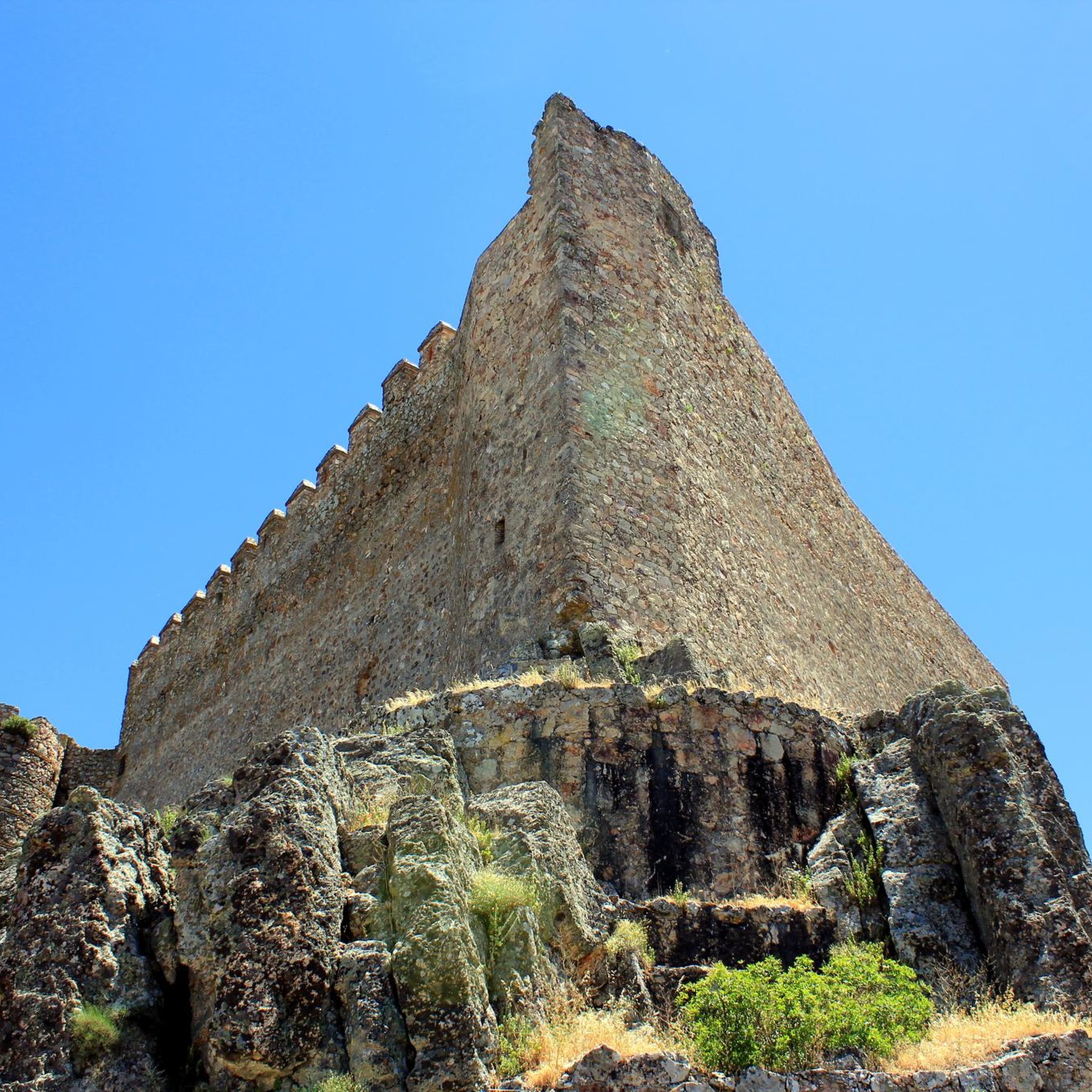
Located south of Castilblanco, this town is surrounded by ferruginous springs. Here we find an Almohad-era castle, now devoid of walls and decoration, built on an octagonal plan atop a high crag south of the town, on a summit that is difficult to access.
2
0
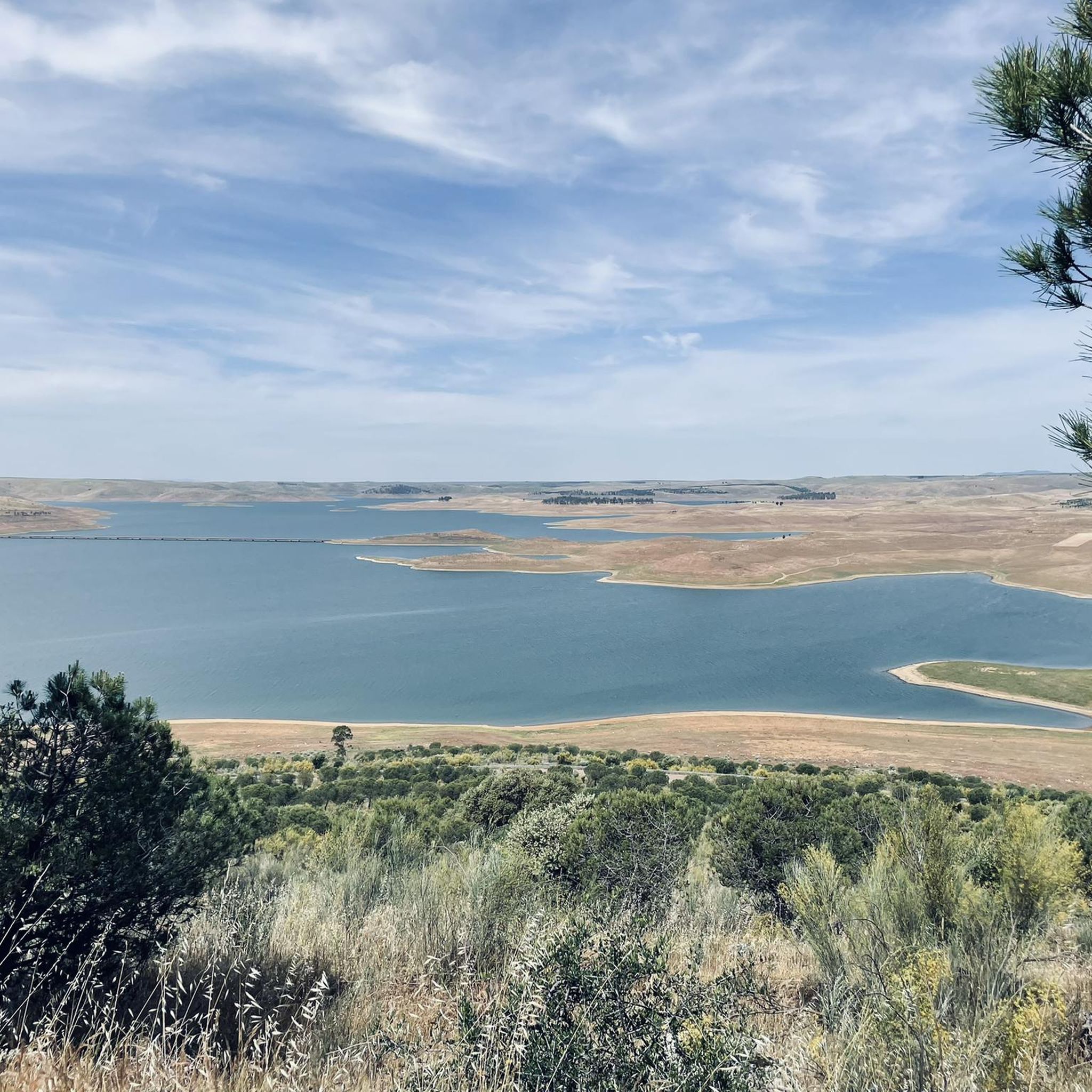
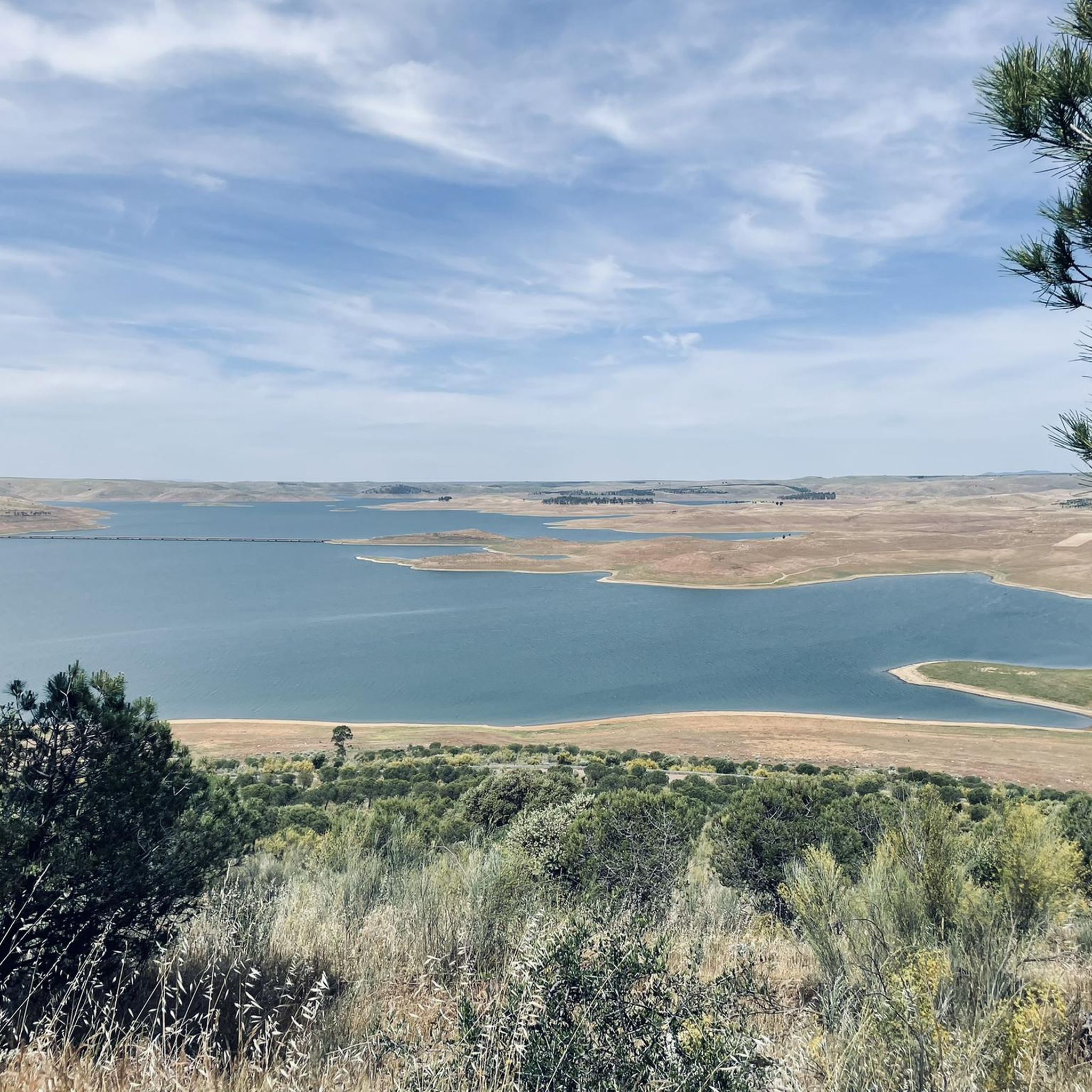
Cerro Masatrigo is a hill located in the municipality of Esparragosa de Lares. This hill is known for its almost perfect conical shape, which has earned it the nickname "the magic mountain" It rises 501 meters above sea level and 161 meters above the surrounding terrain. After the construction of the La Serena Dam, Cerro Masatrigo became a peninsula surrounded by the waters of the reservoir.
7
0
Located to the south of Castilblanco, this town is surrounded by ferruginous springs. In it we find a castle from the Almohad period, devoid of walls and decoration and built in an octagonal plan on a high rock to the south of the town, on a difficult-to-reach peak.
11
1

Herrera del Duque is a small town of Roman origin located at a strategic road junction between Badajoz and Ciudad Real and another with Córdoba and Ávila. The village is a good starting point for the hike up to the castle on the mountain above the village.
3
0

Located in the middle of the La Serena Reservoir and at 501 meters above sea level, it offers us wonderful views at 360 degrees. The Masatrigo hill, for sure, will surprise us with its shape and its curious name. It is called this way because for many its shape is assimilated to a pile of wheat.
1
1

Herrera del Duque is a town located in the northeastern tip of the province and is known for its castle that is located on a hill in the town. From the Castle of Herrera del Duque there is a very beautiful panorama of the whole.
1
0

Located in the middle of the La Serena Reservoir, the Masatrigo hill stands out for its shape and its curious name. It is called this way because for many its shape is assimilated to a pile of wheat. In addition to its curiosities, the top of the hill is 480 meters above sea level and offers wonderful views in all directions.
3
1
Cerro Masatrigo is so called because it looks like a pile of wheat, it is located in the La Serena reservoir, it is located at an altitude of about 500 meters and with views that are worth it.
14
1
Frequently Asked Questions
What types of running routes are available in Puebla de Alcocer?
Puebla de Alcocer offers a diverse range of running routes, catering to various preferences and fitness levels. You can find everything from easy town loops to more challenging trails with significant elevation changes. The landscape features mountainous terrain, expansive reservoirs like La Serena and Orellana, and Mediterranean forests, providing varied scenery for your runs.
Are there any easy running trails suitable for beginners or a relaxed jog?
Yes, there are several easy running options. For a gentle exploration, consider the Herrera del Duque Town Center loop from Herrera del Duque, which is 4.8 km (3.0 miles) long. Another easy option is the Running loop from Talarrubias, spanning 4.7 km (2.9 miles) with minimal elevation gain.
Where can I find more challenging running routes in the area?
For those seeking a challenge, Puebla de Alcocer offers routes with notable elevation changes. The Cerro Masatrigo Botanical Trail is a difficult 6.8 km (4.2 miles) route with distinctive scenery around the conical hill. Another demanding option is the Herrera del Duque Castle loop from Herrera del Duque, a 10.9 km (6.7 miles) trail leading through varied terrain with castle views.
What natural features or landmarks can I see while running in Puebla de Alcocer?
The region is rich in natural beauty and historical sites. You can enjoy views of expansive reservoirs like Garcia de Sola Reservoir and La Serena, or run past unique geological formations such as Cerro Masatrigo. The Castle of Puebla de Alcocer, perched atop a hill, also serves as a prominent landmark and offers panoramic views.
Are there any circular running routes available?
Yes, many of the running routes in the area are designed as loops, allowing you to start and finish at the same point. Examples include the Herrera del Duque Town Center loop and the Herrera del Duque Castle loop, providing convenient options for your run.
What is the best time of year for jogging in Puebla de Alcocer?
The region experiences hot summers, so spring and autumn are generally the most pleasant seasons for jogging, offering milder temperatures. Winter can also be suitable, though temperatures will be cooler. Always check the local weather forecast before heading out.
Can I spot any wildlife while running in this area?
Yes, the area is part of a Special Protection Area for Birds (ZEPA), particularly around the castle esplanade and the García de Sola Reservoir. You might spot valuable birdlife, including griffon vultures, black vultures, black storks, golden eagles, and peregrine falcons, adding an ecological dimension to your outdoor excursions.
Are there any family-friendly running paths in Puebla de Alcocer?
For families, the easier, shorter loop routes are generally most suitable. The Herrera del Duque Town Center loop, at 4.8 km, offers a gentle path through town surroundings that could be enjoyable for families looking for a less strenuous activity.
What do other runners say about the trails in Puebla de Alcocer?
The running routes in Puebla de Alcocer are highly regarded by the komoot community, with an average score of 5.0 stars. Runners often praise the varied terrain, the scenic views of the reservoirs and mountains, and the integration of historical sites into the routes, making for a rewarding experience.
Are there options for combining a run with other activities, like visiting a beach?
Yes, you can combine your run with other activities. The Garcia de Sola Reservoir and the nearby Playa de la Isla del Zújar, an artificial freshwater beach on the Zújar reservoir (about 17 km away), offer opportunities to cool off or enjoy aquatic activities after your run.
Is there public transport access to the running trails?
While specific public transport routes directly to trailheads might be limited, the region is traversed by sections of the Camino Natural del Guadiana. For routes further afield, it's advisable to check local bus schedules to nearby towns like Herrera del Duque or Talarrubias, from which some loops originate.
Where can I find parking for the running routes?
Parking availability will vary by trailhead. For routes starting in or near towns like Herrera del Duque or Talarrubias, you can typically find parking within the town centers or designated areas. For more remote trails, it's best to check specific route details on komoot for recommended parking spots.
Are there any routes that follow the Guadiana River?
Yes, sections of the Camino Natural del Guadiana, a long-distance trail, pass through the area. One notable stage, 'Casas de Don Pedro – Puebla de Alcocer,' offers a route along the Orellana reservoir and across extensive pastures, providing a chance to run near the Guadiana River's influence.
Most popular attractions around Puebla De Alcocer

Get inspired with the komoot mobile app


Explore more
Browse the best Running Trails & Routes in other regions.
