The best walks and hikes around Ea
4.4
(913)
5,630
hikers
213
hikes
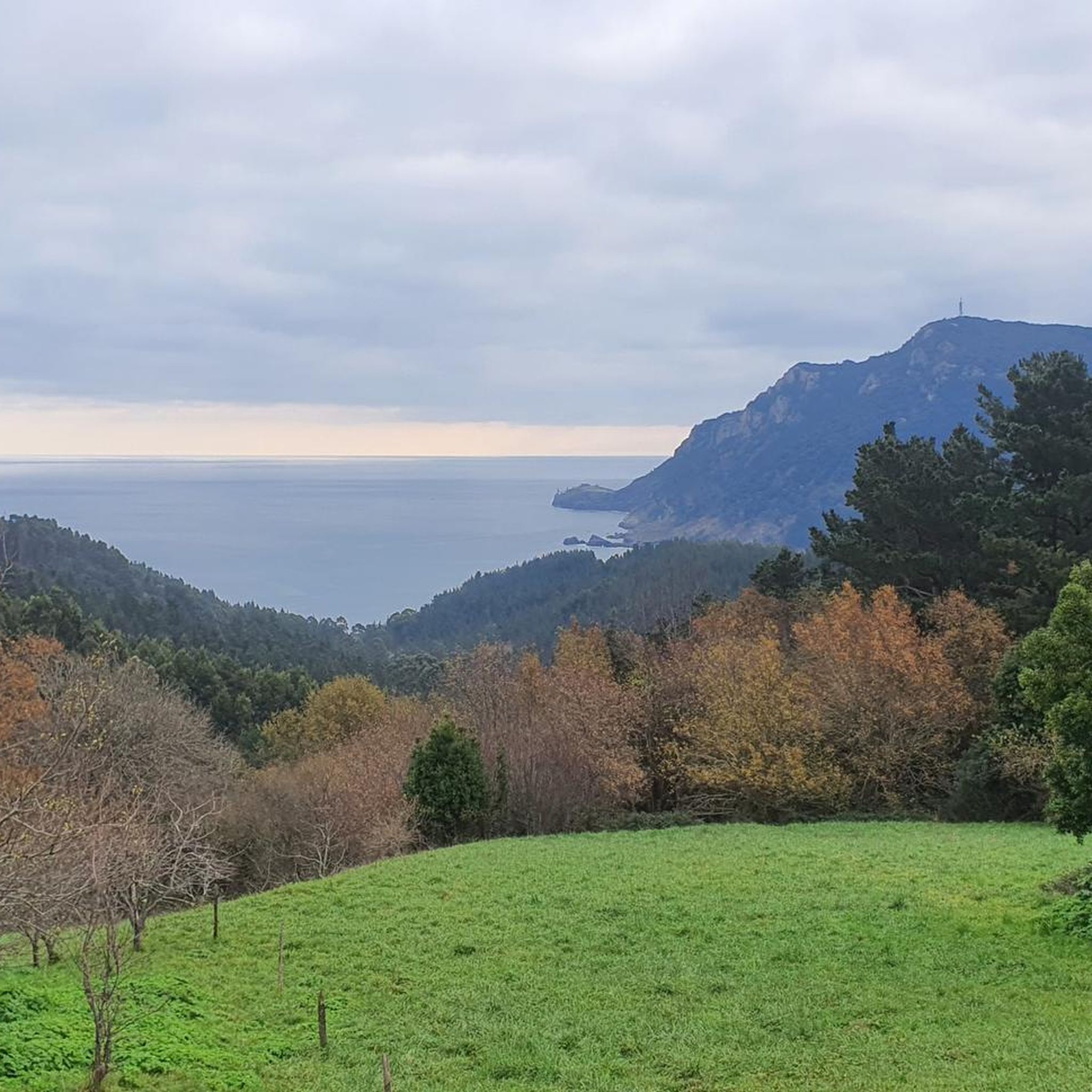
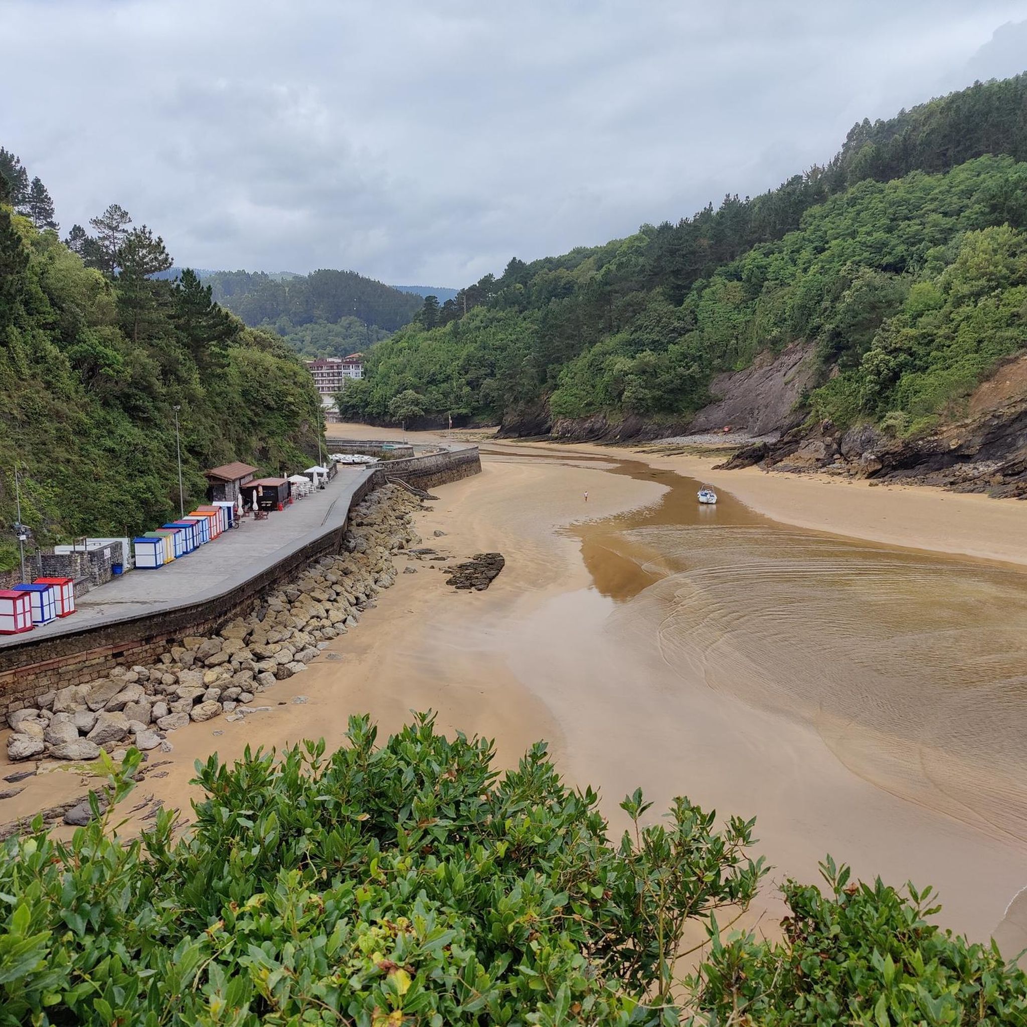
Hiking trails Ea offer a diverse landscape characterized by a coastal setting where mountains meet the sea. The region features a ria extending inland, a creek, and small stone bridges, providing varied terrain for outdoor activities. The surrounding area includes mountainous roads and the nearby Urdaibai Biosphere Reserve, contributing to its natural heritage. This combination of coastal and inland features makes Ea a compelling destination for hikers.
Best hiking trails around Ea
- The most popular hiking route is Following the…
Last updated: June 23, 2026
4.5
(2)
12
hikers
13.1km
03:53
400m
400m
Moderate hike. Good fitness required. Easily-accessible paths. Suitable for all skill levels.
3.7
(3)
20
hikers
10.9km
03:19
380m
380m
Moderate hike. Good fitness required. Easily-accessible paths. Suitable for all skill levels.

Sign up for free
4.0
(4)
18
hikers
8.48km
02:34
290m
290m
Moderate hike. Good fitness required. Easily-accessible paths. Suitable for all skill levels.
4.3
(3)
22
hikers
16.7km
05:03
540m
550m
Hard hike. Very good fitness required. Easily-accessible paths. Suitable for all skill levels.
3.8
(4)
13
hikers
10.4km
03:03
280m
280m
Moderate hike. Good fitness required. Easily-accessible paths. Suitable for all skill levels.
Get access to more routes and recommendations from other explorers.
Sign up for free
Already have an account?
Our route recommendations are based on thousands of hikes, rides, and runs completed by other people on komoot.
Start today with a free account
Your next adventure awaits.
Login or Signup

Tips from the Community

Probably an old Basque song with impressive paintings on the wall
0
0


Also known as Ermita de la Concepción and Ermita de la Atalaya is a religious building in Spain. It is located in the Biscayan town of Ea. The hermitage is located in a natural watchtower, which is accessed from a small path located in the port of the town.
0
0
Biscayan town located on the eastern slope of the rocky mass of Cabo Ogoño, which protects the fishing port, but whose enormous slope forms a cascade of narrow and steep streets in which the houses seem to form a staircase of roofs that reaches the very shore from sea.
1
0
Also known as Ermita de la Concepción and Ermita de la Atalaya is a religious building in Spain. It is located in the Biscayan town of Ea. The hermitage is located in a natural watchtower, which is accessed from a small path located in the port of the town.
0
0
One of the three main districts of Eako (Bizkaia), located to the east of the municipality. It had its own municipality until the 1887 census. The popular pronunciation of the name is "Bedaru".
1
0
Small town on the coast of Vizcaya (Spain). Since the 16th century, fishing has been the most important traditional activity. Ea has a river that divides the town into two parts. The houses are located around this stream, forming two long parallel streets. There are 4 bridges that make it easy for us to move from one street to another. One of the bridges, the so-called 'Roman bridge', has become the image of the town and its image appears on the municipality's flag.
1
0

Ea is a small Basque town that has several stone coves protected by huge cliffs and lush vegetation. Highly coveted spaces among locals and tourists during the summer season. The town itself is covered in a very short time.
0
0
Frequently Asked Questions
How many hiking trails are available around Ea, and what are their difficulty levels?
There are over 220 hiking routes around Ea. These include a variety of options: 74 easy trails, 118 moderate trails, and 28 difficult trails, ensuring there's something for every skill level.
Are there any circular hiking routes near Ea?
Yes, Ea offers several circular routes. For example, the Roman Bridge of Ea – Ea loop from Ea is a moderate 6.7-mile (10.8 km) trail that incorporates the historic Roman Bridge. Another option is the more challenging Talaia (276 m) – Mount Ogoño (305 m) loop from Ibarrangelu, which is 4.3 miles (7.0 km) long and leads through mountainous terrain.
What natural attractions or landmarks can I see while hiking around Ea?
Ea's trails offer views of its unique natural setting, including a ria extending inland, a creek, and small stone bridges. You can explore highlights like the Artzubi Bridge. The region is also close to the Urdaibai Biosphere Reserve, offering diverse landscapes. Hikers can also find viewpoints such as View from San Pedro de Atxarre and summits like Mount Ogoño (305 m).
Are there easy or family-friendly hiking options in Ea?
Yes, Ea has 74 easy trails suitable for families or those looking for a relaxed walk. The village's lagoon-like beach and the general charm of the area make it pleasant for all ages. While specific family-friendly routes aren't detailed, the abundance of easy trails suggests many gentle paths to explore the local landscape.
Can I hike with my dog around Ea?
Many trails in the Ea region are suitable for hiking with dogs, provided they are kept under control and local regulations are followed. It's always a good idea to check specific trail rules or signage for any restrictions, especially in protected areas like the Urdaibai Biosphere Reserve.
When is the best time of year to go hiking in Ea?
Given Ea's coastal location in the Basque Country, spring (April-June) and autumn (September-October) generally offer the most pleasant hiking conditions with mild temperatures and beautiful scenery. Summer can be warm, while winter might bring cooler, wetter weather, though coastal walks can still be enjoyable.
What do other hikers enjoy the most about hiking in Ea?
The komoot community highly rates hiking in Ea, with an average score of 4.4 stars from over 850 reviews. Hikers often praise the diverse landscape where mountains meet the sea, the unique ria, and the charming village setting. The variety of trails, from coastal paths to mountainous ascents, is also a frequently mentioned highlight.
Are there any longer or more challenging hikes for experienced hikers?
Yes, for experienced hikers, there are 28 difficult trails around Ea. A notable longer route is Laga Beach – View from San Pedro de Atxarre loop from Ibarrangelu, a moderate 10.1-mile (16.3 km) path offering extensive coastal views and taking around 4 hours 54 minutes to complete.
Are there any trails that follow a water source or river?
Yes, one of the notable options in the area is Following the Water Trail. This 8.1-mile (13.1 km) route traces a path through the local landscape, likely incorporating the creek and small stone bridges characteristic of Ea's natural setting.
What kind of terrain can I expect on hikes around Ea?
Hiking around Ea offers a diverse range of terrain. You can expect coastal paths where mountains meet the sea, trails along a ria that extends inland, paths alongside a creek with small stone bridges, and more rugged mountainous sections. The roads leading to Ea are also described as mountainous, indicating varied topography.
Are there any viewpoints or summits accessible by hiking in Ea?
Absolutely. The region features several points offering panoramic views. You can hike to the View from San Pedro de Atxarre or ascend to summits like Mount Ogoño (305 m) and Talaia (276 m), which are part of popular loop trails.
Most popular attractions around Ea

Get inspired with the komoot mobile app


Explore more
Browse the best Hikes in other regions.
