The best road cycling routes around Salar
4.7
(57)
1,176
riders
83
rides
Road cycling around Salar is characterized by vast, high-altitude salt flats and surrounding mountainous terrain. The region, particularly Salar de Uyuni, features expansive, flat surfaces often at elevations around 12,000 feet (3,700 meters) above sea level. Cyclists encounter varied surface conditions, from smooth salt tiles to rough bumps and sandy sections. The landscape includes unique geological formations like hexagonal salt patterns and islands with giant cacti, set against a backdrop of snow-capped mountains.
Best road cycling routes around Salar
- The…
Last updated: July 17, 2026
1
riders
57.5km
04:19
930m
930m
This difficult 35.7-mile road cycling route from Moraleda de Zafayona takes you through the dramatic Río Cacín canyon.
5.0
(2)
39
riders
73.9km
03:34
1,040m
1,040m
Hard road ride. Very good fitness required. Mostly well-paved surfaces and easy to ride.

Sign up for free
31
riders
Hard road ride. Very good fitness required. Some segments of this route may be unpaved and difficult to ride.
3.0
(1)
27
riders
48.6km
02:28
700m
700m
Moderate road ride. Good fitness required. Mostly well-paved surfaces and easy to ride.
18
riders
63.8km
03:30
1,300m
1,300m
Hard road ride. Very good fitness required. Mostly well-paved surfaces and easy to ride.
Get access to more routes and recommendations from other explorers.
Sign up for free
Already have an account?
Our route recommendations are based on thousands of hikes, rides, and runs completed by other people on komoot.
Start today with a free account
Your next adventure awaits.
Login or Signup
Tips from the Community


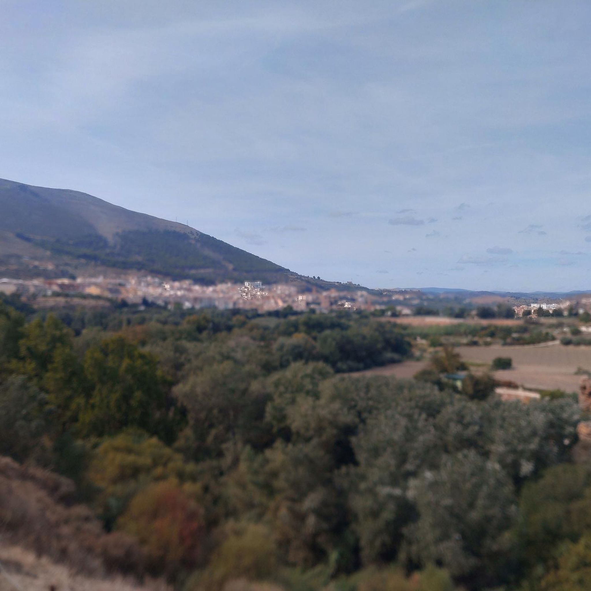
It stands atop a rocky outcrop overlooking the town of Montefrío (Granada, Andalusia). This Nasrid fortress was likely begun by Sultan Yusuf I in the 14th century (around 1352) to defend the northwestern border of the Kingdom of Granada. It consisted of two walled enclosures and several semicircular towers, with pathways carved into the rock and cisterns for water. Christian Conquest (1486): After falling to the Catholic Monarchs, a Gothic-Renaissance church was built within the upper enclosure, leveling the barbican. The church, known as the Church of the Town, was completed in 1507 and later expanded in the Renaissance style.
3
0

This watchtower houses the castle and wall dating from the Caliphate period between the 9th and 10th centuries. In addition to the castle, there are also watchtowers or watchtowers associated with it, among which the Torre de Brácana stands out.
15
0

Easy route highly recommended
0
0

Alhama de Granada* is a picturesque town. It is situated at an altitude of around 900 metres and offers breathtaking views of the surrounding mountains and valleys. The town has a rich history dating back to Roman and Moorish times, which is reflected in its many historic buildings and monuments. Some highlights of Alhama de Granada include: The Arab Baths: Dating back to the 12th century, these well-preserved baths are a beautiful example of Moorish architecture. The Iglesia Mayor de la Encarnación: Built in the 16th century, this church combines Gothic and Renaissance styles. The Alhama Gorge: An impressive natural gorge that runs through the town and is a popular destination for walkers and nature lovers. The Alhama Castle: A medieval fortress that offers beautiful views of the town and its surroundings. The Arab Quarter: A preserved Moorish quarter. Alhama de Granada is famous for its thermal baths, which have been used since Roman times for their medicinal properties. The city has a relaxed and welcoming atmosphere, with narrow streets, white houses and pleasant squares where you can enjoy the local cuisine and culture.
8
0

Beautiful area with lots to explore.
0
1

In 2016, Montefrío received a very special award from National Geographics magazine: it is one of ten places with the best panoramic views in the world. Otherwise, only the Castillo is worth mentioning.
0
0
A tip: you should never go to the Castillo on Monday. Then it's closed 🥲 The 2 euro entrance fee should be worth it. The view is nothing to sneeze at either.
1
0
Frequently Asked Questions
What makes road cycling in Salar de Uyuni unique?
Road cycling in Salar de Uyuni offers an unparalleled experience due to its vast, flat salt flats, which create an otherworldly landscape. Cyclists can enjoy smooth, uninterrupted rides across the world's largest salt flat, often feeling like they are pedaling on another planet. The high-altitude environment, combined with dramatic volcanic backdrops and unique geological formations, provides breathtaking scenery not found anywhere else.
How many road cycling routes are available in Salar?
Komoot features over 70 road cycling routes in the Salar region. These routes cater to various skill levels, with options ranging from moderate to difficult, ensuring there's a challenge for most experienced cyclists.
What is the best time of year for road cycling in Salar de Uyuni?
The best time for road cycling in Salar de Uyuni is generally during the dry season, from May to November. During this period, the salt crust is hardened, providing a smoother surface for cycling. The rainy season (December to April) can transform parts of the Salar into a giant mirror, which is visually stunning, but can also lead to flooded sections, making cycling more challenging or limiting access.
Are there any easy road cycling routes for beginners in Salar?
While the Salar region is known for its challenging, high-altitude terrain, there are a few routes classified as 'easy' within the komoot community. However, even these require preparation for the extreme conditions, including high altitude and intense sun. Most routes are rated moderate to difficult, making it more suitable for experienced cyclists.
What are the typical weather conditions for road cycling in Salar?
Cyclists in Salar de Uyuni should be prepared for extreme conditions. Days can feature intense sun and clear skies, while nights can be freezing. The high altitude (around 3,656 meters or 12,000 feet) means thinner air, requiring acclimatization. Strong winds can also be a factor. Always carry ample water, sunscreen, and appropriate layered clothing.
What kind of natural features can I expect to see along the routes?
The Salar region is rich in unique natural features. You'll encounter the vast, shimmering white salt flats with their distinctive hexagonal patterns. During the rainy season, the 'mirror effect' is a highlight. Beyond the main salt flat, you can find colorful high-altitude lagoons like Laguna Colorada (Red Lagoon) and Laguna Verde, dramatic volcanic landscapes, and geothermal areas with geysers and hot springs.
Are there any specific attractions or landmarks to visit while cycling?
Yes, several unique attractions dot the Salar de Uyuni. You can visit Isla Incahuasi, a rocky island covered in giant cacti, offering panoramic views. Near Uyuni, the Train Cemetery features abandoned locomotives. You might also encounter unique salt hotels and the Dakar Monument on the flats.
What do other road cyclists say about their experience in Salar?
The Salar region is highly rated by the komoot community, with an average score of 4.7 stars from over 50 reviews. Cyclists often praise the surreal, otherworldly landscapes, the unique challenge of high-altitude riding, and the feeling of solitude and adventure on the vast salt flats.
Are there any loop road cycling routes around Salar?
Yes, komoot offers several loop road cycling routes in the Salar region. These circular routes allow you to start and end at the same point, providing a convenient way to explore the diverse landscapes without backtracking. You can find options ranging from moderate to difficult, often incorporating scenic viewpoints and unique natural features.
What should I consider regarding altitude when planning a road cycling trip to Salar de Uyuni?
Salar de Uyuni is located at a very high altitude, around 3,656 meters (12,000 feet) above sea level. Acclimatization is crucial to avoid altitude sickness. It's recommended to spend a few days at a moderate elevation before undertaking strenuous cycling. Always stay hydrated and be aware of your body's signals.
Can I find places to eat or stay along the road cycling routes in Salar?
Due to the remote and extreme nature of Salar de Uyuni, amenities like cafes and traditional accommodations are sparse directly along the cycling routes on the salt flats. Most services are concentrated in nearby towns like Uyuni. Some tours may include lunch on the flats, and unique salt hotels offer immersive stays. It's essential to plan your provisions and overnight stays carefully.
Most popular attractions around Salar

Get inspired with the komoot mobile app


Explore more
Browse the best Road cycling routes in other regions.
