Attractions and Places To See around Ambel - Top 20
Best attractions and places to see around Ambel include historical settlements, ancient religious sites, and natural monuments within a mountainous landscape. This region, located in Spain, offers a variety of experiences from exploring medieval castles to discovering unique geological formations. Visitors can find numerous viewpoints and trails, particularly within the Moncayo Natural Park. The area provides opportunities to engage with both cultural heritage and the natural environment.
Best attractions and places to see around Ambel
- The most popular attractions is…
Last updated: July 12, 2026
Borja
Highlight • Settlement
Translated by Google •
Tip by

Monastery of Santa María de Veruela
Highlight • Religious Site
Translated by Google •
Tip by

Sign up now to discover places like this
Get recommendations on the best single tracks, peaks, & plenty of other exciting outdoor places.
Sign up for free
Cueva de los Pilares
Highlight • Cave
Translated by Google •
Tip by
Majada Baja Refuge, Moncayo Natural Park
Highlight • Mountain Hut
Translated by Google •
Tip by

Cabezo de la Mata
Highlight • Viewpoint
Translated by Google •
Tip by

Sign up for free to discover even more attractions around Ambel.
Sign up for free
Already have an account?
Start today with a free account
Your next adventure awaits.
Login or Signup


Tips from the Community

Cabezo de la Mata is a peak located in the Sierra del Moncayo, in Aragon, Spain. With an altitude of 1,437 metres, it is one of the most accessible peaks in the area. One of the most popular routes to ascend Cabezo de la Mata begins at Fuente de los Frailes. This circular route offers spectacular views of the northeastern slope of the Sierra del Moncayo and the plain of the Ebro Valley. The route includes sections through beech and pine forests, and is suitable for all year round.
5
0

You need to be in shape, it is a climb that requires some climbing skill.
0
0

Real Monasterio de Santa María de Veruela, or "The Royal Monastery of Santa María de Veruela") is a Cistercian abbey from the 12th century. It is located near Vera de Moncayo. It was founded in 1146 by Pedro de Atarés. Source wikipedia.
1
0
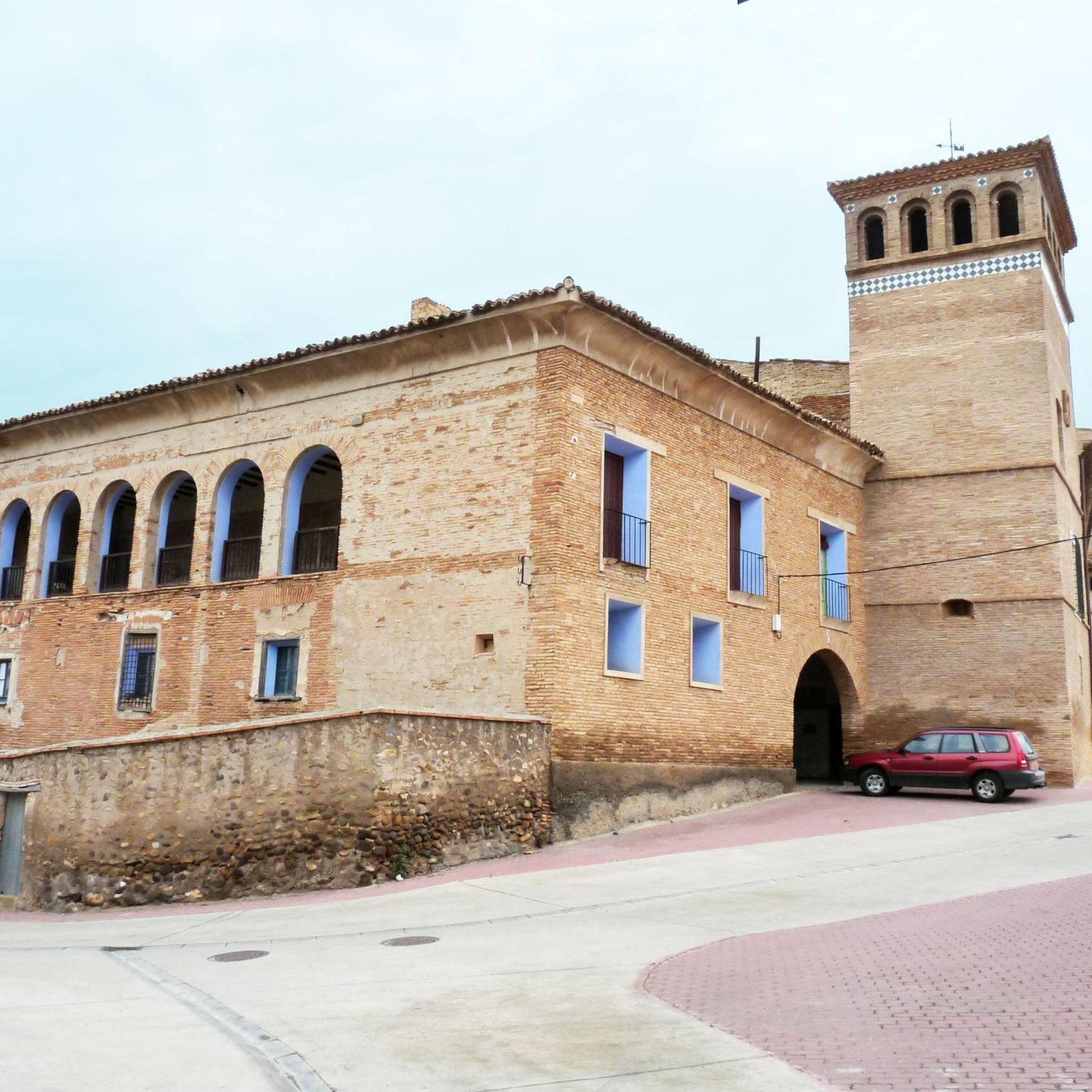
Borja has been on the map since the 5th century BC, there are about 5000 inhabitants and the town offers several sights. Church of San Miquel, church Sante Maria, baroque monastery Santa Klara etc.
1
0
Borja has a pronounced continental climate with limited precipitation of 350 to 450 mm per year. Hail and frost are common in spring and a cold, dry northerly wind (the cierzo) is typical of the area.
4
0

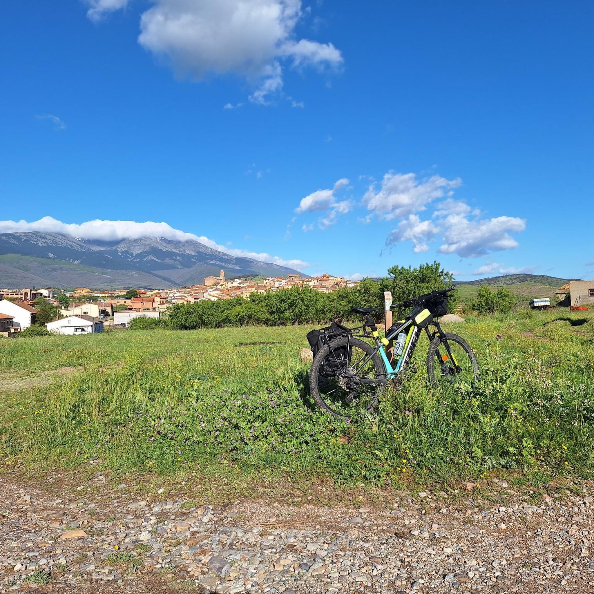
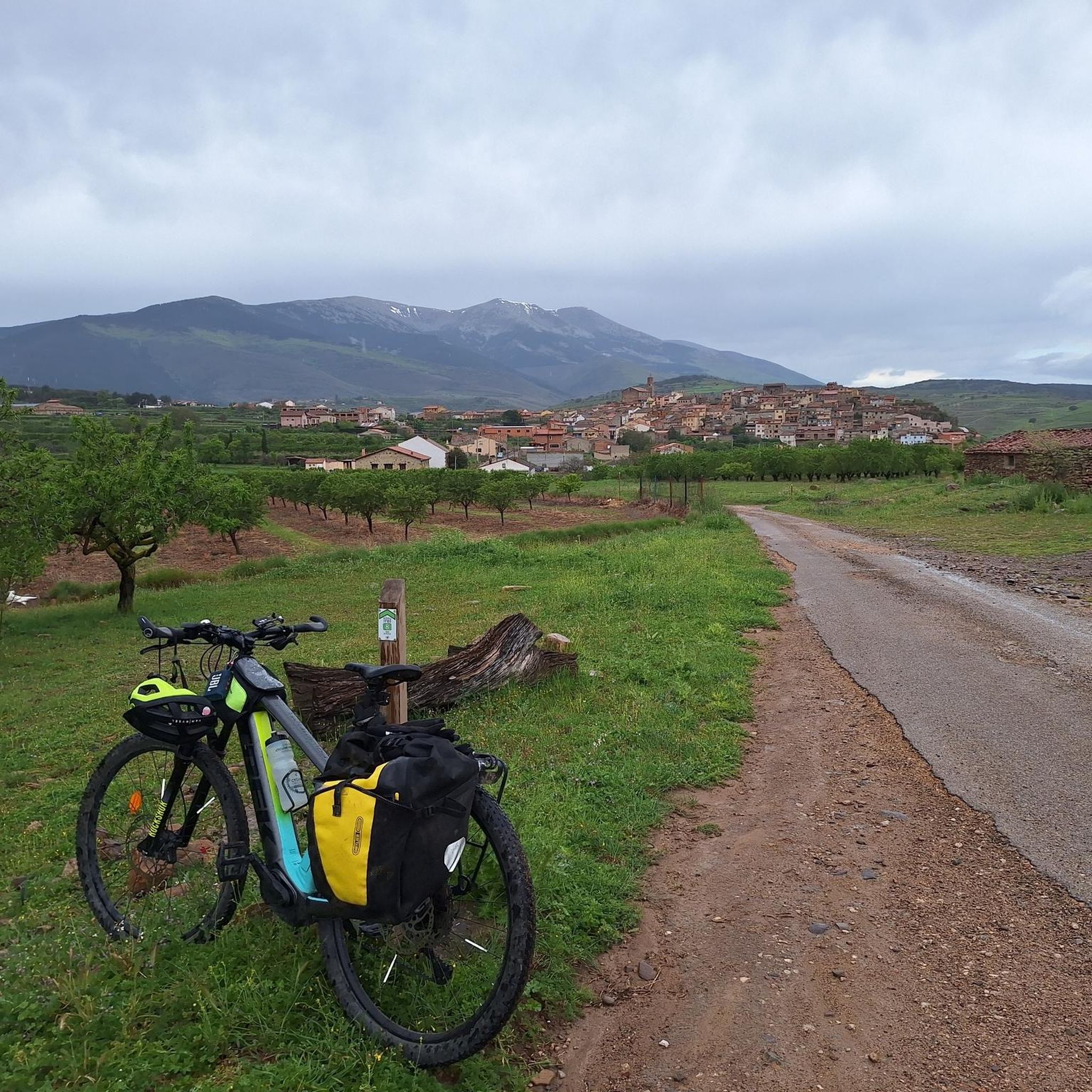
The Moncayo Natural Park crossing is an itinerary for gravel bicycles of a particular design to link with the Santander Mediterráneo Natural Path in Ciria, looking for the best circular bikepacking route back to the city of Soria. The downloaded track is essential in this section, it is impossible to specify in these texts all the detours, intersections and details with the same precision that digital information offers. The mountain bike adventure begins at the Tarazona exit, at the sign for the GR-90 long-distance trail, although it then coincides in a few sections. It is important to carry provisions for the rest of the day and the next, it is not safe to find food in the towns along the way. The route follows a farm road to Grisel and then comes the first spike of the climb in the mountains where the Grisel Wind Farm is located. The hard slope is one kilometer long until you reach the mills, but the slope is steep and the loose stone surface requires extra effort. On the hill, the enormous Moncayo slope covered with pines, oaks and beech trees appears up close. And on top of that, the peaks of the massif are like unattainable islands above a sea of mysterious and impenetrable forests. The path crosses another steep slope of loose stone and begins a long climb up a hill marked with milestones of cycling and hiking routes until it crosses the Agramonte highway and connects with the paved track of the Moncayo Sanctuary. The route continues along the small mountain road, crosses the centuries-old beech forests of Fuente del Sacristán and at the Fuente de los Frailes hairpin it turns to the left to begin the final stretch of the ascent along the forest track of Collado Bellido. In the case of spending the night in the Majada Baja Refuge, where I propose, at the end of the climb, you have to carry water at the source, then there are mountain streams but depending on the season of the year they can be dry. Along the way there are several crossings and detours, generally it is always the uphill track that runs along the entire northern slope of the Moncayo massif to go to the southern face. The climb is long and constant, it leaves the forest and continues until it passes the detour to Collado Bellido, indicated with markers on the ditch of the forest track. The end of the ascent is shortly after, at the curve of the Valdealonso stream, at about 1,900 meters of altitude, the path changes slope and the descent begins. Two kilometers later is the Majada Baja Refuge, it is a natural park refuge, well maintained and available for mountaineers, cyclists, hunters, shepherds and users of the Moncayo environmental space. The place has extraordinary views and it is difficult to pass by at dusk and not stay the night.
1
0

At the Collado de la Atalaya you have to head northeast along the slope of the mountain range following a level path marked with stone markers. The path crosses the Las Hoyas de los Portillos valley and climbs halfway through the pine forest towards the wall of the Muela del Cerro Morrón. In the pine forest you have to keep climbing towards the east and at the base of the walls connect with the path coming from the north face of the mountain. The landmarks are clear between the pine trees and the mole wall, they jump a couple of small slopes near other cavities and lead to the spectacular Cueva de los Pilares, a fantastic natural rock sanctuary with arches, vaults and giant columns. The climb to the summit of the mole leaves from the cave through the canal located to the west, it is a clear and obvious climb, it has stone markers and although it seems that there is no exit with good visibility, it is a simple section along some aerial ledges without too many complications, unless the rock is wet, it cannot even be classified as a climbing step, rather technical mountain hiking. The milestones enter the large inclined molar plain and take the direction of the summit through the center of the mountain.
0
1

Frequently Asked Questions
What historical and cultural sites can I visit around Ambel?
Ambel and its surroundings are rich in history. You can explore the Aragonese town of Borja, known for its Castillo de la Zuda and historical churches like San Miquel. Another significant site is the Monastery of Santa María de Veruela, a 12th-century Cistercian abbey showcasing Romanesque, Gothic, Renaissance, and Baroque architecture.
Are there natural attractions or unique geological features to see near Ambel?
Yes, the region offers impressive natural wonders, particularly within the Moncayo Natural Park. The Cueva de los Pilares is a must-see, featuring spectacular natural rock formations with arches, vaults, and giant columns. You can also find numerous viewpoints and trails throughout the park.
What kind of outdoor activities can I do around Ambel?
The mountainous landscape and Moncayo Natural Park provide excellent opportunities for outdoor activities. You can find various routes for hiking, cycling, and running. For detailed options, explore the dedicated guides for Hiking around Ambel, Cycling around Ambel, and Running Trails around Ambel.
Are there family-friendly attractions in the Ambel area?
Absolutely. Both the town of Borja and the Monastery of Santa María de Veruela are considered family-friendly. The monastery, for instance, offers free admission for children up to 11 years old, making it an accessible historical experience for families.
Where can I find the best viewpoints or scenic spots in the region?
For breathtaking views, head to Cabezo de la Mata, a peak in the Sierra del Moncayo offering spectacular vistas of the northeastern slope of the Sierra del Moncayo and the Ebro Valley. The Cueva de los Pilares also serves as a viewpoint with its unique rock formations.
What is the best time of year to visit Ambel for outdoor activities?
The region experiences a continental climate. While the Cabezo de la Mata route is suitable year-round, spring and autumn generally offer pleasant temperatures for hiking and cycling. Be aware that hail and frost are common in spring, and a cold, dry northerly wind (the cierzo) is typical.
Are there any refuges or facilities for hikers in Moncayo Natural Park?
Yes, within Moncayo Natural Park, you can find facilities like the Majada Baja Refuge. This well-maintained refuge offers extraordinary views and is available for mountaineers, cyclists, and other users of the environmental space, providing a potential overnight stop on longer routes.
What kind of terrain can I expect on hiking trails around Ambel?
Hiking trails around Ambel, particularly in Moncayo Natural Park, feature varied terrain. You can expect sections through beech and pine forests, as well as more challenging paths with loose stone surfaces and aerial ledges, especially when ascending peaks like the Muela del Cerro Morrón near Cueva de los Pilares.
What do visitors enjoy most about the attractions around Ambel?
Visitors appreciate the blend of historical heritage and natural beauty. The ancient architecture of sites like the Monastery of Santa María de Veruela and the unique geological formations of the Cueva de los Pilares are frequently highlighted. The scenic viewpoints and diverse trails within Moncayo Natural Park also receive high praise.
Are there any specific tips for visiting the Monastery of Santa María de Veruela?
When visiting the Monastery of Santa María de Veruela, consider exploring the cloister and the exhibition dedicated to the Bécquer brothers, who worked and stayed there. Admission is free for children up to 11 years old, with a small fee for adults, which is considered well worth it for those interested in its rich history.
Can I find any challenging hiking routes near Ambel?
Yes, for experienced hikers, routes like the "Cueva de los Pilares and Cerro Morrón Loop" offer a challenging experience, covering over 15 km with difficult sections. The ascent to the summit of the Muela del Cerro Morrón from the Cueva de los Pilares involves technical mountain hiking with aerial ledges.
Are there any specific considerations for cycling in Moncayo Natural Park?
Cycling in Moncayo Natural Park, especially routes like the "Moncayo — gravel circular from Monasterio de Veruela," can be challenging with long, constant climbs and sections with loose stone. It's advisable to carry sufficient provisions and water, as finding food in smaller towns along the way might not always be guaranteed.
Most popular attractions around Ambel

Get inspired with the komoot mobile app


Explore more
Still not found the Highlight you’re looking for? See guides of the top attractions in other regions:
