The best walks and hikes around Fonelas
4.4
(253)
1,058
hikers
66
hikes
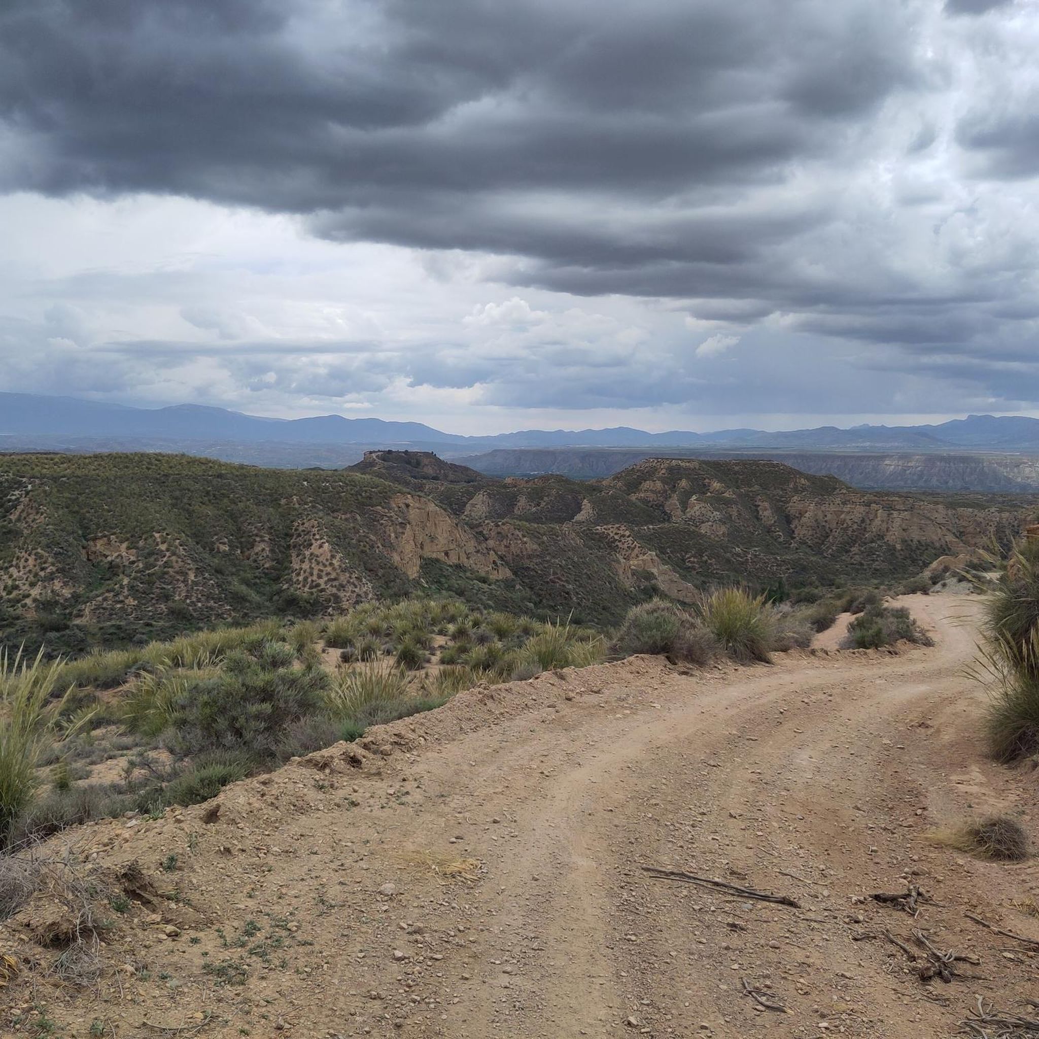
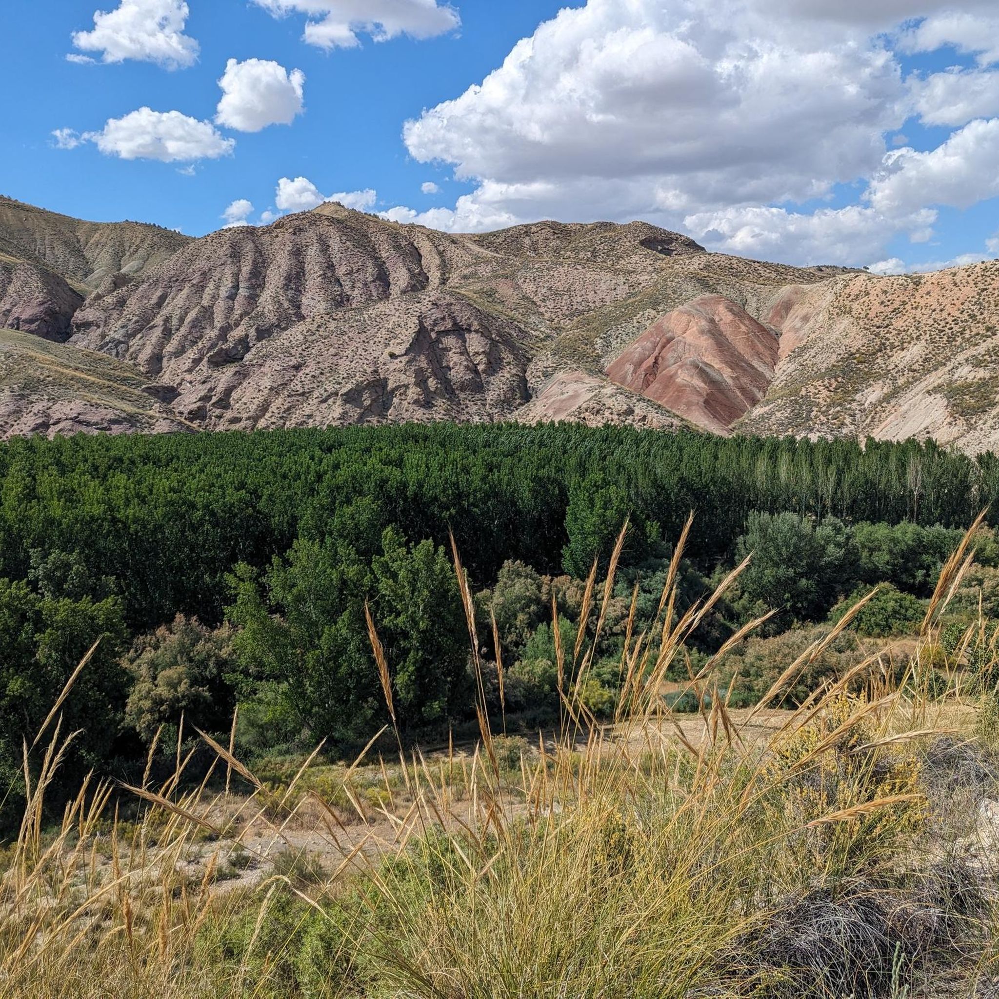
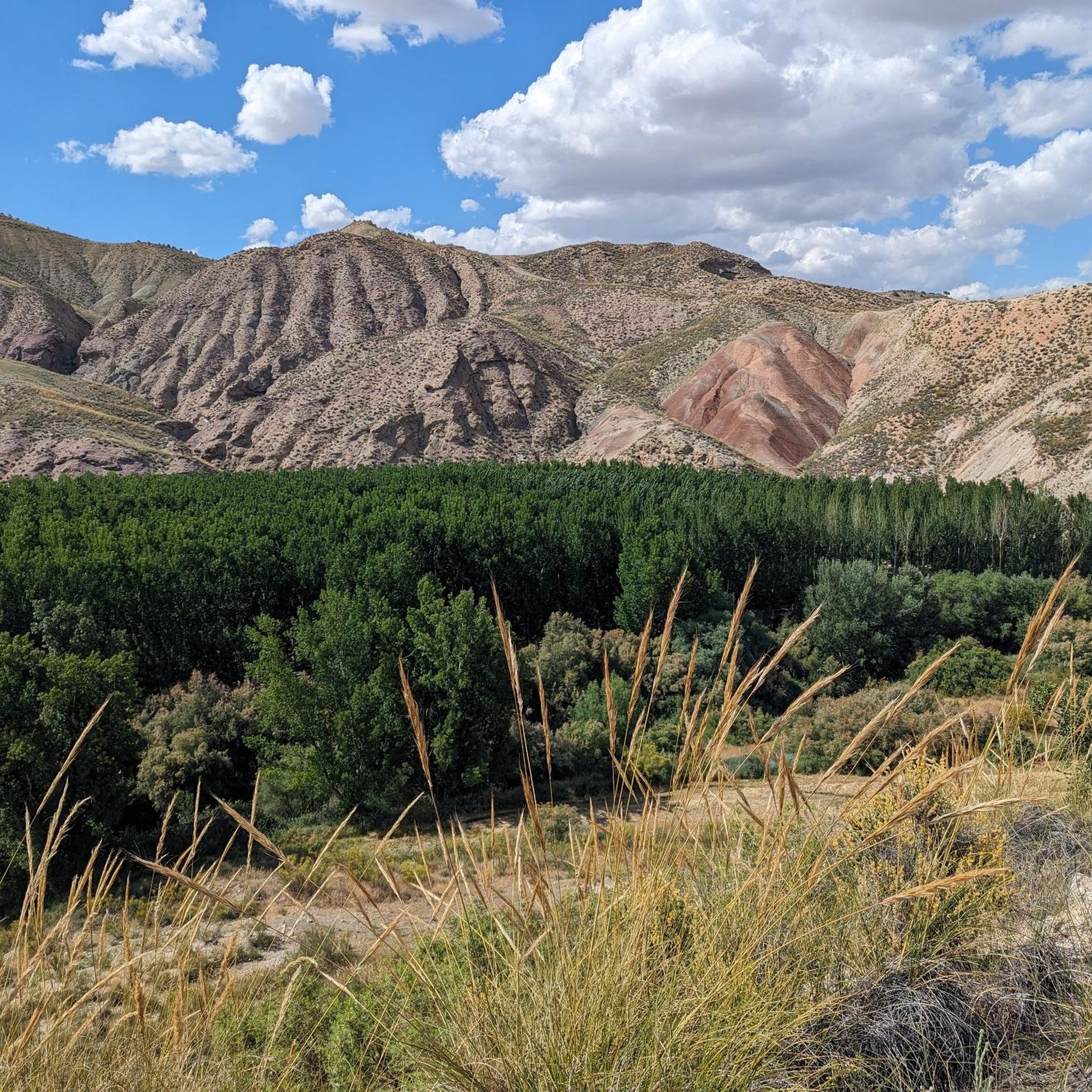
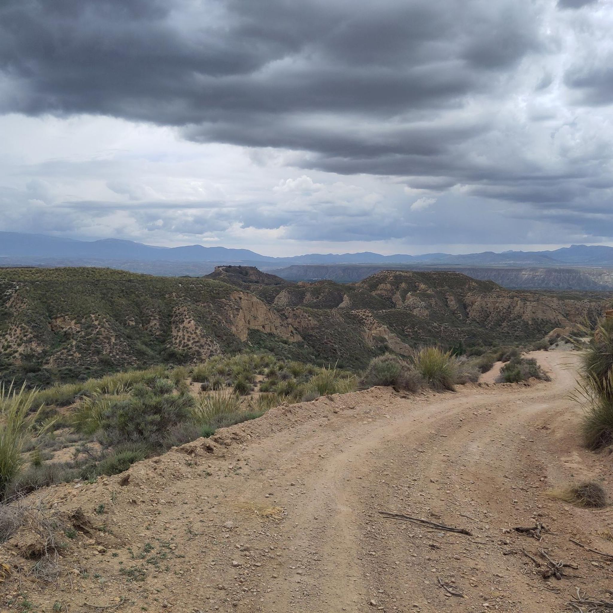
Hiking around Fonelas offers diverse terrain within the Granada Geopark, a region known for its unique geological formations. The landscape is characterized by a striking contrast between clay badlands and verdant valleys, often dotted with poplar trees. The area is situated within the Hoya de Guadix basin, with the River Fardes traversing the municipality. These features provide varied environments for hiking trails.
Best hiking trails around Fonelas
- The most popular hiking route is Badlands de Purullena Viewpoint – Marchal Cave…
Last updated: June 27, 2026
4.7
(28)
77
hikers
15.0km
04:07
250m
250m
Moderate hike. Good fitness required. Easily-accessible paths. Suitable for all skill levels.
4.9
(15)
60
hikers
Moderate hike. Good fitness required. Easily-accessible paths. Suitable for all skill levels.

Sign up for free
4.8
(13)
42
hikers
7.15km
02:01
150m
150m
Moderate hike. Good fitness required. Easily-accessible paths. Suitable for all skill levels.
3.8
(4)
23
hikers
6.70km
01:56
170m
170m
Easy hike. Great for any fitness level. Easily-accessible paths. Suitable for all skill levels.
4.5
(6)
26
hikers
2.51km
00:44
70m
70m
Easy hike. Great for any fitness level. Easily-accessible paths. Suitable for all skill levels.
Get access to more routes and recommendations from other explorers.
Sign up for free
Already have an account?
Our route recommendations are based on thousands of hikes, rides, and runs completed by other people on komoot.
Start today with a free account
Your next adventure awaits.
Login or Signup

Tips from the Community

From the End of the World a beautiful view of the town
3
0

It is a veritable paradise of 4,722 square kilometers, designated as a Global Geopark by UNESCO in 2020, is a rugged semi-desert with deep, wide depressions, gorges, canyons, gullies and ridges with rock formations and cliffs.
4
0

There are panels at this viewpoint explaining the formation process of the Marchal Gullies, making it a very impressive viewpoint.
4
0
This viewpoint has become an outstanding place to watch the sunrise and sunset.
5
0
Hydrogeological studies show that the thermal waters of Alicún de las Torres come mainly from the carbonate aquifer of the Sierra de Baza and, to a lesser extent, from the waters of the Mencal aquifer. Scientists estimate that the aquifer is located at a depth of at least 650 to 800 meters.
7
0
The Troil Canal. According to scientists, they date back at least 3600 years ago. Due to the precipitation of calcium carbonate, these canals grew and continuously formed these amazing walls (some of them are 4 meters wide at the base, less than a meter wide at the top, 15 meters high and reach a length of almost 750 meters
6
0

The place is worth a short visit. There are some caves and a walk to the viewpoints is worth it. Be careful not to drive your car all the way into the town, as there is hardly any way out.
4
1
After descending from the viewpoints, the path along the Camino initially leads through beautiful forest areas and a gorge worth seeing into Purullena.
0
0
Frequently Asked Questions
What kind of terrain can I expect on hikes around Fonelas?
Hiking around Fonelas offers a unique contrast between the dramatic clay badlands, characteristic of the Granada Geopark, and verdant river valleys. You'll encounter distinctive geological formations, often with poplar trees dotting the landscape, especially along the River Fardes.
Are there many hiking options for different skill levels in Fonelas?
Yes, Fonelas provides a wide range of hiking options. There are over 60 routes available, including 26 easy trails perfect for a leisurely stroll, 33 moderate paths for a more engaging experience, and 3 challenging routes for experienced hikers seeking a greater adventure.
What are some notable natural landmarks or viewpoints to see while hiking?
The region is rich in natural landmarks. You can explore the dramatic Badlands, which are part of the UNESCO-recognized Granada Geopark. Specific viewpoints like the Badlands de Purullena Viewpoint offer stunning panoramic views of the unique geological formations. The Puntal de Don Diego Viewpoint is another excellent spot to take in the scenery.
Are there any historical or cultural sites accessible from the hiking trails?
Absolutely. The area around Fonelas is steeped in history. You can find ancient Bronze Age necropolises with dolmens, and the town itself features unique cave dwellings, some of which are still inhabited or restored for tourism. Ancient watchtowers from the Muslim period also dot the landscape, offering glimpses into the region's past.
Are there any easy, family-friendly routes suitable for a short walk?
For an easy, family-friendly walk, consider the Acequia del Toril – Acequia del Toril loop from Cerro de la Raja. This route is just 2.5 km long and offers a pleasant experience through the local landscape.
What do other hikers say about the trails in Fonelas?
The hiking trails in Fonelas are highly regarded by the komoot community, with an average rating of 4.5 out of 5 stars from over 200 reviews. Hikers often praise the unique geological formations, the striking contrast between the badlands and green valleys, and the well-maintained paths that allow for immersive exploration of the Granada Geopark.
Can I find circular hiking routes in Fonelas?
Yes, many routes in Fonelas are circular, allowing you to start and end at the same point. A great option for immersing yourself in the Geopark's unique geology is the moderate Badlands of Granada Geopark loop from SL-A 278 Cañada de la Ventanilla - Campillos, which covers 9.3 km.
Are there any routes that pass by the famous cave dwellings?
Yes, you can explore routes that take you past the distinctive cave dwellings. The Badlands de Purullena Viewpoint – Marchal Cave Houses loop from Purullena is a moderate 15 km trail that specifically explores the dramatic badlands and passes by these historical cave homes.
What is the best time of year to go hiking in Fonelas?
Fonelas offers a compelling destination year-round. The cave dwellings provide a cool refuge in summer and warmth in winter. However, for comfortable hiking, spring and autumn generally offer milder temperatures, making them ideal for exploring the badlands and valleys.
Are there any shorter, easy loops to experience the badlands?
For a shorter and easier loop through the badlands, consider the Badlands de Purullena Viewpoint – Mirador de Marchal loop from Purullena. This easy 6.7 km trail can typically be completed in under two hours, offering a quick immersion into the unique landscape.
What kind of wildlife might I encounter on the trails?
While specific wildlife sightings can vary, the diverse landscape of badlands, river valleys, and agricultural areas supports various bird species and small mammals. Keep an eye out for local birds, and you might spot rabbits or other common wildlife adapted to this unique environment.
Are there any routes that feature the River Fardes?
The River Fardes traverses the municipality and contributes to the verdant valleys. While specific routes directly along the entire river may vary, many trails in the area, such as the Acequia del Toril – Acequia del Toril loop from Acequia del Toril y dólmenes de Alicún, will bring you close to the river's ecosystem and its surrounding green landscapes.
Most popular attractions around Fonelas

Get inspired with the komoot mobile app


Explore more
Browse the best Hikes in other regions.
