The best MTB trails around Vogelschutzgebiet Hullen
4.7
(103)
464
riders
32
rides
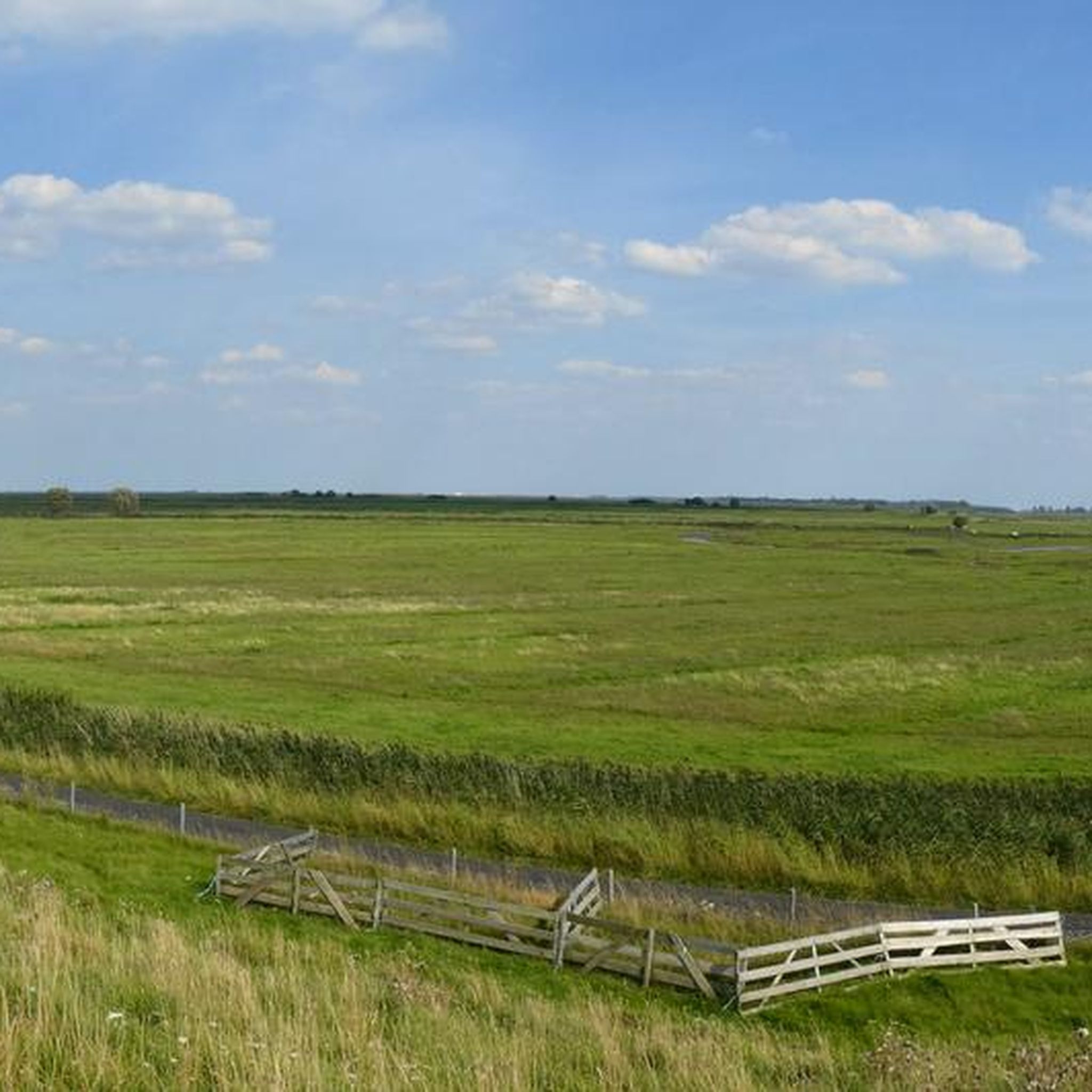
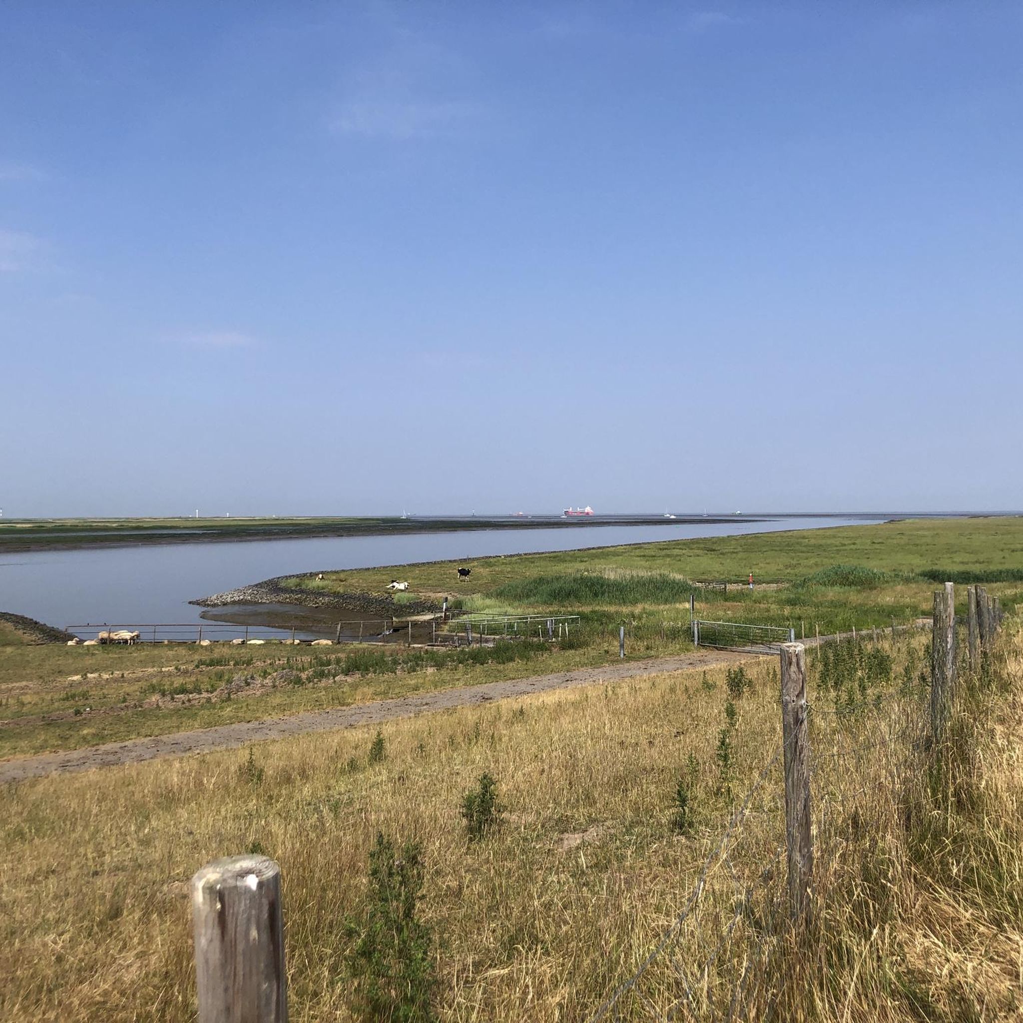
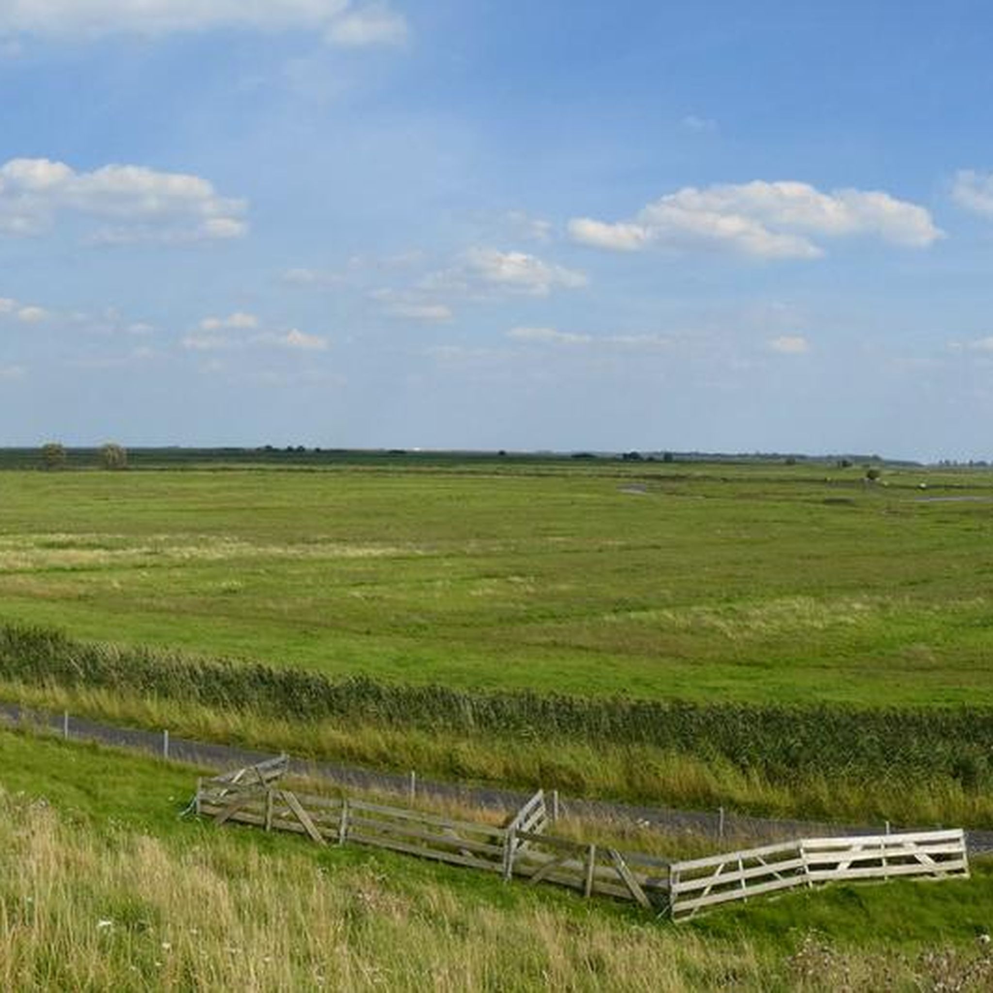
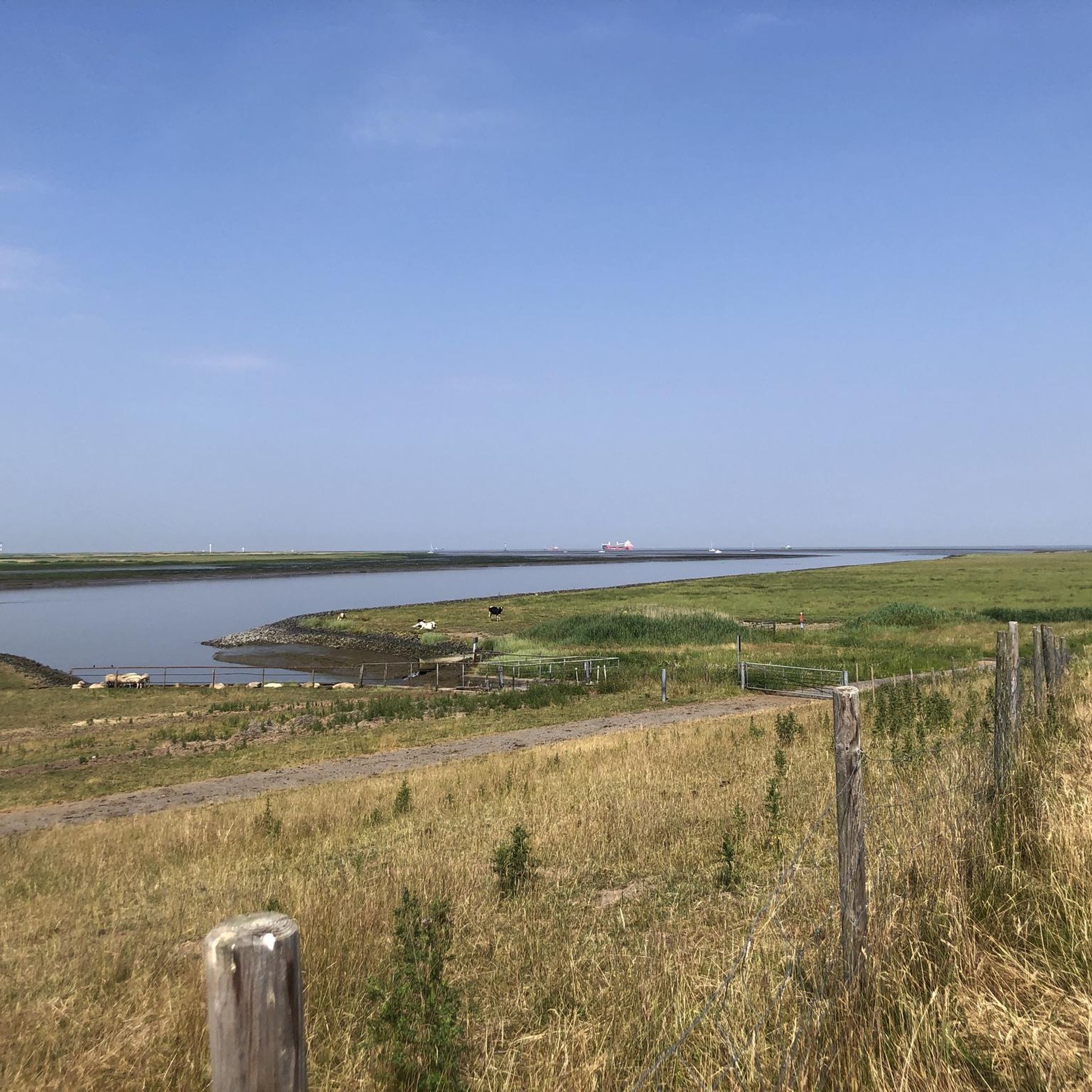
Mountain biking around Vogelschutzgebiet Hullen is characterized by its flat, estuarine landscape at the mouth of the Elbe and Oste rivers. The region features extensive Elbe dikes, tidal reeds, salt marshes, and mudflats, which define the available routes. While the area is primarily a nature reserve focused on bird conservation, general cycling paths exist along the dikes. The terrain generally lacks significant elevation changes or technical trails typical of traditional mountain biking.
Best mountain bike trails around Vogelschutzgebiet Hullen
- The…
Last updated: July 9, 2026
7
riders
Moderate mountain bike ride. Good fitness required. Suitable for all skill levels.
5.0
(5)
16
riders
30.5km
02:30
260m
260m
Moderate mountain bike ride. Good fitness required. Advanced riding skills necessary.

Sign up for free
5.0
(5)
7
riders
53.5km
03:48
300m
300m
Moderate mountain bike ride. Good fitness required. Advanced riding skills necessary.
1
riders
Moderate mountain bike ride. Good fitness required. Suitable for all skill levels.
5.0
(1)
3
riders
19.6km
01:07
100m
100m
Easy mountain bike ride. Great for any fitness level. Suitable for all skill levels.
Get access to more routes and recommendations from other explorers.
Sign up for free
Already have an account?
Our route recommendations are based on thousands of hikes, rides, and runs completed by other people on komoot.
Start today with a free account
Your next adventure awaits.
Login or Signup
Tips from the Community

On the way along the bank of the NOK. Here you can already see the high bridge, a fantastic structure
0
0

Watch the ships and continue walking.
3
0

The port is now deserted, almost a lost place
2
0

The "new" King's Fir is a silver fir, officially designated as the successor to the original King's Fir in 2006. It is about 80 years younger than its predecessor. The original King's Fir, a symbol of the municipality of Wingst and even part of its coat of arms, was planted in 1777 and fell victim to a storm in 1949. The new King's Fir is located about 600 meters south of the site of the original tree. With a height of around 38 meters and a trunk circumference of 3.9 meters, it is an impressive sight.
0
0

Directly in front of the entrance to the Hallig there are two information boards about Helmsand, which provide information about the island, even though you are not allowed to visit it yourself.
0
0

At approximately 74 meters above sea level, the Silberberg is the highest natural elevation in the Wingst region and the entire Elbe-Weser triangle. At the summit, you'll find a memorial plaque commemorating the legend of the giant family "Wingis," a historic Gauss stone, a bench, a summit cross, and a summit book. The area around the Silberberg is part of the Wingst Forest, which includes nature reserves such as the Balksee lake, the Quellental valley, and moors. Many signposted circular trails lead around the Silberberg.
3
0

A beautifully designed place of worship.
0
0

Frequently Asked Questions
How many mountain bike trails are available around Vogelschutzgebiet Hullen?
There are over 30 mountain bike routes available in the vicinity of Vogelschutzgebiet Hullen. These routes range from easy to moderate difficulty, with no technically challenging trails due to the region's flat, estuarine landscape.
What is the terrain like for mountain biking in Vogelschutzgebiet Hullen?
The terrain around Vogelschutzgebiet Hullen is predominantly flat, characterized by its estuarine landscape, extensive Elbe dikes, tidal reeds, salt marshes, and mudflats. You'll find paths along dikes and through marshy areas, but generally, there are no significant elevation changes or technical features typical of traditional mountain biking trails. The routes are more suited for general cycling on a mountain bike.
Are mountain bikes allowed within the Vogelschutzgebiet Hullen nature reserve itself?
Vogelschutzgebiet Hullen is a sensitive nature reserve primarily focused on bird conservation. While general cycling is possible on designated paths, off-road mountain biking that could disturb wildlife or damage habitats is generally restricted or prohibited. It's best to stick to marked paths and respect conservation regulations.
Are there any routes with notable elevation changes or climbs?
Given the flat nature of the region, significant climbs are rare. However, the Silberberg Trail – Silberberg Summit (Wingst) loop from Cadenberge and the New King Fir – Silberberg Summit (Wingst) loop from Cadenberge routes include the Silberberg Summit, which offers one of the few notable elevation changes in the broader area, providing a slight challenge.
What kind of natural features or landmarks can I expect to see along the routes?
The routes offer views of the unique estuarine landscape, including brackish water areas, tidal reeds, salt marshes, and mudflats. You'll also ride along the prominent Elbe dikes, such as the Hörner Außendeich and Baljer Außendeich, which provide expansive views. The area is a significant bird sanctuary, so birdwatching opportunities are abundant. The Natureum Niederelbe, a nature and open-air museum, is also nearby.
Are there any family-friendly mountain bike routes?
Yes, many of the routes are suitable for families due to their easy to moderate difficulty and flat terrain. The Otterndorf Town Hall Square – Medem River in Otterndorf loop from Otterndorf is an easy 19.9 km path with minimal elevation, making it a good option for a family outing. Routes along the dikes also offer safe and scenic cycling.
Can I bring my dog on the mountain bike trails?
While general cycling paths are often dog-friendly, it's crucial to keep dogs on a leash, especially within and around the nature reserve, to protect wildlife. Always check local signage for specific regulations regarding dogs on trails.
What do other mountain bikers enjoy most about the routes around Vogelschutzgebiet Hullen?
The routes around Vogelschutzgebiet Hullen are highly rated by the komoot community, with an average score of 4.6 stars from over 100 reviews. Reviewers often praise the peaceful, scenic rides along the dikes, the opportunities for birdwatching, and the generally easy-going nature of the paths, which are ideal for relaxed cycling.
Are there any circular mountain bike routes?
Yes, many of the routes are designed as loops. For example, the popular Brunsbüttel Ferry – Ostermoor Ferry (Kiel Canal) loop from Brunsbüttel-Ort is a moderate 42.3 km circular trail offering views along the Kiel Canal. The Brunsbüttel Locks – Glückstadt Harbor loop from Brunsbüttel is another moderate loop covering 56.6 km.
What is the best time of year to go mountain biking in this region?
The best time to visit is generally during the spring, summer, and early autumn months (April to October) when the weather is milder and more predictable. This allows for comfortable riding and better opportunities for birdwatching. Be aware that marshy areas can be wet after heavy rain.
Where can I find parking for mountain biking routes?
Parking is typically available at the start points of many routes, often in nearby towns or designated parking areas along the dikes. For routes starting from Brunsbüttel or Cadenberge, you can usually find public parking facilities. Always check specific route details on komoot for recommended parking spots.
Are there options for public transport to reach the trails?
Public transport options exist to reach towns like Brunsbüttel or Cadenberge, which serve as starting points for several routes. However, direct access to all trailheads via public transport might be limited. It's advisable to check local bus or train schedules and connections in advance, especially if you plan to bring your bike.
Most popular routes around Vogelschutzgebiet Hullen

Get inspired with the komoot mobile app


Explore more
Browse the best MTB trails in other regions.
