The best walks and hikes around Marchagaz
4.5
(6)
17
hikers
6
hikes
Hiking around Marchagaz offers diverse landscapes in the province of Cáceres, Extremadura. The region is characterized by the Sierra de Santa Bárbara, providing mountainous terrain and panoramic views. The unique dehesa extremeña, an oak woodland system, contributes to a rich biodiversity. Water features like the Río Los Ángeles and the Gabriel y Galán Reservoir also shape the area's natural environment.
Best hiking trails around Marchagaz
- The most popular hiking route is Tapias Dam Trail from La Pesga, a 6.7…
Last updated: July 8, 2026
5.0
(1)
2
hikers
10.8km
02:59
180m
180m
Moderate hike. Good fitness required. Easily-accessible paths. Suitable for all skill levels.
8.76km
03:04
500m
500m
Moderate hike. Good fitness required. Mostly accessible paths. Sure-footedness required.

Sign up for free
5.0
(3)
5
hikers
7.19km
01:55
80m
80m
Easy hike. Great for any fitness level. Easily-accessible paths. Suitable for all skill levels.
3
hikers
11.0km
03:24
390m
390m
Moderate hike. Good fitness required. Easily-accessible paths. Suitable for all skill levels.
5.0
(1)
2
hikers
6.62km
01:48
100m
90m
Easy hike. Great for any fitness level. Easily-accessible paths. Suitable for all skill levels.
Our route recommendations are based on thousands of hikes, rides, and runs completed by other people on komoot.
Start today with a free account
Your next adventure awaits.
Login or Signup


Tips from the Community

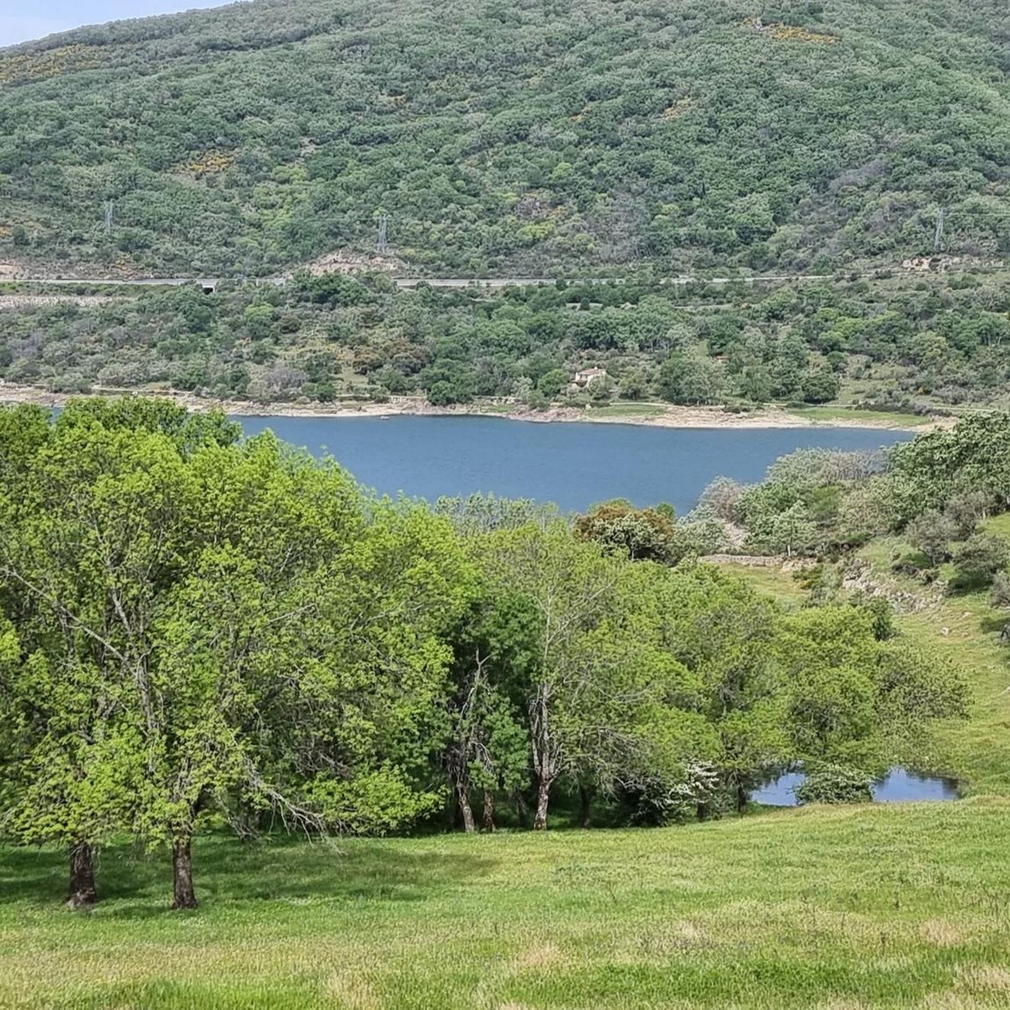
The Pantano de las Tapias is a reservoir located in Caminomorisco, in the province of Cáceres, Extremadura. This reservoir is located near the towns of El Lombo and Mesa Santa. It is an ideal place to enjoy nature and do outdoor activities such as hiking and fishing. One of the popular routes is the one that starts from La Pesga and reaches the reservoir, offering a route of approximately 10.8 km with spectacular views.
3
0
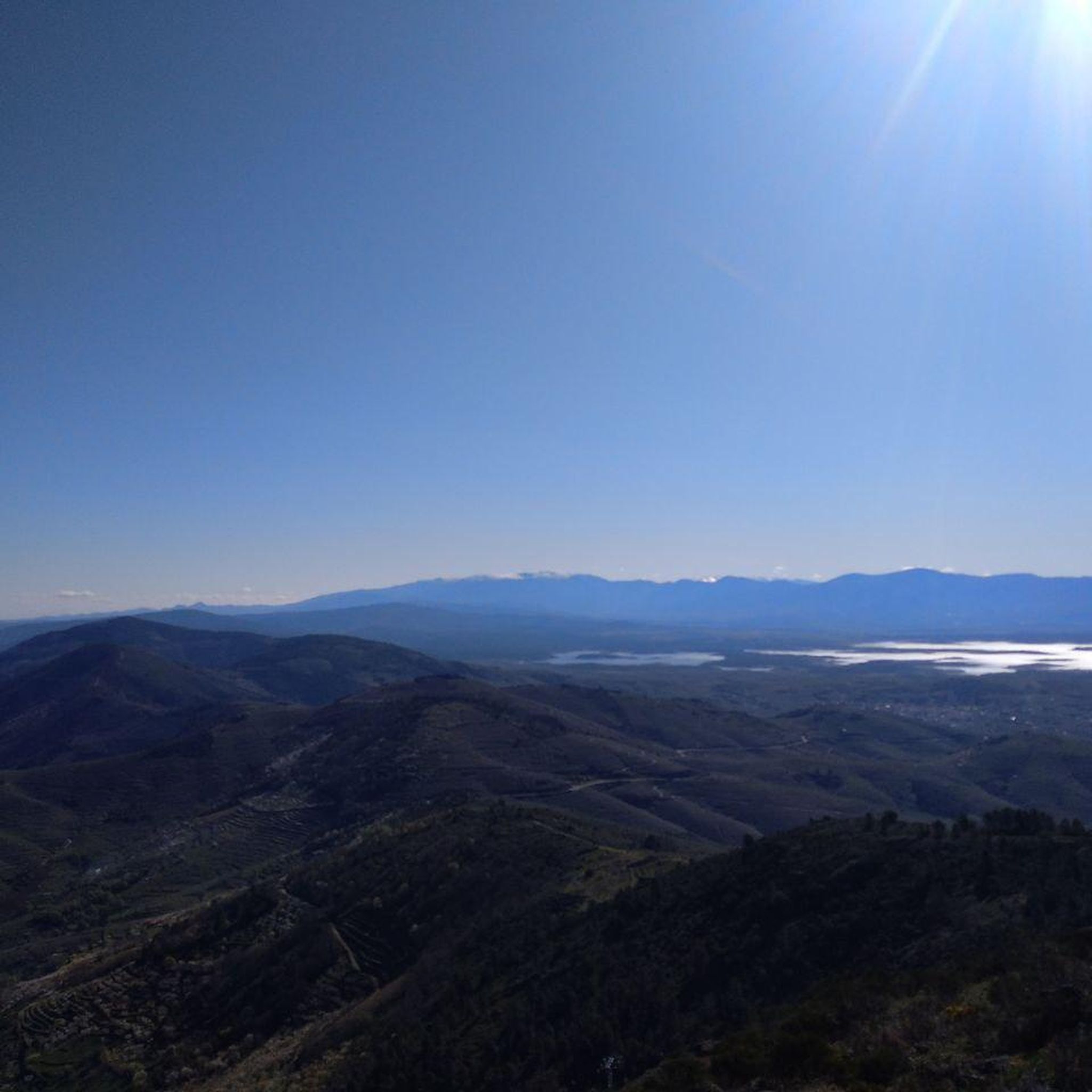
The Mirador Pico Blanco in La Pesga, Extremadura, is a spectacular place to enjoy panoramic views. Located at the highest point in the area, it offers stunning views to the north of Las Hurdes and to the south of the Gabriel y Galán reservoir, the lands of Granadilla and the abandoned town of Granadilla.
4
0

Pinofranqueado is a municipality in the Las Hurdes region, in the province of Cáceres, Community of Extremadura. It is famous for a festival called La Enramá, in which young men and women from the town temporarily pair up to facilitate future courtships. Pinofraqueado is made up of a main nucleus and ten farmhouses. The farmhouses arose from the houses built by the shepherds of the area.
1
0

Passing this important bridge over the Los Angeles River in Pinofranqueado, you can see the natural pools created by the dam downstream. A great place to rest after your cycling trip.
1
0
Mohedas de Granadilla is a small town in the north of the province of Cáceres on the southern flank of the Sierra de La Pesga. Pedal to the Plaza Mayor and see the Parroquia de San Ildefonso.
1
0
Mohedas de Granadilla is a small town in the hills above the Gabriel y Galán Reservoir in the Las Hurdes region. Head to the Plaza Mayor for something to eat or drink on your bike tour.
1
0
Pinofranqueado is a small town located in the beautiful region of Las Hurdes through which the Los Angeles River passes. You can swim on a hot day on the river beach.
1
0

Unknown to many, this beautiful reservoir located in the north of Extremadura is an ideal corner to enjoy the beautiful landscape and especially the tranquility that surrounds it.
1
0
Frequently Asked Questions
What kind of landscapes can I expect to see while hiking around Marchagaz?
Marchagaz offers a diverse range of landscapes. You'll encounter the mountainous terrain of the Sierra de Santa Bárbara, providing panoramic views of northern Extremadura. The region is also characterized by the unique dehesa extremeña, an oak woodland system rich in biodiversity. Additionally, water features like the Río Los Ángeles and the Gabriel y Galán Reservoir contribute to the scenic beauty, alongside extensive terraced olive groves.
Are there any easy hiking trails suitable for beginners or casual walkers in Marchagaz?
Yes, Marchagaz offers several easy hiking options. For instance, the Pinofranqueado – Pinofranqueado Bridge loop from Pinofranqueado is an easy 7.2 km trail that takes about 1 hour 55 minutes to complete, with minimal elevation gain. Overall, 4 of the 7 routes in the area are rated as easy.
What are some notable viewpoints or natural attractions to look out for on the trails?
The region is rich in natural viewpoints. The Pico Blanco Viewpoint, accessible via trails like the Viewpoint of Pico Blanco from La Pesga, offers some of the best panoramic views of the northern Extremadura region, including the Río de los Ángeles and the town of La Pesga. You can also enjoy the tranquil beauty of the Presa de las Tapias, a beautiful reservoir, which is featured on the Tapias Dam Trail from La Pesga.
Are there any circular hiking routes available around Marchagaz?
Yes, there are circular routes available. A popular option is the Pico Blanco Viewpoint – Portillo del Culebra loop from La Pesga. This moderate 12.3 km trail leads through mountainous terrain and typically takes around 3 hours 50 minutes to complete, offering a comprehensive exploration of the area's scenery.
Is Marchagaz a good destination for family-friendly hikes?
Marchagaz offers several trails that are suitable for families, particularly those looking for easy to moderate walks. The diverse landscapes, including the dehesa and views of reservoirs, provide engaging scenery for all ages. Consider the easier routes available, such as the Pinofranqueado – Pinofranqueado Bridge loop, which is less strenuous.
What is the best time of year to go hiking in Marchagaz?
The best time to hike in Marchagaz is generally during spring (April-May) and autumn (September-October). During these seasons, temperatures are milder and more comfortable for outdoor activities, and the natural landscape is often at its most vibrant. Summers can be very hot, and winters can be cooler and wetter, though hiking is possible year-round with appropriate preparation.
Are dogs allowed on the hiking trails in Marchagaz?
While specific regulations for each trail may vary, generally, dogs are welcome on most hiking trails in the Marchagaz region, especially in rural and natural areas like the dehesa. It's always advisable to keep your dog on a leash, especially in areas with livestock or wildlife, and to carry water for them, particularly during warmer months. Please ensure you clean up after your pet.
What are the parking options for hikers in Marchagaz?
For many trails around Marchagaz, parking is typically available in or near the starting points of the routes, often in the nearby villages like La Pesga or Pinofranqueado. These are generally small, local parking areas. It's recommended to check specific route descriptions for detailed parking information, but roadside parking or village squares are common options.
What do other hikers enjoy most about hiking in Marchagaz?
The hiking experience in Marchagaz is highly rated by the komoot community, with an average score of 4.6 stars from 7 reviews. Hikers often praise the stunning panoramic views from elevated points like the Pico Blanco Viewpoint, the tranquility of the natural landscapes, and the unique beauty of the dehesa ecosystem and reservoirs.
Are there any historical or cultural points of interest along the hiking routes?
Yes, beyond natural beauty, the region offers cultural insights. The landscape around Marchagaz is shaped by extensive terraced olive groves, central to local culture and economy. You might also encounter remnants of historical structures, such as the remains of the Convent of San Marcos on the Sierra de Santa Bárbara hillside, which can be explored via trails like the Camino de San Marcos.
How many hiking trails are there in the Marchagaz area?
There are 7 hiking trails documented around Marchagaz on komoot, offering a variety of experiences from easy walks to moderate ascents. These routes allow you to explore the diverse landscapes of the region.
Is public transport available to access the hiking trails around Marchagaz?
Public transport options directly to trailheads in Marchagaz and its immediate surroundings are limited, as is common in more rural areas of Extremadura. Access is generally easier by car. However, local bus services might connect Marchagaz with larger towns in the Cáceres province, from which you might need to arrange further transport to reach specific starting points.
Most popular attractions around Marchagaz

Get inspired with the komoot mobile app


Explore more
Browse the best Hikes in other regions.
