The best walks and hikes around Aladrén
4.3
(3)
14
hikers
10
hikes
Hiking around Aladrén offers access to a varied topography, characterized by hilly and mountainous landscapes within the province of Zaragoza. The region's elevation ranges from approximately 658 meters to 1,062 meters, providing diverse terrain for outdoor activities. A prominent feature is the Sierra del Águila, which includes dense pine forests and offers a range of elevations. This area provides a natural environment suitable for exploration on foot.
Best hiking trails around Aladrén
- The most popular hiking route is Hoces del…
Last updated: June 28, 2026
1
hikers
19.4km
05:11
210m
210m
Hard hike. Very good fitness required. Easily-accessible paths. Suitable for all skill levels.
16.0km
04:50
530m
530m
Moderate hike. Good fitness required. Easily-accessible paths. Suitable for all skill levels.

Sign up for free
1
hikers
14.6km
04:26
510m
510m
Moderate hike. Good fitness required. Easily-accessible paths. Suitable for all skill levels.
4.3
(3)
5
hikers
Moderate hike. Good fitness required. Easily-accessible paths. Suitable for all skill levels.
4
hikers
Moderate hike. Good fitness required. Easily-accessible paths. Suitable for all skill levels.
Get access to more routes and recommendations from other explorers.
Sign up for free
Already have an account?
Our route recommendations are based on thousands of hikes, rides, and runs completed by other people on komoot.
Start today with a free account
Your next adventure awaits.
Login or Signup

Tips from the Community

Water fountain at the entrance to the town of Herrera de los Navarros.
0
0

La Regüelta el Trago (also known as Revuelta del Trago) is a traditional and picturesque enclave located on the climb to the Sanctuary of the Virgen del Águila, in Paniza, Zaragoza. It's a landmark in local pilgrimages, where locals often stop for a rest... and, as the name suggests, for a drink! 🍷
1
0
The Hermitage of the Virgin of the Eagle in Cerveruela, Zaragoza, is a small sanctuary located in a picturesque natural setting, ideal for activities such as hiking and road cycling. It is located in the Campo de Daroca region, within the Zaragoza Iberian System Natural Park, which gives it remarkable scenic and ecological value.
2
0

A beautiful town to get lost in located in the south of the province of Zaragoza, popular with hikers and sports lovers because it is the place chosen to start the ascent to the Sanctuary of the Virgin of Herrera.
0
0
Located at an altitude of 1,349 meters, we are in the Sanctuary of the Virgin of Herrera with wonderful views of the Iberian mountains of Zaragoza and Teruel, the Ebro valley and on a good day you can even make out the Pyrenees. Until the Sanctuary, from the town of Herrera de los Navarros, we will cross the wooded slopes of the Sierra de Herrera.
2
0
The hermitage was erected 500 years ago in the place where, according to tradition, the Virgin appeared to Martín, a charcoal burner from the town who was in the mountains carrying out his work. The paved road ends at the sanctuary itself, so its traffic is limited.
12
0
A beautiful town to get lost in located in the south of the province of Zaragoza, popular with hikers and sports lovers because it is the place chosen to start the ascent to the Sanctuary of the Virgin of Herrera.
2
0
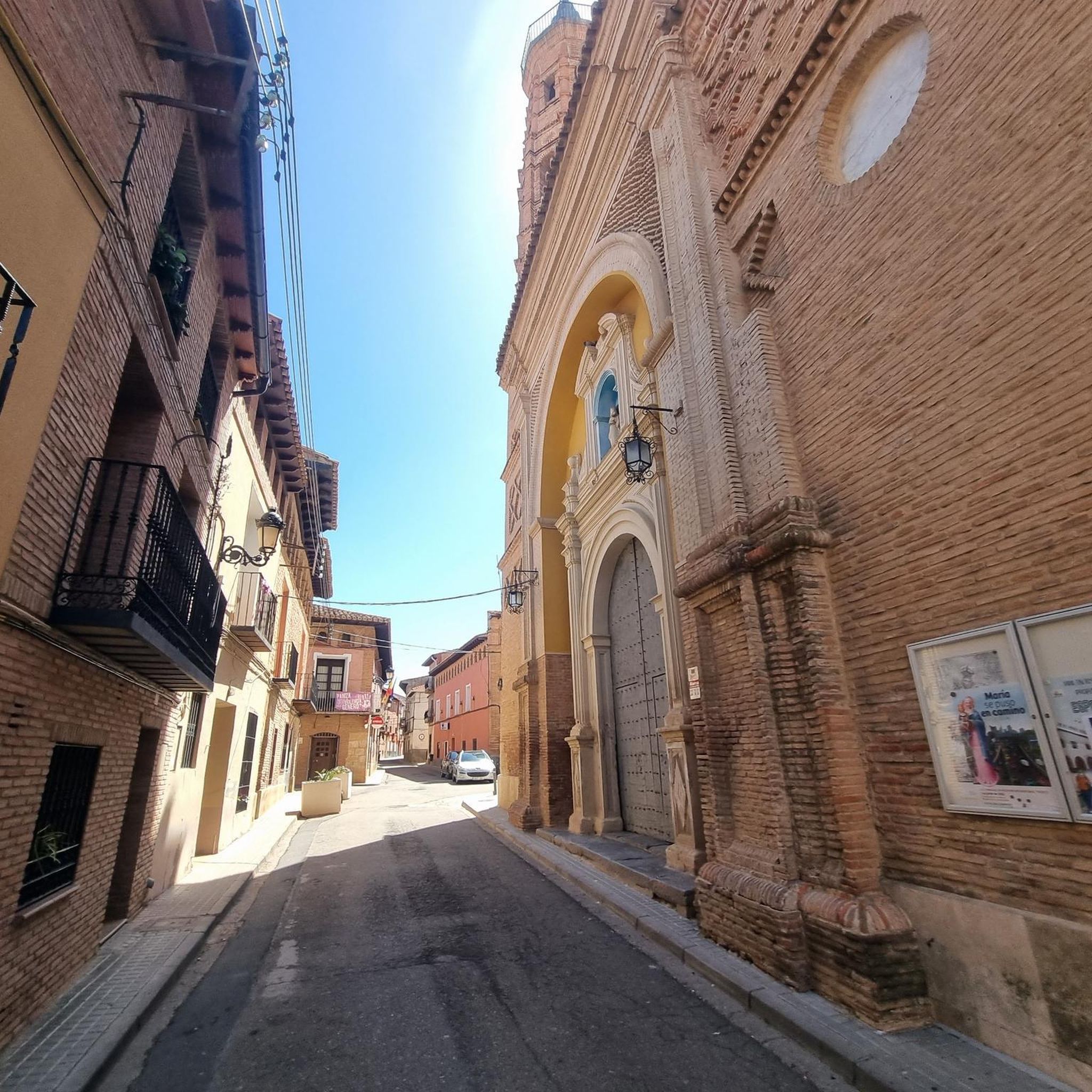
Nice church that we found in the town of Paniza. It is the Church of Nuestra Señora de los Ángeles in and is of Mudejar art and dates from the second half of the 16th century.
1
0
Frequently Asked Questions
How many hiking trails are available around Aladrén?
There are 9 hiking trails available around Aladrén, offering a variety of experiences for different skill levels.
What kind of terrain can I expect when hiking in Aladrén?
Hikers in Aladrén can expect a varied topography, characterized by hilly and mountainous landscapes. The region's elevation ranges from approximately 658 meters to 1,062 meters, providing diverse terrain. You'll also encounter dense pine forests, particularly within the Sierra del Águila.
Are there any circular hiking routes in the Aladrén area?
Yes, there are circular routes available. For example, the PR-Z 25: Circular Route of Herrera de los Navarros is a moderate 9.9-mile path that traverses varied terrain. Another option is the La Regüelta el Trago – Hermitage of the Virgin of the Eagle loop from Paniza, which is a 15 km loop.
What are some notable natural features or landmarks to see while hiking?
The primary natural draw is the Sierra del Águila (Eagle Mountains), known for its surprising landscapes and dense pine forests. You can also visit the Hermitage of the Virgin of the Eagle, a significant religious building often included in routes through the Sierra del Águila. The Torcas Reservoir is another point of interest.
Are there any easy hiking options suitable for beginners or families?
While many routes involve varied terrain, there is at least one easy trail available. The area offers options for different ability levels, so it's best to check individual route details for specific difficulty ratings. For example, the Log Bridge of the Huerva River – Azud del Río Huerva loop from Vistabella is a moderate route with less elevation gain.
What is the best time of year to go hiking in Aladrén?
Aladrén's varied topography and natural features make it suitable for hiking across multiple seasons. However, given the hilly and mountainous landscape, spring and autumn generally offer the most pleasant temperatures for exploring the dense pine forests and higher elevations.
Are there any historical or religious sites accessible via hiking trails?
Yes, several routes lead to significant religious sites. The Hermitage of the Virgin of the Eagle is a key destination on trails traversing the Sierra del Águila. Another notable site is the Sanctuary of the Virgin of Herrera, and the Church of Our Lady of the Angels of Paniza is also nearby.
What do other hikers say about their experience in Aladrén?
The hiking routes in Aladrén are highly rated by the komoot community, with an average score of 4.3 stars from over 3 reviews. Hikers often praise the diverse natural scenery, the challenging ascents, and the opportunity to explore the region's unique topography.
Are there longer, more challenging hikes for experienced trekkers?
Yes, for experienced trekkers seeking a challenge, routes like Hoces del Río Huerva from Vistabella are classified as difficult. This 12.1-mile trail features significant elevation changes and diverse natural scenery, taking over 5 hours to complete.
What kind of forests or vegetation will I encounter?
You will primarily encounter dense pine forests, especially within the Sierra del Águila. The varied terrain also includes areas with agricultural constructions and small hills, offering a mix of natural and cultivated landscapes.
Are there any places to explore nearby after a hike?
After your hike, you can explore the nearby settlement of Herrera de los Navarros, which is often connected by hiking trails. The town of Paniza is also a nearby option, offering additional local experiences.
Most popular routes around Aladrén
Most popular attractions around Aladrén

Get inspired with the komoot mobile app


Explore more
Browse the best Hikes in other regions.
