The best walks and hikes around Vegalatrave
5.0
(1)
13
hikers
4
hikes
Hiking around Vegalatrave offers a variety of trails through a landscape characterized by gentle elevations and rural settings. The region features routes that explore local historical sites and natural elements like waterfalls. These trails provide opportunities to experience the area's pastoral charm and cultural heritage. The network includes options suitable for different skill levels, from easy walks to more moderate hikes.
Best hiking trails around Vegalatrave
- The most popular hiking route is La Palia Waterfall - round trip from Valdoradas bridge, an easy 2.1 miles (3.4 km) trail that takes 57 minutes to complete, leading to a local waterfall.
- Another top favourite among local hikers is Castillo de Alba de Aliste Trail, a moderate 4.9 miles (7.9 km) path. This route explores the area around the historic Alba de Aliste Castle.
- Local hikers also love the Route of the Corrals (PR-ZA 3), a 9.2 miles (14.8 km) trail leading through rural landscapes, often completed in about 4 hours.
- Hiking around Vegalatrave is defined by routes exploring historical sites, rural paths, and natural features like waterfalls. The network offers options for different ability levels, including easy hikes and more moderate trails.
- The routes in Vegalatrave are highly rated by the komoot community with an average score of 4.0 stars from 2 reviews. More than 19 hikers have used komoot to explore Vegalatrave's varied terrain.
Last updated: July 4, 2026
5.0
(1)
2
hikers
3.44km
00:57
60m
60m
Easy hike. Great for any fitness level. Easily-accessible paths. Suitable for all skill levels.
2
hikers
7.95km
02:13
160m
150m
Hike the moderate 4.9-mile (8.0 km) Castillo de Alba circular trail along the Río Aliste, featuring castle ruins and tranquil riverside path

Sign up for free
14.8km
04:00
190m
190m
Hike the moderate 9.2-mile Route of the Corrales circular from Abejera (PR-ZA03) through varied landscapes in Sierra de la Culebra.
4
hikers
6.91km
01:57
150m
150m
Easy hike. Great for any fitness level. Easily-accessible paths. Suitable for all skill levels.
2
hikers
5.31km
01:25
60m
60m
Easy hike. Great for any fitness level. Easily-accessible paths. Suitable for all skill levels.
Our route recommendations are based on thousands of hikes, rides, and runs completed by other people on komoot.
Start today with a free account
Your next adventure awaits.
Login or Signup
Popular around Vegalatrave
Tips from the Community

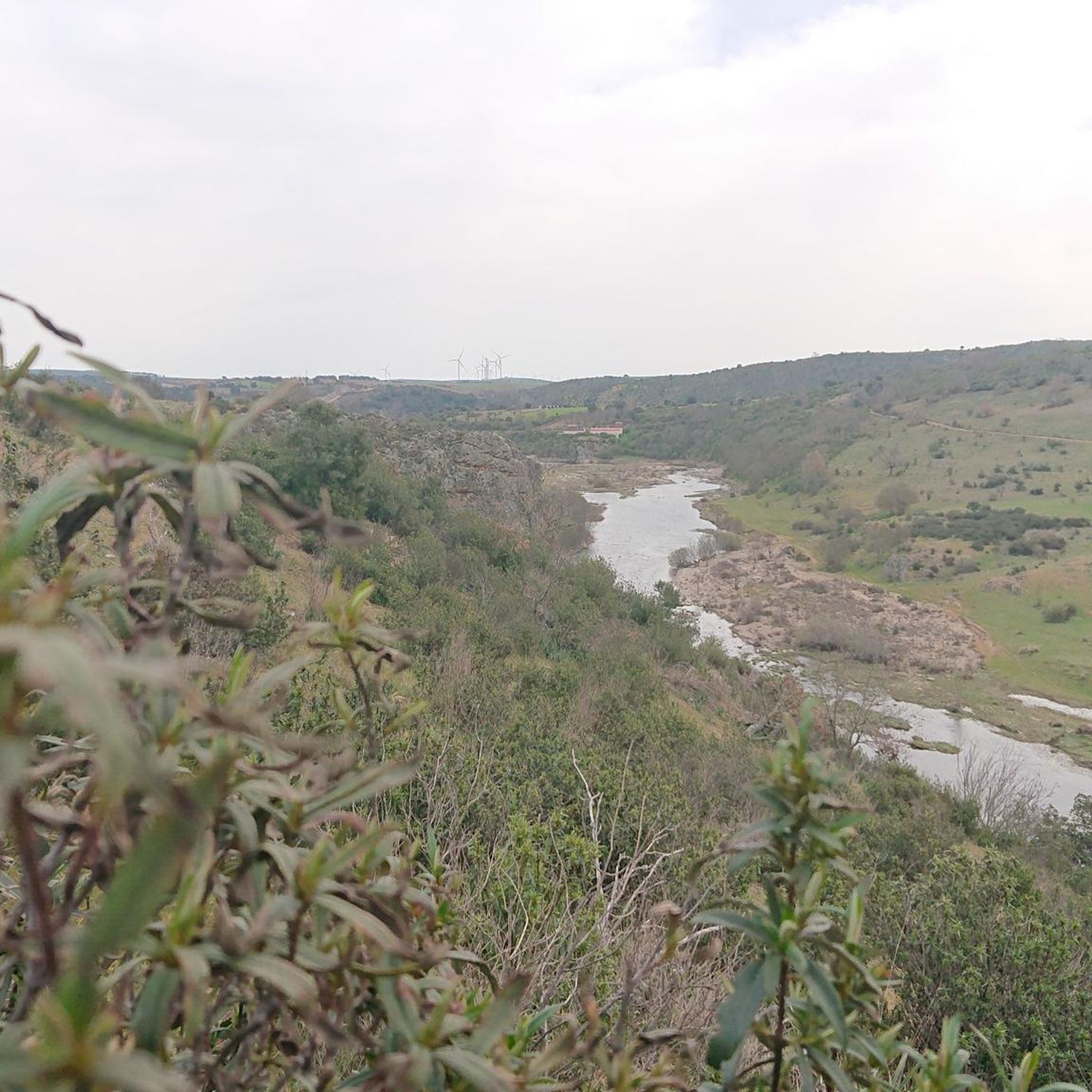
The Aliste River is a watercourse that originates in the Sierra de la Culebra, in the district of San Pedro de las Herrerías, in the province of Zamora, Spain. Along its route, it passes through the towns that make up the valley of the region that bears its name. Some of these towns include Mahíde, Las Torres de Aliste, Pobladura de Aliste, Palazuelo de las Cuevas, San Vicente de la Cabeza, Bercianos de Aliste, Flores de Aliste, Gallegos del Río, Domez, Vegalatrave, Vide de Alba, El Castillo de Alba, and finally reaches Carbajales de Alba.
1
0
The Alba de Aliste Castle is an old medieval fortification located in the town of the same name, belonging to the municipality of Losacino, in the province of Zamora, Spain. The remains of the castle are located on a hill that overlooks the Aliste river and the Retael stream. Although its geographical environment is currently profoundly modified due to the construction of the Ricobayo dam, this castle had notable defensive value in its time.
2
0

another example of a corral restored a few years ago
1
0
wonderful enclave with traditional corals
1
0

Medieval fortress located on a defensive hill. The ruined castle offers spectacular views of the Aliste River canyon. The first references to the castle date back to the 10th century.
2
0

Fortress on a defensive hill that dominates the Aliste river. The ruined castle offers spectacular views of the river canyon.
1
0

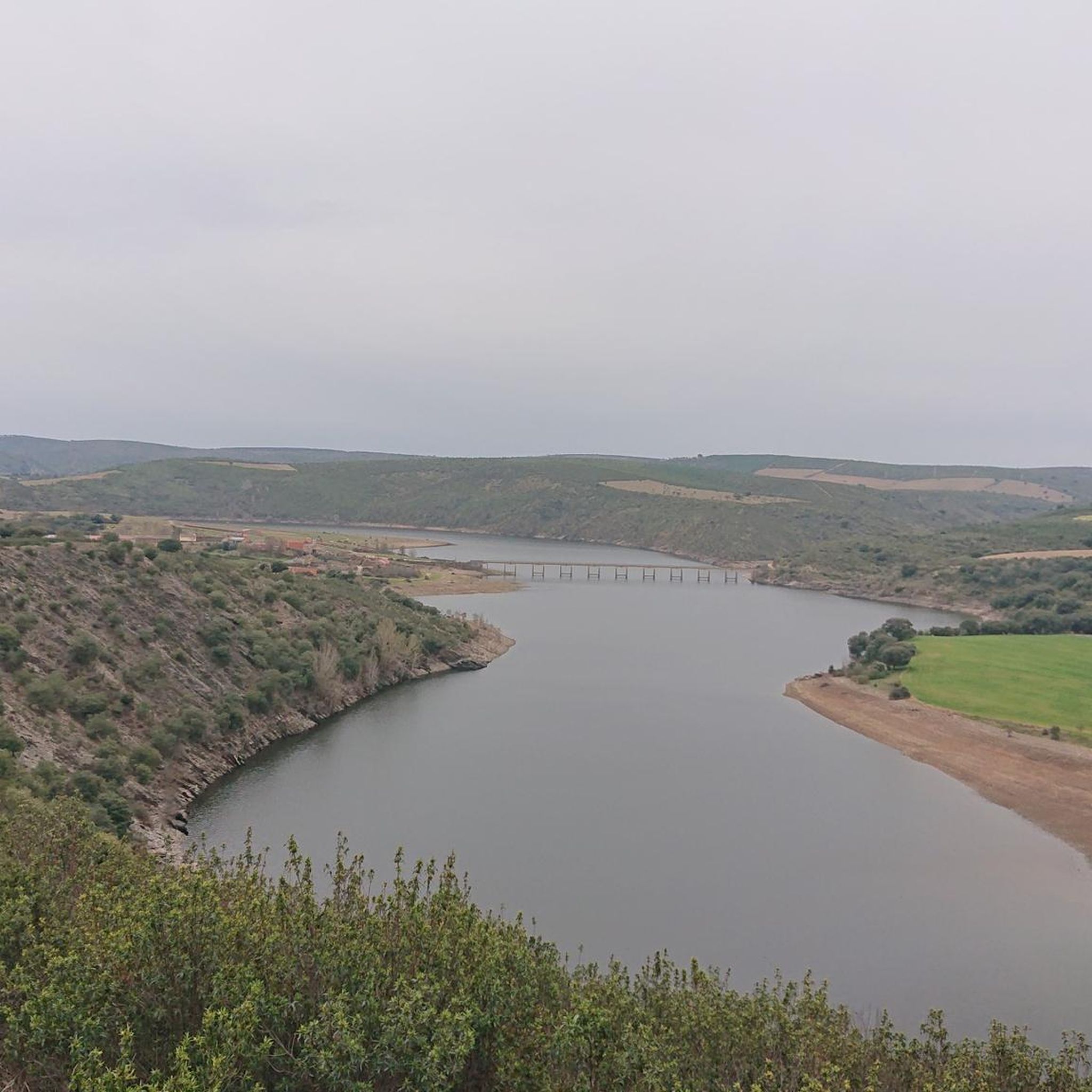
We will find beautiful panoramic views walking along the road near the Valdoradas bridge, surely on our route to the La Palia waterfall.
1
0
Nice bridge over the Ricobayo reservoir that offers us excellent views of it and the entire environment that surrounds us. A few km away is the La Palia Waterfall, well known by nature lovers in the area. On one side of the bridge there is a parking lot where we can leave the car and start our route.
1
0
Frequently Asked Questions
How many hiking trails are available in Vegalatrave?
Vegalatrave offers a selection of 4 hiking routes, ranging from easy strolls to more moderate paths. These trails allow you to explore the region's rural landscapes and historical sites.
Are there easy hiking trails suitable for beginners or families in Vegalatrave?
Yes, Vegalatrave has several easy trails perfect for beginners or families. For instance, the La Palia Waterfall - round trip from Valdoradas bridge is an easy 2.1-mile (3.4 km) route that leads to a local waterfall. Another accessible option is the Alba Castle – Castle of Alba de Aliste loop from Los Milanos, which is also rated as easy.
What kind of natural attractions can I expect to see on hikes in Vegalatrave?
The region's trails feature natural elements such as the La Palia Waterfall, which is accessible via an easy round trip. You can also encounter the Aliste River, which flows through Vegalatrave, adding to the pastoral charm of the area.
Are there any historical landmarks or points of interest along the hiking routes?
Absolutely. Vegalatrave's hiking routes often explore historical sites. You can hike the Castillo de Alba de Aliste Trail, which takes you around the historic Alba Castle. Additionally, you might encounter old bridges like the Valdoradas Bridge and the Losacino Bridge, which are part of the local heritage.
Are there any circular hiking routes in Vegalatrave?
Yes, several routes in Vegalatrave are circular, offering convenient starting and ending points. Examples include the easy La Palia Waterfall - round trip from Valdoradas bridge and the Alba Castle – Castle of Alba de Aliste loop from Los Milanos. The Valdoradas Bridge loop from Carbajales de Alba is another moderate circular option.
What is the best time of year to go hiking in Vegalatrave?
The best time for hiking in Vegalatrave is typically during spring (April to June) and autumn (September to October). During these seasons, the weather is generally mild and pleasant, making for comfortable conditions to explore the rural landscapes and historical sites. Summers can be hot, and winters may bring cooler temperatures and occasional rain.
What do other hikers enjoy most about hiking in Vegalatrave?
The komoot community rates the trails in Vegalatrave highly, with an average score of 4.0 stars. Hikers often appreciate the region's blend of rural paths, historical sites, and natural features like waterfalls, providing a diverse and engaging outdoor experience.
Are the hiking trails in Vegalatrave suitable for dogs?
While specific regulations for dogs on trails can vary, Vegalatrave's rural and natural setting generally makes it a welcoming area for dog walkers. It's always recommended to keep your dog on a leash, especially near livestock or protected areas, and to carry waste bags to maintain the cleanliness of the trails.
Are there any longer or more challenging hikes in Vegalatrave?
For those seeking a longer experience, the Route of the Corrals (PR-ZA 3) is a moderate 9.2-mile (14.8 km) trail that takes approximately 4 hours to complete, leading through extensive rural landscapes. The Castillo de Alba de Aliste Trail is another moderate option at 4.9 miles (7.9 km).
What kind of landscape defines hiking in Vegalatrave?
Hiking in Vegalatrave is characterized by gentle elevations and a predominantly rural setting. You'll find trails that wind through pastoral areas, often alongside the Aliste River, and lead to historical sites, offering a tranquil experience away from bustling urban areas.
Is there public transport access to the trailheads in Vegalatrave?
Public transport options directly to every trailhead in a rural area like Vegalatrave can be limited. It is advisable to check local bus schedules for connections to nearby villages such as Carbajales de Alba or Valdoradas, and plan for potential short walks or taxi services to reach specific starting points.
Where can I find parking for hiking in Vegalatrave?
In rural areas like Vegalatrave, parking is often available in the villages where trails begin, such as near the Valdoradas bridge or in the vicinity of Alba de Aliste. Look for designated parking areas or suitable roadside spots, always ensuring you do not obstruct local access or private property.
Most popular routes around Vegalatrave
Most popular attractions around Vegalatrave

Get inspired with the komoot mobile app


Explore more
Browse the best Hikes in other regions.
