The best walks and hikes around Réserve Naturelle du delta de la Sauer
4.4
(1487)
6,661
hikers
367
hikes
Hiking trails around Réserve Naturelle du delta de la Sauer traverse a protected wetland of approximately 486 hectares in the Grand Est region of France. The terrain is characterized by a mosaic of diverse habitats, including floodplain forests, reed beds, oxbow lakes, willow groves, mudflats, and wet meadows. This landscape is heavily influenced by the confluence of the Sauer and Rhine rivers, leading to dynamic water levels and varied ecological features. The area offers generally flat paths with minimal elevation gain, suitable for exploring its rich biodiversity.
Best hiking trails around Réserve Naturelle du delta de la Sauer
- The most popular hiking route is Bridge over the Sauer – Seltz Gravel Lake loop from Rastatter Rheinaue, a 6.5 miles (10.5 km) trail that takes 2 hours 40 minutes to complete. This route offers views of the river delta and gravel lakes.
- Another top favourite among local hikers is Port de Seitz – Bridge over the Sauer loop from Munchhausen, an easy 4.6 miles (7.5 km) path. This loop follows the river and passes through wetland areas.
- Local hikers also love the Sauer Delta Nature Reserve – Ornithologische Station loop from Rastatter Rheinaue, a 3.2 miles (5.1 km) trail leading through diverse habitats, often completed in about 1 hour 18 minutes.
- Hiking around Réserve Naturelle du delta de la Sauer is defined by floodplain forests, reed beds, and willow groves, offering opportunities for wildlife observation. The network provides options for various ability levels, from easy strolls to moderate treks.
- The routes in Réserve Naturelle du delta de la Sauer are highly rated by the komoot community with an average score of 4.5 stars from more than 1,200 reviews. More than 6,500 hikers have used komoot to explore Réserve Naturelle du delta de la Sauer's varied terrain.
Last updated: October 11, 2026
4.4
(91)
295
hikers
Moderate hike. Good fitness required. Easily-accessible paths. Suitable for all skill levels.
4.8
(58)
194
hikers
Easy hike. Great for any fitness level. Easily-accessible paths. Suitable for all skill levels.

4.6
(53)
162
hikers
Easy hike. Great for any fitness level. Easily-accessible paths. Suitable for all skill levels.
4.1
(16)
64
hikers
Easy hike. Great for any fitness level. Easily-accessible paths. Suitable for all skill levels.
4.5
(6)
27
hikers
13.9km
03:31
30m
30m
Moderate hike. Good fitness required. Easily-accessible paths. Suitable for all skill levels.
Get access to more routes and recommendations from other explorers.
Already have an account?
Our route recommendations are based on thousands of hikes, rides, and runs completed by other people on komoot.
Start today with a free account
Your next adventure awaits.
Popular around Réserve Naturelle du delta de la Sauer
Tips from the Community

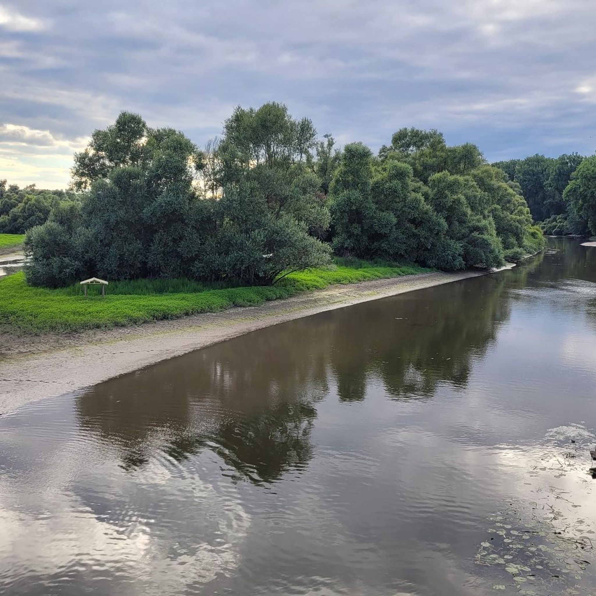
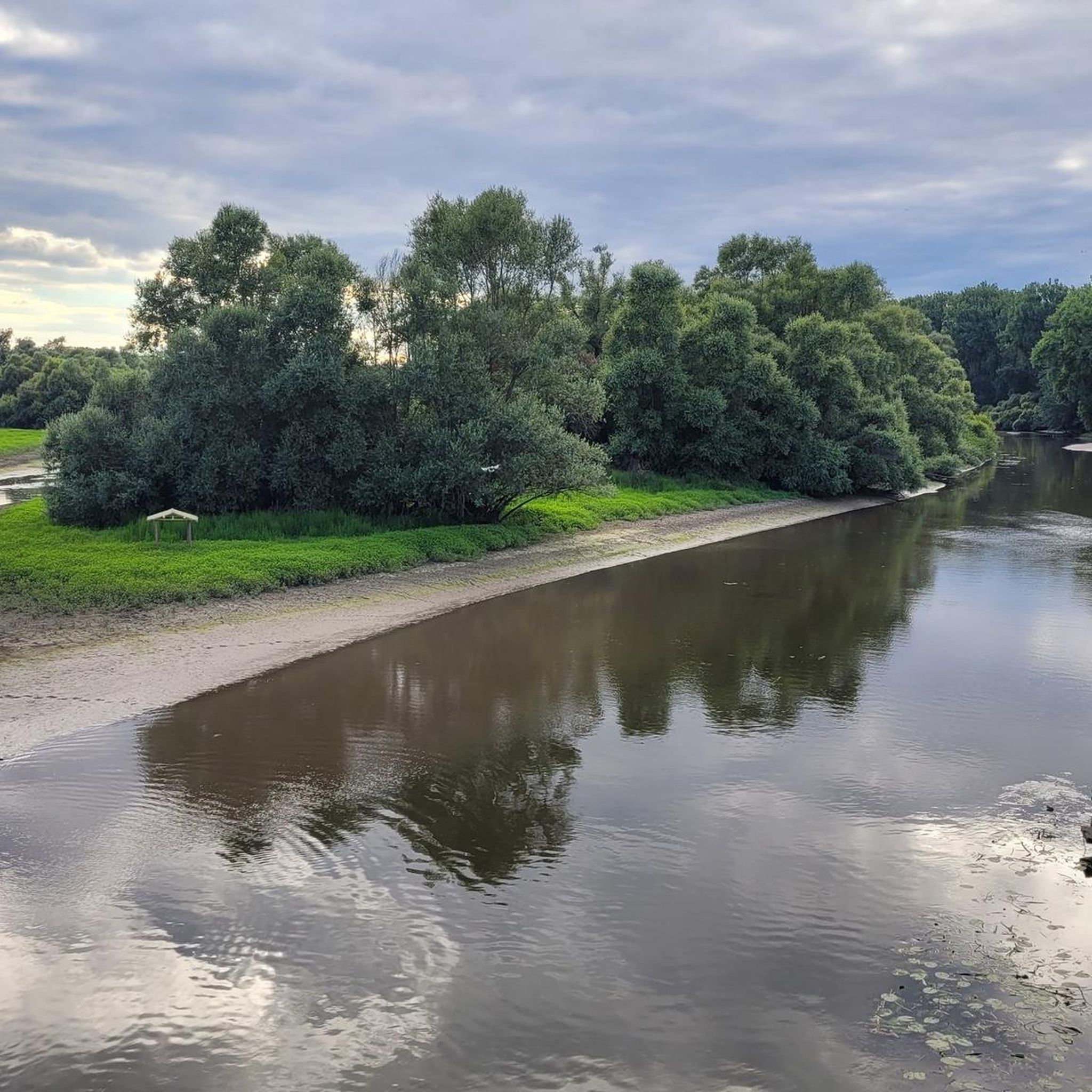
A small, idyllic stretch of beach right on the water, nestled in the natural landscape of the Sauer Delta. The surprisingly bright shore area and the calm water almost convey a little holiday feeling in the middle of the Rhine-Auen landscape.
9
0
Directly in the Rhine plain near Seltz lies the Dyckerhoff Gravières et Sablières gravel pit. Sand and gravel are extracted and processed here, which over many years has also led to the creation of the large water surfaces of the gravel pits.
9
0
The extensive body of water, surrounded by lush greenery and dense bank vegetation, offers beautiful views and attractive photo opportunities, especially in the quiet evening hours. Several former gravel pits, including the Salmengrund, are located in the vicinity of Seltz and shape the landscape along the Rhine today.
9
0
A beautiful and pristine nature reserve near Munchhausen in French Alsace. Over around 486 hectares, floodplain forests, wet meadows, reeds, and quiet water surfaces alternate. The Sauer Delta is one of the last areas where the Rhine's floodwaters can still spread naturally into the floodplains.
9
0
Beautiful bridge over the Sauer near Munchhausen, which leads directly into the charming landscape of the Sauer delta. A beautiful transition between the small Alsatian village and the vast nature with its floodplain forests, meadows, and water areas.
9
0

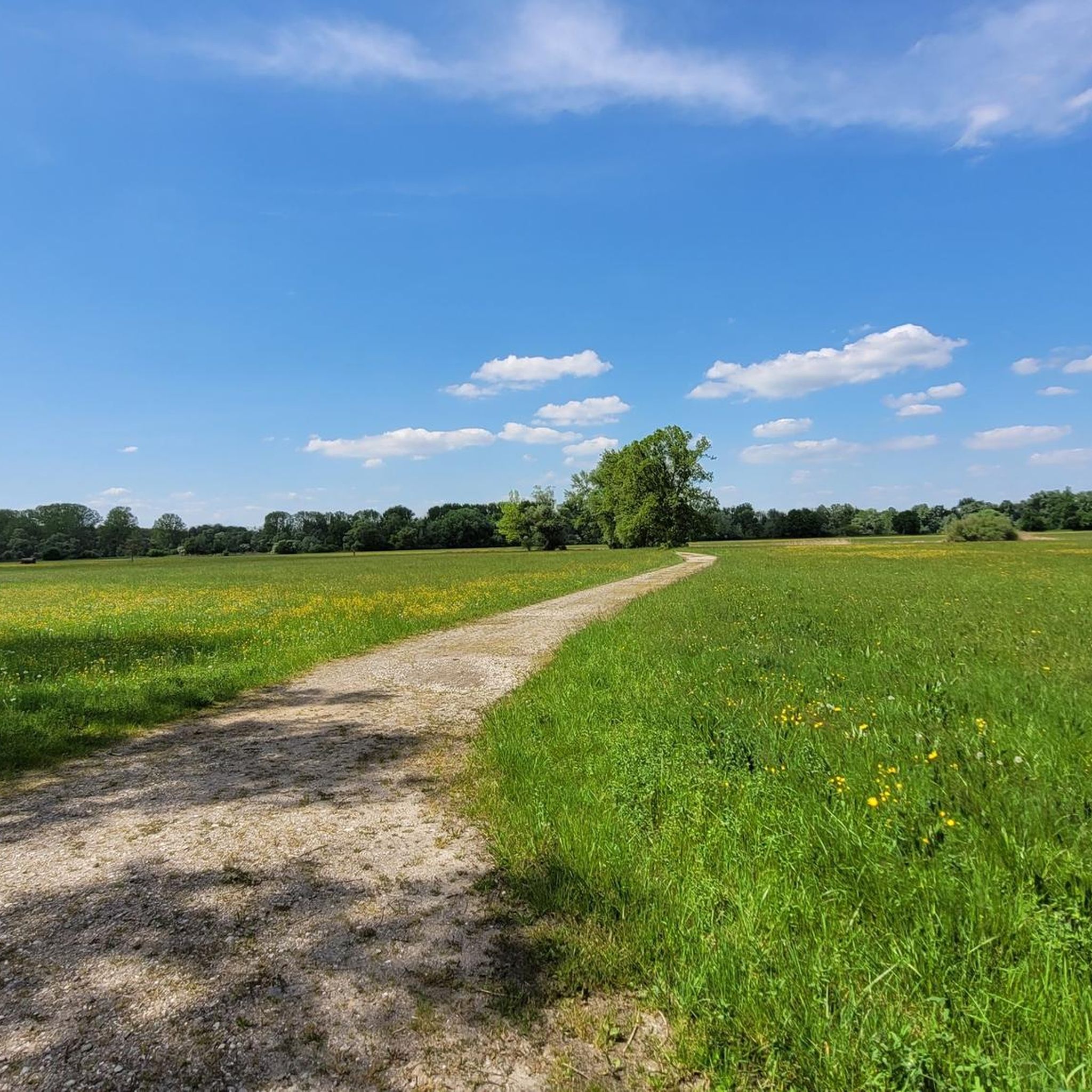
Quiet and secluded. Here you can take a nice break with a siesta.
0
0

The station conducts research on bird migration through marking (ringing). These studies include the development of bird populations and their density in different biotopes.
0
0
The Rhine is one of Europe's most important rivers and is approximately 1,233 km long. Its source lies in the Swiss Alps, where it originates from several mountain streams. From there, it first flows through Switzerland and then partly forms the border between Germany and France, before continuing through Germany and finally the Netherlands. At Rotterdam, the Rhine divides into several distributaries and finally reaches the North Sea. Its catchment area is very large (approx. 185,000 km²) and includes many tributaries such as the Moselle, Main, or Neckar. The Rhine is of great importance to Europe: Shipping: One of the world's most important waterways for trade and transport Economy: Connection of many industrial and port cities Nature: Habitat for numerous animal and plant species Energy: Utilization through hydropower in the Alpine regions Due to its location and use, the Rhine is considered one of Central Europe's most important lifelines.
0
0
Frequently Asked Questions
How many hiking trails are available in the Réserve Naturelle du delta de la Sauer?
There are over 370 hiking routes available in the Réserve Naturelle du delta de la Sauer. The majority, around 278, are considered easy, with 90 moderate and a few more challenging options.
What kind of terrain can I expect when hiking in the Réserve Naturelle du delta de la Sauer?
The terrain in the Réserve Naturelle du delta de la Sauer is generally flat, characterized by a mosaic of diverse habitats. You'll encounter floodplain forests, reed beds, oxbow lakes, willow groves, mudflats, and wet meadows. The landscape is heavily influenced by the Sauer and Rhine rivers, leading to dynamic water levels and varied ecological features, but paths typically have minimal elevation gain.
Are there any circular walks in the Réserve Naturelle du delta de la Sauer?
Yes, the reserve offers many circular walks. An easy option is the Port de Seitz – Bridge over the Sauer loop from Munchhausen, which is about 7.5 km. For a slightly longer moderate option, consider the Bridge over the Sauer – Seltz Gravel Lake loop from Rastatter Rheinaue, covering about 10.5 km.
What is the best time of year to go hiking in the Réserve Naturelle du delta de la Sauer?
Spring and autumn are particularly good seasons for hiking in the Réserve Naturelle du delta de la Sauer, especially for birdwatching, as large migrating flocks can be observed. The diverse habitats offer unique views year-round, but these seasons provide optimal conditions for wildlife spotting and comfortable temperatures.
What are some interesting natural features or landmarks to see along the trails?
The reserve itself, the Sauer Delta Nature Reserve, is a major highlight with its diverse habitats like floodplain forests and oxbow lakes. You can also see the Bridge over the Sauer and experience the dynamic landscape of the Rhine and its flood plains. The area is also known for its rich biodiversity, particularly its bird and amphibian populations.
Is the Réserve Naturelle du delta de la Sauer suitable for family hikes?
Yes, the reserve is well-suited for family hikes due to its generally flat terrain and numerous easy routes. Shorter loops like the Sauer Delta Nature Reserve – Ornithologische Station loop from Rastatter Rheinaue, which is about 5.1 km, are great for families with children, offering opportunities for nature observation.
What kind of wildlife can I expect to see while hiking?
The Réserve Naturelle du delta de la Sauer is renowned for its exceptional biodiversity. It's a prime spot for birdwatching, with 183 bird species, including the bluethroat, penduline tit, great reed warbler, and black kite. It's also a vital habitat for amphibians, with populations of green tree frogs and the rare brown pelobates.
Are there any easy hiking routes for beginners?
Absolutely. Many routes in the Réserve Naturelle du delta de la Sauer are classified as easy. An accessible option is the Plittersdorf–Seltz Rhine Ferry – Seltz Gravel Lake loop from Seltz, which is about 5.7 km and offers gentle paths through the delta landscape.
What do other hikers say about the trails in the Réserve Naturelle du delta de la Sauer?
The trails in the Réserve Naturelle du delta de la Sauer are highly rated by the komoot community, with an average score of 4.5 stars from over 1,200 reviews. Hikers often praise the varied terrain, the opportunities for wildlife observation, and the well-maintained paths that offer a unique natural experience.
Is there parking available near the hiking trails?
While specific parking locations are not detailed in the guide, the presence of various starting points for loops, such as 'from Rastatter Rheinaue' or 'from Munchhausen', suggests that parking facilities are available in these areas to access the trails. It's advisable to check local signage upon arrival.
Can I reach the Réserve Naturelle du delta de la Sauer by public transport?
The region is accessible, and while direct public transport links to every trailhead might vary, towns like Seltz and Munchhausen, which serve as starting points for several routes, typically have public transport connections. For detailed information on routes and schedules, it's best to consult local transport providers.
Are there any longer, more challenging hikes in the area?
While the majority of trails are easy to moderate, there are longer options. The Wintersdorf Rhine Bridge loop from Rastatter Rheinaue is a moderate hike of nearly 14 km, offering a more extended exploration of the delta's surroundings.
Most popular routes around Réserve Naturelle du delta de la Sauer
Most popular attractions around Réserve Naturelle du delta de la Sauer

Get inspired with the komoot mobile app


Explore more
Browse the best Hikes in other regions.
