The best running trails around Abanilla
4.0
(7)
763
runners
49
runs
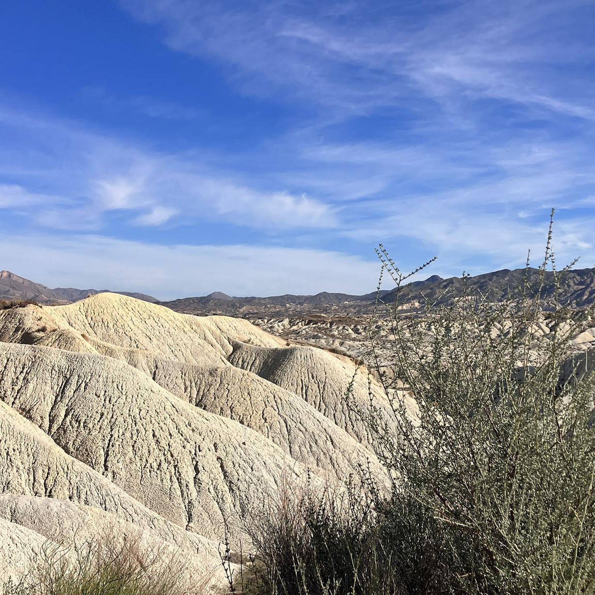
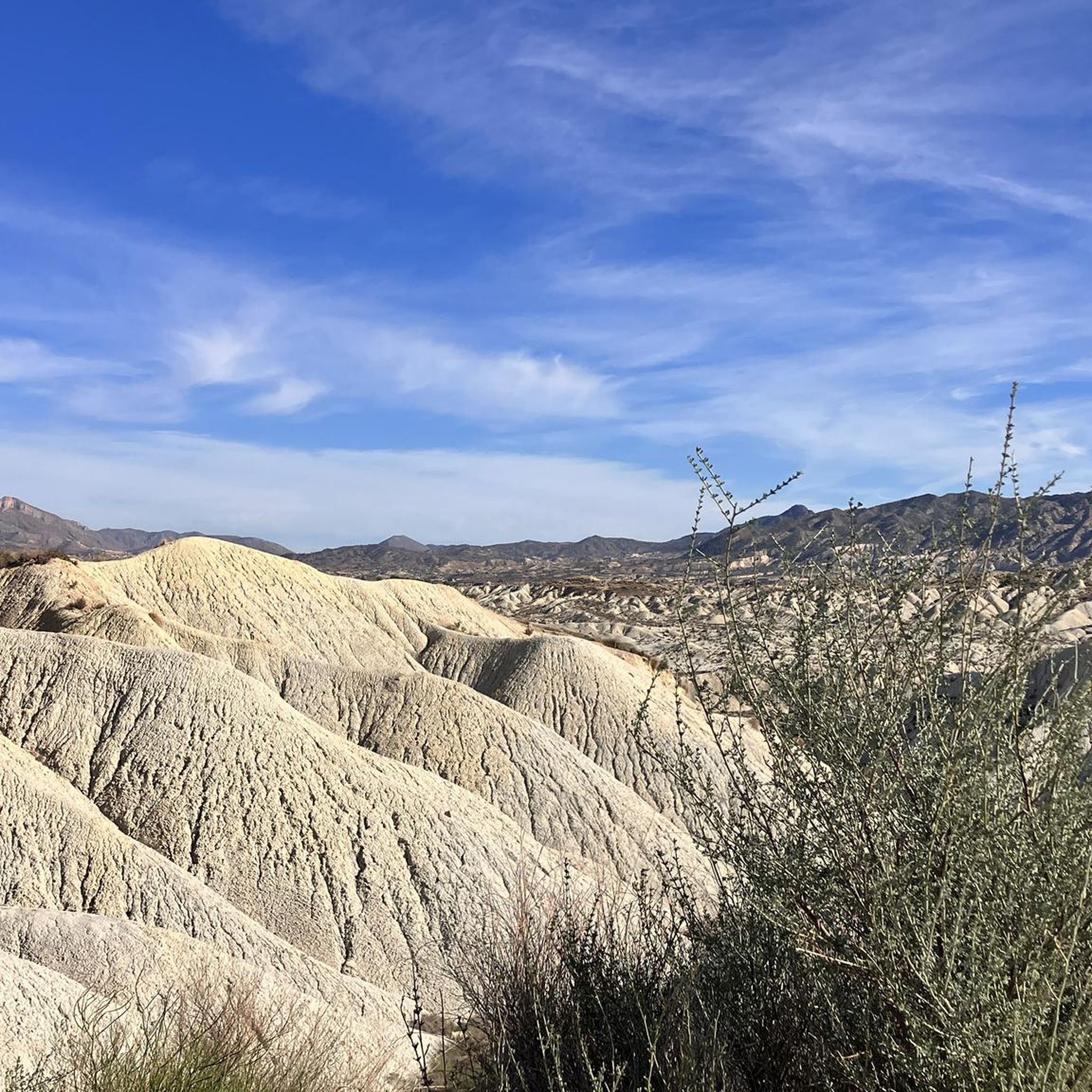
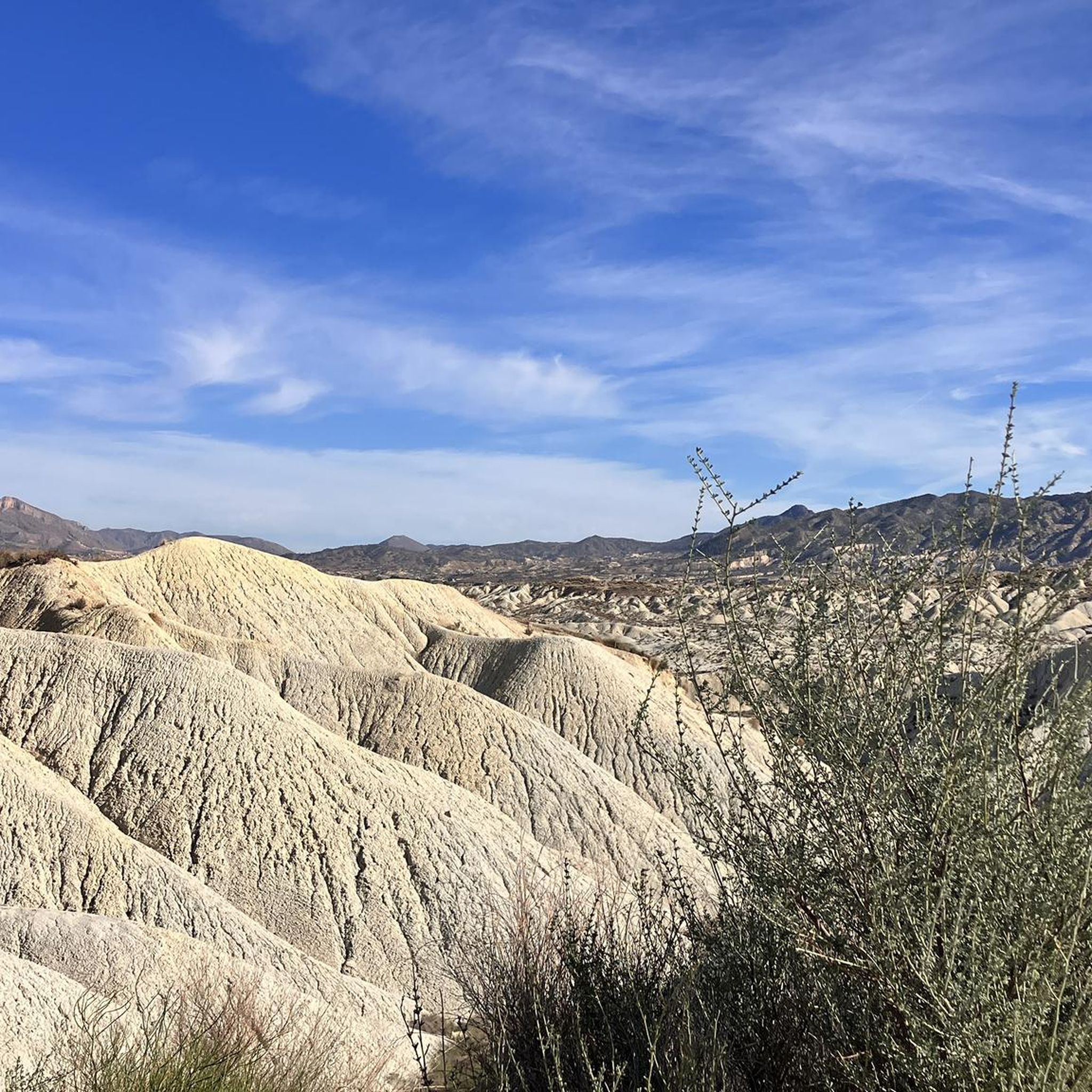
Jogging around Abanilla offers a diverse landscape, characterized by its distinctive "lunar landscape" and dramatic ravines. The region features arid desert scenery, fertile riverbeds, and badlands, providing varied terrain for runners. Natural floodwater run-off channels and the Sierra de El Cantón mountains further contribute to the unique environment. This combination of features makes Abanilla a compelling destination for outdoor activities and running.
Best jogging routes around Abanilla
- The most popular jogging route is Hondón de los Frailes loop from Hondón…
Last updated: August 21, 2026
17
runners
Moderate run. Good fitness required. Mostly paved surfaces. Suitable for all skill levels.
5.0
(1)
6
runners
10.9km
01:14
120m
120m
Moderate run. Good fitness required. Mostly paved surfaces. Suitable for all skill levels.

Sign up for free
5
runners
20.8km
03:02
1,170m
1,170m
Hard run. Very good fitness required. Mostly paved surfaces. Suitable for all skill levels.
5
runners
5.61km
00:36
60m
60m
Moderate run. Good fitness required. Mostly paved surfaces. Suitable for all skill levels.
7
runners
2.81km
00:18
30m
30m
Easy run. Great for any fitness level. Mostly paved surfaces. Suitable for all skill levels.
Get access to more routes and recommendations from other explorers.
Sign up for free
Already have an account?
Our route recommendations are based on thousands of hikes, rides, and runs completed by other people on komoot.
Start today with a free account
Your next adventure awaits.
Login or Signup
Tips from the Community

A very demanding climb, almost 400 meters of elevation gain in less than 3 kilometers, with gradients of up to 22%. With good gearing, you can reach the top without much trouble (as it's partially paved), but it will require a lot of effort. The views, as you might expect, are splendid.
0
0

A beautifully maintained village surrounded by beautiful scenery. Good snacks in the (English) village restaurant.
0
0

Very nice tour! There are a few parts where you have to climb a bit.
1
0

Very artistically designed spinning top
3
0
Beautiful city. Visited by many English tourists.
3
0

The Marble Rotonda in El Pinós/Pinoso is an impressive monument that adorns the access to the city from the CV-83 highway. This rotunda is adorned with 1,100 tons of marble. Its design is an example of the beauty and artistic skill that can be achieved with this natural stone. The marble used in the rotunda creates a striking visual effect and represents the geological richness of the region.
8
0
El Pinós, also known as Pinoso, is a municipality located in the west of the province of Alicante, in the Vinalopó Mitjà region. The pine landscape is characterized by white limestone lands covered with vineyards, mainly of the Monastrell variety, which produces high-alcohol red wines and dessert wines called Fondillón.
8
1
The Parish Church of San Pedro Apóstol, located in El Pinós/Pinoso, is a building with a rich history and notable architecture. The church was founded in 1739 on the site of an old hermitage. Over time, the building was expanded and, in 1888, it acquired its current appearance with the construction of the Communion chapel.
6
0
Frequently Asked Questions
How many running routes are available in Abanilla?
Abanilla offers a good selection of running routes, with over 40 trails available for you to explore. These routes cater to various fitness levels, from easy loops to more challenging paths.
Are there easy running routes for beginners or casual joggers in Abanilla?
Yes, Abanilla has several easy running options. For instance, the Running loop from Los Sigüenzas is an easy 1.7-mile (2.8 km) trail. Another accessible choice is the Running loop from la Canalosa, which is 2.5 miles (4.0 km) long and also rated easy. These routes are perfect for a relaxed run through the Abanilla countryside.
What kind of landscapes can I expect on the running trails around Abanilla?
The running trails in Abanilla offer a truly unique and diverse landscape. You'll encounter the striking "lunar landscape" of the Desierto de Abanilla, dramatic ravines, and fertile riverbeds. The region also features badlands, natural floodwater run-off channels, and the Sierra de El Cantón mountains, providing varied terrain and breathtaking scenery for your run.
Are there any running routes that offer scenic viewpoints or landmarks?
Absolutely. Many routes traverse areas with stunning views. The region is known for its dramatic landscapes, including the Desierto de Abanilla, which offers picturesque rock formations and a unique desert vista. You might also find routes near the Chicamo River Canyon, providing a contrasting green oasis with fascinating rock formations and lush vegetation.
Can I bring my dog on the running trails in Abanilla?
While many natural areas in Spain are generally dog-friendly, it's always best to check local regulations for specific trails or protected areas. Given the diverse terrain, including arid desert and riverbeds, ensure your dog is comfortable with the conditions and always carry enough water for both of you. Keep dogs on a leash, especially in areas with wildlife or other trail users.
Are there family-friendly running options in Abanilla?
Yes, several routes are suitable for families looking for a less strenuous run or walk. The easier loops, such as the Running loop from Los Sigüenzas, are generally well-suited for families. The Chícamo River Canyon also offers easy to moderate walking routes, some of which might involve walking through shallow water, which can be a fun experience for children.
Are there circular running routes available in Abanilla?
Yes, Abanilla features numerous circular running routes, allowing you to start and end your run at the same point. Examples include the popular Hondón de los Frailes loop from Hondón de los Frailes and the challenging Penya de la Mina loop from la Canalosa. Many of the available routes are designed as loops for convenience.
Where can I find parking for the running trails in Abanilla?
Parking availability varies by trailhead. For routes starting from villages like Hondón de los Frailes, La Canalosa, or La Murada, you can often find parking within or on the outskirts of the settlements. When exploring specific areas like the Desierto de Abanilla or the Chícamo River Canyon, look for designated parking areas near popular access points or trailheads. It's advisable to check the route details on komoot for specific parking recommendations.
What is the best time of year to go running in Abanilla?
The best time for running in Abanilla is typically during the cooler months, from autumn through spring (October to May). Summers can be very hot due to the arid climate, making early morning or late evening runs necessary. Spring and autumn offer pleasant temperatures, ideal for enjoying the diverse landscapes without extreme heat.
Are there any longer or more challenging running routes for experienced runners?
Experienced runners will find plenty of challenging options in Abanilla. The region boasts 26 difficult routes, including the Penya de la Mina loop from la Canalosa, a difficult 7.9-mile (12.8 km) path with significant ascents. These routes often feature more rugged terrain and greater elevation changes, providing a good workout and expansive views.
What attractions or points of interest can I see near the running routes?
Beyond the trails, Abanilla offers several interesting points. You can explore the unique "lunar landscape" of the Desierto de Abanilla or the lush Chicamo River Canyon. For relaxation after a run, the nearby spa town of Los Baños de Fortuna with its thermal springs is a great option. The town of Abanilla itself also holds historical charm with Moorish and Roman vestiges.
What do other runners say about the trails in Abanilla?
The running routes in Abanilla are highly rated by the komoot community, with an average score of 4.0 stars from 4 reviews. Over 500 runners have used komoot to explore the region, often praising the unique and varied terrain, from the distinctive desert landscapes to the contrasting riverbeds, which make for an inspiring running experience.
Are there places to eat or drink near the running routes in Abanilla?
While specific cafes directly on every trail might be limited, the towns and villages surrounding the running areas, such as Abanilla itself, Macisvenda, or Hondón de los Frailes, offer options for refreshments. You can find local restaurants and cafes to refuel after your run, experiencing the regional cuisine. It's always a good idea to carry water and snacks, especially on longer routes.
Most popular attractions around Abanilla

Get inspired with the komoot mobile app


Explore more
Browse the best Running Trails & Routes in other regions.
