The best walks and hikes around Albudeite
4.4
(18)
92
hikers
12
hikes
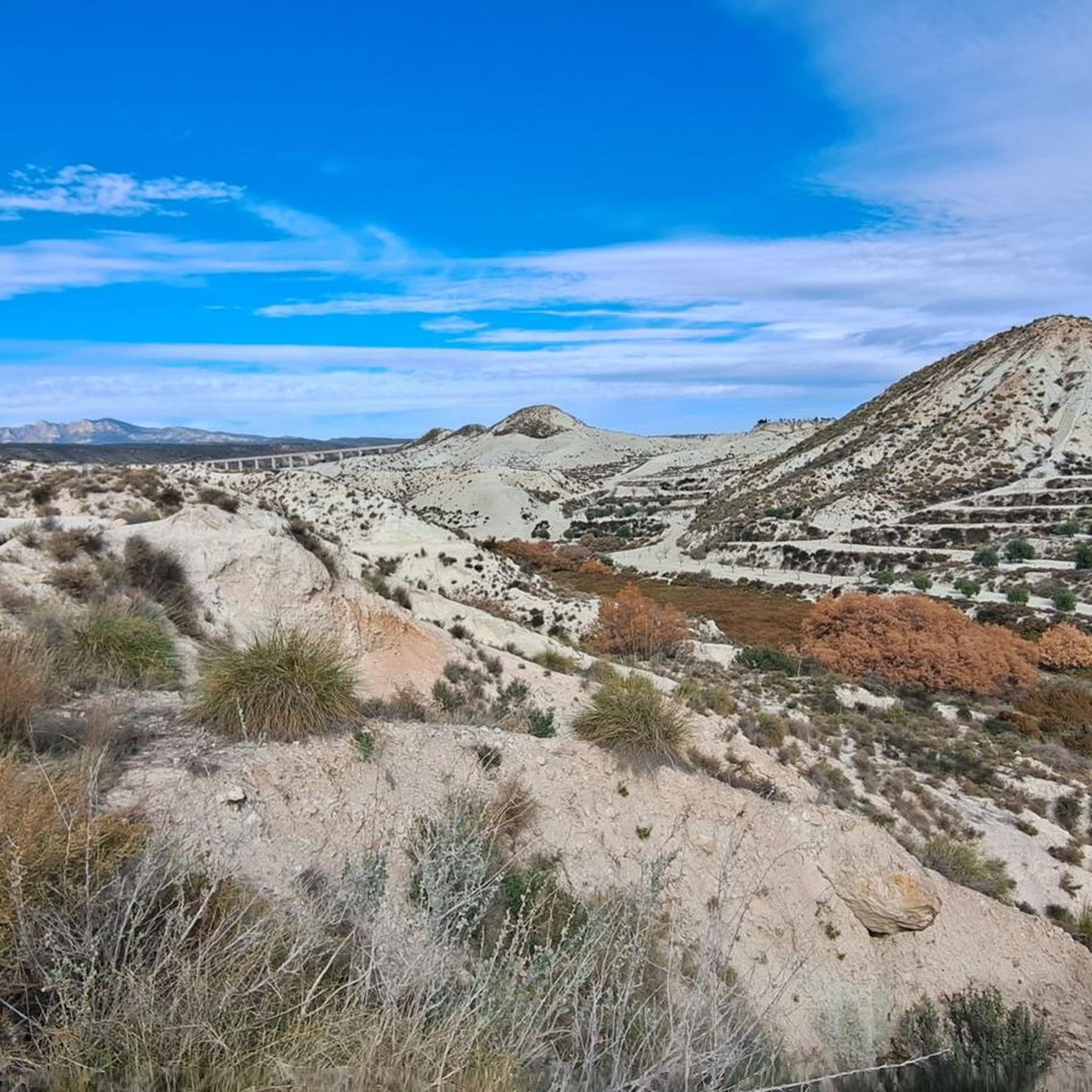
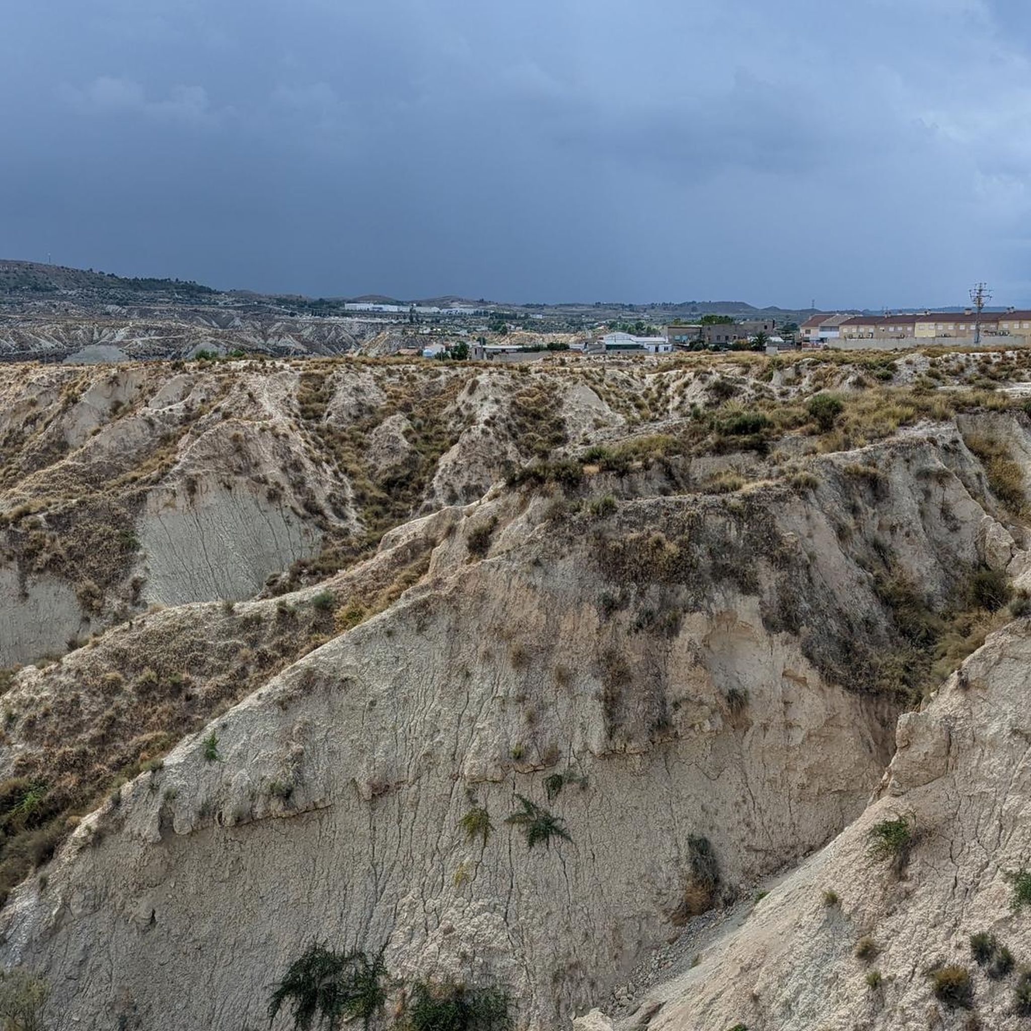
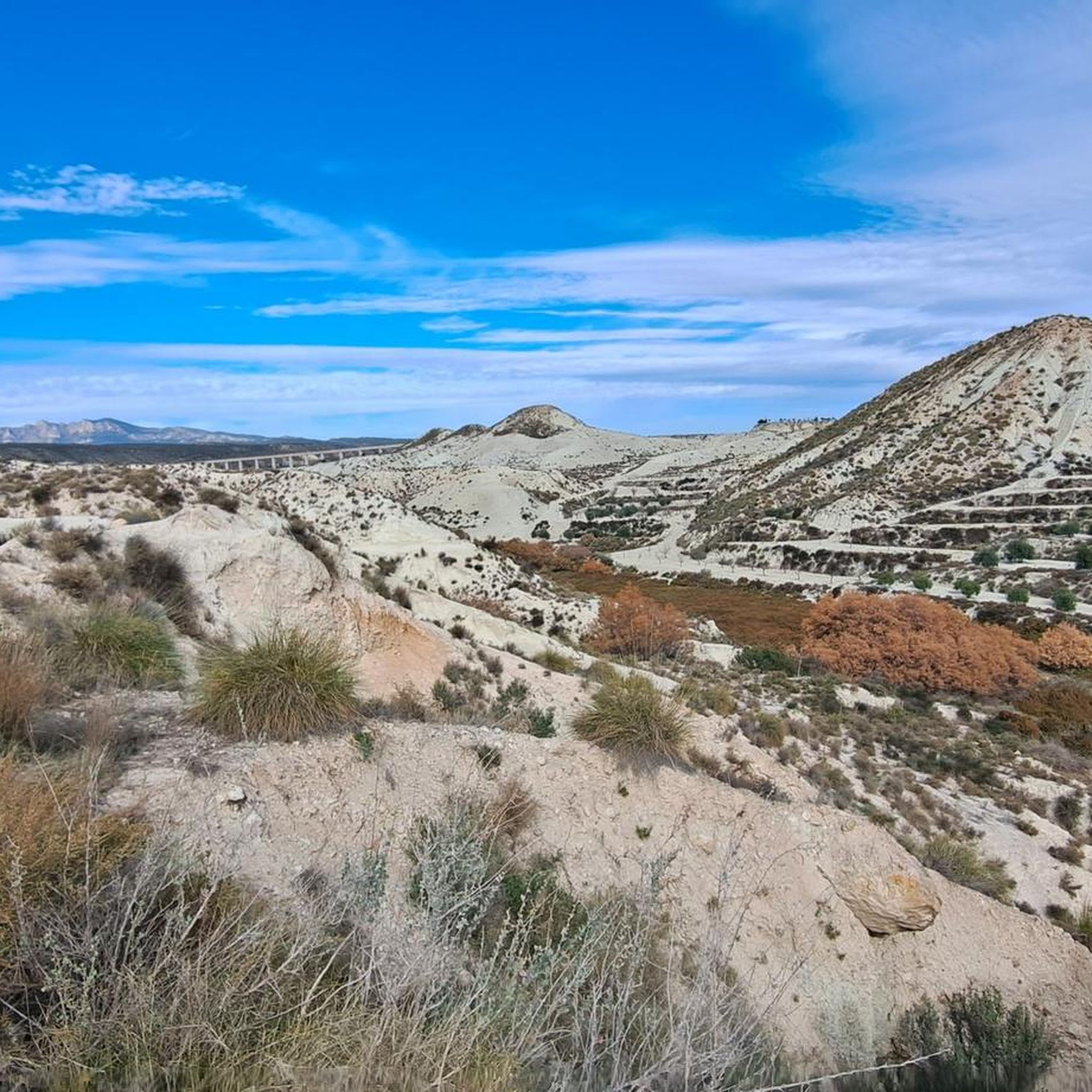
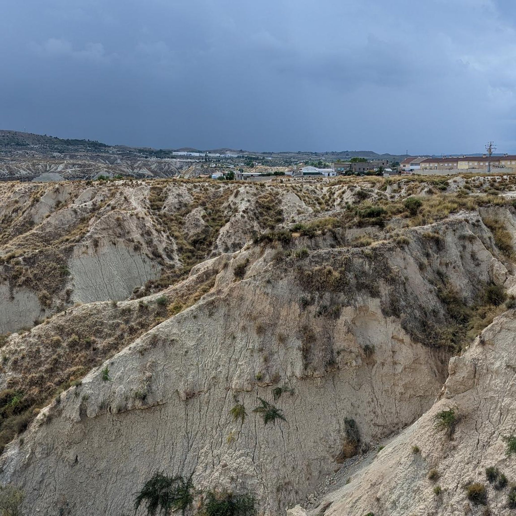
Hiking around Albudeite offers diverse landscapes, from arid, dramatic terrain featuring extensive gullies and dry riverbeds to lush, irrigated areas sustained by the Mula River. The region is characterized by unique geological formations, including "badlands" geology, and pockets of Aleppo pine forests. The Vía Verde del Noroeste, built on an old railway line, provides a significant pathway through these varied environments, connecting historical points of interest. This combination of stark natural beauty and verdant riverine ecosystems defines the hiking experience…
Last updated: July 5, 2026
5.0
(4)
27
hikers
14.7km
04:10
320m
320m
Moderate hike. Good fitness required. Easily-accessible paths. Suitable for all skill levels.
6
hikers
11.4km
03:14
240m
240m
Moderate hike. Good fitness required. Easily-accessible paths. Suitable for all skill levels.

Sign up for free
4.0
(2)
4
hikers
12.2km
03:18
170m
170m
Moderate hike. Good fitness required. Easily-accessible paths. Suitable for all skill levels.
3.0
(1)
7
hikers
17.9km
04:43
160m
160m
Moderate hike. Good fitness required. Easily-accessible paths. Suitable for all skill levels.
4.5
(2)
5
hikers
6.17km
01:46
130m
130m
Easy hike. Great for any fitness level. Easily-accessible paths. Suitable for all skill levels.
Get access to more routes and recommendations from other explorers.
Sign up for free
Already have an account?
Our route recommendations are based on thousands of hikes, rides, and runs completed by other people on komoot.
Start today with a free account
Your next adventure awaits.
Login or Signup

Tips from the Community

There are also some shops here...
0
0
This beautiful campsite near Mula is right in the heart of the action, surrounded by orange and lemon 🍋... 10 minutes away and you're in the thick of things.
0
1

This castle of Renaissance origin is located at the top of the town of Mula. From its walls, you can see the Murcian orchard and the mountains on the horizon.
0
1
It is the old railway station, active until 1971. This stop was one of the busiest, since it is where the most important hot spring in the Region of Murcia is located.
0
1
The panoramic view of the viaduct, about 16 meters high, over the arid boulevard is spectacular. It is one of the most famous corners of the Vía Verde del Noroeste.
0
1
Frequently Asked Questions
How many hiking trails are available around Albudeite?
There are 13 hiking routes available around Albudeite, offering a variety of experiences for outdoor enthusiasts. These include 5 easy routes and 8 moderate routes, ensuring options for different fitness levels.
What kind of terrain can I expect when hiking near Albudeite?
Hiking near Albudeite offers a striking contrast of landscapes. You'll encounter arid, dramatic terrain characterized by extensive gullies and dry riverbeds, often described as a 'lunar landscape.' This is juxtaposed with lush, irrigated areas sustained by the Mula River and pockets of Aleppo pine forests. The Vía Verde del Noroeste also provides a path through diverse environments, including viaducts over ravines.
Are there hiking options for different skill levels in Albudeite?
Yes, Albudeite offers hiking options for various skill levels. The area features 5 easy routes, perfect for a relaxed stroll, and 8 moderate routes for those seeking a bit more challenge. There are no difficult routes listed, making it accessible for most hikers.
Can I hike along the Vía Verde del Noroeste near Albudeite?
Yes, Albudeite is situated along the Vía Verde del Noroeste, a 76.8-kilometer trail built on an old railway line. This greenway offers a unique hiking experience through diverse environments, from arid landscapes to verdant orchards, and features points of interest like viaducts and old railway stations.
Are there any waterfalls to visit on a hike near Albudeite?
Yes, the Fuente Caputa Waterfall is a notable natural feature in the area. You can experience it on the La Cierva Reservoir – Fuente Caputa Waterfall loop from Mula, a moderate 9.1-mile (14.7 km) trail. The waterfall is a refreshing destination, approximately 10 kilometers from Mula, and is also a listed highlight: Fuente Caputa Waterfall.
What natural features or landmarks can I see while hiking around Albudeite?
While hiking around Albudeite, you can discover several interesting natural features and historical landmarks. These include the dramatic 'badlands' geology, the contrasting green Mula River valley, and Aleppo pine forests. Notable points of interest along trails include the Viaduct over the Perea ravine, offering panoramic views, and the picturesque Ricote Valley. You might also encounter historical railway stations like the Old Los Rodeos railway station or the Old Baños de Mula Railway Station.
Are there any circular hiking routes available in Albudeite?
Yes, several circular hiking routes are available. For example, the Square – Castillo de los Vélez loop from Mula is an easy 3.2-mile (5.1 km) path exploring the historic castle area. Another option is the Castillo de los Vélez – Castle of Alcalá loop from Mula, a moderate 7.1-mile (11.5 km) trail. The Castle Path – Interesting Figures loop from Mula is also a moderate 7.6-mile (12.2 km) circular route.
What do other hikers enjoy the most about hiking in Albudeite?
The hiking routes in Albudeite are highly rated by the komoot community, with an average score of 4.5 stars from 15 reviews. Hikers often praise the diverse terrain, from the unique 'badlands' geology to the contrasting green river valleys, and the historical points of interest found along trails like the Vía Verde del Noroeste.
Is Albudeite a good destination for family-friendly hikes?
Yes, Albudeite offers several options suitable for families. With 5 easy routes available, you can find paths that are less strenuous and enjoyable for all ages. These trails often provide a chance to experience the region's unique landscapes without significant difficulty.
What is the best time of year to go hiking in Albudeite?
The best time to go hiking in Albudeite is typically during the spring and autumn months. The weather during these seasons is generally milder and more pleasant for outdoor activities, avoiding the intense heat of summer and the cooler, potentially wetter conditions of winter. This allows for comfortable exploration of the region's diverse landscapes.
Are there any long-distance trails accessible from Albudeite?
Yes, the Vía Verde del Noroeste, a 76.8-kilometer greenway, passes through the area, offering a significant long-distance hiking opportunity. Additionally, the nearby Ricote Valley is part of the GR127 long-distance path, providing further options for extended walks.
Are there any routes that explore historical sites or castles?
Yes, several routes explore historical areas. The Square – Castillo de los Vélez loop from Mula is an easy path that takes you around the historic Castillo de los Vélez. Another option is the Castillo de los Vélez – Castle of Alcalá loop from Mula, which leads through areas with historical castles. The Vía Verde del Noroeste itself is built on an old railway line and features rehabilitated old railway stations.
Most popular attractions around Albudeite

Get inspired with the komoot mobile app


Explore more
Browse the best Hikes in other regions.
