The best walks and hikes around Ablanque
5.0
(1)
20
hikers
8
hikes
Hiking around Ablanque, situated in the northern part of the Alto Tajo Natural Park, is defined by its extensive pine forests and the presence of the Ablanquejo River. This region offers diverse natural features, providing a setting for outdoor activities. The Ablanquejo River, though modest in length, carves out landscapes before its confluence with the Tagus River. The area's terrain primarily consists of forested paths and riverine environments.
Best hiking trails around Ablanque
- The most popular hiking route is Beach…
Last updated: June 28, 2026
5.0
(1)
13
hikers
Moderate hike. Good fitness required. Mostly accessible paths. Sure-footedness required.
2
hikers
11.4km
03:25
260m
260m
Moderate hike. Good fitness required. Mostly accessible paths. Sure-footedness required.

Sign up for free
1
hikers
12.9km
03:51
410m
410m
Moderate hike. Good fitness required. Easily-accessible paths. Suitable for all skill levels.
9.31km
02:43
260m
260m
Moderate hike. Good fitness required. Easily-accessible paths. Suitable for all skill levels.
1
hikers
13.4km
04:01
410m
410m
Moderate hike. Good fitness required. Easily-accessible paths. Suitable for all skill levels.
Get access to more routes and recommendations from other explorers.
Sign up for free
Already have an account?
Our route recommendations are based on thousands of hikes, rides, and runs completed by other people on komoot.
Start today with a free account
Your next adventure awaits.
Login or Signup

Tips from the Community

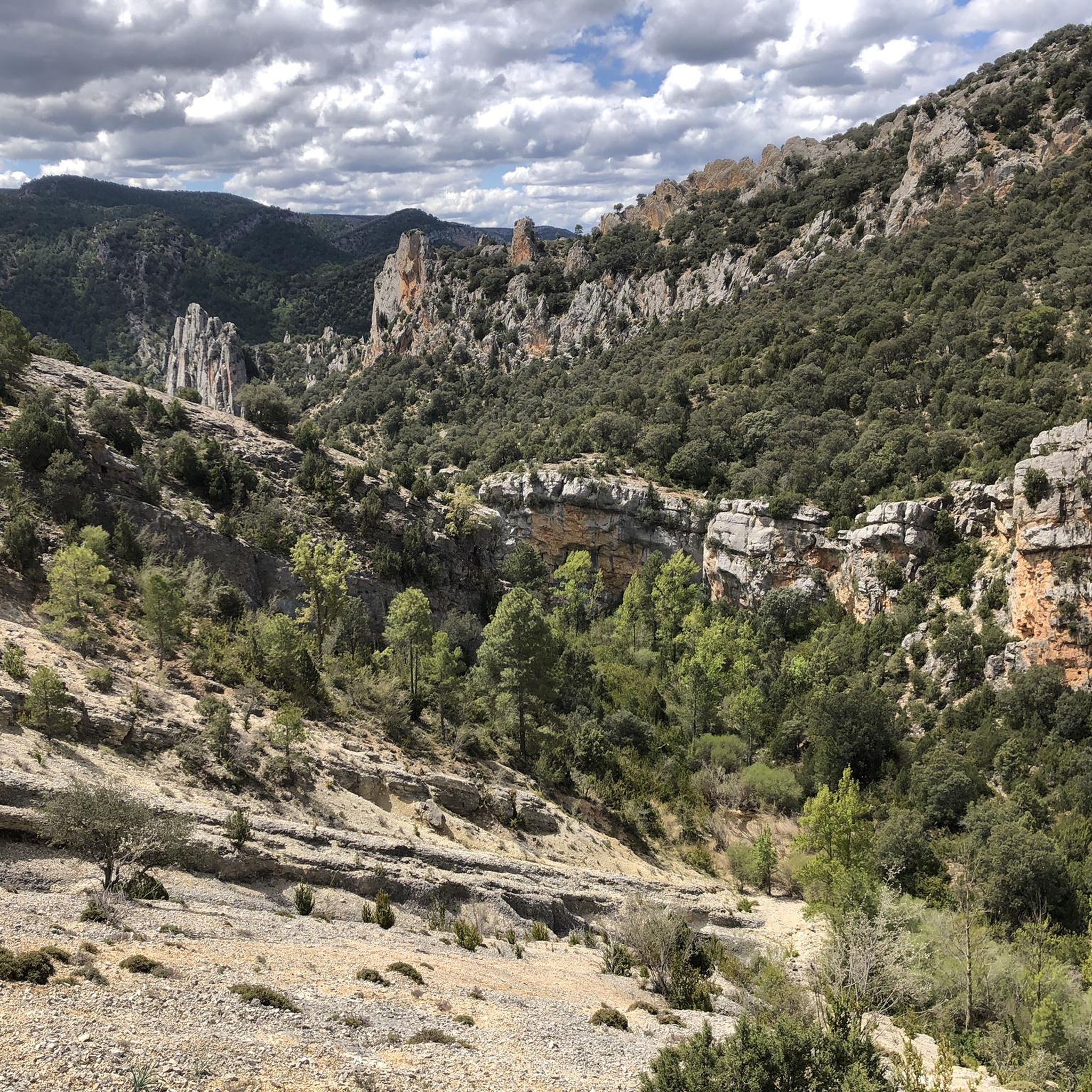
Giant awnings that have been formed "miraculously." A landscape of great beauty.
0
0
Perhaps the best prehistoric cave in Spain. With three rooms or spaces connected by corridors. Many types of animals, some of them in relief.
0
0
The Monastery of Buenafuente del Sistal, of Cloistered Cistercian nuns, is a haven of Peace in the hustle and bustle of daily life. Taking advantage of its inn, you can spend a few days of peace there and away from the busy life of the cities. I highly recommend it to you. The landscapes are extraordinary.
1
0

The Tagüenza bridge is located between the municipalities of Huertapelayo and Huertahernado. The small stone bridge stands out for being built on two high rocks that flank the Tagus River.
2
0

A very nice bridge for walkers and cyclists if they ride a bike. It allows you to cross the Tagus River and avoid the road. The view from both bridges is nice, but I prefer the safety of the pedestrian bridge.
1
0
There is a parking very close so you don't have to walk far. I think it's more fun to include in a long hike, but the views are good either way. From here you can tour the entire valley and down the river. It's quite spectacular and there are several map boards that explain what you're seeing.
2
0

Bridge that allows the hiker to cross the Tagus River over its crystalline waters.
0
0
Former Cistercian monastery of the Common Observance, female, located in the town of La Buenafuente del Sistal. It remains active with a small community. After many years of lethargy, it revived in 1971. It is a renewed center of spirituality.
2
0
Frequently Asked Questions
How many hiking trails are available around Ablanque?
There are currently 8 hiking trails documented around Ablanque on komoot. These routes primarily feature moderate difficulty levels, offering a good balance for various hikers.
What is the best time of year to go hiking in Ablanque?
Ablanque, with its extensive pine forests, offers pleasant hiking conditions for much of the year. While the Ablanquejo River's dam becomes a popular bathing spot in summer, suggesting it's warm enough for outdoor activities, spring and autumn generally provide cooler temperatures ideal for longer hikes. The pine forests offer natural shade, making even warmer days manageable.
Are there any circular hiking routes in Ablanque?
Yes, several routes around Ablanque are circular. For example, the Beach of Puente de San Pedro and waterfall of Campillo - circular in the Natural Park of Alto Tajo is a moderate 5.4-mile (8.8 km) loop. Another option is the Cueva de los Casares and Valley of Miracles Loop, which covers 8.0 miles (12.9 km) through varied landscapes.
Are the hiking trails around Ablanque suitable for families?
The trails around Ablanque are generally rated as moderate. While there are no routes specifically classified as 'easy' in the guide data, many moderate trails can be enjoyed by families with some hiking experience. The natural setting of pine forests and river landscapes provides an engaging environment for children. Consider routes with shorter distances and less elevation gain for younger hikers.
Can I bring my dog on the hiking trails in Ablanque?
Ablanque is located within the Alto Tajo Natural Park, and generally, dogs are welcome on trails as long as they are kept under control, especially to protect local wildlife and respect other hikers. Always ensure your dog is on a leash where required and that you carry out any waste. The natural environment with pine forests and river access is typically very dog-friendly.
Are there any waterfalls to see on the hikes near Ablanque?
Yes, the region features natural attractions like waterfalls. The Beach of Puente de San Pedro and waterfall of Campillo - circular in the Natural Park of Alto Tajo route specifically highlights a waterfall. Additionally, the Escaleruela Waterfall is a notable natural monument in the vicinity.
What kind of natural features can I expect to see while hiking in Ablanque?
Ablanque is characterized by extensive and beautiful pine forests, which provide a serene backdrop for hiking. The Ablanquejo River, after which the village is named, carves out picturesque landscapes before joining the Tagus River. You'll also find riverine environments and, in summer, a small dam on the Ablanquejo River that becomes a popular bathing area.
Are there any interesting viewpoints along the hiking trails?
Yes, some routes offer scenic viewpoints. The San Pedro Bridge and Zaorejas Viewpoint Loop, for instance, provides views from the Zaorejas Viewpoint, allowing you to appreciate the natural beauty of the Alto Tajo Natural Park.
What historical or archaeological sites can be found near Ablanque?
The vicinity of Ablanque is known to have numerous archaeological remains, adding a historical and cultural dimension to the natural exploration of the area. While specific sites are not detailed in the hiking routes, these remnants offer glimpses into the region's past.
Are there any amenities like cafes or accommodation near the hiking trails in Ablanque?
Ablanque is a small village within a natural park. While specific cafes or accommodations directly on the trails are unlikely, the village itself or nearby towns would be the primary places to find such amenities. It's advisable to plan ahead and check local services before your hike.
What do other hikers enjoy most about hiking in Ablanque?
The komoot community rates the hiking experience around Ablanque highly, with an average score of 5.0 stars. Hikers often praise the immersive experience within the extensive pine forests and the tranquil beauty of the river valleys, highlighting the region's natural charm.
Is public transport available to reach the hiking trails in Ablanque?
Information on specific public transport links directly to trailheads in Ablanque is limited. Given its location within a natural park, access is often easier by private vehicle. It's recommended to check local bus schedules or consider driving to reach the starting points of the trails.
Most popular attractions around Ablanque

Get inspired with the komoot mobile app


Explore more
Browse the best Hikes in other regions.
