The best running trails around Cantalejo
75
runners
22
runs
Jogging routes around Cantalejo offer access to a captivating natural environment, primarily characterized by the Lagunas de Cantalejo, a protected wetland area. This region features numerous ponds, sections of the Cega River, and extensive pine forests. The terrain is largely flat and sandy, providing accessible paths for running. These varied landscapes create a diverse and scenic backdrop for runners, from shaded forest trails to open areas alongside the lagoons.
Best jogging routes around Cantalejo
- The most popular jogging route is…
Last updated: October 28, 2026
11
runners
Hard run. Very good fitness required. Mostly paved surfaces.
10
runners
16.5km
02:03
180m
180m
Hard run. Very good fitness required. Mostly paved surfaces.

5
runners
Moderate run. Good fitness required. Mostly paved surfaces.
7
runners
8.45km
00:52
40m
40m
Moderate run. Good fitness required. Mostly paved surfaces.
3
runners
8.39km
00:53
30m
30m
Moderate run. Good fitness required. Mostly paved surfaces.
Get access to more routes and recommendations from other explorers.
Already have an account?
Our route recommendations are based on thousands of hikes, rides, and runs completed by other people on komoot.
Start today with a free account
Your next adventure awaits.



Tips from the Community

The medieval Talcano Bridge is located in Sepúlveda, in the province of Segovia. Although of Roman origin, the current structure probably dates back to the Middle Ages. Today, only one arch of the original bridge remains, as the course of the Duratón River has been altered and no longer passes beneath it.
1
0
The medieval Talcano Bridge is located in Sepúlveda, in the province of Segovia. Although of Roman origin, the current structure probably dates back to the Middle Ages. Today, only one arch of the original bridge remains, as the course of the Duratón River has changed and no longer passes beneath it.
0
0

Cantalejo, one of the gateways to the Hoces del Río Duratón Natural Park, is a good place to make a stop during the trip. Have a coffee in Plaza España or eat something small.
0
0
The angled path that crosses the Hoces del Río Duratón Natural Park reaches the bridge over the Duratón River before heading towards Sepúlveda.
0
0

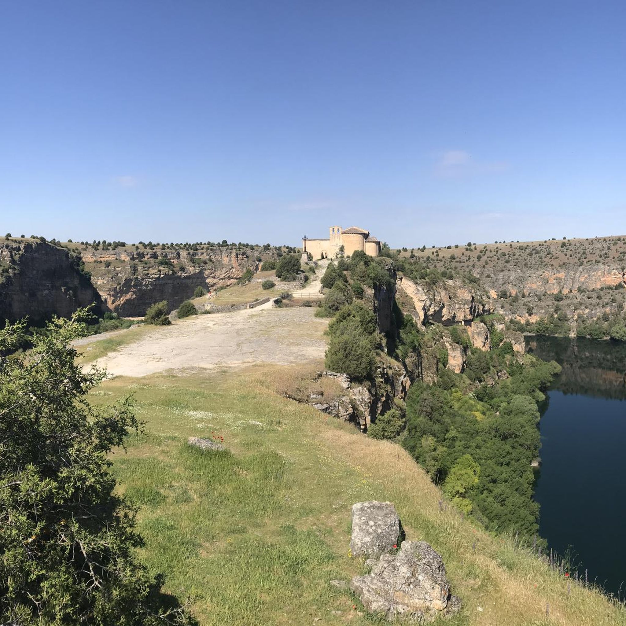
It was the place where San Frutos lived as a hermit. There are seven altars carved into the rocks that seem to come from the Visigothic era.
0
0

The 17th century church of San Andrés is located in the Plaza de España, the central point of the town of Cantalejo, declared a Site of Cultural Interest in 1995. Right next to it there is a water fountain.
2
0

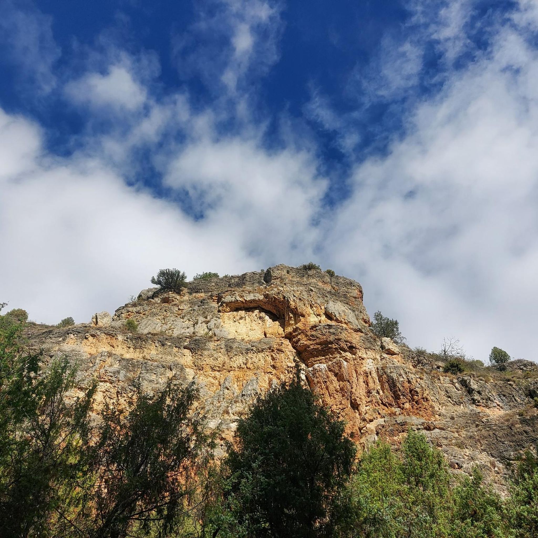
Above the Río Duratón there are these immense rocks, a gorge formed by the river, where we can see these huge animals.
0
1
Population that is located in the old middle of the province of Segovia and that is characterized by being in a flat area where the protected natural area of the Hozes del Río Duratón is located to the north.
1
0
Frequently Asked Questions
What is the general terrain like for running routes around Cantalejo?
The terrain around Cantalejo is largely flat, sandy, and can be wet, especially within the Lagunas de Cantalejo wetland area. You'll find a mix of shaded pine forest paths and open areas alongside lagoons and the Cega River, providing a diverse and scenic backdrop for your run.
Are there running routes suitable for beginners in Cantalejo?
Yes, Cantalejo offers accessible paths perfect for beginners. For an easy start, consider the Long Duratón Trail, which is 2.9 miles (4.6 km) and takes about 35 minutes to complete, offering pleasant views along the Duratón River.
Are there longer or more challenging running trails for experienced runners?
For those seeking a more challenging experience, the Long Trail of the Duratón River – Vultures' Nest loop from Parque Natural de la Hoces del Río Duratón is a difficult 11.7 miles (18.9 km) path. This route explores the natural park's river and forest landscapes and includes some elevation gain.
What natural features can I expect to see while jogging in Cantalejo?
Cantalejo's running routes are defined by extensive wetlands, tranquil pine forests, and sections of the Cega River. The region is part of the Lagunas de Cantalejo, a protected Natura 2000 wetland, offering opportunities to observe diverse aquatic vegetation and a variety of bird species.
Are there any interesting landmarks or points of interest along the running routes?
Many routes offer scenic views and pass by notable points. For example, some trails provide views of the Hoces del Duratón Natural Park. You might also encounter viewpoints like the Viewpoint of Virgen de la Peña or the View of Vulture Nests, especially on routes near the Duratón River.
Can I bring my dog on the running trails in Cantalejo?
The natural environment around Cantalejo is generally welcoming for dogs. While specific leash rules may vary by area, it's always recommended to keep your dog on a leash, especially in protected areas like the Lagunas de Cantalejo, to protect wildlife and ensure a pleasant experience for all users.
Are the running routes in Cantalejo suitable for families?
Yes, many of the flatter and shorter routes are suitable for families. The generally flat and sandy terrain, particularly around the Lagunas de Cantalejo, makes for easy walking trails that can be adapted for family jogging sessions. Always check the route difficulty and length to ensure it matches your family's ability.
Are there circular running routes available in Cantalejo?
Yes, there are several circular running routes. A popular option is the Church of San Andrés – Plaza de España, Cantalejo loop from Cantalejo, which is 4.9 miles (7.9 km) and takes you through the town's surroundings and local fields. Another is the Running loop from Cantalejo, covering 8.4 km.
What is the best time of year to go running in Cantalejo?
Cantalejo offers a great running experience throughout much of the year. The pine forests provide shade in warmer months, while the flat terrain is generally accessible. Spring and autumn are particularly pleasant with milder temperatures and vibrant natural scenery. Be mindful that some areas can be wet, especially after rain.
Is parking available near the trailheads in Cantalejo?
While specific parking information for each trailhead isn't always detailed, Cantalejo is generally accessible. Many routes start from or near the town, where public parking options are typically available. For routes within natural parks, designated parking areas are often provided.
What do other runners enjoy most about the trails in Cantalejo?
Over 40 runners have explored Cantalejo's varied terrain using komoot. They often praise the region's diverse and scenic backdrop, from tranquil pine forests to open areas alongside the lagoons. The accessible, largely flat paths and opportunities for wildlife observation are frequently highlighted as enjoyable aspects.
Are there places to eat or stay near the running routes in Cantalejo?
Cantalejo is a town with local amenities, so you'll find cafes, pubs, and restaurants within or close to the town center. For accommodation, there are options ranging from guesthouses to hotels, providing convenient bases for exploring the running trails.
Most popular attractions around Cantalejo

Get inspired with the komoot mobile app


Explore more
Browse the best Running Trails & Routes in other regions.
