The best road cycling routes around Arenillas De Riopisuerga
12
riders
5
rides
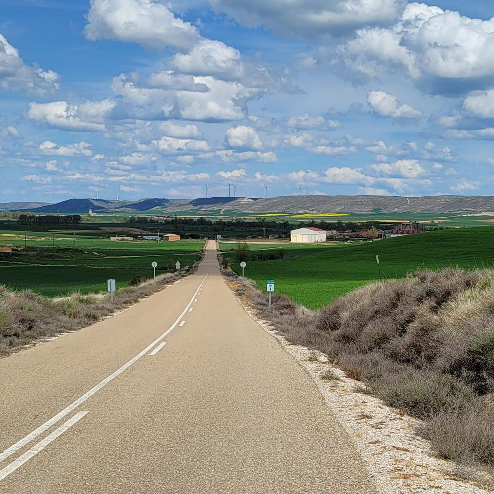
Road cycling routes around Arenillas De Riopisuerga traverse the rolling hills and extensive agricultural plains of the Castilian plateau. The area is situated on the left bank of the Pisuerga River, with the Arroyo de la Vega also flowing through its territory, providing varied terrain for cyclists. Routes often follow quiet rural roads and farm tracks, offering expansive views of the countryside. The region features diverse landscapes, from gentle inclines along riverine environments to more challenging ascents.
Best road cycling…
Last updated: October 29, 2026
1
riders
31.1km
01:15
150m
150m
Easy road ride. Mostly well-paved surfaces and easy to ride.
5
riders
69.1km
03:24
1,070m
1,070m
Hard road ride. Very good fitness required. Mostly well-paved surfaces and easy to ride.

3
riders
Moderate road ride. Good fitness required. Mostly well-paved surfaces and easy to ride.
3
riders
Moderate road ride. Good fitness required. Mostly well-paved surfaces and easy to ride.
31.5km
01:32
460m
460m
Moderate road ride. Good fitness required. Mostly well-paved surfaces and easy to ride.
Our route recommendations are based on thousands of hikes, rides, and runs completed by other people on komoot.
Start today with a free account
Your next adventure awaits.


Tips from the Community

Very nice square with many establishments of all kinds, lots of local shops still open and a great terrace atmosphere
0
0

Hermitage San Jose. Dedicated to St Joseph, the patron saint of Happy Death
0
1

There is an entrance fee; 5 euros.
6
0

Castrojeriz is a charming village located in the province of Burgos, Spain, and forms an important part of the famous Camino Francés. Surrounded by beautiful hills and historical sites, such as the imposing Castrojeriz Castle and the Gothic Collegiate Church of Santa María, the village offers a unique blend of medieval charm and rustic beauty. Known for its Jacobean urbanism, with houses pleasantly arranged along the main street, Castrojeriz is a favorite stop for pilgrims who enjoy the serene atmosphere and rich history of this enchanting place.
8
0

Fabulous views from the ancient castle ruins on the top of the hill
2
0
Large church at the entrance to Castrojeriz
2
0

A museum has now been set up in this church, which pilgrims can visit for 1€. Here, visitors also receive a stamp and can pray at a high altar.
2
0

Stage 1. Alar del Rey/Cervera de Pisuerga 87 kilometers. 1,850 positive meters. The Canal de Castilla begins in Alar del Rey, an illustrious work of 18th century hydraulic engineering that was an important vein of communication, commerce and prosperity in much of the Castilian lands for a century. In 1860 the railway monopolized the trade in cereals, goods and minerals in the north of Castile and transport barges stopped using the canal, which continued in use until the mid-20th century, exploiting the hydraulic energy of the locks and irrigation systems. . The starting point is the dock of the old piers of the Canal de Castilla, a very pleasant place to start a gravel trip of a couple of days of bikepacking along the Palentino Romanesque Natural Path, which largely coincides with the Ruta del Coke charcoal. “Cok” or coke is a high-quality hard coal with good heat capacity that is highly appreciated in the metallurgical industry. The best coke deposits were in exclusive mines in Fuentes Carrionas and Montaña Palentina, mainly in the valleys of Mudá, Castillería and Santullán. The extracted mineral was transported by horse and cart to the piers of the Canal de Castilla bound for Valladolid and Palencia, where distribution began. The cycle tour follows the old mining road to the mountains of northern Palencia, visiting a few rural Romanesque jewels. Before leaving we passed by the milestone where the Canal de Castilla takes its water from the Pisuerga River. I discovered this beautiful river spot thirty years ago, when I cycled along the canal towpaths for the first time. Now we leave in the opposite direction following the red posts of the Nature Trail. The roads are good for gravel cycling, the relief is a bit leg-breaking and there are several hard slopes that warm up the muscles with the gravel single chainring but the surface is great. The first town is Prádanos de Ojeda, on a rural hill above extensive cereal fields that are very good for warming up the legs before the first slopes, it is the end of summer and the stubble is full of large balls of packed straw. The path crosses the Pradera de las Tortas mountain and Santibáñez de Ecla appears hidden among some hills of holm oaks and holm oaks. The church of San Juan can be seen now or in the second stage because the return track connects here. The path runs through hills populated by dense holm oak forests and passes through Villaescusa de Ecla, which has the Romanesque church of Santa Elena and in a nearby ravine the Cervigona Waterfall. The silhouette of the Palentina Mountain and the Curavacas peak draw attention on the horizon. The path jumps small hills of holm oaks and holm oaks and at the heights the view takes in the mountains of the Cantabrian Mountains of Palencia. The surface is excellent and the bikes descend at full speed to the town of Cozuelos de Ojeda. The church is monumental, Renaissance with star-crossed vaults and a Herrerian tower. Outside the church there are remains of an ancient cloud conjurer, a popular place of prayer during harvest time to keep storms and clouds or clouds away from the sky. The route leaves the urban complex of Cozuelos de Ojeda on the left and continues through some steppe hills to a plateau with good views of the mountains, from Valdecebollas to Espigüete. In the moor is the crossing of the Perazancas de Ojeda variant on the return route. The next town is Vallespinoso de Aguilar. The hermitage of Santa Cecilia, immediately standing out on a castle hill, is dated to the 12th century and was declared a historical-artistic monument in 1951. The portico has well-carved capitals and the location conveys the atmosphere of a fortress sanctuary. The path goes up a somewhat rocky slope and enters new slides in the land of Aguilar de Campoo. At the foot of Monte de la Ruya, when the hardest slope of the stage appears in front of you, the detour to Barrio de San Pedro and Barrio de Santa María, two districts of Aguilar de Campoo, comes out on the right. The descent is fantastic with views of the large lake of the Aguilar reservoir. First is Barrio de San Pedro, with a very welcoming ambushed entrance and the church of San Pedro, Romanesque from the 13th century with many later additions. And then the hermitage of Santa Eulalia, solitary next to the road, another well-preserved historical-artistic monument of the rural Romanesque of Palencia. In the town, the church of the Assumption also preserves parts of Romanesque origin.
0
0
Frequently Asked Questions
How many road cycling routes are available around Arenillas De Riopisuerga?
There are over 5 road cycling routes around Arenillas De Riopisuerga, offering a variety of experiences from easy rides to more challenging ascents across the Castilian plateau.
What kind of terrain can I expect on road cycling routes in Arenillas De Riopisuerga?
The region features diverse terrain, from gentle inclines along riverine environments like the Pisuerga River and Arroyo de la Vega, to more challenging ascents through rolling hills and extensive agricultural plains. You'll primarily ride on quiet rural roads and farm tracks, offering expansive countryside views.
What is the best time of year for road cycling in Arenillas De Riopisuerga?
The best time for road cycling in Arenillas De Riopisuerga is generally during spring and autumn when temperatures are milder and the landscapes are vibrant. Summers can be warm, while winters are cooler, so checking local weather patterns before your ride is always recommended.
Are there easy road cycling routes suitable for beginners?
Yes, there is at least one easy road cycling route. For instance, the Canal de Castilla: Melgar de Fernamental - Rezmondo Loop is an easy 19.3-mile (31.1 km) trail that follows the historic Canal de Castilla, offering flat and scenic riding perfect for beginners.
What options are there for advanced road cyclists seeking a challenge?
Advanced cyclists looking for a challenge can explore routes with significant elevation gain. The Pilón loop from Pedrosa del Príncipe is a difficult 42.9-mile (69.2 km) path that features substantial climbing through the region's undulating terrain.
What historical sites or landmarks can I see along road cycling routes?
Many routes pass by or near historical sites. For example, the Convent of San Antón – View of Castrojeriz Castle loop from Villasilos leads through historical sites. You can also find attractions like the Ruins of the Monastery of San Antón, the San Nicolás Hermitage at Puente Fitero, and the Collegiate Church of Santa María del Manzano in the vicinity.
Are there any circular road cycling routes in the area?
Yes, many of the routes are designed as loops, allowing you to start and end in the same location. Examples include the Canal de Castilla: Melgar de Fernamental - Rezmondo Loop and the Convent of San Antón – View of Castrojeriz Castle loop from Villasilos.
Can I find cafes or places to stop for refreshments along the routes?
While specific cafes are not listed for every route, the region is dotted with charming villages. Many routes, such as the Castrojeriz Village and Castle loop from Castrojeriz, pass through settlements like Castrojeriz where you can typically find local establishments for refreshments.
Is parking available for cyclists near the routes?
Parking is generally available in the villages and towns that serve as starting points for these routes, such as Melgar de Fernamental, Pedrosa del Príncipe, or Castrojeriz. It's advisable to check local parking regulations upon arrival.
Are there family-friendly road cycling options?
For families, the easier, flatter routes are most suitable. The Canal de Castilla: Melgar de Fernamental - Rezmondo Loop, with its flat terrain along the historic canal, is an excellent choice for a family-friendly road cycling experience.
What about public transport access to the cycling routes?
Public transport options directly to the starting points of these rural routes may be limited. It is generally recommended to travel by car to the main towns or villages in the area, such as Melgar de Fernamental or Castrojeriz, and begin your ride from there.
Are there any long-distance road cycling routes in the region?
While the listed routes are primarily day trips, the broader Burgos region is part of established cycling networks like the Camino de Santiago and 'Vías Verdes'. These offer potential for connecting routes into longer-distance journeys, though specific long-distance road cycling routes are not detailed here.
Can I bring my dog on road cycling routes?
Road cycling routes typically follow public roads and tracks. While there are no specific restrictions against dogs on these routes, it's essential to ensure your dog is well-trained, can keep pace safely, and is always on a leash or securely carried, especially on roads with traffic. Always respect local regulations and private property.
Most popular routes around Arenillas De Riopisuerga
Most popular attractions around Arenillas De Riopisuerga

Get inspired with the komoot mobile app


Explore more
Browse the best Road cycling routes in other regions.
