The best MTB trails around Fuentesaúco
28
riders
9
rides
Mountain bike trails around Fuentesaúco are set within the Guareña river valley, offering a varied topography suitable for cycling. The region features a "campiña" (countryside) landscape with an average altitude of 750 to 800 meters, interspersed with rolling hills and fertile agricultural lands. This combination provides a dynamic environment for mountain biking, with routes traversing both flat stretches and more challenging ascents and descents. Riders can expect to explore agricultural fields and areas of special bird protection.
Best mountain bike…
Last updated: July 11, 2026
5
riders
62.1km
04:56
620m
630m
Moderate mountain bike ride. Good fitness required. Advanced riding skills necessary.
5
riders
52.9km
03:57
420m
420m
Moderate mountain bike ride. Good fitness required. Advanced riding skills necessary.

Sign up for free
3
riders
42.9km
03:20
370m
370m
Moderate mountain bike ride. Good fitness required. Suitable for all skill levels.
2
riders
17.3km
01:12
170m
170m
Easy mountain bike ride. Great for any fitness level. Suitable for all skill levels.
3
riders
60.1km
05:01
680m
680m
Hard mountain bike ride. Very good fitness required. Advanced riding skills necessary.
Get access to more routes and recommendations from other explorers.
Sign up for free
Already have an account?
Our route recommendations are based on thousands of hikes, rides, and runs completed by other people on komoot.
Start today with a free account
Your next adventure awaits.
Login or Signup
Popular around Fuentesaúco
Tips from the Community

Unique ancient pine within 20 kilometers around
0
0

pine that is more than 100 years old 3 km from the town of Gema, komoot takes you well to it, in summer somewhat sandy terrain
0
0

Corrales del Vino is a town in Zamora crossed by the N-630, located next to the route of the Autovía de la Plata and about 17 km from the capital. Its streets are full of houses built with sandstone, many of them with cellars in the basement. The church of Santa María Magdalena is from the 13th century and has a large portico in one of its side doors.
0
0

A small town on the Jacobean route of the Camino de Santiago. There are hostels and restaurants in the town and of course a lot of wine.
1
0
A small agricultural town, Argujillo is located in the southeast of the province of Zamora within the region of La Guareña. The city is located on the EuroVelo 1 cycling network.
1
1
Small town in the region of La Guareña located in the province of Zamora. The most notable buildings to see in the town are the remains of the Monastery of San Pedro de Alcántara and the Church of San Miguel de la Ribera.
1
1

Beautiful prints left by trees such as pine forests and cork oaks located next to the path in Quejigal de Valparaíso, a place of great beauty and high ecological value located in the Land of Wine
2
0
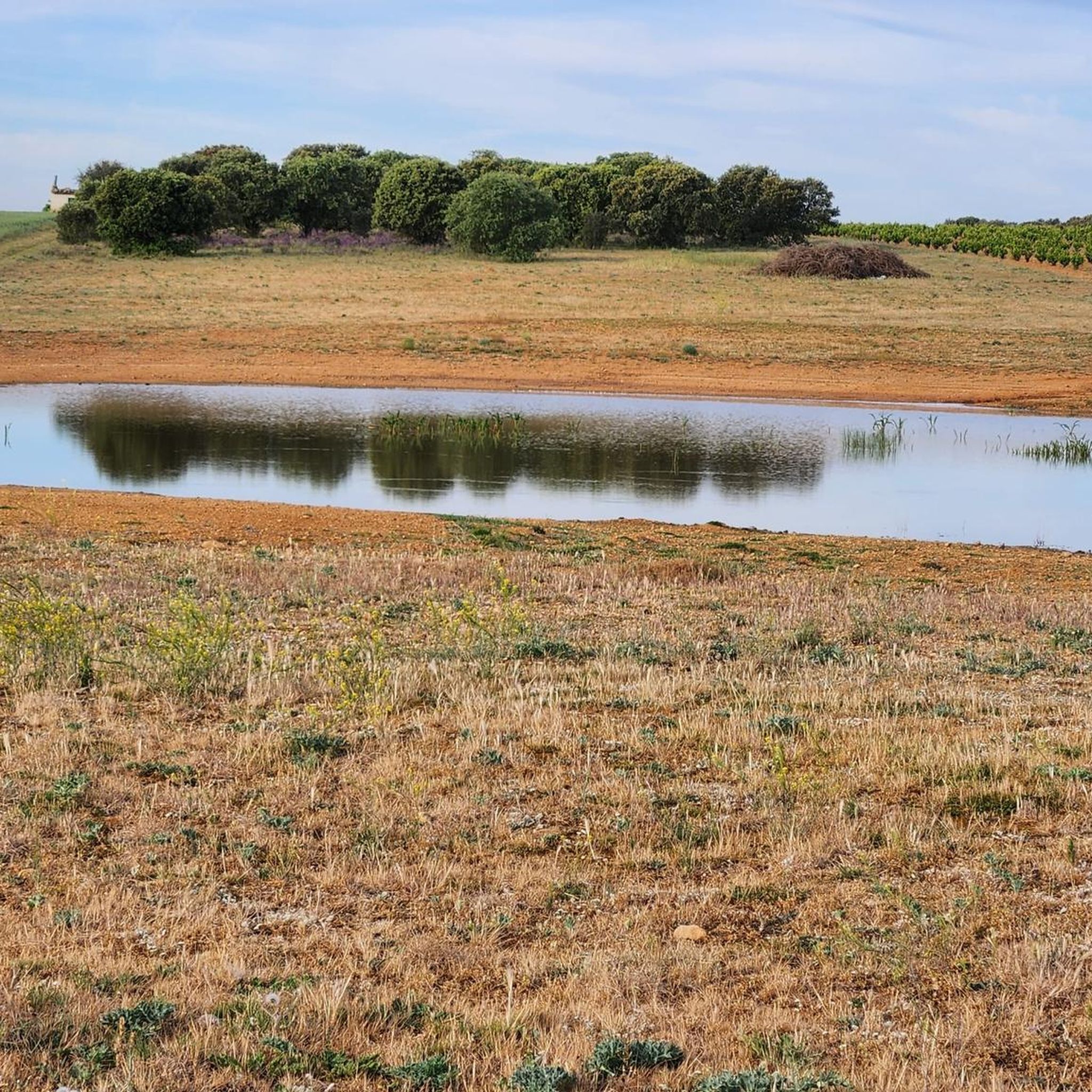
Beautiful pond located in Quejigal de Valparaíso, a place of great beauty and high ecological value located in the Land of Wine.
2
0
Frequently Asked Questions
What kind of terrain can I expect on mountain bike trails around Fuentesaúco?
The mountain bike trails in Fuentesaúco traverse a varied landscape within the Guareña river valley. You'll encounter a mix of 'campiña' (countryside) with rolling hills, fertile agricultural fields, and sections along the river. Routes can feature both well-paved and unpaved segments, offering a dynamic environment for cycling.
How many mountain bike trails are available in the Fuentesaúco area?
There are 6 mountain bike trails detailed for the Fuentesaúco area, catering to various skill levels. These include 1 easy, 4 moderate, and 1 difficult route.
Are there any easy mountain bike routes suitable for beginners or families?
Yes, there is an easy mountain bike route perfect for beginners or families. The Laguna del Mirador loop from Aldeanueva de Figueroa is 27.1 km long and typically takes under 2 hours to complete, with minimal elevation gain.
What is a good moderate-difficulty mountain bike route in Fuentesaúco?
A popular moderate route is the El Cubo del Vino – Fuente de la Remojera loop from Argujillo. This 42.9 km trail explores the countryside, passing through agricultural areas and rolling landscapes, and usually takes around 3 hours 20 minutes.
Are there any longer or more challenging mountain bike routes for experienced riders?
For experienced riders looking for a longer challenge, the Charca Rota – Pico el Pájaro Viewpoint loop from Argujillo is a moderate route that covers 62.1 km and involves significant elevation gain, typically taking nearly 5 hours to complete.
What kind of natural attractions or wildlife can I expect to see while mountain biking?
The region is part of the 'Llanuras del Guareña', a special bird protection area, so you might spot various raptors. The trails also offer views of the rolling 'campiña' landscapes and agricultural fields. You can explore viewpoints like Landscapes of La Armuña and Fuentesaúco Landscapes.
Are there any historical or cultural landmarks near the mountain bike trails?
Yes, you can explore the Main Square of Fuentesaúco or visit the Church of San Miguel de la Ribera. The nearby village of Parada de Rubiales is also a point of interest along some routes. The broader region also features historical towns with Romanesque walls and castle ruins, such as Fuentidueña.
What is the best time of year for mountain biking in Fuentesaúco?
Given the region's climate, spring and autumn generally offer the most pleasant conditions for mountain biking, with milder temperatures. Summers can be hot, and the Guareña river can experience significant dry periods, which might affect some natural features.
Are the mountain bike routes in Fuentesaúco typically circular?
Yes, many of the mountain bike routes in Fuentesaúco are designed as loops, allowing you to start and finish at the same point. Examples include the Charca de Villanueva loop from Parada de Rubiales and the Las Encinas loop from Argujillo.
What do other mountain bikers say about the trails in Fuentesaúco?
The komoot community frequently praises the varied terrain and the opportunity to explore the tranquil, rural Spanish setting. Riders appreciate the mix of rolling hills and agricultural scenery, making for a dynamic and engaging experience.
Is there public transport access to the mountain bike trails in Fuentesaúco?
While Fuentesaúco is a municipality, direct public transport access specifically for trailheads might be limited. It's generally recommended to plan your journey with personal transport to reach the starting points of the routes, especially those originating from smaller villages like Argujillo or Aldeanueva de Figueroa.
Are there any specific considerations for winter mountain biking in Fuentesaúco?
Winter conditions in Fuentesaúco can bring colder temperatures and potentially wet or muddy trails, especially in unpaved sections. It's advisable to check local weather forecasts and trail conditions before heading out and to be prepared with appropriate gear for cooler, potentially damp weather.
Most popular routes around Fuentesaúco
Most popular attractions around Fuentesaúco

Get inspired with the komoot mobile app


Explore more
Browse the best MTB trails in other regions.
