The best running trails around Bozoó
4.7
(3)
111
runners
13
runs
Jogging routes around Bozoó traverse a region characterized by the Montes Obarenes, featuring spectacular canyons and cliffs carved by the Ebro and Oroncillo rivers. The landscape includes diverse forests of beech, holm oak, and pine, offering shaded paths and varied terrain. Runners can explore riverbanks, verdant groves, and the unique cork oak forest, the only one in Burgos province. The area also presents historical elements like ancient necropolises and castles, integrated into the natural trails.
Best jogging routes around Bozoó
…Last updated: October 30, 2026
4.0
(1)
17
runners
11.2km
01:34
400m
400m
Hard run. Very good fitness required. Sure-footedness, sturdy shoes and alpine experience required.
15
runners
16.8km
02:59
920m
920m
Hard run. Very good fitness required. Sure-footedness, sturdy shoes and alpine experience required.

11
runners
20.3km
03:19
1,060m
1,060m
Hard run. Very good fitness required. Sure-footedness, sturdy shoes and alpine experience required.
9
runners
16.7km
02:56
940m
940m
Hard run. Very good fitness required. Sure-footedness, sturdy shoes and alpine experience required.
5
runners
16.1km
02:14
600m
600m
Hard run. Very good fitness required. Mostly paved surfaces.
Get access to more routes and recommendations from other explorers.
Already have an account?
Our route recommendations are based on thousands of hikes, rides, and runs completed by other people on komoot.
Start today with a free account
Your next adventure awaits.
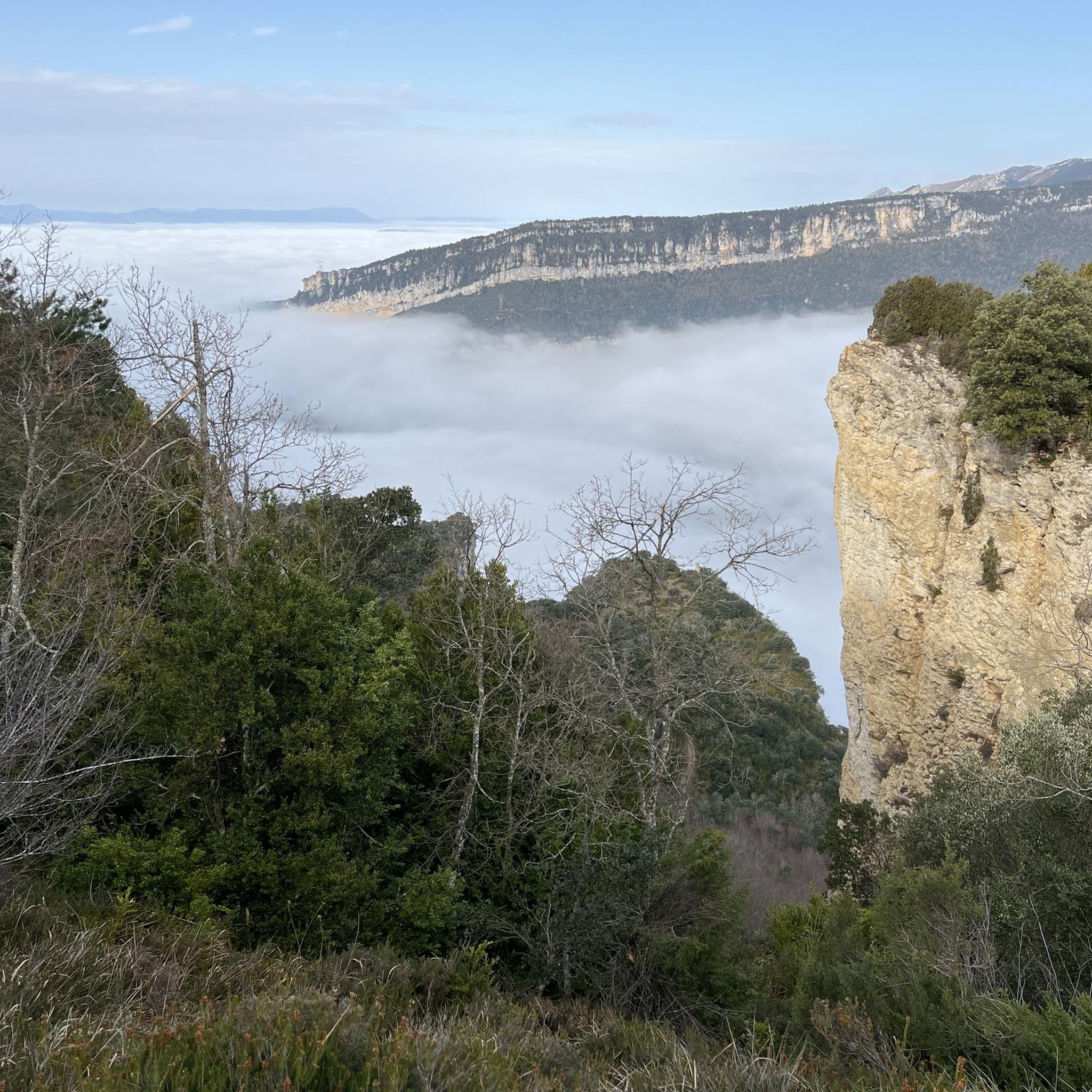
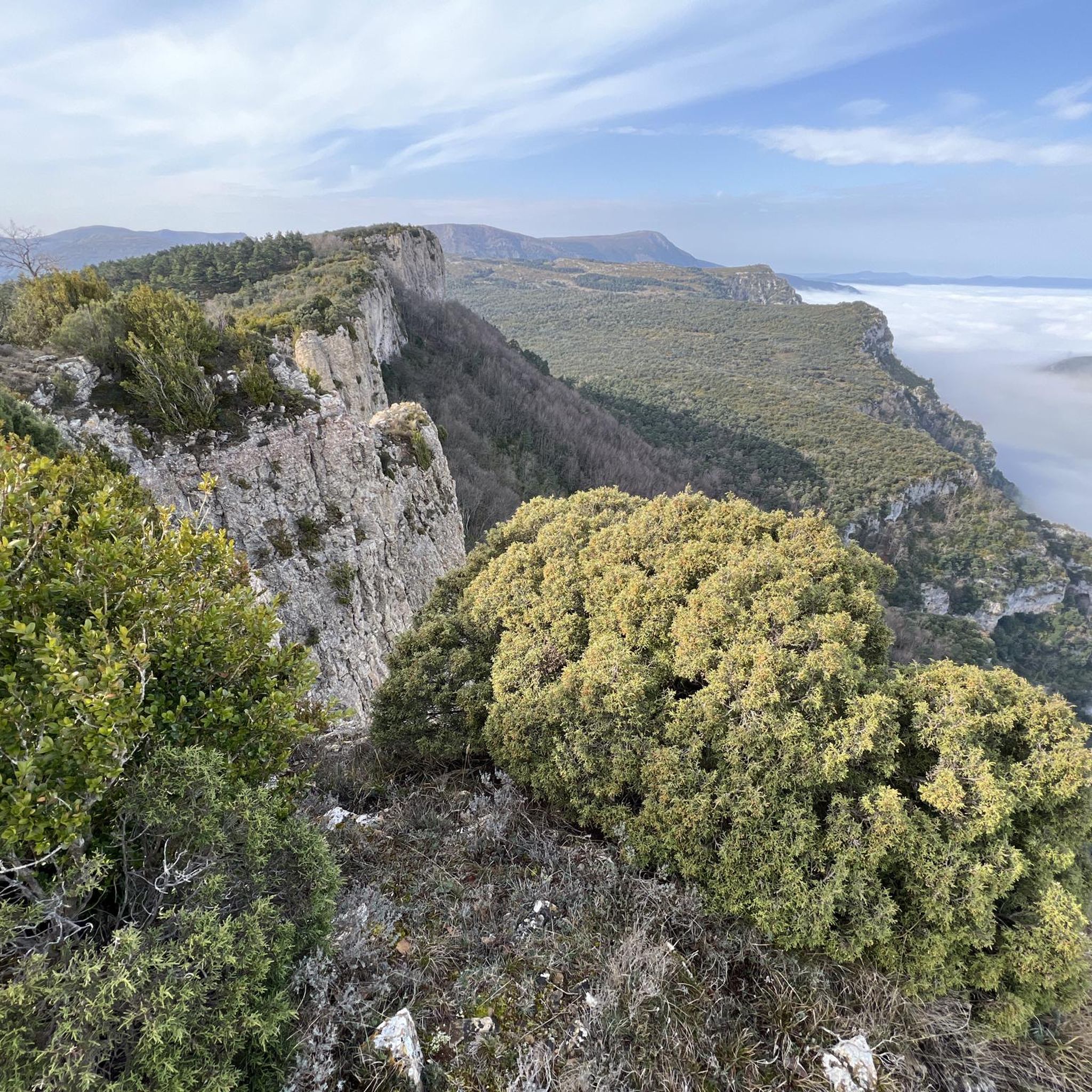

Tips from the Community

Channel of descent/ascent to the town of Cubilla.
1
0
5 minutes from Flor, it is worth it for its proximity, but the views do not change much.
1
0
Frequently Asked Questions
What kind of terrain can I expect on running routes around Bozoó?
Running routes in Bozoó traverse a diverse landscape, primarily characterized by the Montes Obarenes. You'll find spectacular canyons and cliffs carved by the Ebro and Oroncillo rivers, along with varied forests including beech, holm oak, and pine. Expect shaded paths along riverbanks, verdant groves, and even the unique cork oak forest, the only one in Burgos province. The terrain often includes forest tracks, paths, and trails, offering a mix of surfaces.
Are there any easy running routes suitable for beginners in Bozoó?
The routes currently listed for jogging around Bozoó are generally classified as difficult, indicating they involve significant elevation gain or challenging terrain. For instance, the Peña Grajera – Castros de Lalastra loop from Villanañe is a challenging 11.2 km trail. While the region offers trails like the 'Sendero de Bozoo' (SLC-BU 92) which is low difficulty, these specific routes are not yet available on komoot for jogging. It's advisable to check individual route details for elevation and distance to ensure it matches your fitness level.
What natural landmarks or viewpoints can I discover while jogging in Bozoó?
Bozoó's running routes offer access to several natural highlights. You can explore the dramatic canyons of the Montes Obarenes and the unique cork oak forest. The Humion summit offers panoramic views, and you might encounter the Fuente de la Salud, a thermal spring by the Ebro River. Other viewpoints like the Watchtower and TalasDelSomo provide excellent vistas of the surrounding landscapes.
Are there any historical sites or attractions along the running trails in Bozoó?
Yes, jogging in Bozoó can be a journey through history. Routes like sections of the GR 291 ('Agua y roca') allow you to encounter historical elements such as ancient necropolises, Roman roads, and hermitages. Notable historical sights include the Church of St. James in Bozoó, the imposing Santa Marta Castle near Pancorbo, and the Medieval Necropolis of Santa María de Tejuela. The Salinas de Añana also represent a significant historical and cultural landmark.
What do other runners say about the jogging experience in Bozoó?
The running routes around Bozoó are highly regarded by the komoot community, holding an average rating of 4.6 out of 5 stars. Runners often praise the challenging yet rewarding nature of the trails, the stunning natural beauty of the Montes Obarenes, and the varied landscapes that include river valleys and diverse forests. Over 100 runners have used komoot to explore this region, indicating a strong appreciation for its outdoor offerings.
Are there any long-distance running options available in the Bozoó area?
For runners seeking a greater challenge, Bozoó is part of significant long-distance routes. The GR 291 - 'Agua y roca: Del Ebro a los Obarenes' is a long-distance trail spanning approximately 60 km, connecting the Montes Obarenes with the Ebro River and passing through Bozoó. Additionally, the GR 99 - Camino Natural del Ebro also has sections accessible from the area, providing extensive running opportunities through varied landscapes.
Can I find circular running routes around Bozoó?
Yes, several circular running routes are available. For example, the Humión loop from Embalse de Sobrón is a 10.1 km trail that takes you through mountainous landscapes. Another option is the Pico del Águila – Peña del Buey loop from Peña San Pedro, which covers 17.6 km. These loops allow you to start and finish at the same point, offering convenient running experiences.
What is the typical duration for a running route in Bozoó?
The duration of running routes in Bozoó varies depending on the distance and difficulty. For instance, the Peña Grajera – Castros de Lalastra loop from Villanañe, an 11.2 km route, typically takes about 1 hour and 34 minutes. Longer routes like the Estrechon de Sarlota – Peña Horcada loop from Las Rastrillas, at 20.3 km, can take around 3 hours and 19 minutes. Always check the estimated duration for each specific route on komoot.
Are there any running routes that offer significant elevation challenges?
Absolutely. The running routes around Bozoó are known for their significant elevation changes, as they traverse the Montes Obarenes. For example, the Estrechon de Sarlota – Peña Horcada loop from Las Rastrillas features over 1000 meters of elevation gain. Even shorter routes like the Mancubo loop from Las Rastrillas include over 400 meters of ascent, providing a good workout for those seeking uphill challenges.
What is the best time of year for running in Bozoó?
Bozoó's diverse forests and river valleys make it suitable for running across multiple seasons. Spring and autumn generally offer pleasant temperatures and vibrant scenery, with lush greenery or colorful foliage. Summer can be warm, but shaded paths along riverbanks and through dense forests provide relief. Winter running is also possible, though conditions may vary, especially at higher elevations in the Montes Obarenes. Always check local weather forecasts before heading out.
Are there any specific trails in Bozoó known for their scenic beauty?
Many trails in Bozoó are renowned for their scenic beauty. The routes that wind through the Montes Obarenes offer dramatic views of canyons and cliffs. Paths along the Ebro River provide picturesque riverbank scenery. The unique cork oak forest offers a distinctive and beautiful environment. Routes like the Pico del Águila – Peña del Buey loop from Peña San Pedro are likely to offer stunning vistas given their mountainous nature.
Most popular attractions around Bozoó

Get inspired with the komoot mobile app


Explore more
Browse the best Running Trails & Routes in other regions.
