The best running trails around Somosierra
4.0
(1)
216
runners
19
runs
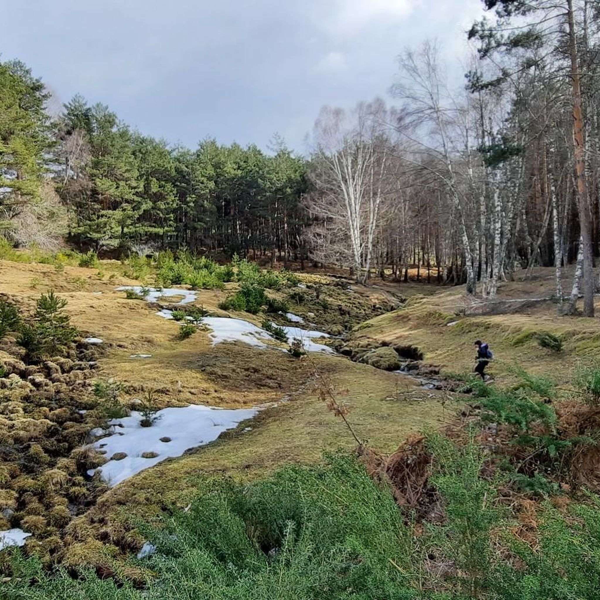
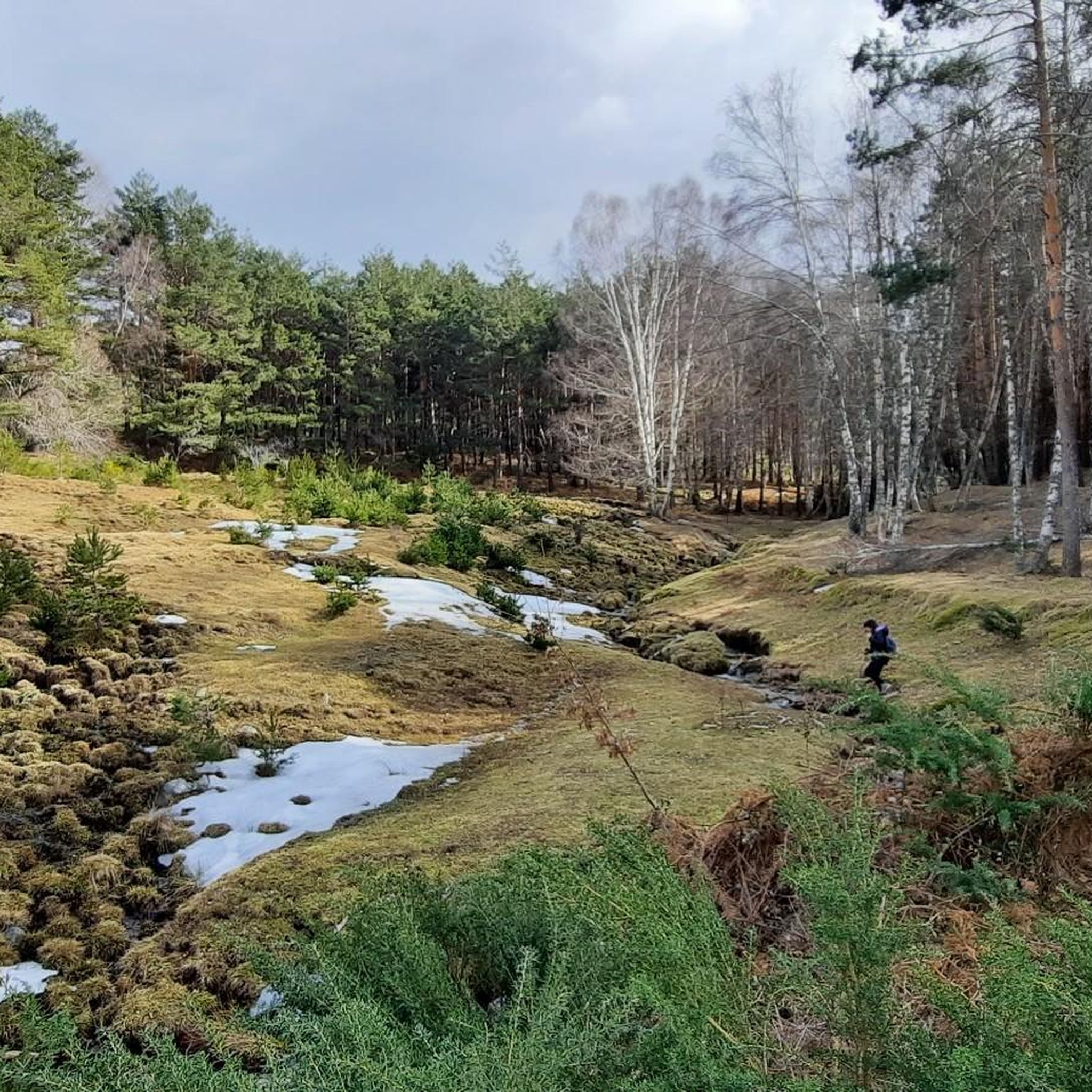
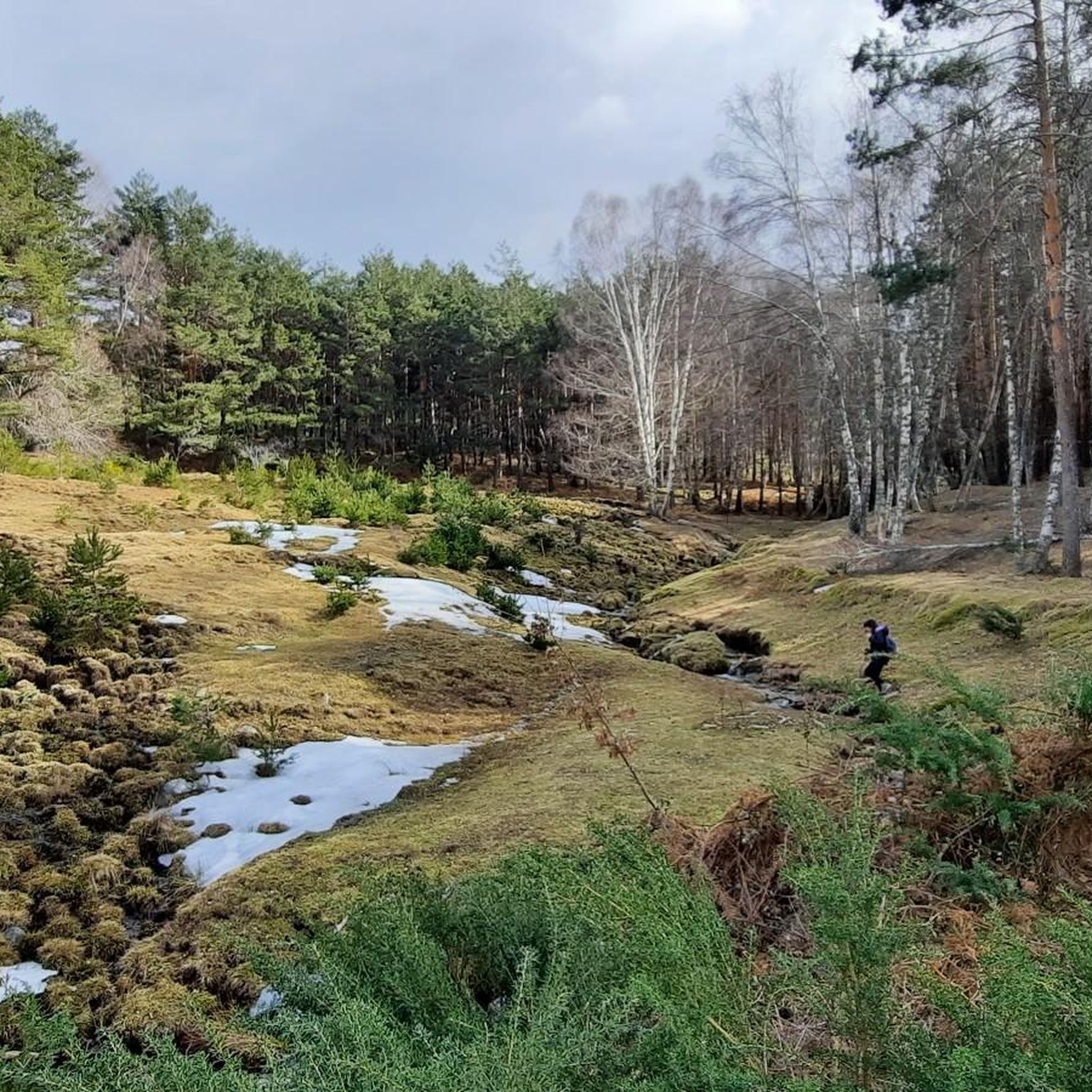
Jogging around Somosierra offers access to a high-mountain environment characterized by meadows, sparse vegetation, and forested slopes. Situated at 1433 meters above sea level, the region features diverse natural features, including ancient birch forests, oak groves, and Scots pine masses. The varied terrain provides engaging running routes through different bioclimatic zones. This area is known for its natural landmarks and significant altitude differences, creating a unique setting for outdoor activities.
Best jogging routes around Somosierra
- The most popular jogging route…
Last updated: July 2, 2026
4.0
(1)
3
runners
Hard run. Very good fitness required. Sure-footedness, sturdy shoes and alpine experience required.
6
runners
Hard run. Very good fitness required. Sure-footedness, sturdy shoes and alpine experience required.

Sign up for free
51
runners
Hard run. Very good fitness required. Sure-footedness, sturdy shoes and alpine experience required.
23
runners
25.1km
04:10
1,260m
1,250m
Hard run. Very good fitness required. Sure-footedness, sturdy shoes and alpine experience required.
14
runners
18.8km
03:37
1,180m
1,180m
Hard run. Very good fitness required. Sure-footedness, sturdy shoes and alpine experience required.
Get access to more routes and recommendations from other explorers.
Sign up for free
Already have an account?
Our route recommendations are based on thousands of hikes, rides, and runs completed by other people on komoot.
Start today with a free account
Your next adventure awaits.
Login or Signup
Tips from the Community

Pico del Lobo Trail. Nature in the air.
0
1

The route to Collado del Aventadero is popular with hikers and mountaineers due to its stunning panoramic views and the diversity of landscapes that can be seen along the way. The trail passes through pine forests and offers spectacular views of the surrounding mountains.
4
0
It is the crossroads that, leaving from Puerto de La Quesera or La Pinilla, take us to Pico del Lobo and its surroundings.
0
1
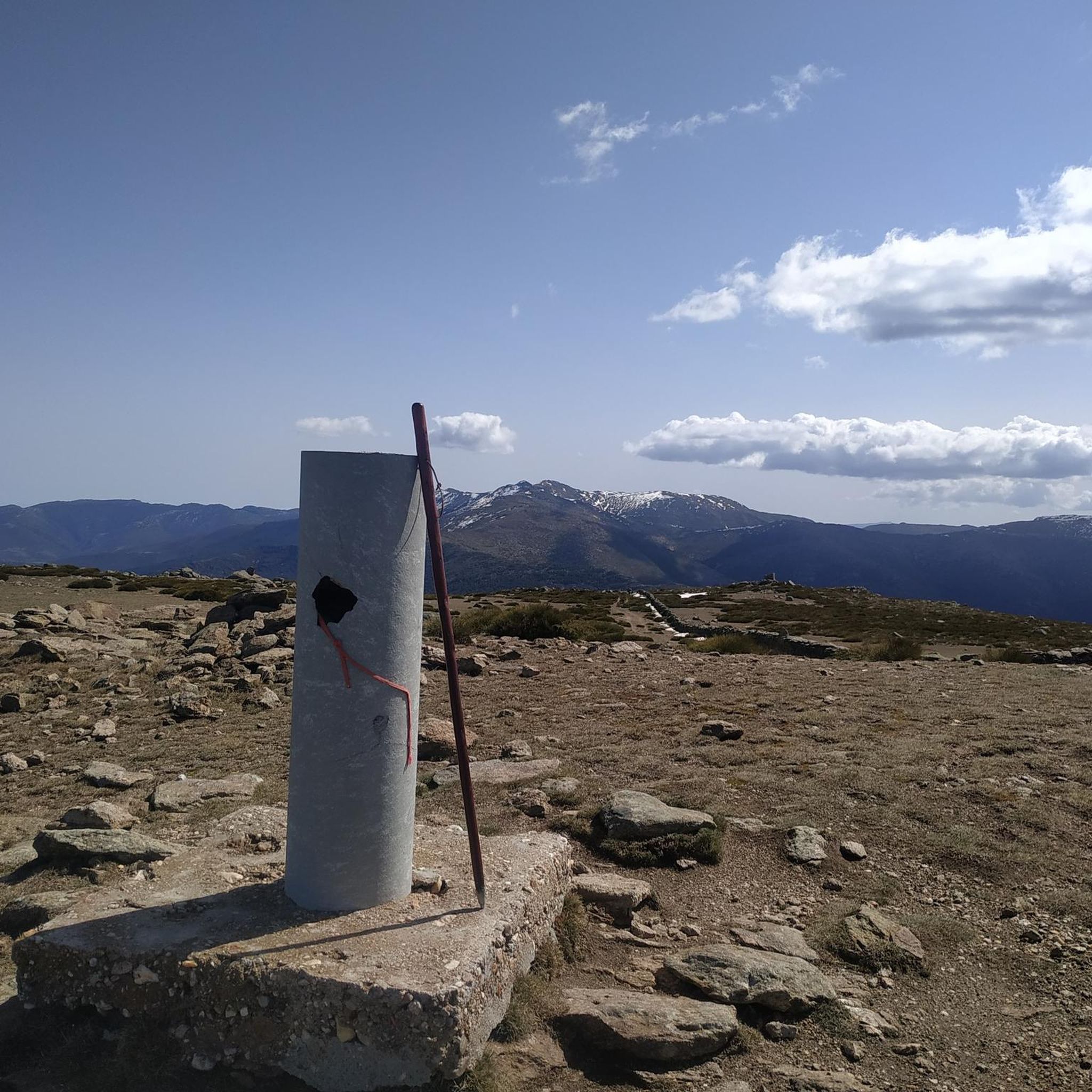
The highest peak in the province of Guadalajara is a special place to admire the landscape in all directions. In winter, with the snow, it is even more beautiful, but at the same time more demanding due to the cold.
1
1
Pico del Lobo is the highest mountain in the Sierra de Ayllón and in the province of Guadalajara, with an altitude of 2,274 metres. It is a popular destination for hiking and offers spectacular views of both Segovia and Guadalajara.
7
0

Pinilla is the town where a ski and mountain resort is located. Good starting point for several trails in the Sierra Norte area of Guadalajara.
2
0
Beautiful meadow of Collado de la Hayuela where we have magnificent views of Pico del Lobo to our right. Also, in spring you can see a lot of flowers.
2
0

Beautiful ascent to the Collado del Aventadero and that comes from the ski slopes themselves to the top of the ridge, on a wide track that keeps going up and up!
1
0
Frequently Asked Questions
How many running trails are available in Somosierra?
There are over 15 dedicated running routes around Somosierra, offering a variety of experiences through its high-mountain landscapes. These routes are well-documented on komoot, with more than 180 runners having explored the area.
Are there any running routes that feature waterfalls in Somosierra?
Yes, one of the most popular running routes leads to the impressive Chorrera de los Litueros Waterfall. You can experience this on the La Chorrera de los Litueros Waterfall – circular trail run from Somosierra, a challenging 7.1-mile (11.5 km) route that is particularly beautiful during thaw and spring.
What kind of landscapes can I expect on a jog around Somosierra?
Jogging in Somosierra offers a diverse high-mountain environment. You'll encounter meadows, sparse vegetation, and forested slopes, including ancient birch forests, oak groves, and dense Scots pine masses. The significant altitude differences create varied bioclimatic zones, providing constantly changing and engaging scenery.
Are there any challenging running routes for advanced runners in Somosierra?
Absolutely. Many of the routes in Somosierra are classified as difficult due to significant elevation gains. For instance, the Ascent to Pico del Lobo via Collado del Aventadero — circular from Pinilla is a demanding 7.8-mile (12.6 km) path offering panoramic views from the high-mountain peak of Pico del Lobo.
What are some notable natural landmarks or viewpoints I can see while running?
Somosierra is rich in natural landmarks. You can run towards Pico Tres Provincias (Cebollera Vieja) for spectacular panoramic views. The Pico del Lobo is another significant high-mountain peak offering expansive vistas, accessible via several challenging routes.
Are there any circular running paths available?
Yes, many routes in Somosierra are designed as circular paths, allowing you to start and end in the same location. Examples include the La Chorrera de los Litueros Waterfall – circular trail run from Somosierra and the Pico del Lobo (2,274 m) – Pico del Lobo loop from La Pinilla Estación de Esquí.
What is the best season for running in Somosierra?
The high-mountain environment of Somosierra means conditions can vary significantly by season. Spring and early summer are ideal for enjoying the lush flora and the full flow of waterfalls like Chorrera de los Litueros. Autumn offers beautiful fall colors. Winter running is possible but requires appropriate gear due to snow and colder temperatures at higher elevations.
Are there any longer running routes for endurance training?
For those seeking longer distances, Somosierra offers routes like the Alto de Corcos – Cuchar Quemado loop from Somosierra, which spans approximately 16 miles (25.8 km). These longer trails provide sustained challenges through varied terrain.
What makes the forests in Somosierra unique for running?
Somosierra boasts a unique mix of forests due to its altitude. You'll find ancient birch forests, similar to those in the Pyrenees, along with oak groves at lower altitudes and dense Scots pine masses at higher elevations. This rich biodiversity and varied tree cover create picturesque and refreshing trails for running.
Are there any running routes that pass through mountain passes?
Yes, several routes incorporate mountain passes, offering both a physical challenge and stunning views. For example, the Pico del Lobo (2,274 m) – Aventadero Pass loop from La Pinilla Estación de Esquí includes the Aventadero Pass, providing a classic high-mountain running experience.
What should I consider regarding difficulty when choosing a running route in Somosierra?
Most running routes in Somosierra are rated as difficult, primarily due to the significant elevation gain and the high-mountain terrain. While there are some moderate options, runners should be prepared for challenging ascents and descents. Always check the route details for elevation profiles and distance before heading out.
Most popular attractions around Somosierra

Get inspired with the komoot mobile app


Explore more
Browse the best Running Trails & Routes in other regions.
