The best walks and hikes around Bijuesca
3.5
(2)
14
hikers
9
hikes
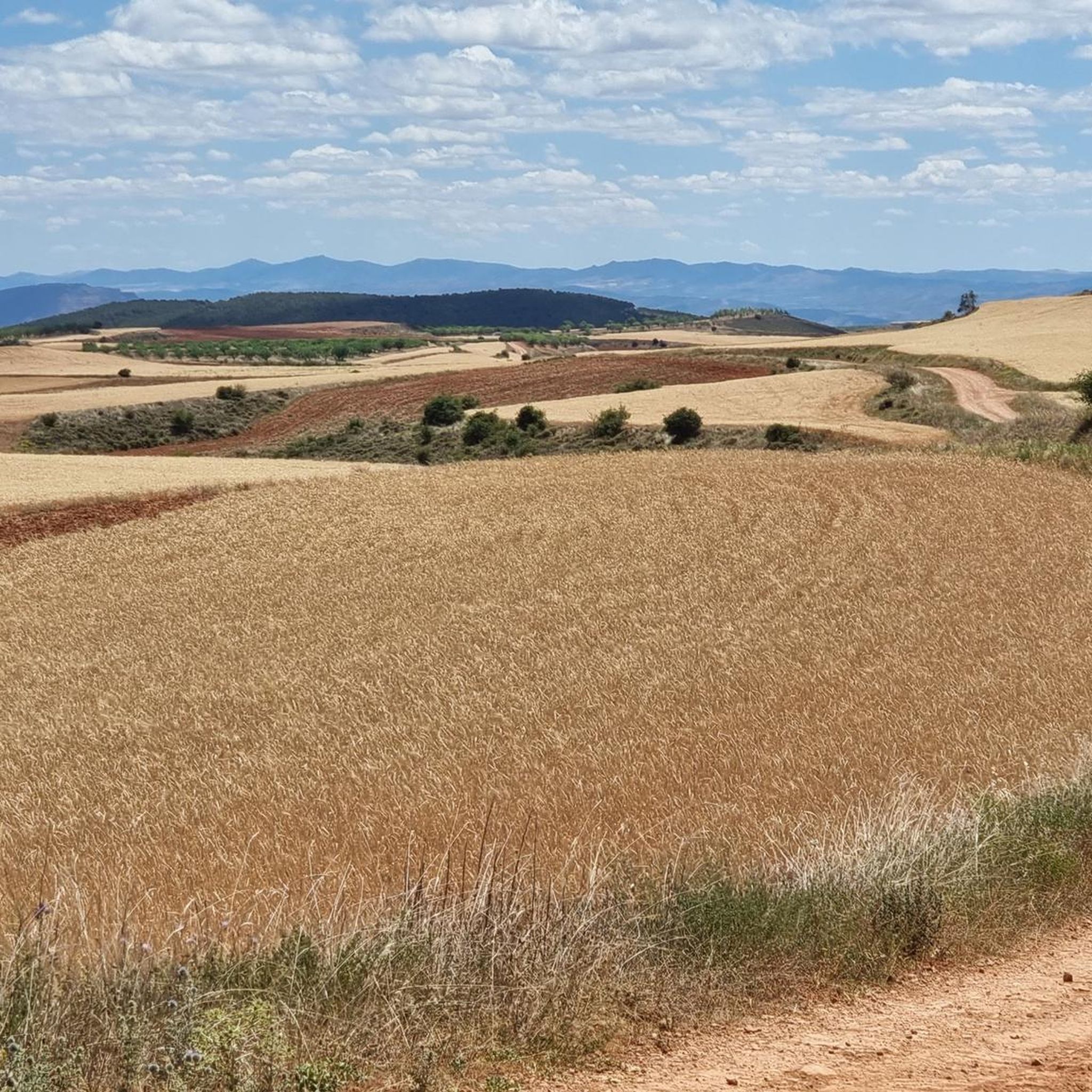
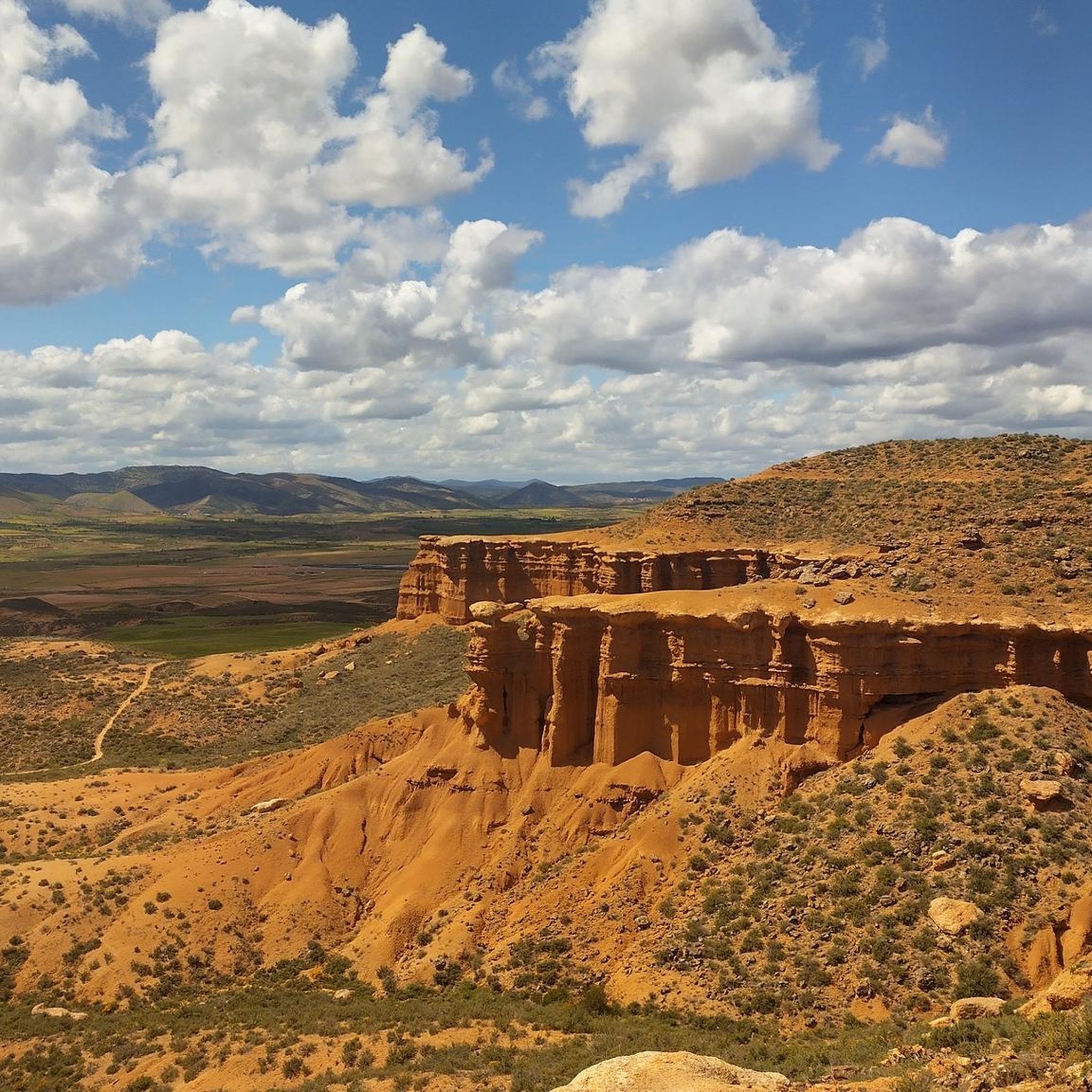
Hiking around Bijuesca offers access to diverse natural landscapes and unique geological formations in the Comunidad de Calatayud. The region is characterized by its "Montaña de Colores," displaying varied hues due to mineral composition, and the serene Manubles River valley. Trails navigate through areas with historical structures like a medieval bridge and the Fuente de los Caños, providing a blend of natural and cultural exploration. The terrain includes accessible paths and routes with moderate elevation changes.
Best hiking trails around Bijuesca
- The most popular hiking route is Cueva del Zapato, Laguna de Ciria, and Laguna de Borobia Loop, a 9.9 miles (15.9 km) moderate trail that takes 4 hours 15 minutes to complete. This route explores a cave and two lagoons.
- Another top favourite among local hikers is Muleteers' Trail, a moderate 5.7 miles (9.2 km) path. This trail follows historical routes through the Bijuesca area, offering varied scenery.
- Local hikers also love the Alto Navarro – circular desde Cihuela, a 4.0 miles (6.5 km) trail leading through open terrain, often completed in about 1 hour 51 minutes.
- Hiking around Bijuesca is defined by unique geological formations, serene river valleys, and historical structures. The network offers options for different ability levels, from easy walks to more challenging routes.
- The routes in Bijuesca are highly rated by the komoot community with an average score of 5.0 stars from 1 review. More than 10 hikers have used komoot to explore Bijuesca's varied terrain.
Last updated: June 28, 2026
15.9km
04:15
180m
180m
Explore the Cueva del Zapato, Laguna de Ciria, and Laguna de Borobia on this 9.9-mile moderate hike near Ciria, taking about 4 hours and 15
9.23km
02:32
150m
150m
Hike the moderate 5.7-mile Fuente de Almazorre loop from Deza, exploring the Camino de Serón de Nágima and natural monuments.

Sign up for free
5.0
(1)
6
hikers
Moderate hike. Good fitness required. Easily-accessible paths. Suitable for all skill levels.
2
hikers
12.3km
03:23
200m
210m
Moderate hike. Good fitness required. Easily-accessible paths. Suitable for all skill levels.
3
hikers
11.6km
03:25
340m
340m
Moderate hike. Good fitness required. Easily-accessible paths. Suitable for all skill levels.
Get access to more routes and recommendations from other explorers.
Sign up for free
Already have an account?
Our route recommendations are based on thousands of hikes, rides, and runs completed by other people on komoot.
Start today with a free account
Your next adventure awaits.
Login or Signup
Popular around Bijuesca

Tips from the Community

Medieval fortress located on top of the hill near the town of Ciria. The history of the castle is linked to the passage of Muslims through the area, since it served to monitor their passage.
1
0
Near the town of Ciria, walking along a wide dirt road, we have excellent views of the Zapato cave.
1
0
Between the towns of Ciria and Borobia, we find the Ciria Lagoon. In the area we will find an information panel that will give us more information about the place.
1
0
Walking near the town of Deza, surrounded by cultivated fields and surely bound for the Fuente de Almazorre, we will find an indicative sign.
1
0
Walking along the long-distance path, on the way from Serón de Nágima to Deza, we find the Almazorre Fountain. An ideal destination if we are in Deza.
1
0
Torrijo de la Cañada is a town located in the Manubles river valley that will undoubtedly leave us speechless. In Torrijo de la Cañada there was an episode that left a mark in the history of Spain during the Celtiberian wars. We can also visit the Church of Nuestra Señora del Hortal, the Hermitage or the old bridge where we are. And on the hills that rise above the town, there are more than a hundred old wineries that give us an unusual and wonderful image.
1
0
Torrijo de la Cañada is a town located in the Manubles river valley that will undoubtedly leave us speechless. In Torrijo de la Cañada there was an episode that left a mark in the history of Spain during the Celtiberian wars. We can also visit the Church of Nuestra Señora del Hortal, the Hermitage or the old bridge where we are. And on the hills that rise above the town, there are more than a hundred old wineries that give us an unusual and wonderful image.
1
0

Pretty town nestled between the cliffs of a canyon. We have a shop and bar
0
1
Frequently Asked Questions
What kind of terrain and landscapes will I encounter on hikes around Bijuesca?
Hiking around Bijuesca offers a diverse range of landscapes. You'll find unique geological formations, most notably the 'Montaña de Colores,' which displays varied hues due to its rich mineral composition. Trails also follow the serene Manubles River valley, bordered by poplars and walnuts, and pass by historical structures like a medieval bridge and the ancient Fuente de los Caños. The terrain varies from accessible paths to routes with moderate elevation changes.
Are there any easy hiking trails suitable for beginners or families in Bijuesca?
Yes, Bijuesca offers trails suitable for various fitness levels. An easy option is the Alto Navarro – circular desde Cihuela, a 6.5 km route that takes about 1 hour 51 minutes through open terrain. The path to the 'Montaña de Colores' is also noted as a pleasant walk, even for children, covering less than a kilometer from where vehicles are left.
What are some notable natural landmarks or points of interest to see while hiking in the Bijuesca area?
The region is rich in natural and historical landmarks. The 'Montaña de Colores' is a geological marvel with its vibrant hues. You can also explore the Cueva del Zapato (Shoe Cave) and the tranquil Laguna de Ciria and Laguna de Borobia. The Manubles River, with its medieval bridge, and the 10th-century Fuente de los Caños also offer scenic and historical interest.
Are there any circular hiking routes available in Bijuesca?
Yes, several circular routes are available. A popular moderate option is the Cueva del Zapato, Laguna de Ciria, and Laguna de Borobia Loop, which is 15.9 km long. For a shorter, easy circular walk, consider the Alto Navarro – circular desde Cihuela. A more challenging circular route is the 21 km Ermita de la Virgen de los Santos, Pico Tablado y Collado del Tablado – circular desde Borobia.
What is the best time of year to go hiking in Bijuesca?
Bijuesca offers pleasant hiking conditions throughout much of the year. Spring and autumn generally provide mild temperatures and vibrant scenery, making them ideal. Summers can be warm, so early morning or late afternoon hikes are recommended. Winters are cooler, but trails remain accessible, offering a different, serene experience.
What do other hikers enjoy most about the trails in Bijuesca?
The hiking trails in Bijuesca are highly rated by the komoot community, with an average score of 5.0 stars. Reviewers often praise the unique geological formations, such as the 'Montaña de Colores,' the serene river valleys, and the blend of natural beauty with historical elements like the medieval bridge and ancient fountains.
Are there any longer or more challenging hikes for experienced hikers?
Yes, for experienced hikers seeking a challenge, the Ermita de la Virgen de los Santos, Pico Tablado y Collado del Tablado – circular desde Borobia is a difficult 21 km route with significant elevation gain. Another moderate but longer option is the Virgen de la Sierra – Collado de la Cruz de Piedra loop from Viñas Bajas, covering 14.3 km.
What kind of historical sites or cultural points of interest can I find near Bijuesca's hiking trails?
Beyond the medieval bridge and Fuente de los Caños within Bijuesca itself, the surrounding area features several historical sites. You can explore nearby settlements like Borobia and Torrijo de la Cañada. The Castle and Church of San Millán de Berdejo is another notable historical landmark in the vicinity.
How long do the hikes around Bijuesca typically take?
Hiking durations vary depending on the route and your pace. Shorter, easy walks like the Alto Navarro – circular desde Cihuela can be completed in under 2 hours. Moderate trails such as the Cueva del Zapato, Laguna de Ciria, and Laguna de Borobia Loop typically take around 4 hours and 15 minutes. Longer, more challenging routes can extend to 6 hours or more.
Are there any trails that follow historical paths or offer insights into the region's past?
Yes, the Muleteers' Trail is a moderate 9.2 km path that follows historical routes through the Bijuesca area, offering varied scenery and a glimpse into the region's heritage. Additionally, the ancient Fuente de los Caños and the medieval bridge over the Manubles River are integral parts of the local history you'll encounter on many trails.
What are the general difficulty levels of the hiking routes in Bijuesca?
The hiking routes in Bijuesca cater to a range of abilities. You'll find easy walks, such as the 6.5 km Alto Navarro – circular desde Cihuela. The majority of trails are moderate, like the 15.9 km Cueva del Zapato, Laguna de Ciria, and Laguna de Borobia Loop. There are also more difficult options for experienced hikers, such as the 21 km Ermita de la Virgen de los Santos, Pico Tablado y Collado del Tablado – circular desde Borobia.
Most popular routes around Bijuesca
Most popular attractions around Bijuesca

Get inspired with the komoot mobile app


Explore more
Browse the best Hikes in other regions.
