The best cycling routes around Jayena
4.7
(7)
186
riders
24
rides
Touring cycling routes around Jayena offer diverse and challenging landscapes within Andalusia, Spain. The region features mountainous terrain, deep valleys, and rolling hills, providing varied experiences for cyclists. Jayena's location within the Natural Park Sierras de Tejeda, Almijara y Alhama, and its proximity to Sierra Nevada National Park, contributes to its scenic beauty and varied topography. The area includes a mix of paved and unpaved segments, catering to different preferences for touring cyclists.
Best touring cycling routes around Jayena
- The…
Last updated: June 21, 2026
5.0
(1)
15
riders
33.4km
02:18
570m
570m
Hard bike ride. Very good fitness required. Mostly paved surfaces. Suitable for all skill levels.
18
riders
68.7km
04:35
1,100m
1,090m
Hard bike ride. Very good fitness required. Mostly paved surfaces. Suitable for all skill levels.

Sign up for free
18
riders
49.1km
05:00
1,310m
1,310m
Hard bike ride. Very good fitness required. Mostly paved surfaces. Suitable for all skill levels.
5.0
(1)
14
riders
43.5km
04:04
980m
980m
Hard bike ride. Very good fitness required. Mostly paved surfaces. Suitable for all skill levels.
4.0
(1)
7
riders
46.4km
04:32
1,110m
1,120m
Hard bike ride. Very good fitness required. Mostly paved surfaces. Suitable for all skill levels.
Get access to more routes and recommendations from other explorers.
Sign up for free
Already have an account?
Our route recommendations are based on thousands of hikes, rides, and runs completed by other people on komoot.
Start today with a free account
Your next adventure awaits.
Login or Signup




Tips from the Community

The Alto de los Morros viewpoint, located near Jayena (Granada), is ideal for nature lovers and those who appreciate stunning views: Situated in the municipality of Jayena, within the Alhama region (Granada), it forms part of the Sierras de Tejeda, Almijara y Alhama Natural Park. Its altitude reaches approximately 1277 meters above sea level. It is part of a circular route starting from the "El Bacal" recreation area, covering a distance of about 15 km, with an elevation gain of between 925 and 1322 meters and a moderate level of difficulty. It offers sweeping panoramic views of the Sierra Almijara Natural Park, including peaks such as La Maroma, Peña del Águila, Cerro Lucero, and La Chapa.
3
0

The Hermitage of Our Lady of the Angels is located on the Camino de la Trucha, which runs parallel to the Alhama or Marchán River, at the foot of the impressive Alhama Cliffs. There are two routes to reach the hermitage from the village. One is a wide dirt road that begins at the school, and another, which we liked the most, leads through one of the most beautiful places in Alhama. It begins at the old Pérez cinema, passes through the flour mills, and passes through some washhouses carved into the rock itself.
0
0
That you don't starve or die of thirst 🍪🍩🥩☕🍗🧀
0
0

Ventas de Huelma is a small village. It is located in the comarca of Alhama and has an area of approximately 42 km². The village has approximately 640 inhabitants (2016). The village has a rich history that dates back to the Middle Ages. A document from the 14th century mentions that there were several villages in the region, including one called "Al Wallina," which is probably the current name of Ventas de Huelma. The village's only monument is the church, which dates back to the 16th century
6
0
Street art with a message.
7
0
The Embalse de los Bermejales is a reservoir in the province of Granada, Andalusia, Spain. It is located in the municipality of Arenas del Rey and is fed by the rivers and streams of the Sierra de Almijara mountains. The reservoir was completed in 1958 and has a capacity of approximately 104 million cubic meters of water. With beautiful views of the natural surroundings.
5
0
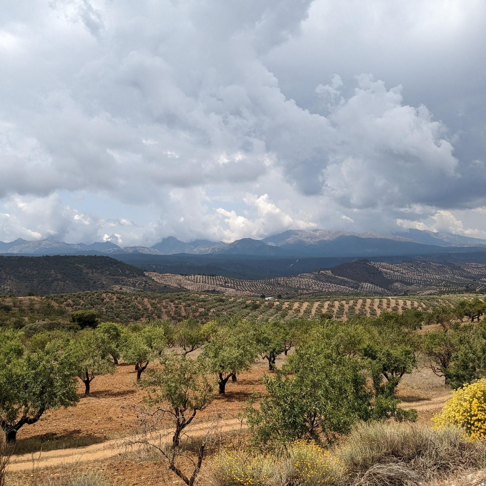
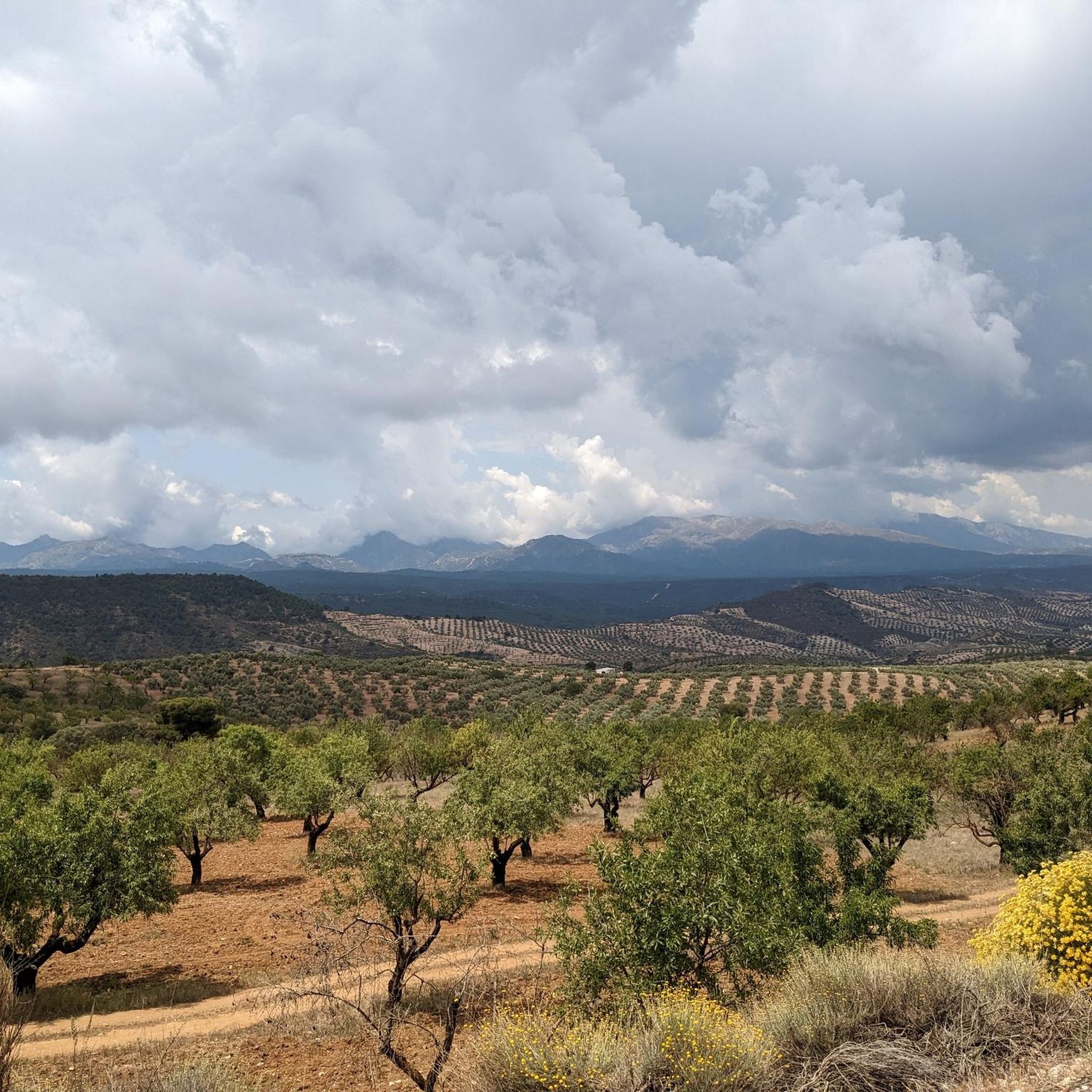
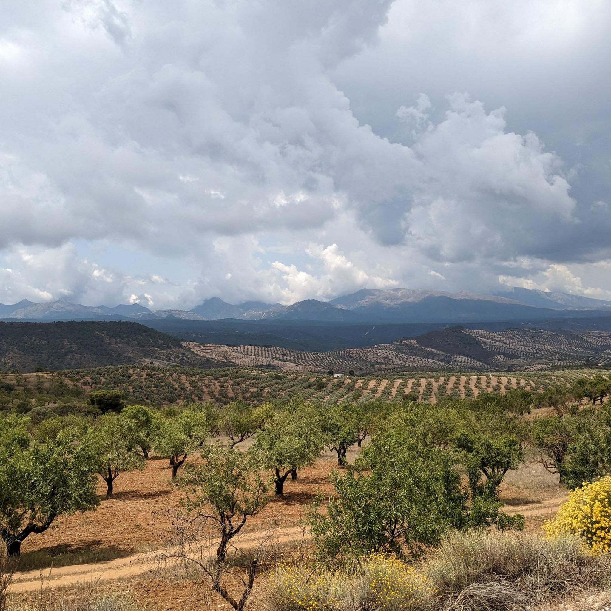
Beautiful view of the village, from here you can see the whole city of Alhama de Granada, surrounded by fields of almond trees.
7
0

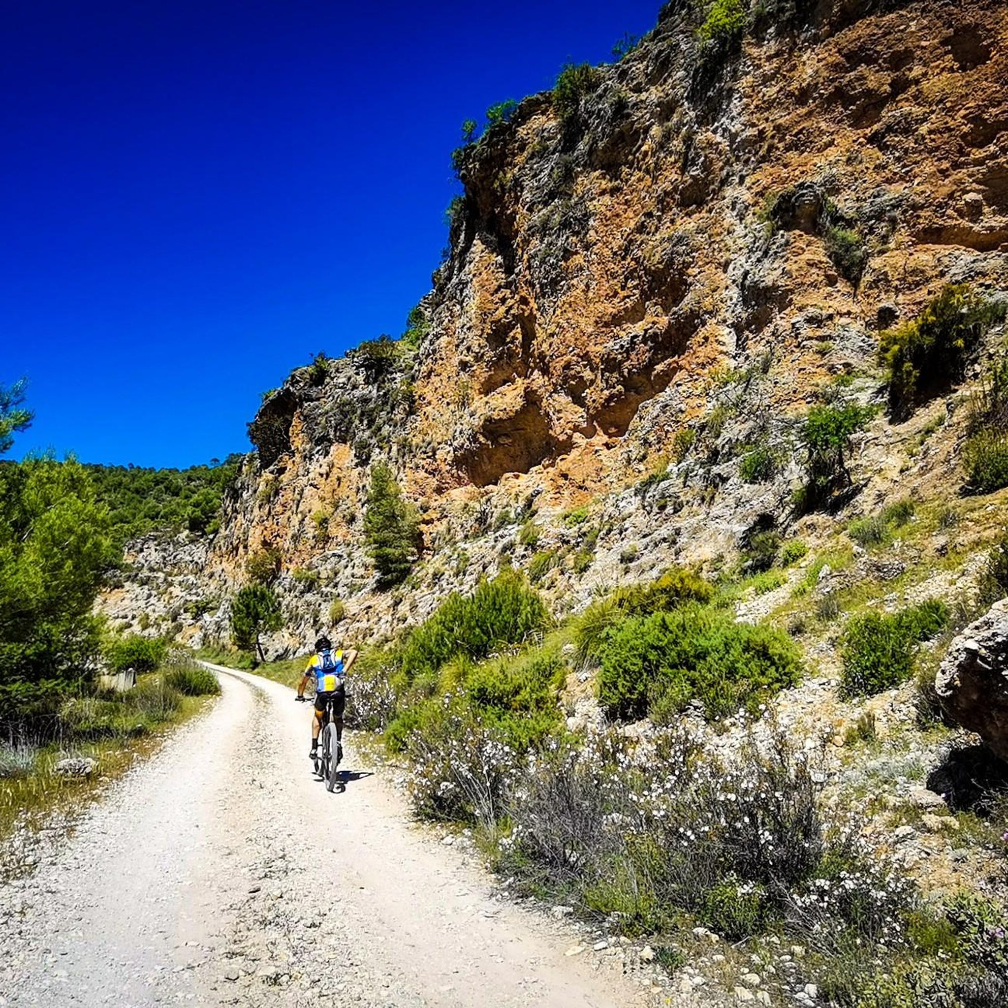
In the middle of nature on gravel roads
0
0
Frequently Asked Questions
How challenging are the touring cycling routes around Jayena?
The touring cycling routes around Jayena are generally challenging, with many requiring good to very good fitness due to significant elevation gains. Out of 26 available routes, 22 are classified as difficult. For example, the Mesón los Prados – Cabra Montes Tunnel loop from Morro de los Prados features over 1,380 meters of elevation gain over 50.5 km.
What kind of terrain can I expect on the cycling routes near Jayena?
You can expect a diverse range of terrain, from paved surfaces suitable for various skill levels to unpaved segments offering a more rugged experience. The region is characterized by mountainous terrain and rolling hills, providing engaging and picturesque cycling journeys through Andalusia.
Are there any notable natural attractions or viewpoints along the cycling routes?
Yes, the area around Jayena is rich in natural beauty. You can find stunning water features like the Río Verde Waterfalls and the Las Chorreras Pool on the Río Verde. Additionally, routes often pass by significant lakes such as the Los Bermejales Reservoir, offering scenic stops and exploration opportunities. Many routes also provide breathtaking views of the surrounding mountainous landscape, including the Sierra Nevada.
Can I find family-friendly cycling routes in Jayena?
While many routes in Jayena are noted for their difficulty, there are some options that might be more suitable for families or those seeking an easier ride. The region offers a total of 26 touring cycling routes, with 1 classified as easy and 3 as moderate. It's advisable to check the specific route details for distance and elevation before setting out with family.
What is the best time of year to go touring cycling in Jayena?
Jayena's location in Andalusia suggests a climate generally favorable for cycling for much of the year. However, given the mountainous terrain and potential for significant elevation, spring and autumn typically offer the most comfortable temperatures for touring cycling, avoiding the intense heat of summer and the cooler conditions of winter at higher altitudes.
Are there options for parking when cycling in Jayena?
Specific dedicated cycling parking facilities are not detailed in the general information. However, starting points for many routes, such as Jayena itself, Arenas del Rey, or Morro de los Prados, are typically towns or villages where general public parking would be available. It's recommended to check local parking options at your chosen starting point.
Is public transport available for cyclists in Jayena?
Information regarding public transport options specifically accommodating bicycles in Jayena is not readily available. Given the rural and mountainous nature of the region, personal vehicle transport to route starting points is often the most practical option for cyclists.
Do I need any special permits to cycle on trails around Jayena?
General touring cycling on established routes around Jayena typically does not require special permits. However, if your route takes you into specific protected areas or natural parks like Sierra Nevada National Park, it's always wise to check for any specific regulations or permit requirements that might apply to certain trails or activities within those zones.
What do other touring cyclists enjoy most about cycling in Jayena?
The touring cycling routes in Jayena are highly rated by the komoot community, with an average score of 5.0 stars from 8 reviews. Cyclists often praise the diverse and challenging landscapes, the breathtaking views from mountain passes, and the opportunity to explore the natural beauty of Andalusia. Over 200 touring cyclists have used komoot to discover the varied terrain of Jayena.
Are there any circular touring cycling routes available in Jayena?
Yes, many of the touring cycling routes around Jayena are designed as loops, allowing you to start and finish in the same location. Examples include the Ventas de Huelma – CP4- DESERTUS 25 loop from La Muga, a 68.7 km route, and the Fornes loop from Jayena, which covers 48.2 km.
Where can I find refreshments or accommodation along the cycling routes?
While specific cafes, pubs, or accommodations directly on the routes are not detailed, many routes start or pass through towns and villages such as Jayena, Arenas del Rey, or La Muga. These locations would be the most likely places to find local establishments for refreshments and overnight stays. It's advisable to plan your route and check for amenities in these towns.
What makes the touring cycling experience in Jayena unique?
The touring cycling experience in Jayena is unique due to its combination of diverse and challenging Andalusian landscapes, significant elevation gains, and proximity to major natural parks like Sierra Nevada. Cyclists can enjoy a mix of paved and unpaved paths, mountain passes, and stunning views, offering both physical challenge and mental rejuvenation in a beautiful natural setting.
Most popular attractions around Jayena

Get inspired with the komoot mobile app


Explore more
Browse the best Cycling routes in other regions.
