The best walks and hikes around Narrillos Del Álamo
4.3
(4)
15
hikers
5
hikes
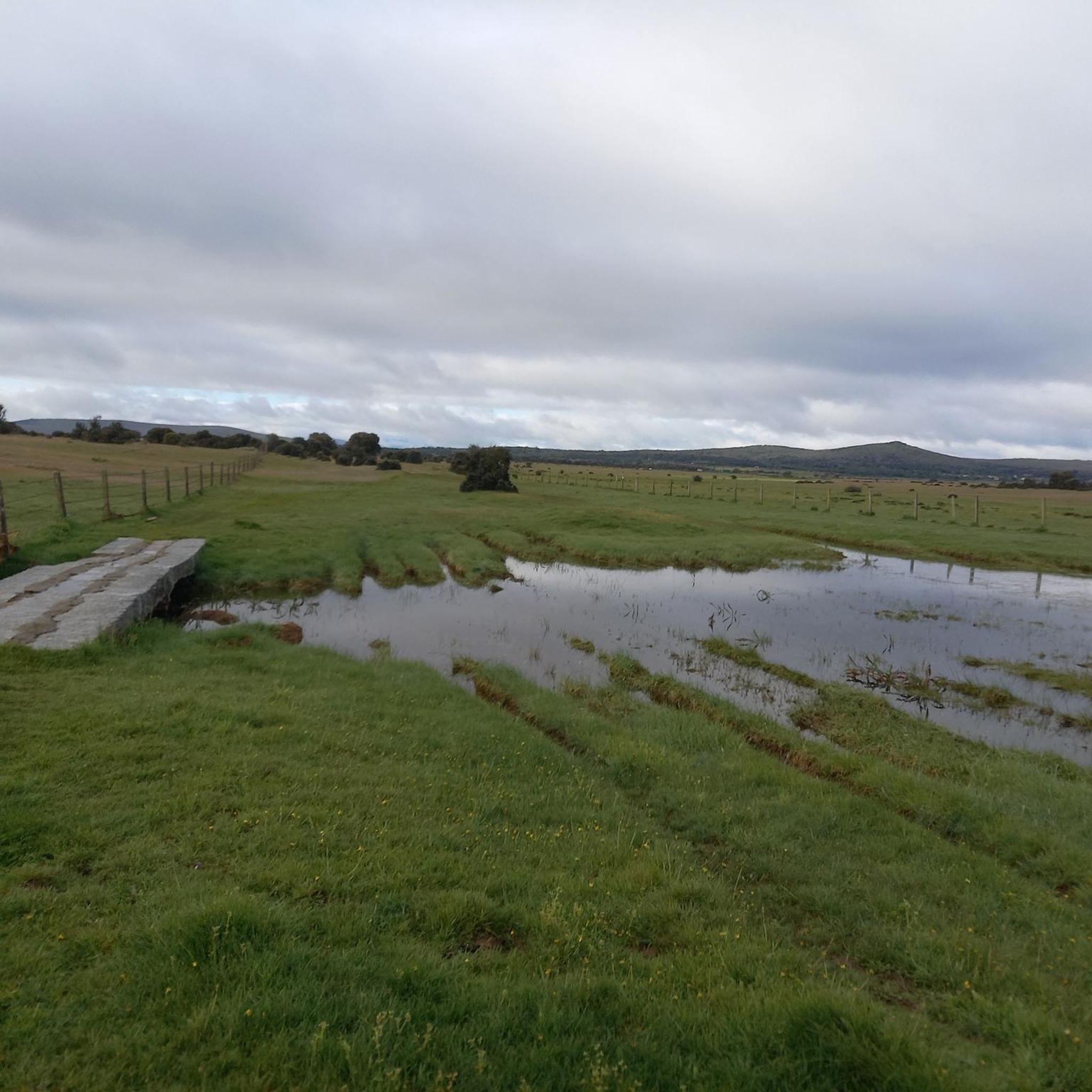
Hiking trails Narrillos Del Álamo Avila Spain traverse a diverse landscape within the Serrezuela region, characterized by rolling pastures, cereal fields, and meadows. The terrain includes traditional Mediterranean dehesas dominated by holm oaks and notable granite outcrops, offering varied topography. Situated at altitudes between 1079 and 1343 meters, the area is part of the Sierra de Narrillos, providing elevated viewpoints. The proximity to the Embalse de Santa Teresa also adds to the natural appeal.
Best hiking trails around Narrillos Del…
Last updated: July 25, 2026
1
hikers
12.1km
03:27
270m
270m
Hike the moderate 7.5-mile Castillo de El Mirón circular trail for panoramic views, historic ruins, and fun natural granite slides.
5.0
(1)
5
hikers
Moderate hike. Good fitness required. Easily-accessible paths. Suitable for all skill levels.

Sign up for free
5.0
(1)
3
hikers
Moderate hike. Good fitness required. Easily-accessible paths. Suitable for all skill levels.
3.0
(2)
3
hikers
Moderate hike. Good fitness required. Easily-accessible paths. Suitable for all skill levels.
1
hikers
14.9km
03:59
170m
170m
Moderate hike. Good fitness required. Easily-accessible paths. Suitable for all skill levels.
Our route recommendations are based on thousands of hikes, rides, and runs completed by other people on komoot.
Start today with a free account
Your next adventure awaits.
Login or Signup
Popular around Narrillos Del Álamo

Tips from the Community

The Church of Our Lady of the Assumption was built in the 14th century on the site of the old fortress and rebuilt in the 16th century. Of considerable size, its polygonal sanctuary and transept stand out, towering above the rest of the church and displaying magnificent ashlar masonry and stepped prismatic buttresses. The apse and the central section of the transept are covered with star-shaped ribbed vaults. They are the work of Lucas Giraldo and Juan Gutiérrez, two of the finest architects of the 16th century. The body of the church, with three naves formed by wide semicircular arches rising from octagonal pillars, resembles a large hall. It is entered through two doorways with pointed and splayed arches on pilasters, sheltered by simple alfices. The very simple, rectangular tower features ashlar masonry in the lower section, granite ashlar in the upper section, and balls in the cornice. Inside, the main altarpiece, dating from the early 18th century, is Churrigueresque in the main section and Rococo in the shell to match the shape of the apse vault, the sacristy altarpiece, and other altarpieces distributed throughout the naves of the church.
1
0

straddle _navsmorales_straddle
0
0
La Horcajada is located in the southwest triangle of the province of Ávila. It is practically the space between the foothills of Gredos and the mountain ranges of Malpartida and Collado del Mirón, on the one hand, and the port of Villatoro and the confluence of the Corneja and Tormes rivers, on the other. This surface has been called "Valdecorneja" for centuries. The Cancionero de Baeza, from 1445, for example, records this. The four most important towns in the Valley are, possibly since Vetton times or before, El Mirón, Piedrahíta, La Horcajada and El Barco de Ávila. La Horcajada is located about 75 kilometers southwest of the provincial capital, Ávila, about 82 kilometers from Salamanca and 185 kilometers from Madrid. The town is located at 1033 m above sea level. n. m. between the towns of Piedrahíta and Barco de Ávila on the slopes of the Sierra de la Horcajada.
1
0
Old bridge, currently misnamed La Fonseca, its real historical name is La Ponseca. It belongs to the municipality of La Horcajada, which has also recently been rehabilitated because its rock was detaching and its stability was beginning to be endangered. It crosses the river Corneja and as a curiosity, Emperor Carlos V passed over this bridge on his retirement journey to the Yuste monastery.
2
0

Among the routes that run from Valdemolinos to the town of Santa María del Berrocal we find this source, which will allow us to take a break in the middle of our route.
1
0
Right at the top of the town of El Mirón there is a hill with an old tower/castle from past times that offers impressive views of the town and the area as a whole.
1
0

At this point I come across the parish church of the town of La Horcajada. I took advantage of my visit to this beautiful town to fill up the bottle at the fountain that we will find in the center.
1
0
Frequently Asked Questions
What kind of terrain can I expect on hikes around Narrillos Del Álamo?
The hiking trails in Narrillos Del Álamo offer a varied landscape, ranging from rolling pastures and cereal fields to meadows and traditional Mediterranean dehesas dominated by holm oaks. You'll also encounter notable granite outcrops, adding unique geological features and varied topography to your walks. The area is nestled within the Sierra de Narrillos, providing elevated viewpoints and undulating terrain.
Are there any historical landmarks or points of interest to see while hiking?
Absolutely! The region is rich in history. You can explore the ancient Puente del Congosto, an 11th-century bridge, or hike to El Mirón Castle for extensive panoramic views. The ancient settlement of La Tala near the Embalse de Santa Teresa also offers historical context and scenic views. Keep an eye out for Roman milestones in tranquil villages, hinting at ancient routes.
What is the best time of year to go hiking in Narrillos Del Álamo?
Given the region's Mediterranean climate and varied altitude, spring and autumn are generally ideal for hiking. The temperatures are milder, and the natural landscape is vibrant. Summer can be quite warm, especially at lower elevations, while winter offers a different, often cooler, experience, though some higher routes might be more challenging.
Are there any circular hiking routes available?
Yes, several routes in the area are designed as loops, allowing you to start and finish at the same point. For example, the "View of El Mirón Castle – El Mirón Castle loop from Santa María del Berrocal" is a moderate circular hike offering great views. Another option is the "Ponseca Bridge – La Horcajada loop from Navamorales" which takes you through diverse scenery.
What kind of wildlife can I expect to see on the trails?
Narrillos Del Álamo is a haven for diverse flora and fauna. The area is particularly known for its rich birdlife, serving as a significant flight zone for large gliding birds such as the black vulture and griffon vulture. You might also spot various species of amphibians, reptiles, and other common birds amidst the Mediterranean scrub and holm oak forests.
How long do the hikes typically take in Narrillos Del Álamo?
The hikes in this region vary in length and duration. For instance, the "Trail of the Washhouses" is a moderate route that typically takes around 3 hours and 27 minutes to complete. Other routes, like the "Ponseca Bridge – La Horcajada loop from Navamorales", can take closer to 4 hours, offering a longer exploration of the landscape.
What is the difficulty level of hiking trails in Narrillos Del Álamo?
Most of the hiking trails around Narrillos Del Álamo are rated as moderate. This means they are suitable for hikers with a reasonable level of fitness, featuring some ascents and descents, and varying terrain. There are no easy or difficult rated trails currently listed, making it a great destination for those looking for a balanced challenge.
Are there any trails that pass by water features or reservoirs?
Yes, the region's proximity to the Embalse de Santa Teresa (Santa Teresa Reservoir) means you can find walks that offer waterside views and increased biodiversity. While specific routes directly along the reservoir aren't detailed, the general area provides opportunities for scenic walks near water, enhancing the natural appeal of your hike.
What do other hikers enjoy most about hiking in Narrillos Del Álamo?
The komoot community highly rates the hiking experience in Narrillos Del Álamo, with an average score of 4.3 stars. Hikers often praise the diverse and picturesque natural landscape, the rich biodiversity, and the opportunity to discover historical attractions like castles and ancient bridges along the routes.
Are there any specific natural monuments or unique geological features to look out for?
Beyond the general granite outcrops, you might encounter specific natural features like El Barrancon Spring. The region's varied topography, shaped by the Sierra de Narrillos, also presents numerous elevated viewpoints offering stunning vistas of the surrounding mosaic of pastures and dehesas.
Most popular routes around Narrillos Del Álamo
Most popular attractions around Narrillos Del Álamo

Get inspired with the komoot mobile app


Explore more
Browse the best Hikes in other regions.
