The 5 Most Amazing Peaks around Whitbourne
Best mountain peaks around Whitbourne are characterized by a gentler topography, with an average elevation of about 70 meters. The area features a serene natural environment and walking trails, rather than towering peaks. Whitbourne offers a landscape with natural features and hiking opportunities, including wetlands and various ponds. The region provides multi-use trails suitable for hiking, biking, and snowshoeing, connecting to other natural attractions on the Avalon Peninsula.
Best mountain peaks around Whitbourne
- The most popular mountain peaks is North…
Last updated: October 2, 2026
North Hill Summit
Highlight • Natural Monument
Tip by

Table Hill (375 m)
Highlight • Natural Monument
Tip by

Sign up now to discover places like this
Get recommendations on the best single tracks, peaks, & plenty of other exciting outdoor places.
Sugarloaf Hill
Highlight • Natural Monument
Tip by

Ankerdine Hill
Highlight • Viewpoint
Tip by

End Hill
Highlight • Natural Monument
Tip by
Sign up for free to discover even more peaks around Whitbourne.
Already have an account?
Start today with a free account
Your next adventure awaits.
Tips from the Community

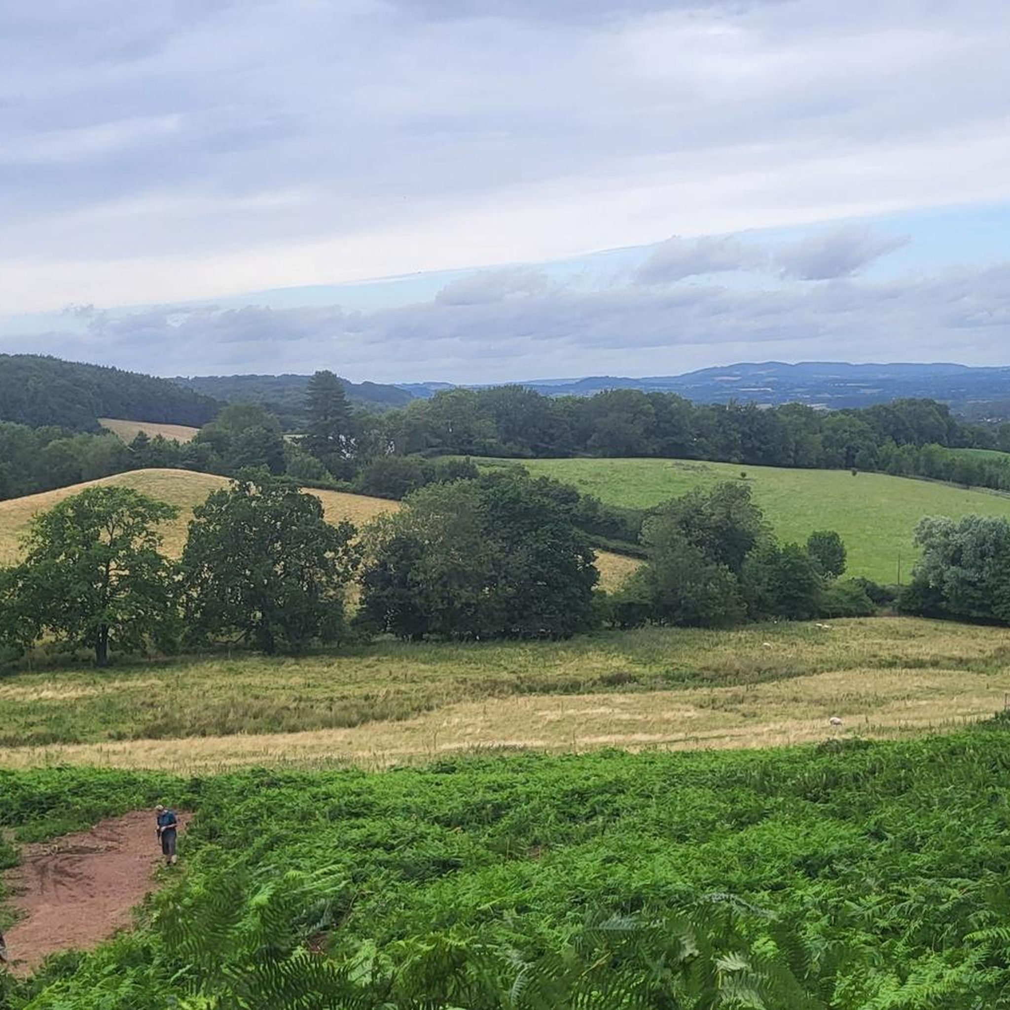
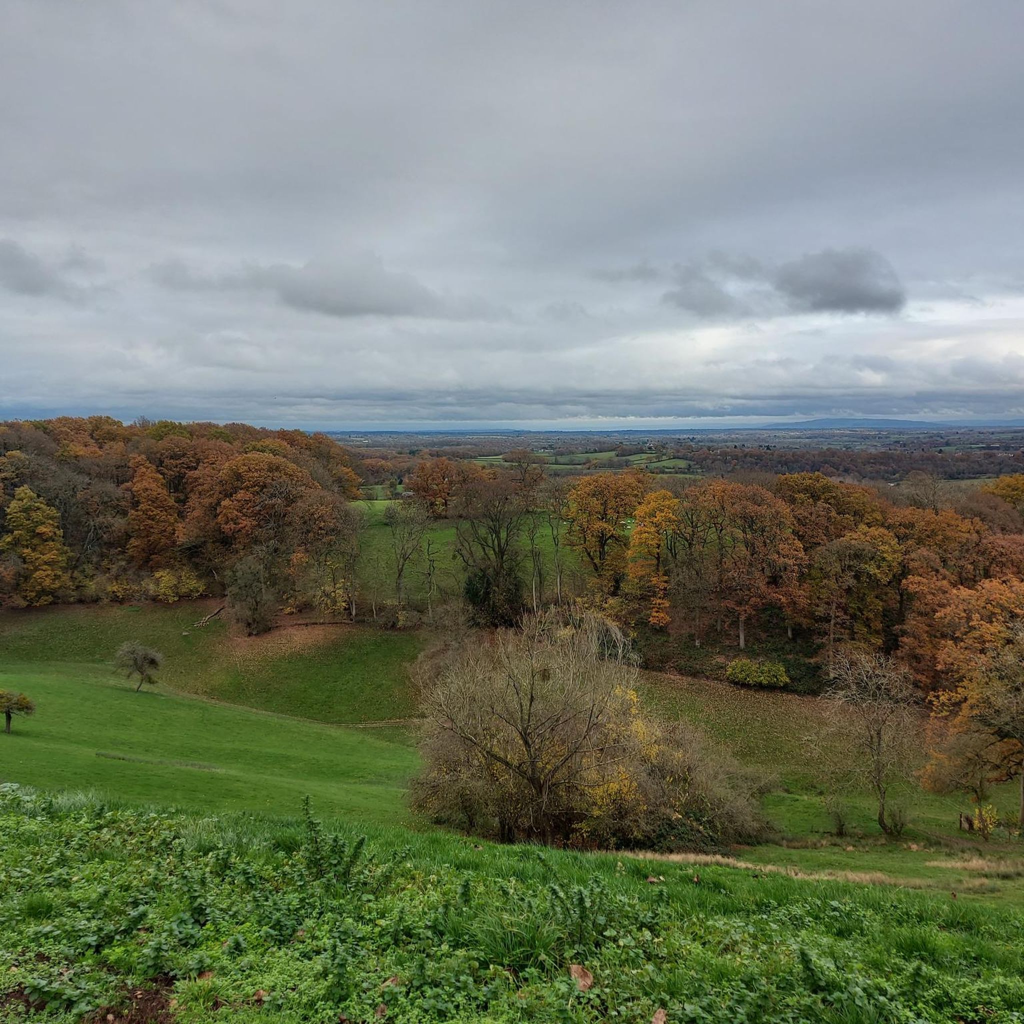
North Hill is a very good viewpoint - but this image was taken on the way up to Table Hill, which is next to North HIll.
0
0
Sugar Loaf hill is to be recommended, but unfortunately the hill in the centre of this picture is North Hill. Sugar Loaf Hill is on the extreme left of the picture, just about in shot.
0
0
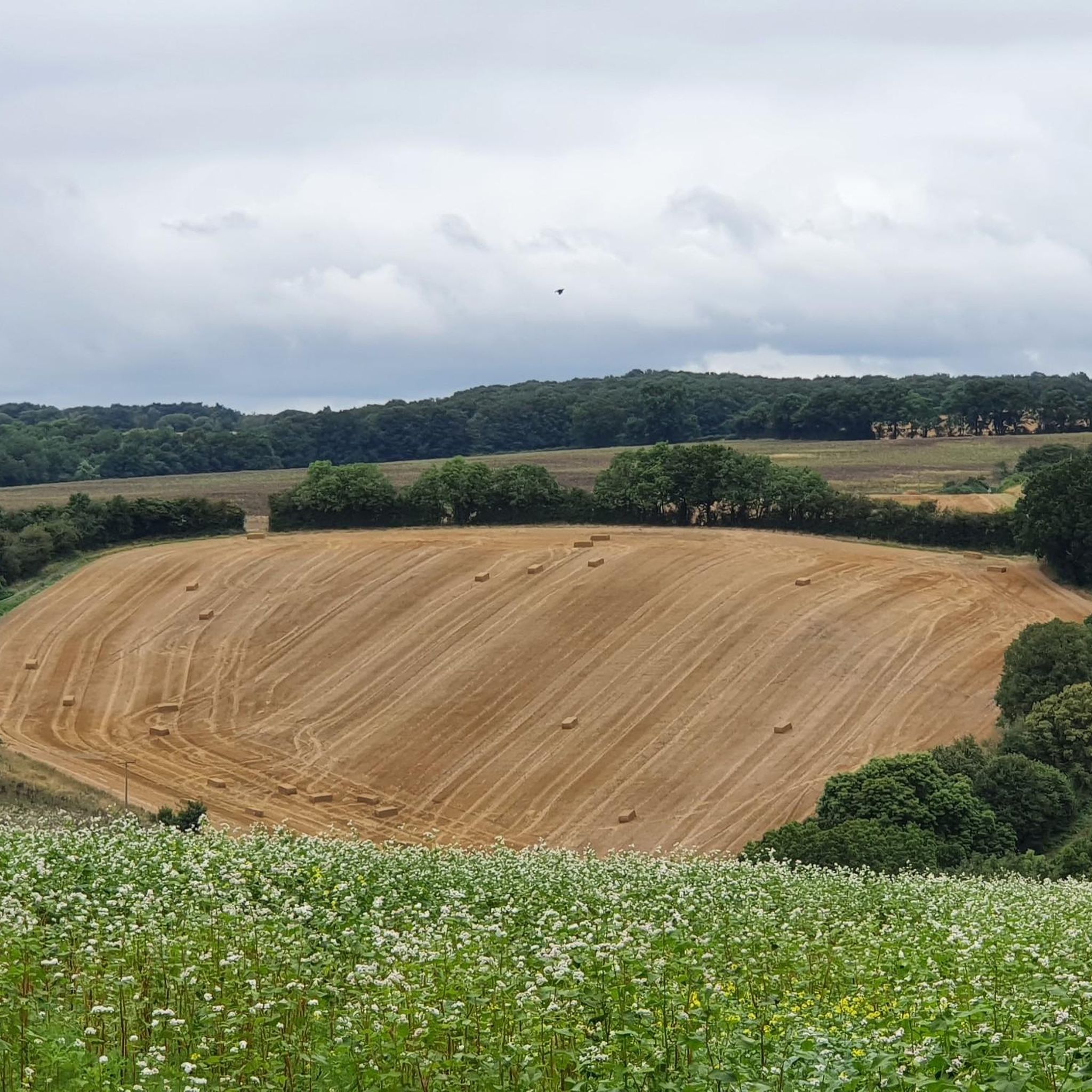
Between North Hill and The Beacon (and Sugar Loaf Hill) this flat topped hill can get overlooked, but it does afford great views of the Beacon, and is photogenic in it's own right when covered in snow.
0
0

North Hill is the second highest point of the range of Malvern Hills that runs about 13 kilometres (8.1 mi) north-south along the Herefordshire-Worcestershire border, although North Hill lies entirely within Worcestershire. It has an elevation of 397 metres (1,302 ft), making it the highest point of the Worcestershire Way. The eastern flank of the hill lies directly behind Worcester road in Great Malvern from where its summit is a brisk 15 – 20 minutes steep walk from the town centre via St Ann's road and Happy Valley. A path from the car park in North Malvern follows the lower contour of North Hill to Happy Valley and St. Ann's Well. Although the flint route from North Wales to Wessex lay to the north of Malvern, there is some evidence to suggest that traders passed over the Malvern Hills. Parts of an arrowhead, scraper and flint flakes have been discovered between the North Hill and Table Hill. A 19th-century guide book describes both a collapsed burial mound on North Hill named the Giant's Grave and a tump on Table Hill. These tumuli may have been connected to the Dobunni settlement in Mathon. A track that runs along North Hill was known as the "Pyx Path" and was used by the priest from Worcestershire when bringing Sacrament to the hermits that lived in Malvern in the 11th Century. It was also referred to as the "Pixie Path", as it was believed to be used by fairies. The Lodge spring can be found at the foot of North Hill, off Worcester road. The ornamental fountain has a small spout and basin that is similar in design to those at St Ann's Well.
1
0
Table Hill is situated in the range of Malvern Hills that runs about 13 kilometres (8 mi) north-south along the Herefordshire - Worcestershire border. It lies between North Hill and Sugarloaf Hill and has an elevation of 373 metres (1,224 ft). Although the flint route from North Wales to Wessex lay to the north of Malvern, there is some evidence to suggest that traders passed over the Malvern Hills. Parts of an arrowhead, a scraper and flint flakes have been discovered between North Hill and Table Hill. A 19th-century guidebook describes a collapsed burial mound on North Hill, named the Giant's Grave, and a tump on Table Hill. These tumuli may have been connected to the Dobunni settlement in Mathon: Upon the Table Hill, you will perceive the figure of a large table, from which the name is derived. In the centre is a cross, of the same size as that by the Giant's Grave, upon North Hill. Source: Wikipedia
0
0
Sugarloaf Hill lies between the Worcestershire Beacon and North Hill in the range of Malvern Hills that runs about 13 kilometres (8 mi) north-south along the Herefordshire - Worcestershire border. The summit of Sugarloaf Hill is 368 metres (1,207 ft) above sea level and is a popular peak usually passed by walkers hiking between the Worcestershire Beacon and North Hill — respectively the highest and second highest Malvern Hills summits.
0
0

Enjoy another excellent view from the top of Sugarloaf Hill, a 368m hilltop located in the beautiful Malvern Hills in Worcestershire.
1
0
End Hill is the northernmost top of the Malvern Hills and provides excellent panoramic views across the Hertfordshire and Worcestershire countryside.
1
0
Frequently Asked Questions
What kind of 'mountain peaks' can I expect to find around Whitbourne, Newfoundland?
Whitbourne, Newfoundland, is characterized by a gentler topography, with an average elevation of about 70 meters. While you won't find towering mountain peaks in the traditional sense, the area offers a serene natural environment with numerous walking trails and elevated viewpoints. The guide highlights features such as North Hill Summit, Sugarloaf Hill, and Table Hill (375 m), which provide excellent views and hiking experiences.
What are the most popular elevated spots or viewpoints in the Whitbourne area?
Among the most popular elevated spots, visitors frequently enjoy North Hill Summit, which stands at 397 meters and offers extensive panoramas. Sugarloaf Hill, at 368 meters, is another favorite for its excellent views. Table Hill (375 m) also provides a great view from its 373-meter summit, located between North Hill and Sugarloaf Hill.
Are there any historical or ecological points of interest related to the elevated areas?
Yes, the area around Whitbourne has interesting historical and ecological aspects. For instance, Sir Robert Bond Park, while not a 'peak' itself, is recognized for its unique natural elements, including a rare abundance of northern lichens like the Degelia plumbea. Historically, areas like North Hill Summit and Table Hill (375 m) have evidence of ancient trade routes and burial mounds, suggesting a long history of human activity.
What kind of hiking trails are available near Whitbourne's elevated areas?
Whitbourne offers a variety of multi-use trails suitable for hiking, biking, and snowshoeing. For specific hiking routes, you can explore options like 'Suckley Hills on the Worcestershire Way' or the 'Parkland Walk'. Many trails provide access to the elevated viewpoints and natural features of the region. You can find more details on these and other hiking routes on the Hiking around Whitbourne guide page.
Are there family-friendly options for exploring the elevated terrain around Whitbourne?
Yes, the gentler topography around Whitbourne makes many trails suitable for families. Sir Robert Bond Park offers beautiful walking trails and picnic areas, perfect for a family outing. While specific 'family-friendly' categories aren't listed for the higher points, the general nature of the trails and the moderate difficulty of many routes mean that families can enjoy exploring the natural beauty and viewpoints together.
What natural features, besides the elevated points, can I explore in the Whitbourne area?
Beyond the elevated viewpoints, Whitbourne is rich in natural beauty, particularly its numerous ponds such as Black Duck Pond, Mill Pond, Goose Pond, and Island Cove Pond, which provide tranquil settings. The Wetlands Conservation Trail is also a significant point of interest, offering a chance to experience a vital ecosystem and observe local wildlife, especially waterfowl.
What is the best time of year to visit Whitbourne for outdoor activities?
The region's natural beauty can be enjoyed across multiple seasons. While specific recommendations for 'mountain peaks' are not available, the multi-use trails are suitable for hiking and biking in warmer months and snowshoeing in winter. The serene natural environment and wildlife observation opportunities are generally pleasant from spring through autumn.
What other outdoor activities can I do near these elevated areas?
In addition to hiking, the multi-use trails around Whitbourne are popular for biking and ATVing. For those interested in cycling, there are various routes available, such as 'Ankerdine Hill – Tough, Long, Steady Climb loop' for road cycling or 'Martley & Holt Heath loop' for general cycling. You can find more information on these activities on the Road Cycling Routes around Whitbourne and Cycling around Whitbourne guide pages.
What do visitors enjoy most about the elevated areas and trails around Whitbourne?
Visitors consistently appreciate the stunning panoramic views from elevated points like North Hill Summit and Sugarloaf Hill. The sense of accomplishment from the climb and the opportunity to connect with nature in a serene environment are frequently highlighted. The diverse landscapes, from open viewpoints to wooded trails and tranquil ponds, also contribute to a highly rated experience.
Are there any challenging trails for experienced hikers near Whitbourne?
While Whitbourne's overall topography is gentler, some trails offer more challenging sections. For instance, the ascent to North Hill Summit is described as a brisk and steep walk. Similarly, the 'Suckley Hills on the Worcestershire Way' hiking route is rated as moderate, suggesting more demanding terrain for those seeking a challenge. The 'Ankerdine Hill – Tough, Long, Steady Climb loop' is also available for road cyclists looking for a more strenuous ride.
Where can I find information about the geological significance of the elevated areas?
The region, particularly around Walsgrove Hill Summit View, is part of a geologically significant area, spanning 700 million years of natural history. Formations from the Silurian period, including siltstone and mudstones, are present. Local signage often provides detailed information about the geological makeup and history of these elevated features.
Are there any specific viewpoints that offer exceptional photographic opportunities?
Many of the elevated points are renowned for their photographic potential. North Hill Summit and Sugarloaf Hill are frequently mentioned for their excellent views, especially on clear days, offering panoramas that can include distant hills and the surrounding countryside. Table Hill (375 m) is also noted for being photogenic, particularly when covered in snow.
Most popular attractions around Whitbourne

Get inspired with the komoot mobile app


Explore more
See even more amazing summits around Whitbourne with these guides:
