The best cycling routes around Langarve
3.0
(1)
46
riders
6
rides
Touring cycling around Langarve features routes that traverse areas with notable lakes and riverside paths, offering varied terrain for cyclists. The region includes parkland and designated cycle paths, providing a mix of natural and managed landscapes. Elevations are generally moderate, with some routes featuring more significant climbs.
Best touring cycling routes around Langarve
- The most popular touring cycling route is Lap the Lough loop from Portadown, an 86.4 miles (139.0 km) trail that takes 8 hours 8 minutes to…
Last updated: July 9, 2026
9
riders
139km
08:08
560m
560m
Embark on the difficult Lap the Lough loop from Portadown, a touring bicycle route that spans 86.4 miles (139.0 km) with 1828 feet (557 metres) of elevation gain. This journey…
10
riders
127km
07:30
640m
640m
Hard bike ride. Very good fitness required. Mostly paved surfaces. Suitable for all skill levels.

Sign up for free
12
riders
Easy bike ride. Great for any fitness level. Mostly paved surfaces. Suitable for all skill levels.
3.0
(1)
3
riders
25.2km
01:30
130m
130m
Easy bike ride. Great for any fitness level. Mostly paved surfaces. Suitable for all skill levels.
6
riders
58.4km
03:25
300m
300m
Moderate bike ride. Good fitness required. Mostly paved surfaces. Suitable for all skill levels.
Our route recommendations are based on thousands of hikes, rides, and runs completed by other people on komoot.
Start today with a free account
Your next adventure awaits.
Login or Signup
Popular around Langarve

Tips from the Community

Small coffeeshop right by the river Bann, directly next to Sustrans Route 9 / Newry Canal Towpath. The cafe is practically on the roadside, making it a logical stop for cyclists following the canal path. The old brick building has a relaxed atmosphere; inside and out it's a place where cyclists and walkers cross paths. Ideal for a coffee, a small snack and a short break before you cycle back into the canal landscape towards Craigavon Lakes. Enjoyed the stop, but forgot the photo.
7
0
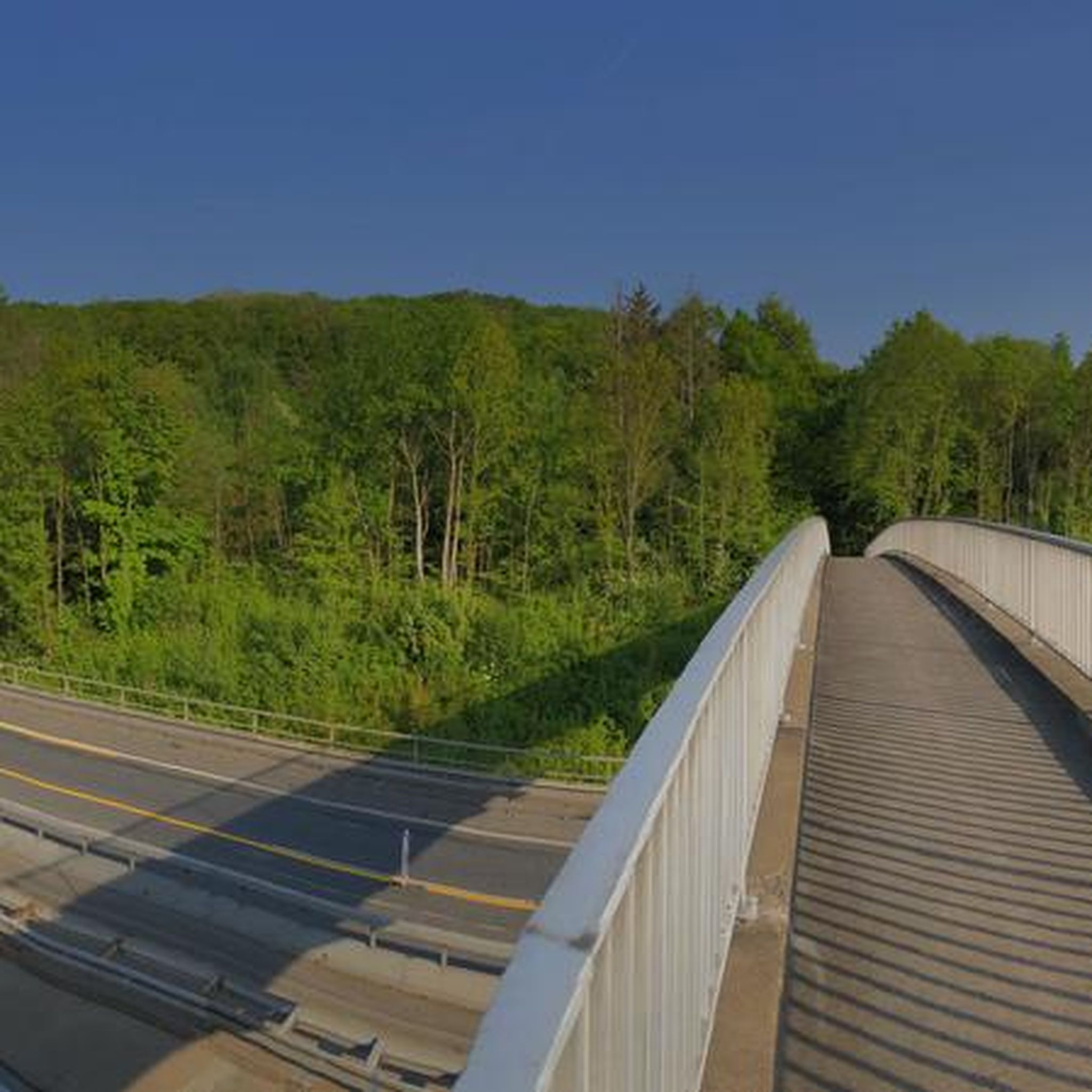
For cyclists following the 'Lough Neagh Cycle Way' (National Cycle Route 94), the Maghery footbridge is an iconic resting point and an essential link. This elegant, modern bridge spans the mouth of the Upper Bann as it enters the lough.
8
0

Need water proof gear heavy rain Crumlin, I just cycled on as I’ve stated skin is water proof
0
0

The Round Tower is an impressive reminder of Antrim's ancient monastic settlement. Built around the 10th century as the monastery's bell tower, it is known locally as The Steeple. It stands 28 meters tall. The monastic site was burned down in 1147.
2
0

A row of terraced houses just outside the town of Randalstown. An important military location, these houses could've been used as barracks or staff housing. The symmetry of these houses is very pleasing as you ride past.
0
0

The Maghery Footbridge on the edge of Lough Neagh offers a small moment of peace in the midst of the expansive landscape. As you cross the bridge, your gaze glides over the gentle waters of the largest lake in the British Isles. In good weather, the clouds are impressively reflected on the surface of the water, making the scene look almost like a painting. Even when the sky is cloudy, the lake has a special atmosphere that invites you to linger rather than to quickly pass by. The paths around the bridge are mostly flat, but you should be prepared for occasional sections with unpaved surfaces. This could be a bit slippery, especially in wet weather, but this is not a problem. The connection to the National Cycle Network, Route 94, also offers you many other opportunities to explore the area. A little tip: Maghery itself does not have much to offer apart from the bridge, but a short detour to the nearby Oxford Island nature reserve is definitely worth it. This means you can easily combine a visit to the bridge with a larger circular tour.
4
0
The paths are wide and perfect for families, as there are no cars to disturb you. As you glide along the car-free cycling and hiking trails, you can enjoy the view of the water - especially when the sky is cloudy, the lake has a very special atmosphere, almost mystical. The route is mostly asphalt, but there are also some gravel sections that provide some variety. These single-track paths add a certain challenge to the route without being really demanding. Ideal if you prefer to take it easy, but still don't want to just walk on smooth asphalt. If you want to take a break, the lake offers many corners to catch your breath and have a picnic. There is enough space on the banks to rest a bit and enjoy the surroundings to the fullest.
0
0
Ground Espresso Bars Café is located right on the road, making it an ideal stop for cyclists travelling along the Newry Canal Towpath. Just a stone's throw from the River Bann, the small café offers a welcome place to take a quick breather. Here you can recharge your batteries with a cup of coffee or a small snack before continuing on. The atmosphere around the old, charming brick building is relaxed and inviting. Its proximity to the cycle path makes it a meeting point for cyclists and walkers alike. You can have a good conversation here or just watch the cyclists go by while sitting outside. Those who continue along the river soon find themselves in a rural landscape, accompanied by the Craigavon Lakes in the distance.
2
0
Frequently Asked Questions
What is the general difficulty level of touring cycling routes in Langarve?
Langarve offers a diverse range of touring cycling routes. You'll find options suitable for various skill levels, from easy, flat paths perfect for a leisurely ride, to more challenging routes with significant climbs and longer distances. For example, the Broad Water Riverside Path – Broad Water Cycle Path loop from Aghalee is an easy option, while routes like Lap the Lough loop from Portadown are considered difficult.
Are there any family-friendly touring cycling routes in Langarve?
Yes, Langarve has routes that are well-suited for families. The region features designated cycle paths and parkland areas that offer safer, often flatter terrain. The Broad Water Riverside Path – Broad Water Cycle Path loop from Aghalee is an easy 9.1-mile route along the riverside, ideal for a family outing.
What kind of scenery can I expect on touring cycling routes around Langarve?
Touring cycling in Langarve is characterized by beautiful natural landscapes. You can expect to cycle alongside notable lakes, follow scenic riverside paths, and pass through pleasant parkland. Many routes offer extensive views, particularly those that circle large bodies of water.
Are there any circular touring cycling routes available in Langarve?
Yes, many of the touring cycling routes in Langarve are designed as loops, allowing you to start and finish at the same point. Examples include the Lap the Lough loop from Portadown and the Craigavon Lakes – Antrim Castle Gardens loop from Antrim, both offering extensive circular journeys.
How long are the touring cycling routes in Langarve?
The routes in Langarve vary significantly in length. You can find shorter, more leisurely rides, such as the Foxes Pub – Antrim Castle Gardens loop from Crookedstone Road, which is about 15.6 miles (25.2 km). For more ambitious cyclists, there are much longer routes like the Lap the Lough loop from Portadown, spanning 86.4 miles (139.0 km).
What do other touring cyclists say about the routes in Langarve?
The touring cycling routes in Langarve are generally well-regarded by the komoot community, holding an average score of 3.0 stars. Over 40 touring cyclists have used komoot to explore the region, often praising the varied terrain and scenic lakeside and riverside paths.
Are there any moderate difficulty touring cycling routes in Langarve?
Yes, for those looking for a balance between an easy ride and a challenging endurance test, Langarve offers moderate routes. The View of Lough Shore – Antrim Castle Gardens loop from Ballinderry Upper is a great example, covering 36.3 miles (58.4 km) with moderate elevation changes, providing a rewarding experience without being overly strenuous.
What types of landscapes define touring cycling in Langarve?
Langarve's touring cycling landscape is primarily defined by its prominent lakes, serene riverside paths, and well-maintained parkland. These features combine to offer a mix of natural beauty and managed green spaces, providing varied scenery throughout your ride.
Are there any routes that combine natural scenery with cultivated gardens?
Yes, some routes in Langarve offer a blend of natural lakeside scenery with the cultivated beauty of historic gardens. The Craigavon Lakes – Antrim Castle Gardens loop from Antrim is a prime example, allowing you to experience both the expansive views of the lakes and the structured elegance of castle gardens.
How many touring cycling routes are available in Langarve?
There are 6 touring cycling routes currently available in Langarve, offering a good selection for different preferences and abilities. These routes range from easy to difficult, ensuring there's something for every touring cyclist.
What are some longer touring cycling routes in Langarve for experienced cyclists?
Experienced touring cyclists looking for longer, more challenging rides will find several options in Langarve. The Lap the Lough loop from Portadown, at 86.4 miles (139.0 km), and the Craigavon Lakes – Antrim Castle Gardens loop from Antrim, at 78.7 miles (126.6 km), are both difficult routes that offer extensive distances and significant elevation changes.
Most popular routes around Langarve

Get inspired with the komoot mobile app


Explore more
Browse the best Cycling routes in other regions.
