The best road cycling routes around Lake Cà Selva
4.9
(7)
150
riders
4
rides
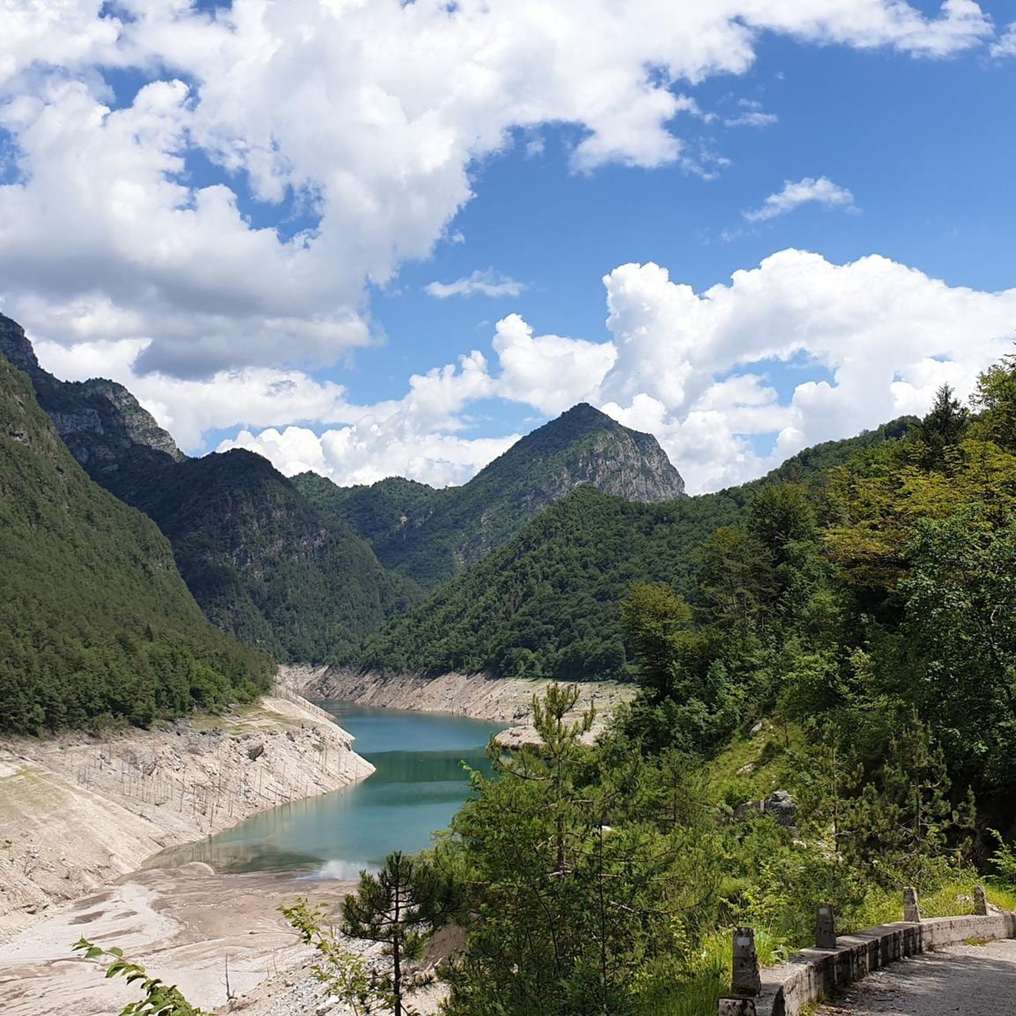
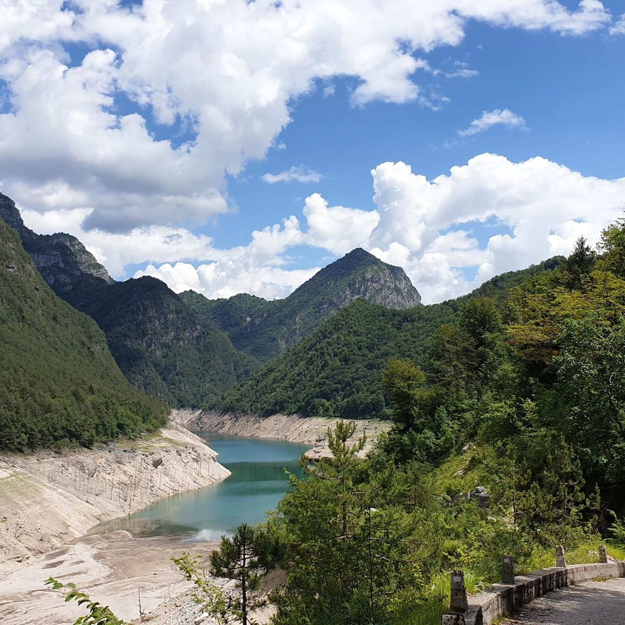
Road cycling around Lake Cà Selva offers routes through the Friuli-Venezia Giulia region of Italy, situated within the Dolomiti Friulane Natural Park. The area features an artificial lake created by a 111-meter high arched dam on the Silisia river, providing a unique backdrop for cycling. Routes navigate mountainous terrain, sharp spires, and narrow valleys, often involving significant elevation gain on paved roads. This landscape provides a variety of challenges for road cyclists.
Best road cycling routes around Lake Cà Selva
…Last updated: October 9, 2026
8
riders
Moderate road ride. Good fitness required. Mostly well-paved surfaces and easy to ride.
4.5
(4)
48
riders
52.7km
02:36
720m
720m
Moderate road ride. Good fitness required. Mostly well-paved surfaces and easy to ride.

5.0
(1)
19
riders
Moderate road ride. Good fitness required. Mostly well-paved surfaces and easy to ride.
5
riders
21.1km
00:54
170m
170m
Easy road ride. Great for any fitness level. Mostly well-paved surfaces and easy to ride.
5.0
(1)
33
riders
43.8km
02:56
1,430m
1,430m
Hard road ride. Very good fitness required. Mostly well-paved surfaces and easy to ride.
Our route recommendations are based on thousands of hikes, rides, and runs completed by other people on komoot.
Start today with a free account
Your next adventure awaits.
Tips from the Community

The new arch bridge over Lake Barcis, inaugurated in the early months of 2021, is a strategic infrastructure located near the Ponte Antoi dam. It is a single-span arch bridge, approximately 78 meters long with an overall width of 12.90 meters. It allows the transit of heavy vehicles — particularly those used for transporting inert materials during the basin's de-silting operations — avoiding passage over the historic dam or through the inhabited center of Barcis. https://www.fvgstrade.it/it/20585/fase-finale-varo-ponte-di-barcis
0
0
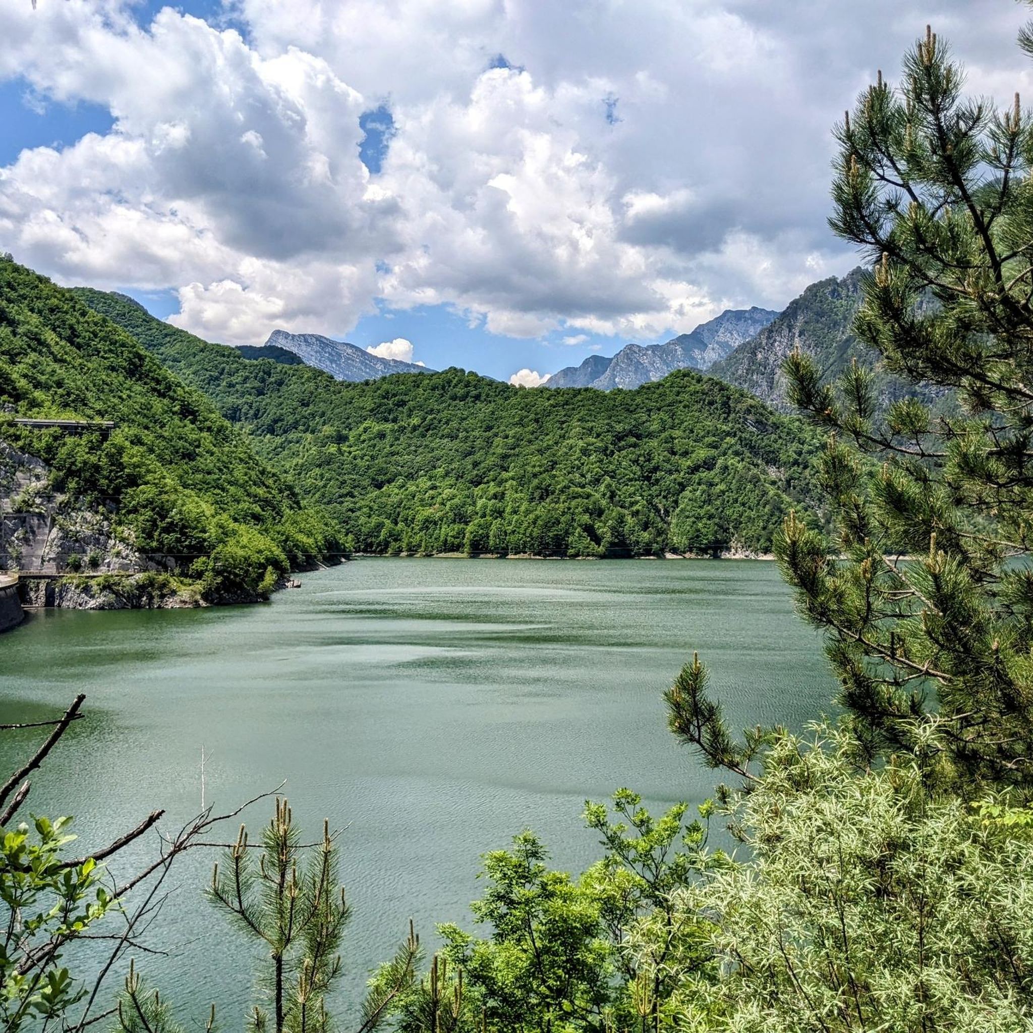
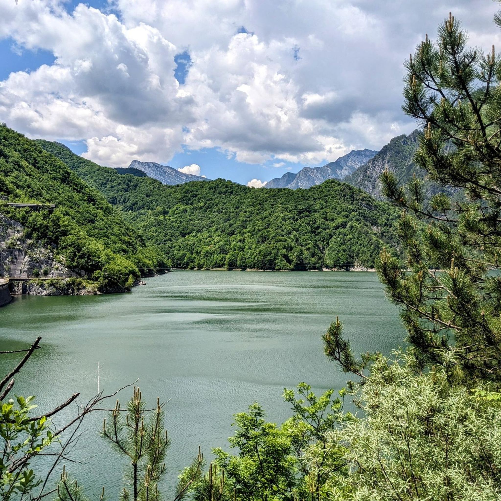
Lake Aprilis, better known as Lake Barcis, is an artificial basin created in 1954 by damming the Cellina stream near the Ponte Antoi gorge. Its characteristic brilliant green color is due to the combination of sunlight with minerals and calcareous sediments carried by the waters. The presence of dense beech and fir forests along the banks accentuates the emerald green tones.
1
0
Located on a panoramic plateau, the beautiful Pieve di Santa Maria Maggiore is the oldest church in Val Tramontina. It was probably established during the Hungarian invasion (10th century) by people who had taken refuge within the Meduno canal. What is certain is that a bull of Pope Urban III indicates it as a Parish in 1186. The current structure is supposed to have been built in 1500. The Pieve is surrounded by a fenced churchyard that was anciently used as a cemetery. The external facade is simple: a lintelled portal and a central circular eye are the only ornaments, while on the right rises the bell tower which partially invades the nave. The bell cell features arched single-light windows on all four sides, and in the upper part a blind octagonal lantern. The interior opens into a single rectangular nave with three buttresses erected in 1660 following an exceptional snowfall that caused the roof to collapse. These events are recalled by a plaque walled on the second arch. The floor was built in 1950. The artistic value of the Pieve is due in particular to the entirely frescoed choir, attributed to Gianpietro da Spilimbergo, restored in 1953 by Gino Marchetot and, after the earthquake of 1976, by the painter Giancarlo Magri. The high altar, which dominates the choir with its amplitude, was built in 1692 by the then parish priest Deiure. The tabernacle, finely crafted and decorated with marble inlays, is supported by six small columns with Corinthian capitals that support a dome. In 1741 the altar was enriched by three white marble statues.
1
0

Beautiful passage on the lake!!!
0
0

An important, well-maintained water fountain for refilling water containers before the climb to Poffabro. When I was there, a watermelon was stored in the fountain, protected by goldfish.
0
0
Great bridge over the dam, which offers fantastic views of the mountains and plains of Friuli.
0
0

Hardly any traffic. It's deserted. Great driveway. Beautifully situated in the forest.
0
0
Frequently Asked Questions
How many road cycling routes are available around Lake Cà Selva?
The Lake Cà Selva area offers a selection of 5 road cycling routes, catering to various skill levels. These routes are highly rated by the komoot community, with an average score of 5.0 stars.
What is the general difficulty level of road cycling routes around Lake Cà Selva?
The routes around Lake Cà Selva offer a mix of challenges. You'll find 1 easy route, 2 moderate routes, and 2 difficult routes, ensuring options for different fitness levels. The terrain often involves significant elevation gain within the mountainous landscape of the Dolomiti Friulane Natural Park.
Are there challenging road cycling routes for experienced cyclists?
Yes, experienced road cyclists will find challenging options. For instance, the Lake Tramonti – Passo Rest loop from Chievolis / Cjevules is a difficult 45.0-mile route with substantial elevation gain. Another demanding option is the Passo Rest – Passo Rest loop from Chievolis / Cjevules, a 24.8-mile path known for its challenging climbs and panoramic views.
Can beginners find suitable road cycling routes around Lake Cà Selva?
While many routes involve significant elevation, there is at least one easy road cycling route available. It's advisable for beginners to check the route profiles on komoot to ensure they match their fitness level and comfort with ascents.
What natural features or landmarks can I see while cycling around Lake Cà Selva?
Road cycling routes around Lake Cà Selva offer stunning views of the Dolomiti Friulane Natural Park, characterized by sharp spires and narrow valleys. You'll also encounter the impressive artificial Lake Cà Selva itself, formed by a 111-meter high arch dam on the Silisia torrent. The dam's crest is accessible and provides a visually impactful experience. The region is also home to other artificial lakes like Lake Cà Zul and Lake Tramonti (Redona).
Are there any historical points of interest along the routes?
Yes, the area holds historical significance. For example, a route nearby can lead past the Ruins of the Submerged Village of Erto at Vajont Lake, offering a unique historical perspective. When water levels are low, the abandoned village of Frasseneit at Lake Cà Zul can also be seen.
Is parking available for road cyclists near Lake Cà Selva?
While specific parking areas for cyclists are not detailed, visitors typically access the area via the SS 552 to the Tramonti dam and continue towards Chievolis. Parking is generally available in the small towns and villages that serve as starting points for many routes.
When is the best time of year for road cycling around Lake Cà Selva?
The region's mountainous terrain suggests that late spring, summer, and early autumn are generally the most favorable times for road cycling, offering pleasant temperatures and clear conditions. Always check local weather forecasts before heading out, especially for routes with significant elevation.
Are the road cycling routes around Lake Cà Selva suitable for families?
Given the presence of an easy route and several moderate options, some parts of the Lake Cà Selva area could be suitable for families with older children who are comfortable with road cycling and some elevation changes. However, many routes involve significant climbs and distances, so it's crucial to select routes carefully based on the family's experience and fitness level.
Are there circular road cycling routes available?
Yes, many of the routes around Lake Cà Selva are designed as loops. Examples include the Lake Tramonti – Passo Rest loop from Chievolis / Cjevules and the Lago di Tramonti – Lake Tramonti loop from Tramonti di Sotto / Tramonç Disot - Vildisot, allowing cyclists to start and finish in the same location.
What do other road cyclists appreciate about the routes here?
The komoot community highly rates the road cycling experience around Lake Cà Selva, with an average score of 5.0 stars. Cyclists often praise the stunning views of the Dolomiti Friulane Natural Park, the unique backdrop of the artificial lake and dam, and the variety of challenging climbs and scenic descents.
Are there places to stop for refreshments or accommodation near the cycling routes?
The region around Lake Cà Selva, including the Val Tramontina, has small towns and villages like Chievolis and Frisanco. These areas typically offer local amenities where cyclists can find refreshments or accommodation. It's advisable to plan stops in advance, especially on longer routes, as services may be sparse in more remote sections of the natural park.
Most popular routes around Lake Cà Selva

Get inspired with the komoot mobile app


Explore more
Browse the best Road cycling routes in other regions.
