The best walks and hikes around Grünsee - Lake Verde
4.7
(6750)
32,567
hikers
342
hikes
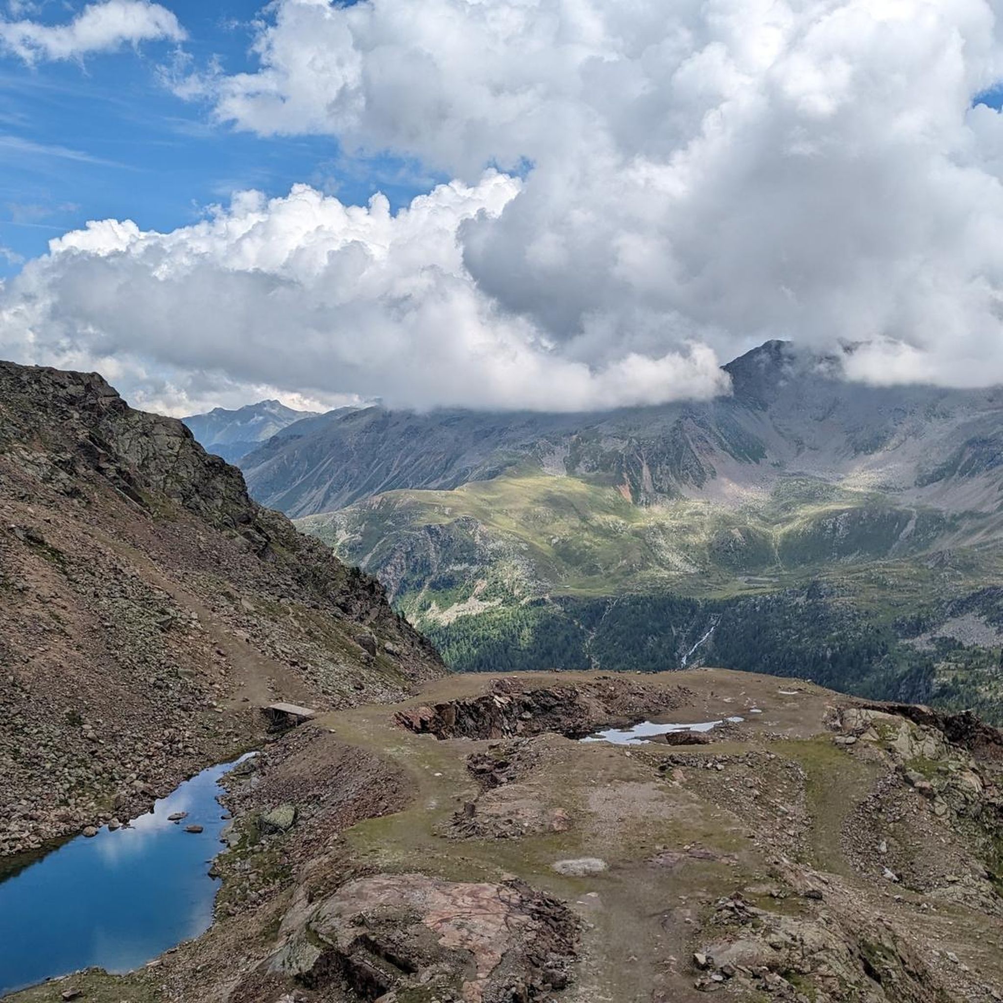
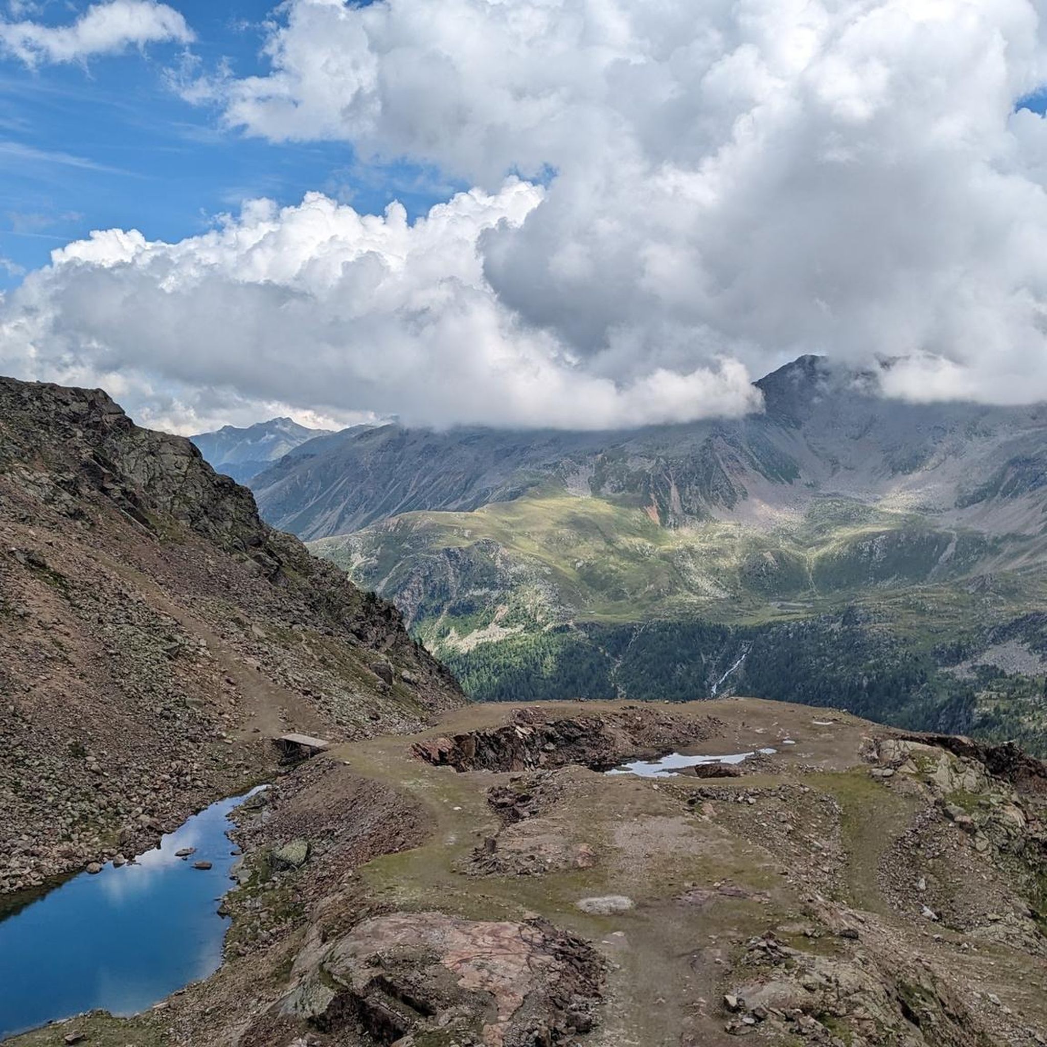
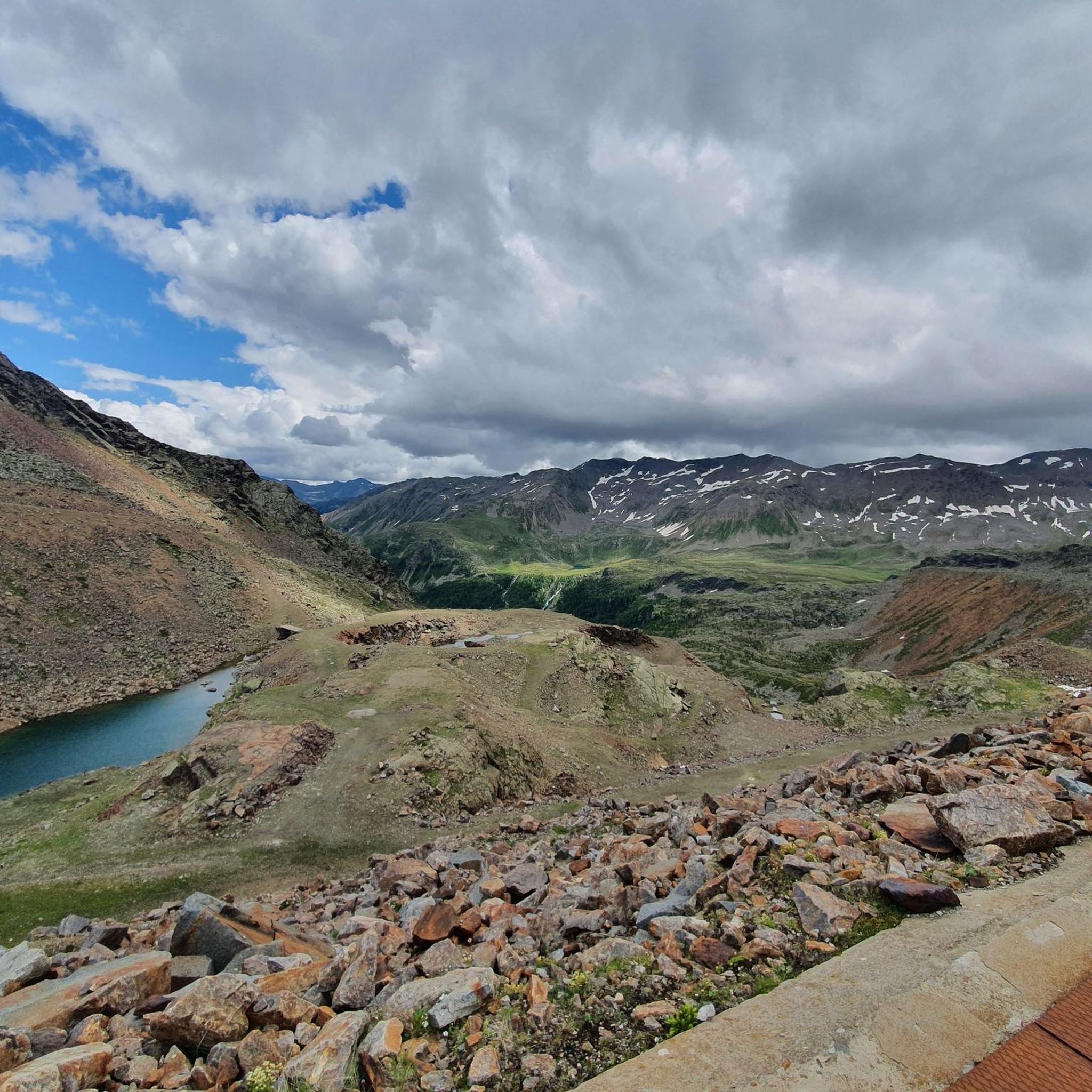
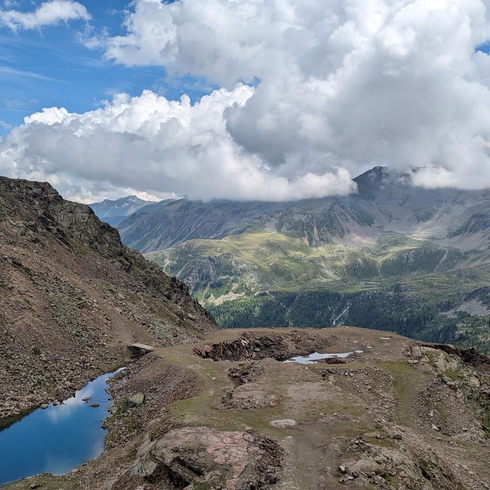
Hiking around Grünsee - Lake Verde in South Tyrol, Italy, offers an alpine landscape characterized by clear, cold waters and impressive surrounding mountain views. This region, nestled in the westernmost part of the Pflersch Valley, features remnants of glacial activity. An extensive network of accessible paths caters to various fitness levels, with trails winding through mountain terrain and along lake shores. The area provides diverse hiking terrain with significant elevation changes.
Best hiking trails around Grünsee - Lake Verde
- The most popular hiking route is View of Grünsee – Zufrittferner Saddle loop from Grünsee - Lago Verde, a 3.9 miles (6.3 km) trail that takes 4 hours 5 minutes to complete. This difficult route offers panoramic views of the lake and surrounding peaks.
- Another top favourite among local hikers is Grünsee (Lago Verde) – Oberweißbrunn Lake loop from Weißbrunnsee - Lago Fontana Bianca, a moderate 6.6 miles (10.6 km) path. This trail features varied terrain, including sections along the lake and through alpine meadows.
- Local hikers also love the Fischer Lake Plateau – Fiechter Alpine Hut loop from Weißbrunnsee - Lago Fontana Bianca, a 4.0 miles (6.4 km) trail leading through alpine landscapes and past mountain huts, often completed in about 2 hours 14 minutes.
- Hiking around Grünsee - Lake Verde is defined by alpine lakes, mountain vistas, and well-maintained trails. The network offers options for different ability levels, from easy walks to more challenging ascents.
- The routes in Grünsee - Lake Verde are highly rated by the komoot community with an average score of 4.7 stars from over 7,000 reviews. More than 33,000 hikers have used komoot to explore Grünsee - Lake Verde's varied terrain.
Last updated: July 9, 2026
5.0
(1)
13
hikers
Hard hike. Good fitness required. Sure-footedness, sturdy shoes and alpine experience required.
4.9
(209)
747
hikers
4.97km
01:59
250m
260m
Moderate hike. Great for any fitness level. Mostly accessible paths. Sure-footedness required.

Sign up for free
4.9
(489)
1,988
hikers
Moderate hike. Good fitness required. Mostly accessible paths. Sure-footedness required.
4.9
(125)
453
hikers
Moderate hike. Good fitness required. Mostly accessible paths. Sure-footedness required.
5.0
(29)
171
hikers
Moderate hike. Good fitness required. Mostly accessible paths. Sure-footedness required.
Get access to more routes and recommendations from other explorers.
Sign up for free
Already have an account?
Our route recommendations are based on thousands of hikes, rides, and runs completed by other people on komoot.
Start today with a free account
Your next adventure awaits.
Login or Signup
Tips from the Community


Popular for its miles of hiking trails, this picturesque national park features mountains, valleys, and a lake.
0
0
is the largest nature park in South Tyrol. It is characterized by the enormous diversity of its landscapes and their influence on water.
0
0

A detour of a few meters, but it's worth it!
0
0

The panorama from here is incomparable.
1
0

A very beautiful mountain lake invites you for a break
0
0
It really is totally green.
0
0
Very good food nice staff
0
0
Frequently Asked Questions
How many hiking trails are available around Grünsee - Lake Verde?
The Grünsee - Lake Verde area in South Tyrol, Italy, offers an extensive network of over 330 hiking trails. These routes cater to various fitness levels, with options ranging from easy walks to more challenging ascents through alpine landscapes.
What is the best time of year to go hiking around Grünsee - Lake Verde?
The prime hiking season around Grünsee - Lake Verde typically runs from late spring to early autumn. During these months, the weather is generally favorable, and the trails are clear of snow, allowing for full enjoyment of the alpine lakes and mountain vistas. Winter hiking conditions can be challenging due to snow and ice, requiring specialized gear and experience.
Are there family-friendly hiking options in the Grünsee - Lake Verde area?
Yes, the region offers several accessible paths suitable for families. While specific family-friendly routes are not detailed in the provided data, the area is known for its diverse network, including 43 easy hiking trails. These often feature well-maintained paths along lake shores and through alpine meadows, perfect for a leisurely family outing.
Can I bring my dog on the hiking trails around Grünsee - Lake Verde?
Generally, dogs are welcome on hiking trails in the Grünsee - Lake Verde area. It's always recommended to keep them on a leash, especially in nature protection zones or when encountering wildlife or livestock. Be sure to carry water for your pet and clean up after them to maintain the pristine alpine environment.
Are there any circular walks available around Grünsee - Lake Verde?
Yes, many routes in the area are designed as circular walks, allowing you to start and end at the same point. A popular moderate option is the Grünsee (Lago Verde) – Oberweißbrunn Lake loop from Weißbrunnsee - Lago Fontana Bianca, which covers 10.6 km and features varied terrain along the lake and through alpine meadows.
Where can I park when visiting Grünsee - Lake Verde for hiking?
Parking facilities are typically available at common starting points for hikes, such as near Weißbrunnsee - Lago Fontana Bianca or other access points to the Pflersch Valley. It's advisable to check local signage for specific parking regulations and fees, especially during peak season.
What kind of natural features and landmarks can I expect to see on the trails?
The Grünsee - Lake Verde area is characterized by its stunning alpine landscape, clear, cold waters, and impressive surrounding mountain views. You'll encounter remnants of glacial activity, pristine alpine lakes, and expansive mountain vistas. The trails often lead through alpine meadows and past traditional mountain huts, offering picturesque scenery.
What are the difficulty levels of hikes around Grünsee - Lake Verde?
The hiking trails around Grünsee - Lake Verde offer a range of difficulty levels. There are 43 easy trails for casual walkers, 173 moderate routes for those seeking a bit more challenge, and 115 difficult trails for experienced hikers looking for significant ascents and rugged terrain. For example, the View of Grünsee – Zufrittferner Saddle loop from Grünsee - Lago Verde is a difficult route offering panoramic views.
Are there cafes or restaurants near the hiking trails?
Yes, especially around popular starting points like Weißbrunnsee - Lago Fontana Bianca, you can often find cafes or restaurants. Many trails also pass by traditional alpine huts, such as those encountered on the Fischer Lake Plateau – Fiechter Alpine Hut loop from Weißbrunnsee - Lago Fontana Bianca, where you can enjoy refreshments and local cuisine.
What do other hikers enjoy most about the Grünsee - Lake Verde area?
The Grünsee - Lake Verde area is highly rated by the komoot community, with an average score of 4.7 stars from over 7,000 reviews. Hikers frequently praise the stunning alpine lakes, the impressive mountain vistas, and the well-maintained trails that cater to various ability levels. The diverse terrain and the pristine natural environment are often highlighted as key attractions.
Is public transport available to reach the hiking areas around Grünsee - Lake Verde?
While specific public transport details are not provided, many popular hiking regions in South Tyrol are accessible by local bus services, especially during the main tourist season. It's recommended to check local public transport schedules for routes serving the Pflersch Valley and access points to Grünsee - Lake Verde.
Are there any less crowded hiking routes around Grünsee - Lake Verde?
With over 330 trails, it's possible to find less crowded options, especially outside of peak hours or by choosing routes that are slightly off the most popular paths. Exploring some of the longer moderate trails, such as the Hike in Val d'Ultimo – loop in Stelvio National Park, might offer a more serene experience away from the busiest spots.
Most popular routes around Grünsee - Lake Verde

Get inspired with the komoot mobile app


Explore more
Browse the best Hikes in other regions.
