The best walks and hikes around Altnahinch Resevoir
4.8
(190)
1,409
hikers
11
hikes
Hiking trails around Altnahinch Reservoir explore a landscape of exposed peaty moorland, dense coniferous forests, and the reservoir itself. The area is part of the Antrim Coast and Glens, characterized by rolling hills and expansive blanket bogs. The terrain offers a mix of forest tracks and remote upland paths, with the River Bush having its source in the nearby hills.
Best hiking trails around Altnahinch Resevoir
- The most popular hiking route is Hiking loop from Beaghs, a 7.4 mile (11.9 km) trail that takes about 3 hours 20 minutes to complete. This moderate route passes through the open moorland typical of the region.
- Another top favourite among local hiking enthusiasts is Dungonnell Reservoir loop from Cargan, a moderate 8.6 mile (13.9 km) path. The route follows tracks around the neighboring Dungonnell Reservoir.
- Local hiking enthusiasts also love the Hiking loop from Loughguile, a 2.2 mile (3.5 km) trail leading through the local countryside, often completed in about 1 hour 5 minutes.
- Hiking around Altnahinch Reservoir is defined by expansive peaty moorland, managed coniferous forests, and reservoir-side tracks. The network of Altnahinch Reservoir walking routes provides options for different fitness and experience levels.
- The routes in Altnahinch Resevoir are highly rated by the komoot community with an average score of 4.8 stars from over 160 reviews. More than 1,200 hikers have used komoot to explore Altnahinch Resevoir's varied terrain.
Last updated: July 9, 2026
4.0
(2)
12
hikers
3.54km
01:06
150m
150m
Easy hike. Great for any fitness level. Easily-accessible paths. Suitable for all skill levels.
4
hikers
22.0km
06:20
520m
520m
Hard hike. Very good fitness required. Easily-accessible paths. Suitable for all skill levels.

Sign up for free
5.0
(2)
1
hikers
19.3km
05:18
320m
320m
Hard hike. Very good fitness required. Easily-accessible paths. Suitable for all skill levels.
5
hikers
14.8km
04:14
350m
350m
Moderate hike. Good fitness required. Easily-accessible paths. Suitable for all skill levels.
5.0
(1)
11
hikers
13.9km
03:48
210m
210m
Moderate hike. Good fitness required. Easily-accessible paths. Suitable for all skill levels.
Get access to more routes and recommendations from other explorers.
Sign up for free
Already have an account?
Our route recommendations are based on thousands of hikes, rides, and runs completed by other people on komoot.
Start today with a free account
Your next adventure awaits.
Login or Signup
Popular around Altnahinch Resevoir
Tips from the Community

Memorial stone and plaque in memory of fallen US soldiers and a Royal Air Force aircraft crash in which 10 people died
0
0

Glenariff is one of nine valleys in the Glens of Antrim. These impressive glens were created by glaciers millions of years ago during the Ice Age and shaped by the tides. Glenarm, Glenariff, Glendun, Glencorp, Glenaan, Glenbllyeamon, Glenshesk, Glencloy, and Glentaisie are a scenic gem located on the coast of Northern Ireland.
0
0

Beautiful to look at, the river is more than fascinating
0
0
Great view of the valley
0
0

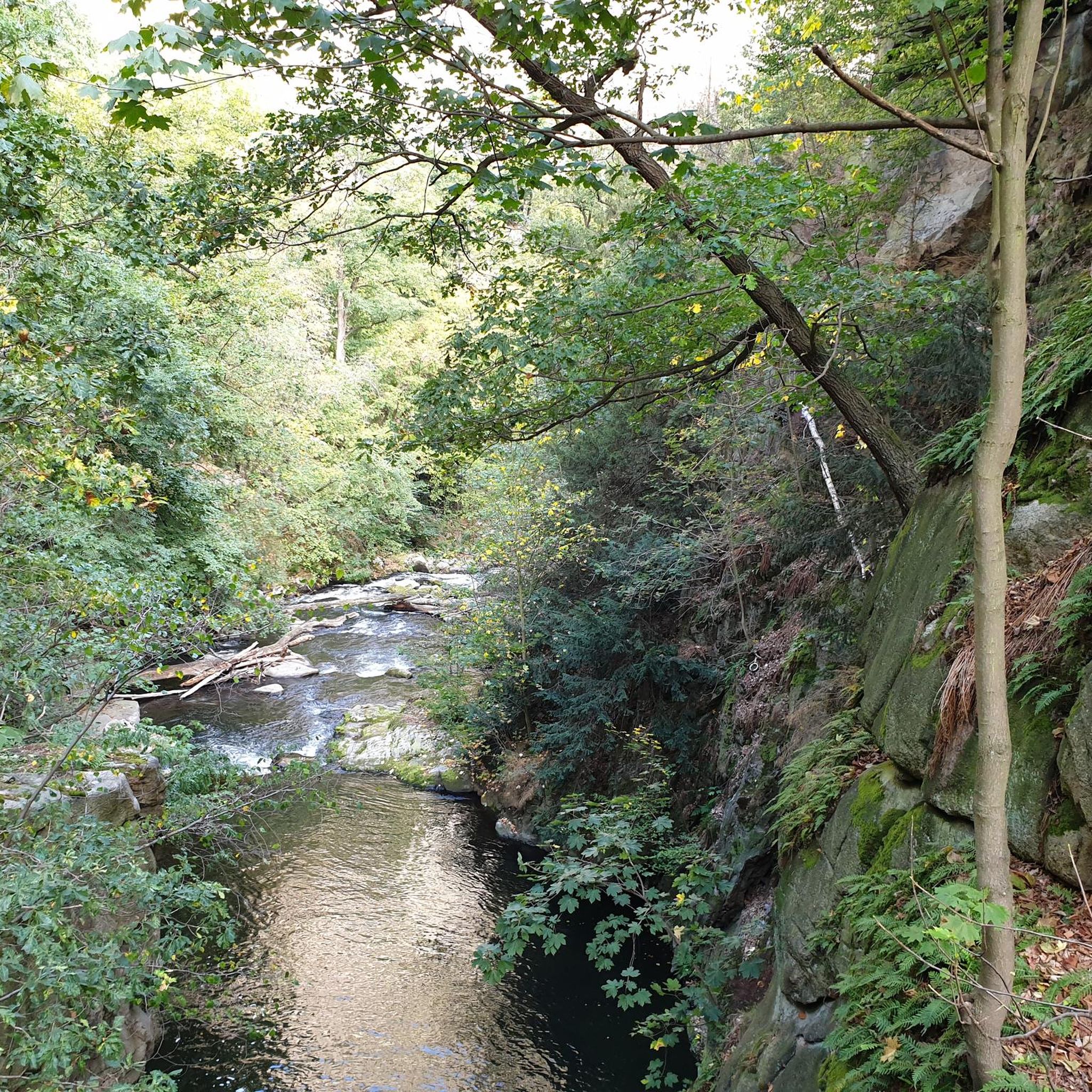
Stumble along the flowing Gleneshk River in the beautiful Breen Forest in County Antrim. The river is a refreshing oasis and great place to sit down and picnic before continuing on your journey.
2
0
The majestic Breen Forest covers an area of 600 hectares. A wide path leads you through the forest amongst beautiful native oak within a mainly coniferous woodland of maturing spruce, larch and pine.
1
0
Frequently Asked Questions
Are dogs allowed at Altnahinch Reservoir?
Yes, dogs are generally welcome on the trails around Altnahinch Reservoir, but they should be kept on a lead. The area is an important habitat for wildlife, including ground-nesting birds, and is also used for grazing sheep. Keeping your dog under control ensures the protection of local fauna and livestock.
Is there parking available at Altnahinch Reservoir?
Yes, there is a car park at Altnahinch Reservoir. However, it can be small and may fill up quickly, especially on weekends and holidays. It's a good idea to arrive early to secure a spot. Please park considerately and do not block any access gates.
Are there any easy, family-friendly walks in the area?
For a shorter, accessible walk, the Hiking loop from Loughguile is a great option. It's a relatively short trail of about 3.5 km that explores the local countryside without significant climbs, making it suitable for families and casual walkers.
What is the new circular walk and boardwalk like?
A project has been developed to create a full circular walk around the reservoir. This includes a raised boardwalk section along the southern and eastern banks. This path is designed to be more accessible and provides a safe route across the boggy, peaty moorland, allowing you to enjoy the serene waterside scenery up close.
How does hiking at Altnahinch compare to Glenariff Forest Park?
Altnahinch offers a wilder, more remote experience characterized by open peaty moorland and expansive views. Glenariff Forest Park, a very popular local favorite, is more developed with well-defined forest paths and is particularly famous for its spectacular waterfalls and wooded glens. Choose Altnahinch for rugged solitude and Glenariff for dramatic river and waterfall scenery.
Are there any challenging, long-distance hikes available?
Yes, for experienced hikers looking for a challenge, the Breen Forest loop from Loughguile is a demanding route of over 22 km. It involves significant elevation and traverses a mix of forest tracks and remote upland terrain, offering a true test of endurance.
What kind of wildlife might I see around Altnahinch Reservoir?
The area is a designated Area of Special Scientific Interest (ASSI) due to its important peatland habitat. Keep an eye out for birdlife such as hen harriers, merlins, and red grouse. The blanket bog supports unique flora like sphagnum moss, heather, and insect-eating sundews.
Can I go fishing in the reservoir?
Yes, Altnahinch Reservoir is a popular angling spot known for its brown and rainbow trout. Fishing is managed by the local department, so you will need the appropriate permits. For detailed regulations and permit information, it's best to check with DAERA (Department of Agriculture, Environment and Rural Affairs).
What do other hikers enjoy about the Altnahinch Reservoir area?
The area is highly regarded by the komoot community. Hikers often praise the sense of remoteness and the stunning panoramic views from the higher ground, which can stretch to Rathlin Island on clear days. The mix of open moorland, quiet forest tracks, and reservoir-side paths is frequently mentioned as a key highlight.
Are there any historical points of interest on the trails?
Yes, on the slopes of Slieveanorra, which is accessible from the area, there is a monument commemorating the crash of a US Air Force B-17 Flying Fortress from 1942. This adds a poignant historical element to hikes in the surrounding hills.
What is the terrain like on the trails?
The terrain is quite varied. Expect a mix of gravel forest tracks, open moorland paths across peaty bog, and some tarmac sections. The ground can be uneven and wet in places, especially after rain, so waterproof hiking boots with good grip are strongly recommended.
Are there any circular routes that explore the nearby reservoirs?
Absolutely. A popular choice is the Dungonnell Reservoir loop from Cargan. This moderate trail of about 14 km takes you on a circuit around the neighbouring Dungonnell Reservoir, offering a different perspective on the region's water landscapes.
Most popular routes around Altnahinch Resevoir

Get inspired with the komoot mobile app


Explore more
Browse the best Hikes in other regions.
