The best walks and hikes around Embalse de Navamuño
4.5
(184)
1,155
hikers
89
hikes
Hiking around Embalse de Navamuño offers a variety of trails centered around the reservoir in La Sierra. The region features a landscape of water, surrounding hills, and natural areas, providing diverse terrain for outdoor activities. Trails often follow the shoreline or ascend into the nearby slopes, offering different perspectives of the reservoir and its environment. The area is suitable for various hiking experiences, from gentle walks to more challenging ascents.
Best hiking trails around Embalse de Navamuño
- The most popular…
Last updated: July 8, 2026
1
hikers
9.44km
02:39
190m
190m
Moderate hike. Good fitness required. Easily-accessible paths. Suitable for all skill levels.
3
hikers
7.00km
01:57
130m
130m
Easy hike. Great for any fitness level. Easily-accessible paths. Suitable for all skill levels.

Sign up for free
3
hikers
9.85km
03:02
360m
350m
Moderate hike. Good fitness required. Easily-accessible paths. Suitable for all skill levels.
5.0
(2)
8
hikers
Hard hike. Good fitness required. Sure-footedness, sturdy shoes and alpine experience required.
3.8
(4)
5
hikers
13.1km
04:03
450m
450m
Hike Peña Negra via Embalse de Navamuño in Sierra de Candelario Natural Space for challenging trails and 360-degree panoramic views.
Get access to more routes and recommendations from other explorers.
Sign up for free
Already have an account?
Our route recommendations are based on thousands of hikes, rides, and runs completed by other people on komoot.
Start today with a free account
Your next adventure awaits.
Login or Signup

Tips from the Community

Intricate route. For connoisseurs only
0
0

After passing the town of Garganta and going up the slopes of the Sierra de Béjar, there are panoramic views of the Navamuño Reservoir.
0
0

Peña Negra is one of those peaks that more than rewards the effort to reach its top. The views from here at 1634 masl are truly amazing and you will have 360 degree panoramic views of the entire Sierra de Candelario Natural Area including the Navamuño Reservoir.
1
0
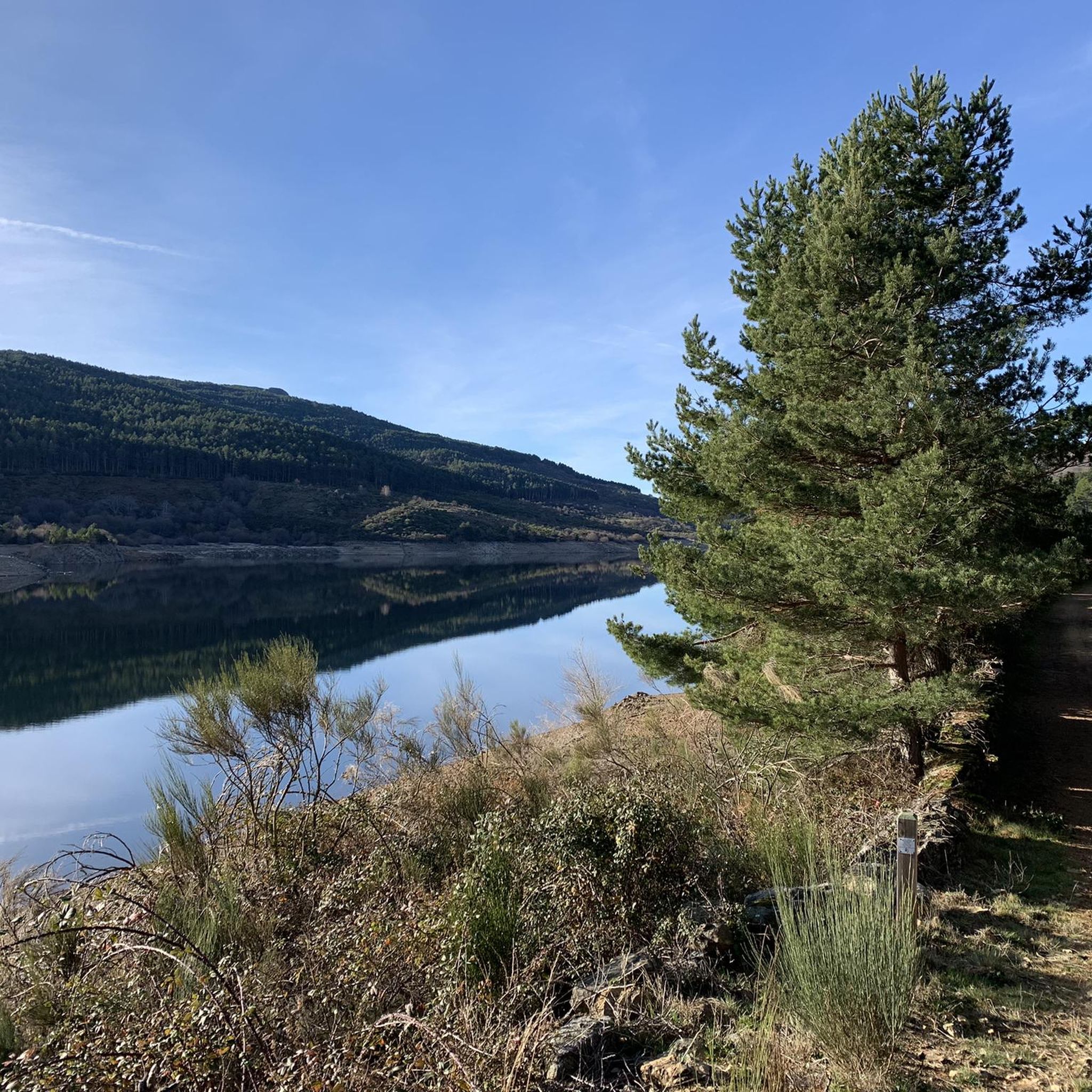
One of the many jewels offered by the Sierra de Candelario, the Navamuño Reservoir combines perfectly with the landscape that surrounds it.
1
0
Very close to the Cuerpo de Hombre river and the border with the Extremadura region, this beautiful and picturesque peat bog offers an ideal place to take a break and appreciate this magnificent landscape of the Sierra de Candelario.
1
0
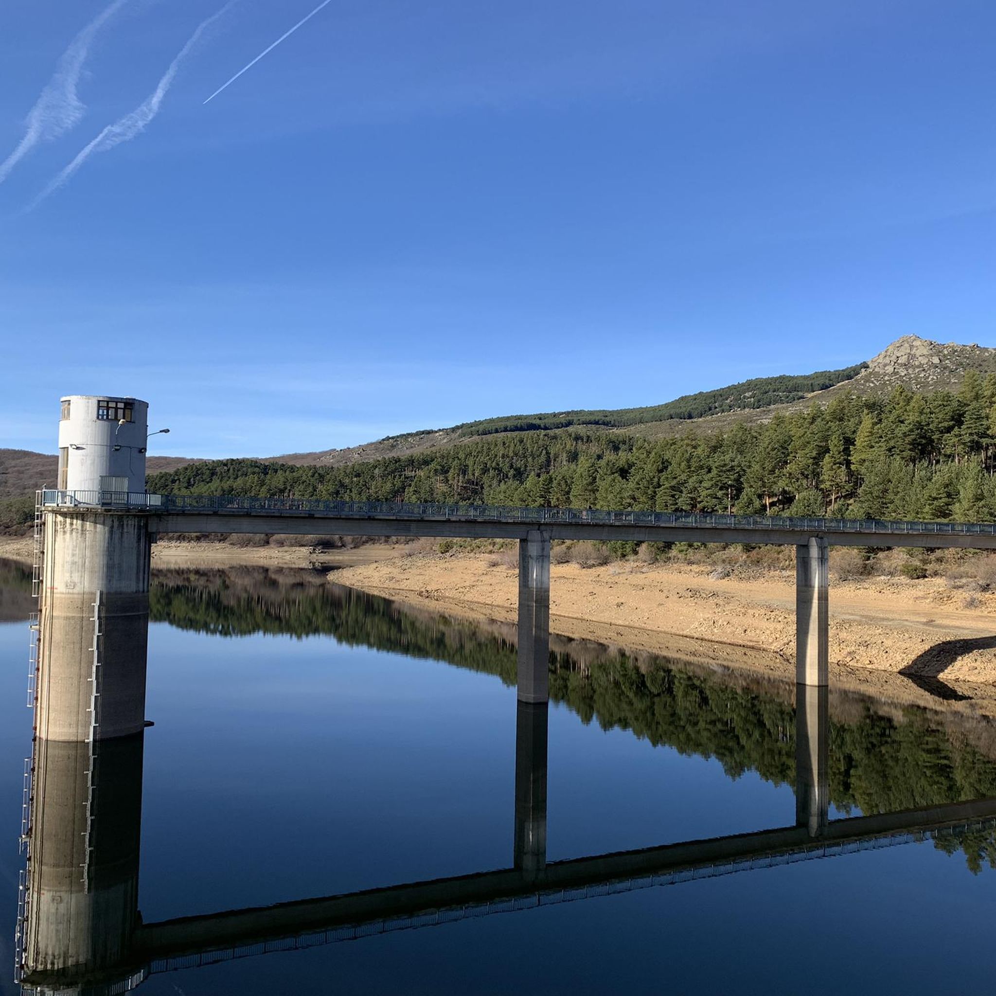
The views from the dam towards the reservoir are postcard. On clear days you can fully appreciate this wonderful landscape that is worth visiting!
1
1
Peña Negra is one of those challenging but highly rewarding peaks. The views from its top at 1634 meters above sea level are truly amazing and you will have 360 degree panoramic views of the entire Sierra de Candelario Natural Area, including the Navamuño Reservoir.
1
1

It is the reference point that crosses the road to start the ascent to La Muela.
0
0
Frequently Asked Questions
How many hiking trails are available around Embalse de Navamuño?
There are nearly 100 hiking routes around Embalse de Navamuño, offering a wide range of options for different skill levels. You'll find everything from easy strolls along the reservoir to more challenging ascents into the surrounding hills.
Are there easy hiking trails suitable for beginners or families?
Yes, Embalse de Navamuño offers 19 easy hiking trails. A great option is the Navamuño Dam loop from Fuente del Peregrino, which is an easy 7 km circular path providing pleasant views of the dam and reservoir, suitable for a relaxed outing.
What are some challenging hikes around Embalse de Navamuño?
For those seeking a challenge, there are 23 difficult routes. One notable option is the Peña Negra and Embalse de Navamuño Loop, a 13.1 km trail with significant elevation gain, offering rewarding views from higher ground.
Can I find circular hiking routes in the area?
Yes, many trails around Embalse de Navamuño are circular. For example, the popular Navamuño Dam loop from Fuente del Peregrino is a circular route. Another excellent circular option, for those looking for more varied terrain, is La Muela – circular by the Turbal de Navamuño.
Are there any hikes with good viewpoints of the reservoir?
Absolutely. Several routes are designed to offer panoramic views of Embalse de Navamuño. The Peña Negra – Views on the embalse de Navamuño loop from El Puertecito is a moderate 9.8 km path specifically known for its ascents to viewpoints overlooking the reservoir.
What is the best season to go hiking around Embalse de Navamuño?
The best seasons for hiking around Embalse de Navamuño are generally spring and autumn. During these times, the weather is milder, and the natural scenery is particularly vibrant, with blooming flora in spring and rich colors in autumn. Summer can also be pleasant, especially in the mornings or late afternoons, but be prepared for warmer temperatures.
Is Embalse de Navamuño a dog-friendly hiking destination?
Yes, Embalse de Navamuño is generally dog-friendly. Many trails are suitable for walking with dogs, but it's always recommended to keep your dog on a leash, especially near wildlife or livestock, and to carry water for both yourself and your pet. Always check local regulations for specific areas.
What do other hikers say about the trails in Embalse de Navamuño?
The hiking trails around Embalse de Navamuño are highly rated by the komoot community, with an average score of 4.6 stars from over 170 reviews. Hikers often praise the diverse terrain, the beautiful reservoir views, and the variety of routes available for different fitness levels.
Are there any nearby attractions or points of interest to explore?
The region around Embalse de Navamuño is part of La Sierra, offering natural beauty beyond the reservoir itself. While specific highlights are not listed in the provided data, the area is known for its natural landscapes and traditional villages, providing opportunities for exploration and cultural immersion.
What should I pack for a day hike in Embalse de Navamuño?
For a day hike, essential items include sufficient water, snacks, appropriate footwear (hiking boots or sturdy shoes), sun protection (hat, sunscreen), and layers of clothing to adapt to changing weather conditions. A map or GPS device is also recommended, along with a fully charged phone for emergencies.
Are there options for parking near the trailheads?
While specific parking locations are not detailed, popular starting points for trails, such as Fuente del Peregrino or El Puertecito, typically offer designated parking areas or roadside parking options for hikers. It's advisable to arrive early during peak seasons to secure a spot.
Most popular routes around Embalse de Navamuño

Get inspired with the komoot mobile app


Explore more
Browse the best Hikes in other regions.
