The best road cycling routes around Embalse de El Burguillo
4.3
(8)
1,964
riders
63
rides
Road cycling routes around Embalse de El Burguillo offer diverse terrain at the foot of the Sierra de Gredos, fed by the Alberche River. The region features a blend of landscapes, from reservoir-side roads to climbs with significant elevation gains. Cyclists can navigate routes through river valleys, past natural viewpoints, and along roads with varying gradients. The area provides a range of road cycling experiences for different skill levels.
Best road cycling routes around Embalse de El Burguillo
- The most…
Last updated: October 28, 2026
58
riders
71.7km
03:19
880m
880m
Moderate road ride. Good fitness required. Mostly well-paved surfaces and easy to ride.
17
riders
Moderate road ride. Good fitness required. Mostly well-paved surfaces and easy to ride.

3.7
(3)
72
riders
72.9km
03:47
1,290m
1,290m
Hard road ride. Very good fitness required. Some segments of this route may be unpaved and difficult to ride.
66
riders
96.9km
04:39
1,330m
1,330m
Hard road ride. Very good fitness required. Mostly well-paved surfaces and easy to ride.
33
riders
48.4km
02:15
590m
590m
Moderate road ride. Good fitness required. Mostly well-paved surfaces and easy to ride.
Get access to more routes and recommendations from other explorers.
Already have an account?
Our route recommendations are based on thousands of hikes, rides, and runs completed by other people on komoot.
Start today with a free account
Your next adventure awaits.


Tips from the Community

Los Toros de Guisando are a set of zoomorphic sculptures of Vettonian origin, carved in granite between the 4th and 2nd centuries BC. They probably represent bulls or verracos and were linked to rituals for the protection of livestock and the delimitation of territory.
0
0

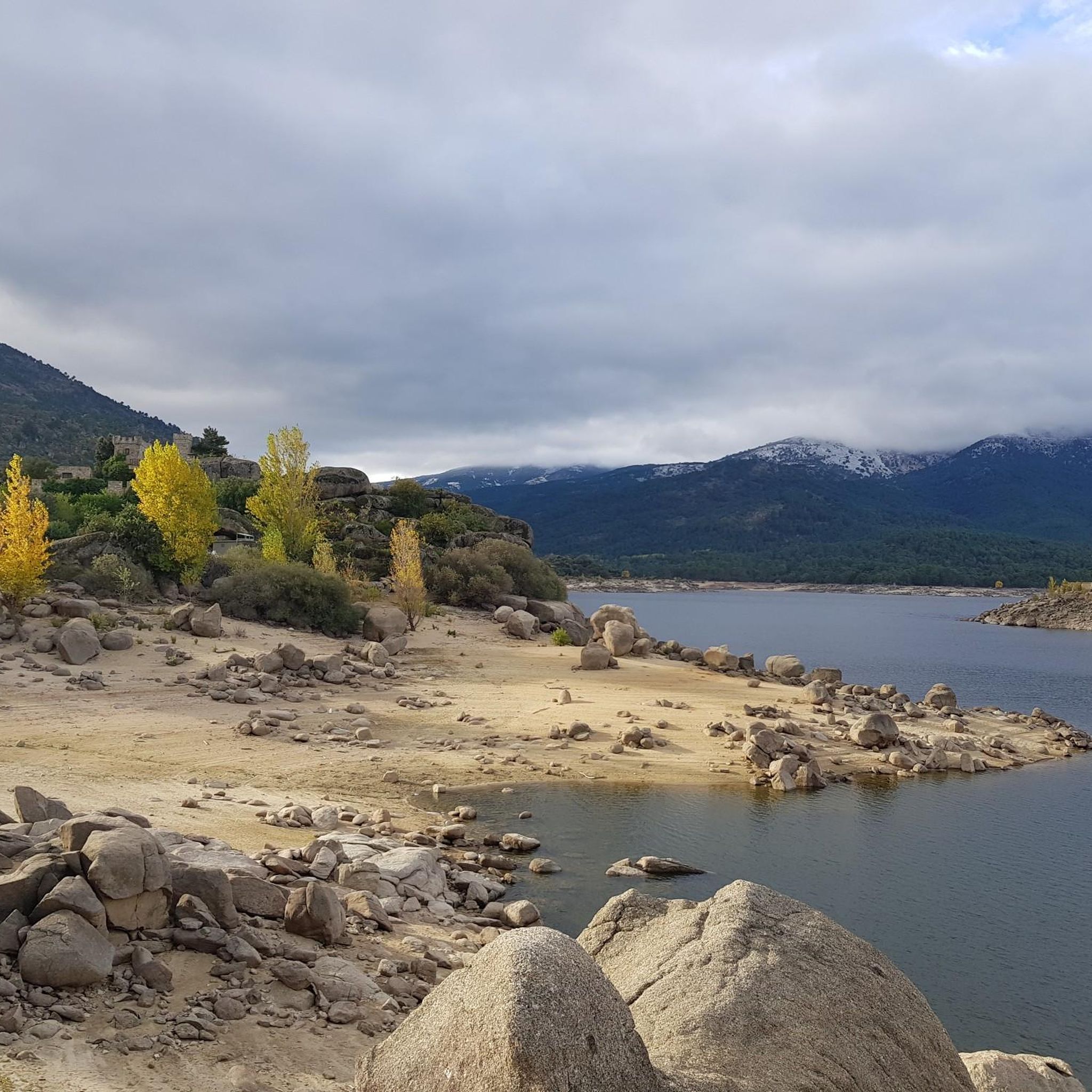
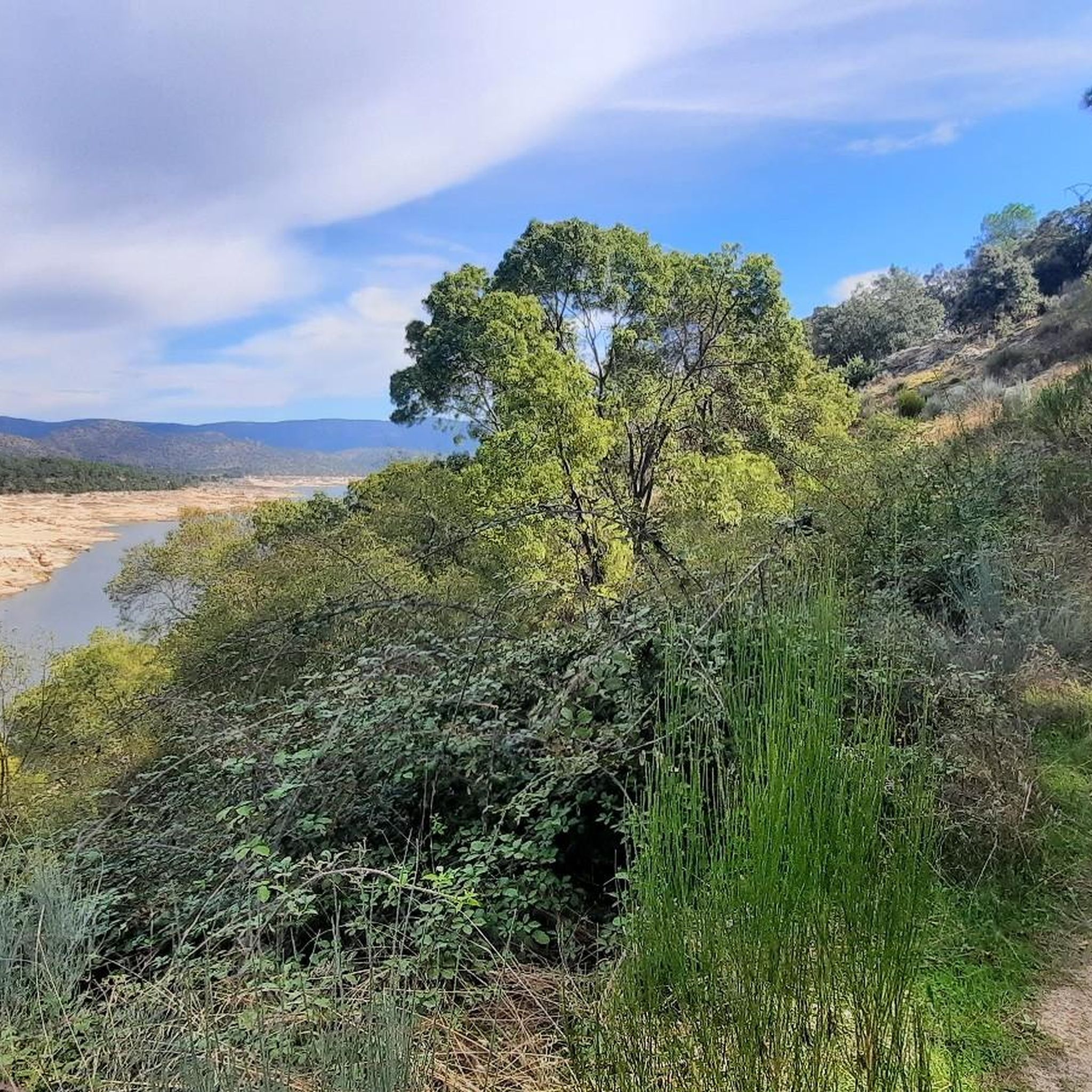
Beautiful road alongside the reservoir, very quiet. It has no paved exit.
0
0

The cycle trip continues along the lane of the Jacobean route until it connects with the Cebreros highway. The route continues along the side of the road, passing through the popular port of Arrebatacapas and another descent to Cebreros, a mountain town with a wine-growing tradition that would be a good place to finish the second stage when organized as a three-day trip. The Camino de Levante descends from the port along a mountain path that is quite technical and difficult by bicycle, suitable for trail experts and everyone can choose. The path begins next to the port sign and ends where the road enters the urban complex. The track goes down the road, crosses the town and continues the descent along the old Camino Real de Toledo, used by the funeral procession of Isabel la Católica when they carried her remains from Medina del Campo to Granada. At the Cebreros exit there are remains of the old medieval road and on the Alberche River there are the monumental bridges of Valsordo and Santa Yusta, used since Roman times, although they have undergone several reconstructions throughout history. The climb coincides with the last arrows of the Camino de Levante and deviates through the Puente Nuevo urbanization towards San Martín de Valdeiglesias, following the markings of the GR-10 long-distance path, with several hard ramps on the Camino de la Aliseda.
0
0

The arrangement of the sculptures is interesting: they are side by side, forming a line in a north-south direction and all of them facing west, to the hill of Cerro de Guisando, from which they receive their name. The Tórtolas stream, which is located behind it, marks the natural border between the communities of Castilla y León and Madrid.
13
0

It is a place where you can admire stone carvings that are more than 2,000 years old that were recovered and taken there so that they can be contemplated by visitors who wish to do so. You have to pay a small entrance fee of €2 to ensure the conservation and maintenance of the sculptures, but it is definitely worth it. These are 4 bulls carved in stone from the 3rd century BC. next to an old inn or inn called "Juradera" in which the pact was signed between Enrique IV and his sister Isabel.
21
0

The Guisando Bulls are an outstanding example of Vetona sculpture, a pre-Roman art, found in the municipality of El Tiemblo, in the province of Ávila. These are four large granite statues that represent bulls. These sculptures date from the 6th or 3rd century BC. and they are considered one of the most outstanding examples of Veton sculpture, associated with Celtic culture. Although their exact meaning is unclear, it is believed that the Guisando Bulls could have a symbolic or religious purpose related to fertility and the protection of livestock. There has also been speculation about its possible connection with ritual ceremonies.
12
0

Robledo de Chavela is a crossroads between the high mountains of Guadarrama and the western mountains of Madrid. It is an ideal place for a stop along the way and to get supplies.
0
1
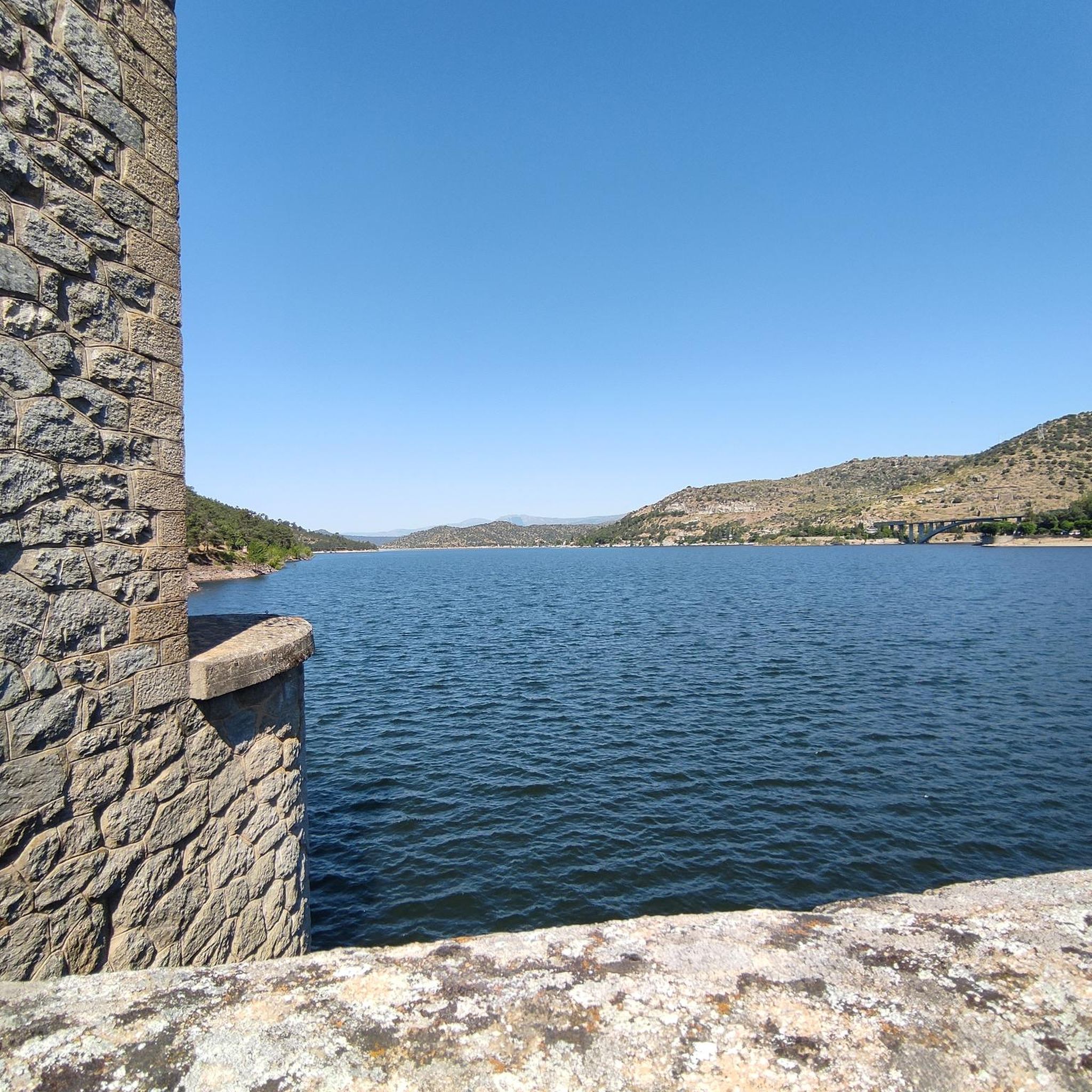
From the Burguillo reservoir dam you can see a spectacular panoramic view of the sheet of water surrounded by mountains and forests.
1
0
Frequently Asked Questions
What kind of terrain can I expect on road cycling routes around Embalse de El Burguillo?
The region offers a diverse blend of landscapes, from reservoir-side roads to climbs with significant elevation gains. You'll find routes through river valleys, past natural viewpoints, and along roads with varying gradients, including some challenging sections with gradients up to 20%.
Are there challenging road cycling routes for experienced riders?
Yes, Embalse de El Burguillo is well-suited for experienced riders seeking a rigorous workout. There are 40 difficult routes available, with some featuring significant elevation gains exceeding 3,000 feet. For example, the Views of Hoyo de Pinares – Viewpoint of the city of Madrid loop from El Tiemblo is a difficult 45.3-mile (72.9 km) trail with over 1200 meters of ascent.
Are there easier road cycling options for beginners or those looking for a moderate ride?
Absolutely. While there are challenging routes, the area also offers moderate options. There are 12 moderate routes, such as the El Burguillo Reservoir – Burguillo Reservoir loop from La Chorreta, a 44.6-mile (71.8 km) trail offering extensive views of the reservoir without extreme difficulty.
What natural features or landmarks can I see while road cycling around Embalse de El Burguillo?
You'll encounter stunning natural beauty, including the reservoir itself, the Sierra de Gredos in the background, and the Alberche River. Notable highlights include the El Burguillo Reservoir and various viewpoints like the View of the Alberche River. The region is also home to the Valle de Iruelas Natural Park and the ancient Celtiberian sculptures of the Bulls of Guisando.
What is the best time of year for road cycling around Embalse de El Burguillo?
Spring and autumn generally offer the most pleasant conditions for road cycling around Embalse de El Burguillo, with milder temperatures and beautiful scenery. Summers can be quite hot, while winters may bring colder weather, though cycling is possible year-round depending on conditions.
Are there circular road cycling routes available?
Yes, many of the routes around Embalse de El Burguillo are designed as loops, allowing you to start and end in the same location. Examples include the El Burguillo Reservoir – Burguillo Reservoir loop from La Chorreta and the Coracera Castle – San Martín de Valdeiglesias loop from El Tiemblo.
Is parking available for cyclists near Embalse de El Burguillo?
Yes, parking is generally available in towns surrounding the reservoir, such as Navaluenga, El Tiemblo, and El Barraco, which serve as common starting points for many routes. Specific parking areas may vary, so it's advisable to check local information for your chosen starting location.
Can I reach Embalse de El Burguillo by public transport with my bike?
Public transport options to the Embalse de El Burguillo area, particularly with bikes, can be limited. While some bus services connect to nearby towns, policies regarding bicycle transport vary. It's recommended to check with specific transport providers for their current regulations and schedules.
Are there cafes or places to stop for refreshments along the road cycling routes?
Yes, the towns and villages surrounding Embalse de El Burguillo, such as Navaluenga, El Tiemblo, and El Barraco, offer various cafes, restaurants, and shops where cyclists can stop for refreshments and meals. Some routes may pass through these towns, providing convenient breaks.
What do other road cyclists enjoy the most about road cycling in Embalse de El Burguillo?
The area is highly rated by the komoot community, with an average score of 4.0 stars from several reviews. Cyclists often praise the extensive views of the reservoir, the challenging climbs, and the diverse terrain that caters to various skill levels, making for a rewarding experience.
Are there any family-friendly road cycling routes around Embalse de El Burguillo?
While many routes feature significant climbs, there are some easier sections and quieter roads that might be suitable for families with older children or those looking for a less strenuous ride. It's best to review the elevation profiles and distances of specific routes to find the most appropriate option for your family.
Can I bring my dog on road cycling routes around Embalse de El Burguillo?
Road cycling routes are generally not ideal for dogs due to traffic and the pace of cycling. While dogs are welcome in many natural areas, it's usually safer and more enjoyable for them to accompany you on dedicated hiking trails or in areas where they can run freely off-leash, away from roads.
Most popular routes around Embalse de El Burguillo
Most popular attractions around Embalse de El Burguillo

Get inspired with the komoot mobile app


Explore more
Browse the best Road cycling routes in other regions.
