The best running trails around Blunham
4.4
(88)
7,728
runners
392
runs
Jogging around Blunham offers accessible pathways through a predominantly flat landscape, situated between 20 and 36 meters above sea level. The region is characterized by the Rivers Great Ouse and Ivel, providing scenic riverside routes with mature willows. Many running trails utilize the former Oxford to Cambridge railway line, now part of National Cycle Network Route 51, ensuring level and easy paths. Disused sand and gravel pits have formed lakes, such as Priory Lake, adding waterside scenery to the area's…
Last updated: August 25, 2026
8
runners
16.1km
01:42
50m
50m
Hard run. Very good fitness required. Mostly accessible paths. Some sure footedness required.
5.0
(1)
242
runners
24.2km
02:32
40m
40m
Hard run. Very good fitness required. Mostly paved surfaces. Suitable for all skill levels.

Sign up for free
22
runners
17.5km
01:48
50m
50m
Hard run. Very good fitness required. Mostly paved surfaces. Suitable for all skill levels.
15
runners
5.21km
00:32
10m
10m
Moderate run. Good fitness required. Mostly paved surfaces. Suitable for all skill levels.
7
runners
10.1km
01:04
20m
20m
Moderate run. Good fitness required. Mostly paved surfaces. Suitable for all skill levels.
Get access to more routes and recommendations from other explorers.
Sign up for free
Already have an account?
Our route recommendations are based on thousands of hikes, rides, and runs completed by other people on komoot.
Start today with a free account
Your next adventure awaits.
Login or Signup


Tips from the Community

I choose not to stop for coffee and cake as it's a little expensive and they don't accept cash. Their business so it's up to them but I choose to go elsewhere where they do accept coin of the realm.
0
0

Traffic free NCN route through the countryside, very easy riding.
0
0

Great peaceful place to make a stop on your ride for coffee or drink.
0
0

Fantastic views upstream from one of the two Blunham Bridges which spans over the River Ivel on Tempsford Road.
1
0
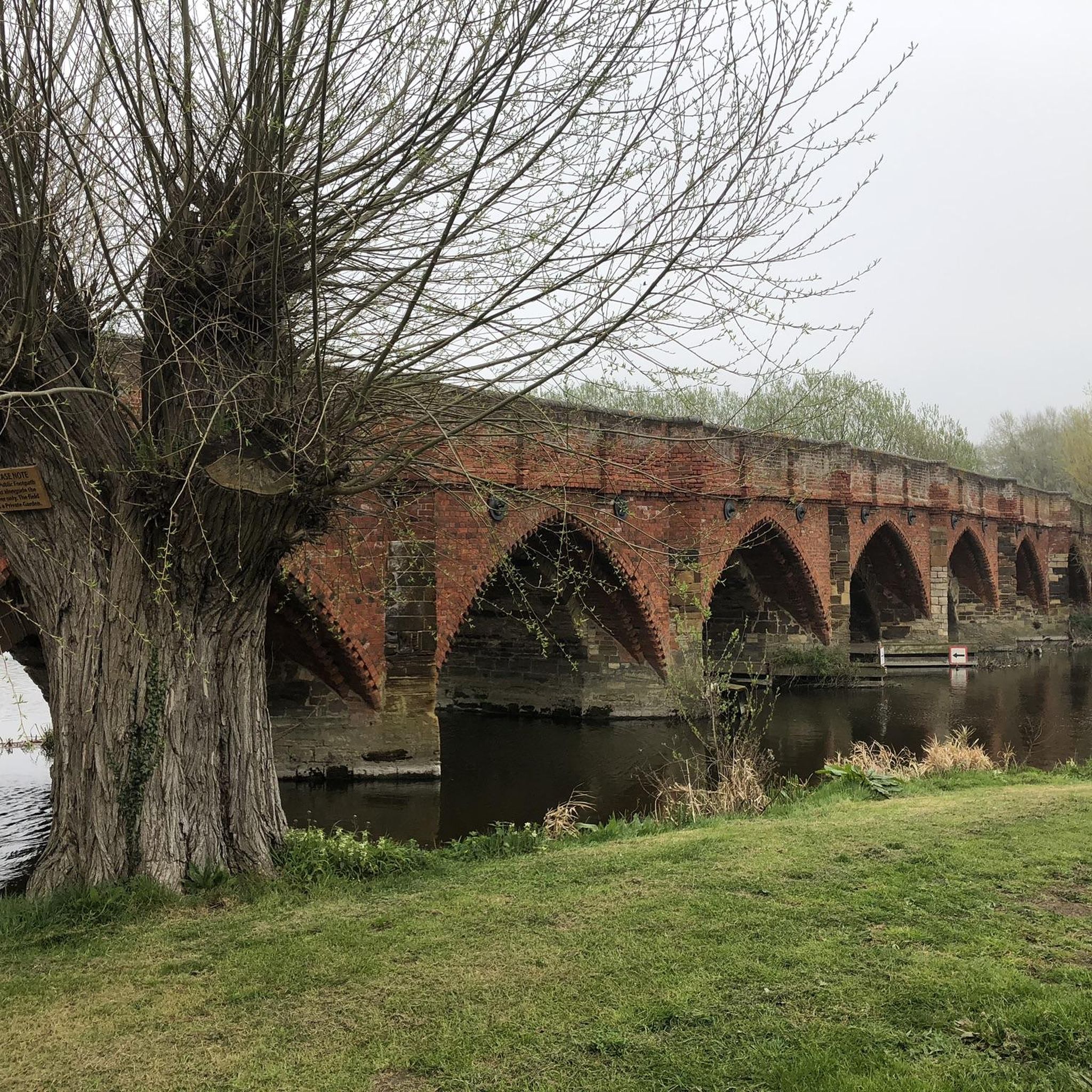
Enjoy fantastic views down the River Great Ouse from Great Barford Bridge. Barford Bridge is an impressive landmark dating back to the 15th century. It was originally built from sandstone and limestone and has an impreswsive 17 arches!
1
0

The River Ouse is navigable by canal boat from here West to Kempston.
0
0
Route 51 is super along this stretch, it follows a disused railway bed.
1
0
Great waterside riding through the park on Route 51 or using the cycle friendly paths and trails around Priory.
0
0
Frequently Asked Questions
How many running routes are available around Blunham?
Blunham offers a wide variety of running options, with over 400 routes available on komoot. These range from easy strolls to more challenging runs, catering to all fitness levels.
What is the terrain like for running in Blunham?
The terrain in Blunham is predominantly flat, situated between 20 and 36 meters above sea level, making it very accessible for runners. Many routes follow level paths, including sections of the former Oxford to Cambridge railway line, now part of National Cycle Network Route 51. You'll find paths alongside rivers, around lakes, and through open farmland.
Are there any easy running routes suitable for beginners in Blunham?
Yes, Blunham has a good selection of easy running routes. There are 57 routes classified as 'easy' on komoot, perfect for beginners or those looking for a relaxed run. These often follow flat, well-maintained paths, such as those found along the rivers or former railway lines.
Can I find running routes that follow rivers or lakes in Blunham?
Absolutely. Blunham is characterized by the Rivers Great Ouse and Ivel, offering numerous scenic riverside routes with mature willows. Additionally, disused sand and gravel pits have formed lakes, such as Priory Lake, providing additional waterside scenery and tracks for runners.
What kind of natural features or landmarks can I see while running in Blunham?
While running in Blunham, you can enjoy diverse natural features. The National Cycle Route 51 offers a pleasant path, and you might pass through the Blunham Railway Nature Reserve, also known as 'Blunham Marshes', which is rich in wildflowers. You'll also encounter the picturesque Rivers Great Ouse and Ivel, and lakes like Priory Lake. Historic features like the double humpback bridge over the River Ivel add character to longer excursions.
Are there any circular running routes in Blunham?
Yes, many running routes in Blunham are designed as loops. For example, the Great Barford Bridge loop from Great Barford is an 8.5-mile trail that takes you through open farmland and along riverbanks, offering a great circular option.
Are the running trails in Blunham suitable for families?
Given Blunham's predominantly flat terrain and the presence of many easy and moderate routes, including those along the National Cycle Network Route 51, many trails are suitable for families. These paths are generally level and easy to navigate, making them enjoyable for all ages.
Are dogs allowed on the running trails around Blunham?
Many public footpaths and trails in the Blunham area are dog-friendly, especially those through open fields and along riverbanks. However, it's always advisable to keep dogs under control, particularly near livestock or in nature reserves like the Blunham Railway Nature Reserve, to protect wildlife.
Where can I park when going for a run in Blunham?
While specific parking areas for each route vary, Blunham and its surrounding villages like Great Barford often have public parking options. Look for designated car parks in village centers or near popular trailheads. Always check local signage for any restrictions.
Is Blunham accessible by public transport for runners?
Blunham is a village in Bedfordshire, and while public transport options might be more limited than in larger towns, local bus services connect it to nearby areas. For detailed information on bus routes and schedules, it's best to consult local transport authority websites.
What do other runners think about the routes in Blunham?
The running routes in Blunham are highly rated by the komoot community, with an average score of 4.4 stars from over 55 reviews. Runners often praise the scenic riverside paths, the flat and accessible terrain, and the variety of routes available for different abilities.
Are there any longer, more challenging running routes in the Blunham area?
Yes, for those seeking a greater challenge, Blunham offers several difficult routes. An example is the Roxton running loop via Kingfisher Way, a 10-mile trail that provides expansive views and a more demanding experience. There are 66 routes classified as 'difficult' in the area.
Can I find running routes that connect Blunham to nearby villages?
Yes, many routes in the Blunham area connect to neighboring villages. You can explore trails that link Blunham to places like Great Barford and Tempsford, often featuring picturesque riverside paths and routes through open fields, offering a great way to explore the wider region.
Most popular attractions around Blunham

Get inspired with the komoot mobile app


Explore more
Browse the best Running Trails & Routes in other regions.
