The best cycling routes around Embalse de Buendía
5.0
(1)
57
riders
12
rides
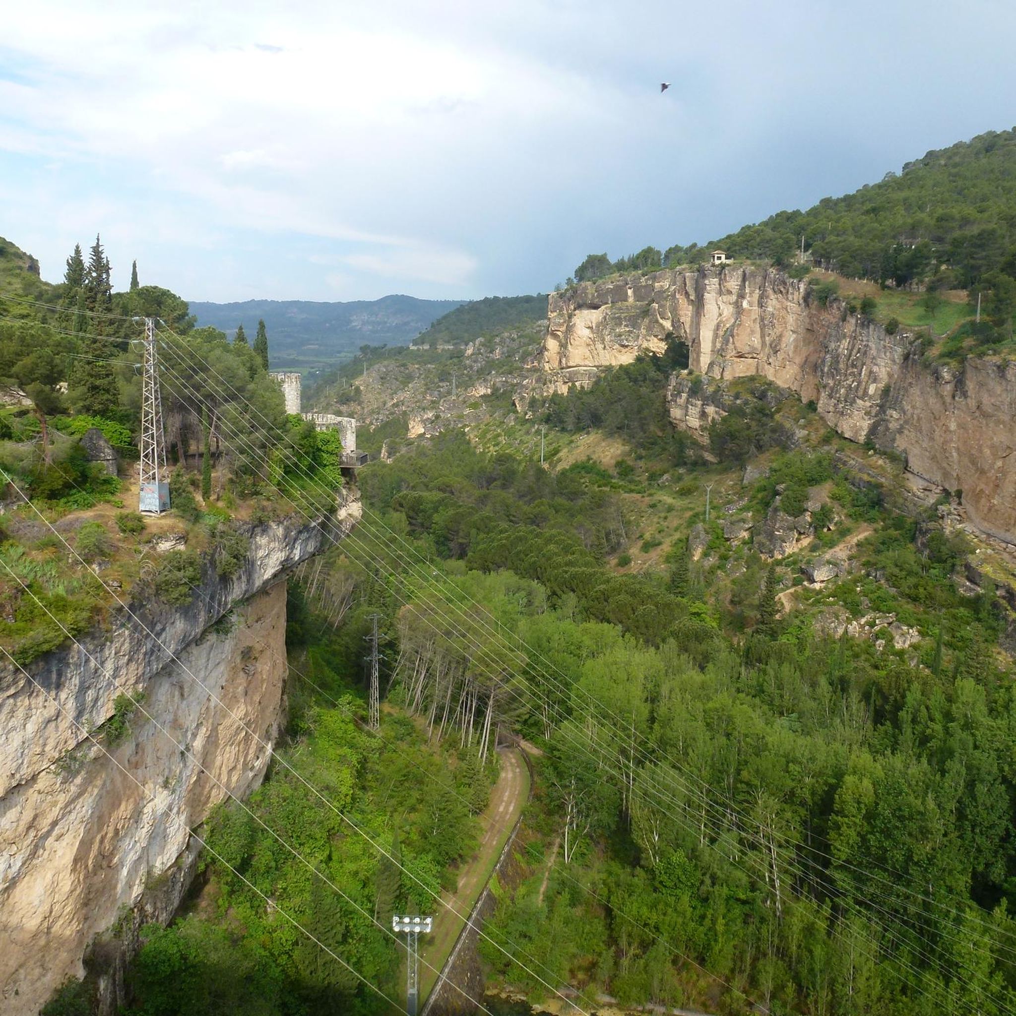
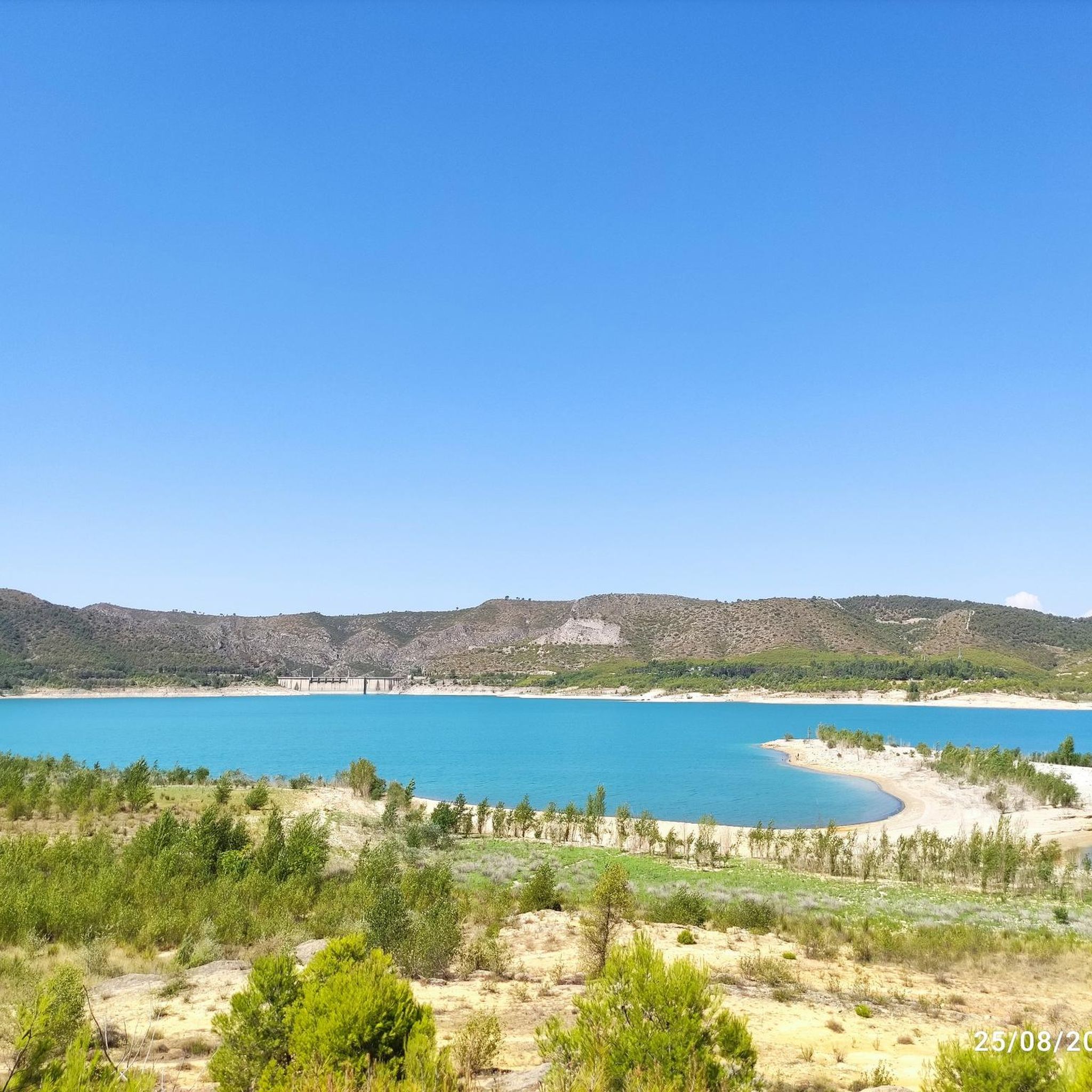
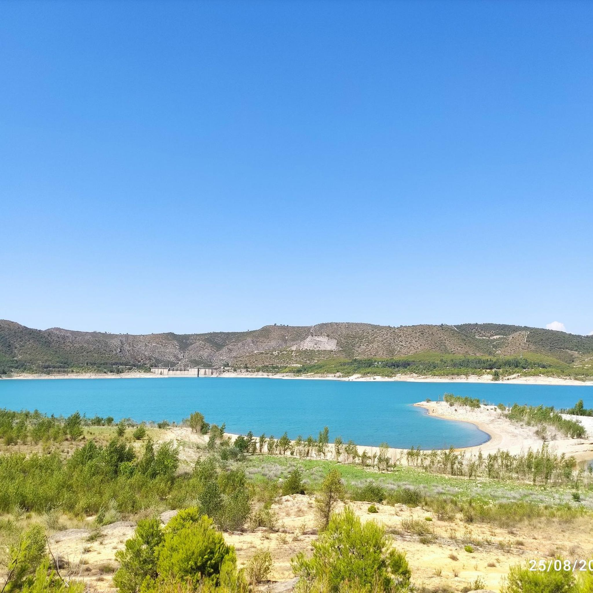
Touring cycling routes around Embalse de Buendía traverse a landscape characterized by rugged, rocky terrain, featuring hills and mountains forested with oak and pine trees. The area includes numerous cliffs and gorges, with the reservoir's clear blue waters providing a central feature. The low population density and minimal vehicular traffic in the broader Serranía de Cuenca region enhance the cycling experience. This environment offers a diverse setting for various outdoor pursuits.
Best touring cycling routes around Embalse de Buendía
- The…
Last updated: July 5, 2026
2
riders
23.5km
01:52
180m
190m
Moderate bike ride. Good fitness required. Some segments of this route may be unpaved and difficult to ride.
1
riders
38.8km
02:04
440m
440m
Moderate bike ride. Good fitness required. Mostly paved surfaces. Suitable for all skill levels.

Sign up for free
6
riders
11.3km
00:49
100m
100m
Easy bike ride. Great for any fitness level. Mostly paved surfaces. Suitable for all skill levels.
5
riders
33.9km
02:04
310m
310m
Moderate bike ride. Good fitness required. Mostly paved surfaces. Suitable for all skill levels.
17
riders
49.4km
03:15
720m
730m
Hard bike ride. Very good fitness required. Mostly paved surfaces. Suitable for all skill levels.
Get access to more routes and recommendations from other explorers.
Sign up for free
Already have an account?
Our route recommendations are based on thousands of hikes, rides, and runs completed by other people on komoot.
Start today with a free account
Your next adventure awaits.
Login or Signup
Tips from the Community

The Peña de la Virgen viewpoint is located near the Entrepeñas and Buendía reservoirs, close to the village of Buendía, within the municipality of Sacedón. It is situated very near: Santa María de Poyos, a submerged village now in ruins (2 km to the northwest). Buendía (6 km to the south). Cañaveruelas (9 km to the east). From this viewpoint, there are beautiful views of the Buendía reservoir, making it a popular spot for enjoying the scenery.
1
0
In Buendía (Cuenca), there are several options for motorhome owners, especially the Buendía Motorhome Park, also known as the “La Veguilla” Service Area.
2
0
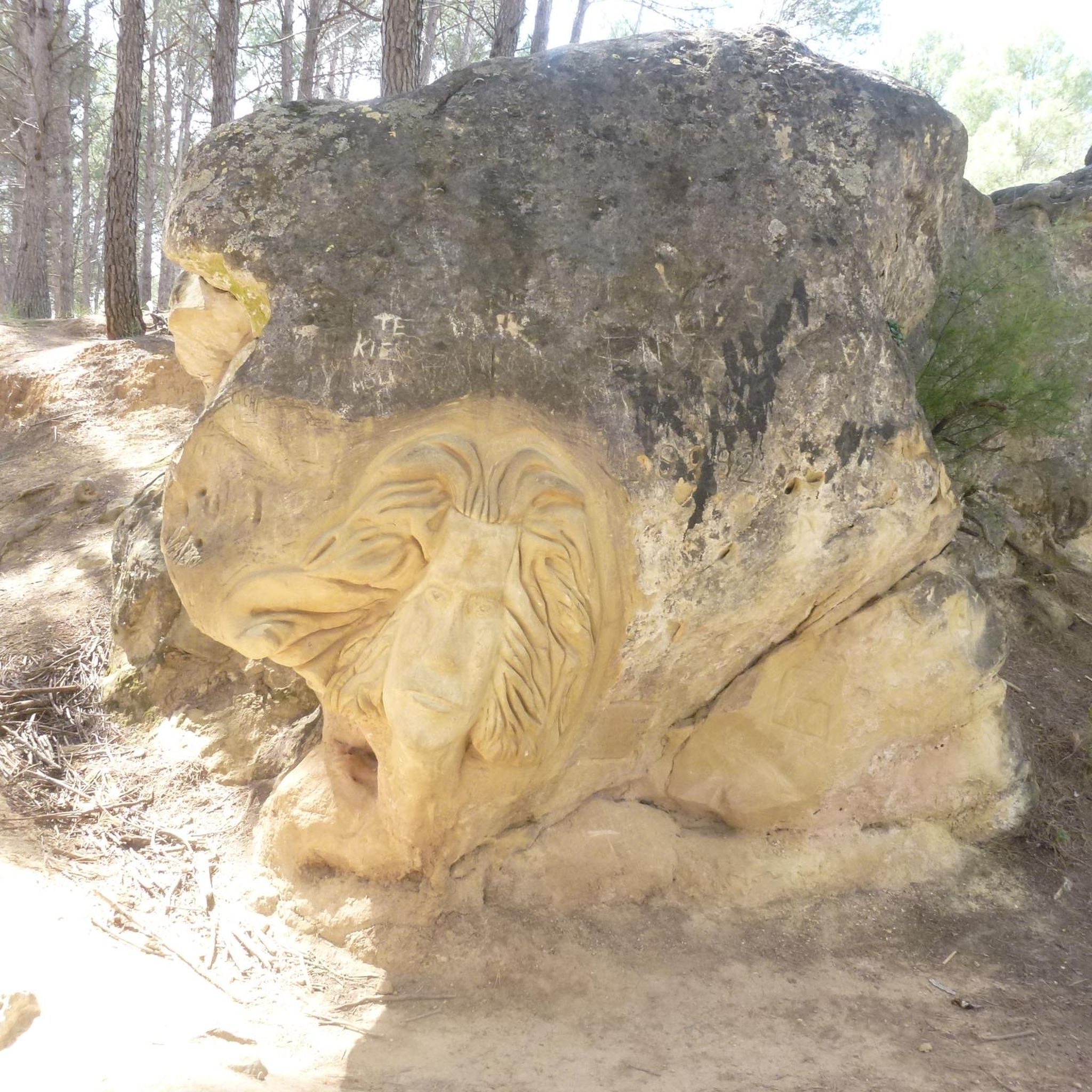
Free access tourist route located near the municipality of Buendía, Cuenca, among pine forests, sandstone stones abound. Here you will find the Ruta de las Caras, a hiking route of a couple of kilometers in which you will be accompanied by pine trees and allegorical sculptures. Faces sculpted in sandstone rock of different sizes, some spectacular, with dimensions of four and six meters, which took eight years to sculpt due to the hardness of the rock.
4
0

Exceptional site with these characters carved into the rock 🤩
0
1

A very entertaining route admiring the extraordinary work of the artists.
1
0
This time we went down to the River through the Presa tunnel.
1
0
The Embalse Dam and the entire area is very touristy, suitable for quiet hiking.
1
0

The medieval bridge of Auñón crosses the Tagus river near the Entrepeñas reservoir. It was built in the 14th century and is more than 80 meters long.
2
0
Frequently Asked Questions
What kind of terrain can I expect when touring cycling around Embalse de Buendía?
The area around Embalse de Buendía features a rugged, rocky terrain with hills and mountains densely forested with oak and pine trees. You'll encounter numerous cliffs and gorges, offering dramatic scenery. The clear blue waters of the reservoir provide a picturesque contrast, and the low population density ensures a tranquil cycling experience.
How many touring cycling routes are available in the Embalse de Buendía area?
There are over 10 touring cycling routes available around Embalse de Buendía on komoot, catering to various skill levels. These include easy loops, moderate paths, and more challenging routes.
Are there any easy touring cycling routes suitable for beginners or a relaxed ride?
Yes, for an easier ride, consider the Route of the Faces loop from Buendía. This 6.6-mile (10.6 km) trail takes you through pine woods and past unique rock carvings, typically completed in about 41 minutes.
What are some notable points of interest I can explore along the cycling routes?
Many routes offer access to unique attractions. A highlight is the "Ruta de las Caras" (Route of the Faces), where you can see approximately 20 sculptures carved into sandstone along the reservoir's edge. You can also visit the Buendía Dam and the Peña de la Virgen Viewpoint, which offers stunning panoramic views of the reservoir.
Are there any circular touring cycling routes around Embalse de Buendía?
Yes, many routes are circular. A popular option is the Route of the Faces and Buendía Reservoir — circular from Buendía, a 14.6-mile (23.5 km) moderate trail. Another is the Castejón — circular from Cañaveruelas, a 24.1-mile (38.8 km) moderate path exploring the broader landscape.
What is the best time of year to go touring cycling in Embalse de Buendía?
The region generally offers pleasant conditions for cycling outside of the peak summer heat. Spring and autumn provide milder temperatures and beautiful scenery, making them ideal for exploring the reservoir and its surroundings. Winters are generally mild but can be cooler.
Are there any family-friendly touring cycling routes in the area?
For families, the Route of the Faces loop from Buendía is a great choice. Its shorter distance and relatively easy terrain make it suitable for a relaxed outing with children, allowing time to enjoy the unique sandstone carvings.
What kind of wildlife might I encounter while cycling around Embalse de Buendía?
The Embalse de Buendía region is home to diverse wildlife. While cycling, you might spot various bird species, including eagles and vultures, soaring above the cliffs and gorges. Ibex are also known to inhabit the rugged terrain.
Are there any facilities like cafes or accommodation near the cycling routes?
While the region is known for its low population density, you can find cafes and accommodation in the nearby towns and villages surrounding the reservoir, such as Buendía. These spots offer opportunities to refuel and rest during or after your ride.
Where can I park my car when planning a touring cycling trip to Embalse de Buendía?
Parking is generally available in the towns and villages surrounding the reservoir, such as Buendía or Cañaveruelas, which serve as common starting points for many routes. Look for designated parking areas or inquire locally upon arrival.
What is the longest touring cycling route available in this guide?
The longest route featured in this guide is Azud de Pareja from Sacedón — circular by the Embalse de Entrepeñas. This difficult route covers approximately 30.7 miles (49.4 km) and involves significant elevation gain, offering a challenging ride with extensive views.
Most popular routes around Embalse de Buendía
Most popular attractions around Embalse de Buendía

Get inspired with the komoot mobile app


Explore more
Browse the best Cycling routes in other regions.
