The best running trails around Tievecrom
5.0
(4)
631
runners
52
runs
Jogging routes around Tievecrom provide diverse landscapes and varied terrain, ideal for dynamic running experiences. The region is characterized by rolling hills and the dramatic backdrop of Slieve Gullion, an extinct volcano, which offers elevated routes and panoramic views. Runners can explore serene forests and ancient stone paths, encountering constantly changing scenery across southern Armagh.
Best jogging routes around Tievecrom
- The most popular jogging route is Slieve Gullion running loop, a difficult 8.5 miles (13.6 km) trail that takes…
Last updated: November 10, 2026
21
runners
13.6km
01:44
450m
450m
1
runners
10.9km
01:13
160m
160m

1
runners
13.0km
01:23
160m
160m
Moderate run. Good fitness required. Mostly paved surfaces.
4.16km
00:32
140m
150m
Moderate run. Good fitness required. Mostly paved surfaces.
24
runners
6.70km
00:41
20m
20m
Moderate run. Good fitness required. Mostly paved surfaces.
Get access to more routes and recommendations from other explorers.
Already have an account?
Our route recommendations are based on thousands of hikes, rides, and runs completed by other people on komoot.
Start today with a free account
Your next adventure awaits.



Tips from the Community

Two joined medieval churches under Slieve Gullion. On our Ring Dyke climbing loop: cyclesoutharmagh.com/routes/the-ring-dyke
0
0
A Neolithic portal tomb, its huge capstone balanced on three stones at the end of a long cairn. A short spur off the road on our Poets' Trail and Ring Dyke rides: cyclesoutharmagh.com/routes/the-poets-trail
0
0

The Ballykeel Dolmen, also known as the "Witch's Chair", stands alone on the edge of a green river terrace and invites you to take a look back into the past. With its three supporting stones and the imposing capstone, over three metres long, the dolmen looks like a stone sculpture left behind by a long-forgotten culture. The simple but distinctive tripod shape is a testament to the archaic construction that attracted people to this place over 4000 years ago. Excavations around the dolmen have uncovered the remains of a stone mound and Neolithic pottery that tell of the rites and customs of this early community. When you stand among the stones, you feel the mystique of the place - a place that inspires the imagination then and now. Nearby you will find other megalithic structures such as the Portal Tomb of Aughadanove, which together reflect the rich archaeological heritage of the region.
1
0
In the middle of the forest, you suddenly find yourself standing in front of a bizarre stone creature - the "witch". She looks as if she has just risen from the mossy ground, with a mischievous smile and deep, expressive wrinkles on her face. This artfully designed stone is one of those unexpected encounters that transform the forest into a small adventure land. When you explore this magical place surrounded by old trees and whispering leaves, it almost seems as if the witch is greeting you with a wink. Here you can linger for a moment, enjoy the silence and let your imagination run wild - who knows what stories this forest still has to tell?
1
0


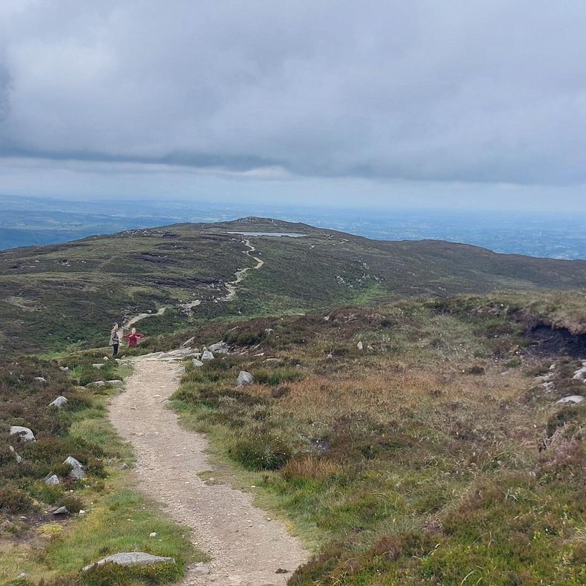
This small forest at the foot of Slieve Gullion seems to be straight out of a fairy tale. Running through it will leave you enchanted, and you'll come across curious sculptures like this giant witch's face.
0
0
To be able to see the Ballykeel dolmen, you'll need to take a small detour from Mill Road onto Ballykeel Road. Here, you can view the Ballykeel dolmen and cairn, which is dated between 4000 and 2500 BC
0
0
This section of Lough Road crosses the Cloverhill Golf Course, which you can catch glimpses of at certain points above the side bushes, with Slieve Gullion in the background.
0
0
Frequently Asked Questions
How many running routes are available around Tievecrom?
There are over 50 running routes around Tievecrom, offering a wide range of experiences from easy strolls to challenging ascents. The komoot community has explored 56 different trails in the area.
Are there easy running routes suitable for beginners in Tievecrom?
Yes, Tievecrom offers several easy running routes perfect for beginners. There are 9 routes classified as 'easy' that allow you to enjoy the scenic landscapes without significant elevation challenges. For a relatively flat and accessible option, consider the Running loop from Dundalk Stadium, which is just over 4 miles (6.7 km) with minimal elevation gain.
What kind of terrain can I expect on the jogging trails in Tievecrom?
The jogging trails around Tievecrom feature diverse terrain, ranging from serene forests and ancient stone paths to rolling hills and elevated routes on Slieve Gullion. You'll encounter constantly changing scenery, including varied landscapes and panoramic views across southern Armagh.
Are there any challenging running routes for experienced runners?
Absolutely. For experienced runners seeking a challenge, Tievecrom offers 15 difficult routes. The Slieve Gullion running loop is a particularly demanding option, covering 8.5 miles (13.6 km) with significant elevation gain around the extinct volcano.
What interesting landmarks or natural features can I see along the running routes?
Many running routes in Tievecrom pass by significant natural features and historical sites. You can explore the dramatic backdrop of Slieve Gullion Summit, visit the ancient North Cairn of Slieve Gullion, or discover the mystical Long Woman's Grave Memorial. Some trails also lead past the scenic Druids' Circle in Ravensdale Forest.
Are there any circular running routes in the Tievecrom area?
Yes, many of the running routes in Tievecrom are circular, allowing you to start and finish at the same point. For example, the popular The Poets Trails: Ballykeel running loop — Ring of Gullion is a moderate 8.1-mile (13.0 km) circular path winding through varied terrain.
What do other runners enjoy most about jogging in Tievecrom?
The running routes in Tievecrom are highly rated by the komoot community, with an average score of 5.0 stars. Runners frequently praise the diverse landscapes, the constantly changing scenery, and the breathtaking panoramic views that can extend across southern Armagh.
Are there family-friendly running trails in Tievecrom?
Yes, there are several routes suitable for families. The The Giant's Lair & Killeavy Castle — Ring of Gullion is a moderate 2.6-mile (4.2 km) trail that leads through woodland and past historical sites, offering an engaging experience for all ages.
Are dogs allowed on the running routes in Tievecrom?
Many trails in the Tievecrom and Slieve Gullion area are dog-friendly, but it's always recommended to keep your dog on a leash, especially in areas with livestock or wildlife. Check local signage for specific restrictions on individual routes.
Is there public transport access to the trailheads in Tievecrom?
While some trailheads might be accessible by local bus services, public transport options can be limited in rural areas like Tievecrom. It's advisable to check local bus schedules in advance or consider driving to the starting points, where parking is often available.
When is the best time of year to go running in Tievecrom?
Tievecrom offers a great running experience year-round, but the best time often depends on your preference. Spring and autumn provide pleasant temperatures and vibrant scenery. Summer is ideal for longer runs, while winter can offer crisp, clear days with unique views, though some higher routes on Slieve Gullion might be more exposed.
Are there any cafes or places to get refreshments near the running routes?
While the immediate trailheads might not always have facilities, the nearby towns and villages such as Forkhill and Newry offer various cafes, pubs, and accommodation options where you can refuel and relax after your run.
Most popular routes around Tievecrom
Most popular attractions around Tievecrom
Get inspired with the komoot mobile app


Explore more
Browse the best Running Trails & Routes in other regions.