The best MTB trails around Fathom Lower
5.0
(3)
207
riders
8
rides
Mountain biking around Fathom Lower features a landscape characterized by varied terrain, including forested areas, coastal paths, and mountainous sections. The region offers routes that traverse both natural and historical points of interest. Elevations vary, with some trails leading through hills and others offering more significant climbs. The area provides a mix of singletrack and wider paths suitable for mountain biking.
Best mountain bike trails around Fathom Lower
- The most popular mountain bike trail is Newry, Carnavaddy and Annaloughan Mountain…
Last updated: July 2, 2026
65.9km
05:37
1,280m
1,280m
Hard mountain bike ride. Very good fitness required. Advanced riding skills necessary.
9
riders
9.42km
00:47
170m
170m
Easy mountain bike ride. Great for any fitness level. Suitable for all skill levels.

Sign up for free
9
riders
70.2km
04:20
290m
290m
Moderate mountain bike ride. Good fitness required. Suitable for all skill levels.
7
riders
45.2km
03:00
190m
190m
Moderate mountain bike ride. Good fitness required. Suitable for all skill levels.
6
riders
63.4km
04:46
920m
920m
Hard mountain bike ride. Very good fitness required. Suitable for all skill levels.
Get access to more routes and recommendations from other explorers.
Sign up for free
Already have an account?
Our route recommendations are based on thousands of hikes, rides, and runs completed by other people on komoot.
Start today with a free account
Your next adventure awaits.
Login or Signup

Tips from the Community

This charming seaside town overlooks the Mourne Mountains, whose silhouette rises along the coast of Northern Ireland. Carlingford is very lively at weekends thanks to its many pubs and restaurants, which attract visitors from the north, and is famous for its oysters. The village has several historical sights, such as the small King John's Castle, with its romantic silhouette overlooking the sea, and Taaffe's Castle, a former 16th-century merchant's house located a little further from the quay.
6
0
The Tholsel is undoubtedly one of the most unique structures in the heart of Carlingford. This medieval city gate, originally built in the 15th century, is the only remaining gate from the original town wall and served for centuries as the ceremonial and administrative entrance to the town.
6
1
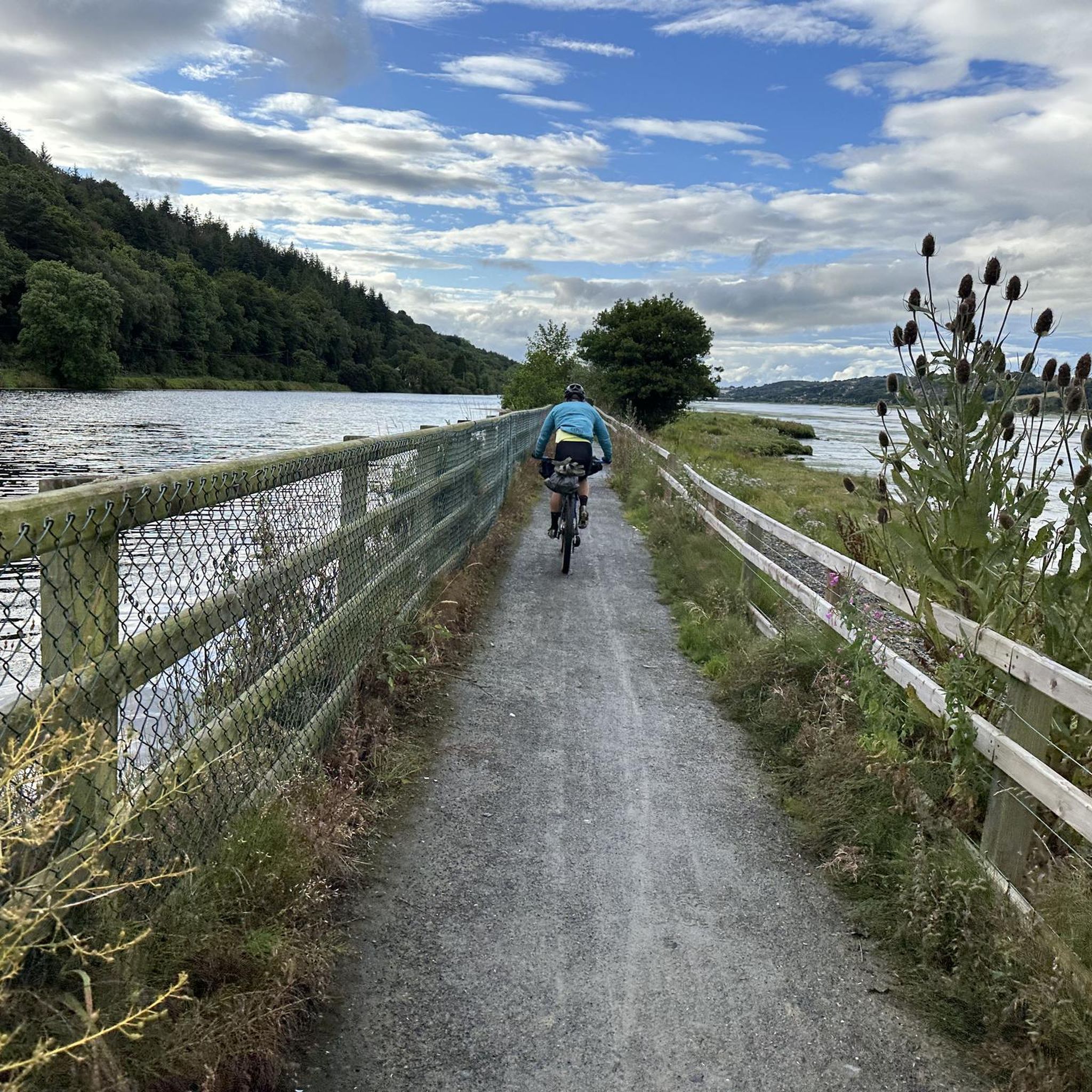
Once you leave the city of Newry behind, you cycle towards tranquility on An Bealach Glas, also known as the Carlingford Lough Greenway. This flat, smoothly asphalted path follows the banks of the canal and offers spectacular views of the river's mudflats along the way, where you can spot numerous wading birds and sometimes even a stray seal. The route is a true sensory experience: the salty sea air blows towards you while the mountains seem to get closer and closer. The absolute endpoint of this section is the historic Victoria Lock, an impressive lock complex from 1850 that marks the transition from the canal to the open waters of Carlingford Lough. It is the perfect place to get some fresh air and enjoy the maritime dynamics before continuing your journey to the coast.
6
0
Saint Patrick and Saint Colman's Cathedral is the architectural jewel of Newry and one of Ireland's most impressive Neo-Gothic structures. Construction began in 1825, and upon its completion in 1829, the cathedral made history as the first Catholic cathedral to open in Ireland following the repeal of the penal laws (Catholic Emancipation). Built from local granite from the nearby Mourne Mountains, this edifice exudes a robust yet elegant power. The cathedral is world-renowned for its fabulous interior: the walls and ceiling are adorned with colourful mosaics, meticulously applied by hand by Italian master craftsmen in the early 20th century. For the cyclist, this is not only a visual highlight along the route but also a place of serene tranquility. Its detailed stained-glass windows and monumental tower make it one of the city's most photographed locations and a worthy endpoint (or starting point) for your tour along the Newry Canal Towpath.
6
0
Here you will be treated to a magnificent view of the cathedral. The imposing tower of Saint Patrick and Saint Colman rises majestically above the city, dominating the skyline with its neo-Gothic architecture. This cathedral, completed in 1829, is unique as it was the first Catholic cathedral built in Ireland after the relaxation of the penal laws. From this point, you can see the beautiful texture of the local granite from the Mourne Mountains, from which the church is built.
5
0
Taaffe's Castle is a fortified merchant's house dating from the early 16th century, built by the wealthy Taaffe family, who later became the Earls of Carlingford. Situated near the old harbour, the building originally served as a trading post on the ground floor with residential floors above. The architecture displays typical defensive features such as machicolations, narrow loopholes, spiral staircases, and multi-level garderobes. [curiousireland.ie], [castles.nl], [carlingfor...centre.com] The main structure is a four-storey rectangular tower, later extended with a 16th-century northern extension. Its location and construction clearly demonstrate Carlingford's importance as a thriving trading town during that period. After the 17th century, it fell into disuse, and eventually fell into disuse. Today, it forms part of a pub complex and remains a striking example of medieval urban defensive architecture in Carlingford.
6
1

Carlingford Castle, also known as King John’s Castle, is a striking 12th-century fortress overlooking the charming medieval town of Carlingford and its scenic harbour. Built by Hugh de Lacy to guard the strategic Lough, the castle has a commanding presence with its weathered stone walls and rugged silhouette against the water. Though partially in ruins, it still captures the atmosphere of Ireland’s Norman past, and its elevated position offers sweeping views of the surrounding mountains and coastline.
2
2
The Táin Way is a 40 kilometre (25 mi) circular hiking trail that starts and ends in Carlingford. Named after the ancient Irish epic "Táin Bó Cúailnge", the route winds through the Cooley Peninsula, offering a mix of coastal views, forest paths, and mountain tracks. Typically completed over two days, the trail includes a total ascent of about 1,025 meters and is marked with yellow arrows on a black background. Along the way, hikers encounter historical sites like Bronze Age cairns and enjoy panoramic vistas of Carlingford Lough and the Mourne Mountains. Alternative trailheads are available at Omeath and Ravensdale, providing flexibility for different starting points. Please note that dogs are not permitted on farmland sections of the trail.
1
0
Frequently Asked Questions
How many mountain bike trails are available around Fathom Lower?
There are 9 mountain bike trails around Fathom Lower listed in this guide. These routes offer a mix of moderate and difficult options, catering to various skill levels.
What is the general difficulty level of mountain biking trails in Fathom Lower?
The mountain bike trails around Fathom Lower are predominantly moderate, with 7 routes falling into this category. There are also 2 more difficult trails for experienced riders seeking a challenge.
Are there any family-friendly mountain biking options in Fathom Lower?
While specific 'easy' routes are not highlighted, many of the moderate trails, especially those winding through forested areas or along coastal paths, can be suitable for families with some mountain biking experience. Always check the route details for elevation and terrain before heading out.
What kind of terrain can I expect on mountain bike trails in Fathom Lower?
The region offers varied terrain, including forested areas, coastal paths, and mountainous sections. You'll find a mix of singletrack and wider paths, with elevations varying from gentle hills to more significant climbs.
What are some notable natural attractions I can see while mountain biking in Fathom Lower?
While exploring the trails, you can encounter several natural monuments. Consider visiting Slieve Gullion Summit for expansive views, or the North Cairn of Slieve Gullion and Calliagh Beara's Lough. The area is characterized by rugged terrain and diverse habitats.
Are there any historical sites or landmarks along the mountain bike routes?
Yes, several routes pass by historical points of interest. For example, the Ruins in Ravensdale Forest – Ravensdale Creek loop from Drumnasillagh winds through dense forest, passing historical ruins. You might also encounter sites like the Druids' Circle in Ravensdale Forest or the Long Woman's Grave Memorial.
What do other mountain bikers say about the trails in Fathom Lower?
The mountain bike routes in Fathom Lower are highly rated by the komoot community, with an average score of 5.0 stars from over 3 reviews. Many mountain bikers praise the varied terrain, which includes coastal paths, forested trails, and challenging mountain loops.
Are there any long-distance mountain bike loops for experienced riders?
For experienced riders looking for a longer challenge, the Newry, Carnavaddy and Annaloughan Mountain loop is a difficult 41.0-mile (65.9 km) trail offering challenging climbs and expansive mountain views. Another option is the Warrenpoint Shore Road – Carlingford Castle loop from Rostrevor, a 43.6-mile (70.2 km) coastal route.
Can I find mountain bike routes that offer coastal views in Fathom Lower?
Absolutely. Mountain biking around Fathom Lower is defined by coastal paths. The Warrenpoint Shore Road – Carlingford Castle loop from Rostrevor is a prime example, leading through coastal areas and past historical sites.
Are there any mountain bike trails that pass through forests?
Yes, several trails wind through forested areas. The Ruins in Ravensdale Forest – Ravensdale Creek loop from Drumnasillagh is a moderate path that takes you through dense forest, following a creek and passing historical ruins.
What is the best time of year for mountain biking in Fathom Lower?
Given the varied terrain including coastal paths and forested areas, spring and autumn generally offer pleasant temperatures and beautiful scenery. Summer can also be great, but always check local weather conditions, especially for mountainous sections.
Are there any mountain bike routes that include castles or other man-made monuments?
Yes, you can incorporate historical structures into your ride. The Bagenal's Castle loop from Warrenpoint is a moderate route that includes a visit to the castle. Additionally, the Warrenpoint Shore Road – Carlingford Castle loop from Rostrevor passes by Carlingford Castle.
Most popular attractions around Fathom Lower

Get inspired with the komoot mobile app


Explore more
Browse the best MTB trails in other regions.
