The best running trails around Lake Sfundau
44
runners
9
runs
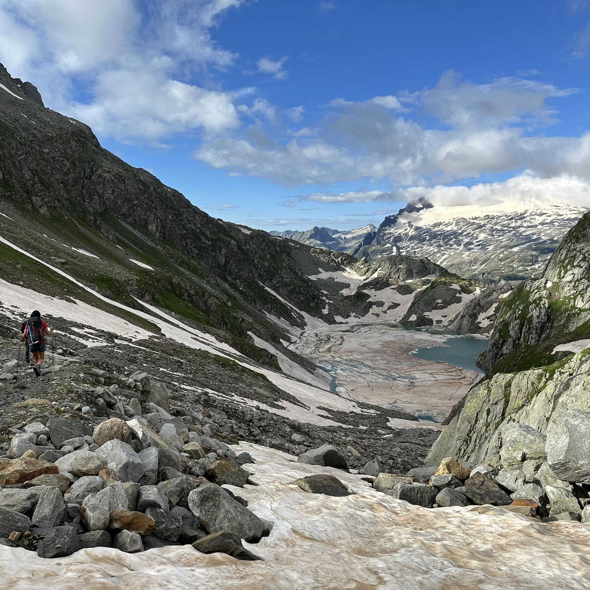
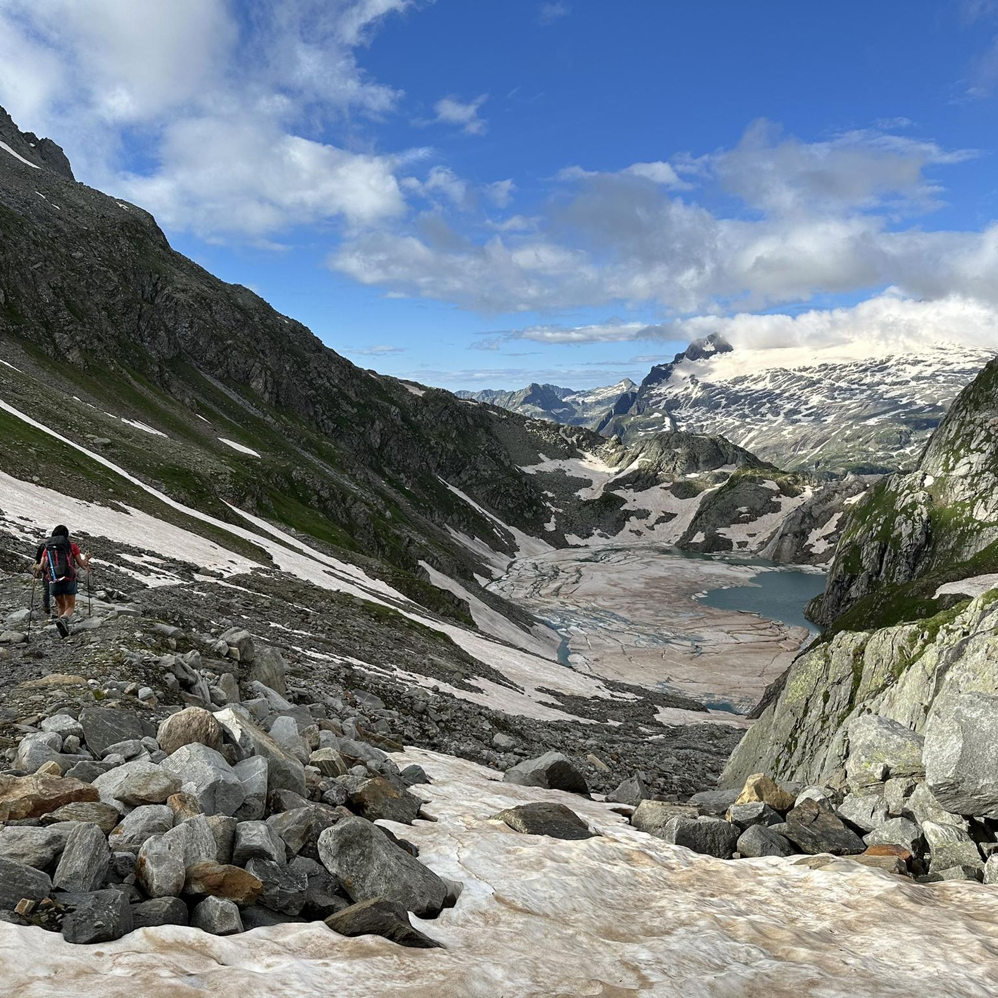
Jogging routes around Lake Sfundau are set within a high-alpine landscape in Ticino, Switzerland, characterized by rugged mountain peaks and a serene environment. The area features a succession of lakes, including Lago Bianco and Lago di Robiei, and offers views of the Basòdino glacier. Trails leading to and around Lake Sfundau present a mixed terrain of both asphalt and natural paths, often traversing alpine meadows and barren mountain landscapes with glittering rock formations. Runners should note the high altitude of…
Last updated: October 1, 2026
11.8km
02:29
750m
750m
Hard run. Very good fitness required. Sure-footedness, sturdy shoes and alpine experience required.
2
runners
3.73km
00:27
100m
90m
Easy run. Great for any fitness level. Mostly paved surfaces. Suitable for all skill levels.

8
runners
10.8km
01:57
600m
600m
Hard run. Very good fitness required. Sure-footedness, sturdy shoes and alpine experience required.
5
runners
6.68km
00:48
150m
150m
Moderate run. Good fitness required. Mostly paved surfaces. Suitable for all skill levels.
7
runners
13.9km
02:27
720m
720m
Hard run. Very good fitness required. Sure-footedness, sturdy shoes and alpine experience required.
Get access to more routes and recommendations from other explorers.
Already have an account?
Our route recommendations are based on thousands of hikes, rides, and runs completed by other people on komoot.
Start today with a free account
Your next adventure awaits.


Tips from the Community


A great hiking area with several reservoirs and the glacier
0
0

Ristorante, Hotel Locanda Orelli. Kitchen closed at 2:20 p.m., very unfriendly staff.
0
0

The Capanna Cristallina is an alpine refuge located in the Canton of Ticino, in the Lepontine Alps, at almost 2,600 meters above sea level. It is open all year round and has beds, showers, refreshments and electricity. It can be reached from various locations, including Ossasco, Robiei and the Narèt dams. It is a starting point for ascents and traverses, especially for experienced runners, given the terrain and altitude conditions.
1
1
The Naret pass is an Alpine pass that connects Val Sambuco with Val Torta and Val Bedretto in the Canton of Ticino. It is located at the foot of Pizzo del Naret, at 2,438 meters above sea level. Nearby you can admire the Naret lakes and the Cristallina hut, offering various trail running possibilities especially for expert runners, given the terrain and altitude conditions.
1
0
Lake Naret is an alpine lake in the Canton of Ticino. It is located at an altitude of 2310 meters above sea level and is formed by the Naret dam, which uses the waters of the Maggia river to produce electricity. It is surrounded by a spectacular landscape, with mountains, forests and other lakes.
1
0
The Ri di Ronco watercourse forms a small suggestive waterfall here. A wooden walkway allows the passage of the path of the four sources, which connects the sources of the Rhine, Reuss, Ticino and Rhone rivers, crossing the cantons of Uri, Grisons, Ticino and Valais.
0
0
Frequently Asked Questions
What kind of terrain can I expect on running routes around Lake Sfundau?
The trails around Lake Sfundau offer a diverse surface, including both asphalt and natural paths. You'll traverse picturesque alpine pastures and barren mountain landscapes with glittering rock formations, providing a visually stimulating experience for your run.
Are there any easy jogging routes suitable for beginners or families near Lake Sfundau?
Yes, there are options for easier runs. For instance, the Robiei – Lago di Robièi loop from Lago dei Cavagnöö is an easy 2.3-mile (3.7 km) path that provides a scenic run around alpine lakes with varied surfaces, making it suitable for those looking for a less strenuous option.
What are the notable natural features or landmarks I might see while running in the Lake Sfundau area?
The region boasts stunning high-alpine scenery, including spectacular views of the Basòdino glacier. You'll also encounter a succession of beautiful lakes, such as Lago Bianco and Lago di Robiei, and a small waterfall graces the edge of Lake Sfundau itself. The trails often pass through alpine meadows and past unique rock formations.
What is the overall difficulty level of running trails around Lake Sfundau?
The routes around Lake Sfundau offer a range of difficulties. While some are considered easy, like the Robiei – Lago di Robièi loop, many are more challenging, with 8 out of 10 routes in the area rated as difficult. Runners should be prepared for high-alpine conditions and potential steep ascents.
Are there any circular running routes available near Lake Sfundau?
Yes, several circular routes are available. The Robiei – Lago di Robièi loop from Lago dei Cavagnöö is an easy option, and the Four Sources Trail Loop offers a longer, more challenging circular run through high-alpine valleys.
What is the best time of year to go running around Lake Sfundau?
Given its high-alpine setting at nearly 2,400 meters, the best time for running is typically during the warmer months when trails are free of snow and ice. Summer and early autumn offer the most favorable conditions, though runners should always check local weather and trail conditions before heading out.
Can I reach the Lake Sfundau area using public transport?
While the guide focuses on the routes themselves, the region around Lake Sfundau, particularly areas like Robiei, is generally accessible via public transport options such as cable cars from San Carlo in Val Bavona, which connect to higher elevations. It's advisable to check specific schedules and connections for your starting point.
Are there parking facilities available near the running trailheads?
Access points to the Lake Sfundau area, such as Robiei, typically have parking facilities, especially for those arriving by car to use the cable car or start their routes. Specific parking availability and fees should be checked for your chosen starting location.
What do other runners say about the trails in Lake Sfundau?
The running routes in Lake Sfundau are highly rated by the komoot community, with an average score of 5.0 stars. Runners often praise the stunning high-alpine scenery, the breathtaking views of the Basòdino glacier, and the varied terrain that makes for an inspiring run.
Is the high altitude a factor to consider when planning a run near Lake Sfundau?
Yes, Lake Sfundau is situated at an elevation of nearly 2,400 meters. This high altitude can impact performance and may require some acclimatization, especially for those not accustomed to running at such heights. It's important to be aware of this and plan your run accordingly.
Are there any longer, more challenging running routes in the area?
For experienced runners seeking a challenge, routes like Run along the Val Torta between Capanna Cristallina and Lago del Naret offer a difficult 7.3-mile (11.8 km) trail with significant elevation changes and expansive views across the high-alpine terrain.
Can I find a mountain hut or refuge along the running trails?
Yes, the modern Capanna Cristallina mountain hut is a significant attraction in the area. It's located about 1.5 hours further than Lago Sfundau from Robiei along popular trails, offering a comfortable stopover and extensive panoramic views from its sunlit terrace.

Get inspired with the komoot mobile app


Explore more
Browse the best Running Trails & Routes in other regions.
