The best running trails in Perry County
9
runs
Jogging routes in Perry County, Pennsylvania, traverse a landscape characterized by narrow valleys, steep ridges, and extensive forests. The region features rolling hills and diverse terrain, with nearly 90% of the land protected as public or farmland. Runners can explore areas like the Tuscarora State Forest, sections of the Appalachian Trail, and Little Buffalo State Park. The Susquehanna and Juniata Rivers also define the county's eastern edge and central flow, offering scenic backdrops for outdoor activity.
Best jogging routes in Perry County
- The most popular jogging route is Mogan Ridge Trail Loop, a 15.1 miles (24.3 km) trail that takes 2 hours 56 minutes to complete. This difficult route features significant elevation gain through forested terrain.
- Another top favourite among local runners is Tipsaw Lake Trail, a moderate 5.9 miles (9.6 km) path. This route offers a pleasant experience around Tipsaw Lake, with minimal elevation changes.
- Local runners also love the Saddle Lake Trail, a 2.6 miles (4.2 km) trail leading through lakeside scenery, often completed in about 26 minutes.
- Jogging in Perry County is defined by extensive forests, rolling hills, and river valleys. The network offers options for different ability levels, from easy lakeside paths to challenging ridge trails.
- The guide includes highly-rated routes that showcase the best of the region's landscape. More than 1 runner has used komoot to explore Perry County's varied terrain.
Last updated: October 10, 2026
9.57km
01:09
60m
60m
The Tipsaw Lake Trail offers a moderate jogging experience, covering 5.9 miles (9.6 km) with an elevation gain of 206 feet (63 metres). You can expect to complete this route in about 1 hour and 8 minutes. As you jog, you'll move through a diverse hardwood forest, which often gives way to fragrant pine sections, creating soft needle beds underfoot. The trail consistently provides picturesque views of Tipsaw Lake and the surrounding valley, with several overlooks offering great vantage points. Be prepared for varied terrain, including roots, small rocks, and creek beds, especially on the more technical segment between Tipsaw Beach and the dam, where you'll encounter steeper inclines.
Planning your visit to the Tipsaw Lake Trail is straightforward, as it's part of the Tipsaw Lake Recreation Area. You can begin your jogging adventure from one of three distinct trailheads. One of these trailheads, located within the recreation area itself, conveniently offers water and toilet facilities. Parking is generally available at all access points, making it easy to start your journey. The recreation area also provides amenities like a beach and picnic spots, perfect for relaxing after your jog.
This loop in Hoosier National Forest provides a rewarding experience, immersing you in a natural setting. The consistent views of Tipsaw Lake are a highlight, offering a serene backdrop to your workout. The trail's blend of hardwood and pine forests showcases the diverse ecology of the region. It's a great option if you're looking for a quick workout in a scenic environment, combining physical activity with natural beauty.
19.7km
02:06
310m
310m
Embark on a challenging jogging adventure along the Two Lakes Loop Trail, a difficult route spanning 12.2 miles (19.7 km) through the Hoosier National Forest. You will gain 1008 feet (307 metres) in elevation, a workout that typically takes around 2 hours and 6 minutes to complete. The trail offers frequent, scenic views of Indian Lake and Lake Celina as you navigate through dense deciduous and hardwood forests, providing a constantly changing landscape.
When planning your visit, be aware that portions of the trail can become muddy and slippery, especially after rainfall or during cooler periods. You will encounter several stream crossings; some may be knee-deep depending on recent precipitation. For your safety during late fall hunting seasons, it is advisable to wear blaze orange.
This route is notable for its maintained wildlife openings, where you might spot deer or turkey. The area truly comes alive in the fall, with the changing leaves creating a vibrant and colorful backdrop for your run. It is a rewarding experience for those seeking a demanding workout amidst natural beauty.

18.3km
02:20
330m
330m
Prepare for a challenging jogging experience on the German Ridge Trail, a difficult route spanning 11.4 miles (18.3 km) with a significant 1093 feet (333 metres) of elevation gain. You can expect to complete this varied terrain in about 2 hours and 20 minutes. As you jog, you will move through constantly changing landscapes, from tall pine stands to rolling hardwood forests. Keep an eye out for impressive views of the Ohio River and unique sandstone rock outcrops, such as the Glacial Boulders. The trail also features wildlife ponds and small waterfalls, adding to its natural beauty.
When planning your visit to the German Ridge Trail, be aware that it is a multi-use path. You will share the route with hikers, mountain bikers, and horses, so always yield to horses and make your presence known. For the best experience, consider visiting from late fall to early spring. This period offers fewer crowds and helps you avoid ticks. Primitive camping is available nearby if you are looking to extend your outdoor adventure.
Located within the Hoosier National Forest, the German Ridge Trail offers a deep dive into the region's diverse ecosystems. You will encounter areas of tall prairie grasses alongside the dense woodlands. The trail's unique sandstone formations, including the Glacial Boulders, highlight the geological history of the area. This route is ideal if you are seeking a substantial run through varied natural settings, providing a true sense of wilderness in southern Indiana.
4.20km
00:26
20m
30m
Lace up your jogging shoes for an easy loop around Saddle Lake, a refreshing escape within the Hoosier National Forest. This scenic route stretches for 2.6 miles (4.2 km) and features a gentle elevation gain of just 82 feet (25 metres), making it perfect for a quick outing. You can comfortably complete this jog in about 26 minutes, enjoying the peaceful atmosphere as the path winds through a pleasant mix of hardwoods and conifers. The views of Saddle Lake itself are a constant companion, offering a serene backdrop to your run.
Planning your visit to the Saddle Lake Trail is straightforward, as it is part of the broader Saddle Lake Recreation Area. You will find parking readily available at the trailhead, ensuring an easy start to your activity. There are no specific warnings regarding permits, fees, or seasonal closures for this particular route, so you can generally plan your jog with ease. This makes it a convenient option for spontaneous outdoor adventures.
Beyond the immediate jogging experience, the area around Saddle Lake is known for its opportunities to observe local wildlife. As you move along the trail, keep an eye out for various creatures that call this natural setting home. This route offers a peaceful immersion into the Hoosier National Forest, providing a chance to connect with nature and enjoy the quiet beauty of the surroundings.
24.3km
02:56
330m
330m
Prepare for a difficult jogging experience on the Mogan Ridge Trail Loop, covering 15.1 miles (24.3 km) with a challenging 1082 feet (330 metres) of elevation gain, typically taking around 2 hours and 56 minutes. As you jog, you'll move through diverse landscapes, from dense hardwood forests featuring oak and hickory to stands of tall pines. Keep an eye out for interesting rock outcroppings and seasonal wildflowers, especially daffodils near an old homestead. From the ridge tops, you might catch scenic glimpses of the Ohio River and distant hills, adding to the rewarding views.
Before you head out, be aware that the trail features varied terrain, including wide rutted paths, gravel roads, and narrow natural sections. Cell service can be unreliable in this area, so plan accordingly and download your route offline. There are no restrooms or other facilities along the way, and water sources can be scarce, especially during dry periods. Make sure to carry enough water for the entire 15.1 miles (24.3 km) of your run.
This route takes you through the picturesque Hoosier National Forest, offering a chance to experience its rich natural environment. A notable highlight is passing through the Clover Lick Wildflower Meadows, providing open grassy areas amidst the forest. The diverse scenery, from towering trees to open meadows, makes this loop a distinctive option for a demanding jog in the region.
7.21km
00:49
120m
120m
Embark on a moderate jogging route along the Oriole West Trail Cliffs via Orange Grove Trail, covering 4.5 miles (7.2 km) with an elevation gain of 378 feet (115 metres). You can expect to complete this scenic journey in about 49 minutes. The trail guides you through an old pine forest before descending into a picturesque valley where a creek flows, offering a diverse and engaging experience for your run. As you climb to the ridge tops, you will be rewarded with beautiful views, passing sections where large rocks line the path with the creek visible below.
Before you head out, be aware that there are no restrooms or sources of potable water available at the trailhead, so plan accordingly. The trail can become quite muddy, especially after rain, and may be heavily impacted by horse traffic in certain areas. Preparing for these conditions will ensure a more comfortable and enjoyable jogging experience on the route.
This trail is situated within the Hoosier National Forest, providing a rich natural backdrop for your activity. Keep an eye out for the historic Doan Cemetery, a notable landmark located just off the trail, which adds a unique historical element to your journey. The route also offers glimpses of Oriole Lake, enhancing the natural beauty and setting it apart as a distinctive option for joggers in the region.
12.9km
01:36
230m
230m
Lace up your jogging shoes for the German Ridge Trail, a moderate route that takes you through the diverse landscapes of the Hoosier National Forest. This 8.0-mile (12.9 km) journey involves a steady 750 feet (229 metres) of elevation gain, typically completed in about 1 hour and 36 minutes. As you jog, you will encounter tall pine stands and impressive sandstone rock outcroppings. Keep an eye out for the picturesque German Ridge Lake, a highlight offering scenic bluffs and stone steps, which you can explore further on a separate loop.
Planning your visit to the German Ridge Trail is straightforward, with parking generally available at various trailheads within the Hoosier National Forest. The route is part of a multi-use trail system, so be prepared to share the path with mountain bikers and horseback riders; remember to yield to them. The trail's unique "ladder style" design also allows you to combine smaller loops, offering flexibility to customize your jogging distance.
This trail stands out for its varied terrain, moving from dense pine forests to areas with rolling hills covered in hardwood. Beyond the main route, you might spot wildlife ponds and small waterfalls, particularly from late fall to early spring. The German Ridge Trail offers a dynamic experience for those looking to jog through a rich natural environment.
3.31km
00:20
0m
0m
Lace up for an easy jogging experience on the Tell City Riverwalk, a flat, paved path stretching 2.1 miles (3.3 km). You'll enjoy continuous views of the Ohio River as you move, with a minimal elevation gain of just 11 feet (3 metres). This route is perfect for a quick 20-minute outing. The trail winds through Sunset Park, offering a pleasant atmosphere for your jog. Keep an eye out for the vibrant murals along the floodwall within the park, adding a splash of local history to your run.
Accessing the Riverwalk is straightforward, making it a convenient choice for your next jog. You'll likely find parking available close to Sunset Park, which serves as a great starting point. The entire route is paved and flat, ensuring it's suitable for everyone, including those with strollers or wheelchairs. Within Sunset Park, you'll also find handy amenities like restrooms and picnic areas, perfect for a post-jog break. Consider an early morning or late afternoon visit for cooler temperatures and pleasant light.
The Tell City Riverwalk offers more than just a place to jog; it's a window into the local community and its heritage. The colorful murals along the floodwall in Sunset Park specifically depict stories from Tell City's past, providing an engaging backdrop. Being a family-friendly area, Sunset Park itself is a notable feature, enhancing the overall experience. This trail stands out as an accessible way to connect with the Ohio River and local culture.
2.08km
00:13
0m
0m
Set out for an easy jogging experience on the Windy Creek Trail, a paved 8-foot-wide asphalt path that gently winds through a pleasant wooded area within Hagedorn Park. This route offers a peaceful escape where you can enjoy the sounds of nature as you run alongside the actual Windy Creek. Covering a distance of 1.3 miles (2.1 km) with a minimal elevation gain of just 7 feet (2 metres), it is perfect for a quick and refreshing outing. You can expect to complete this easy jog in about 12 minutes, making it an ideal choice for a short, invigorating run.
Planning your visit to the Windy Creek Trail is straightforward, as this easily accessible, shared-use path is located within Hagedorn Park. You will find ample parking available directly within the park, which makes it very convenient whether you are looking for a quick stop or a longer outing. The trail is suitable for jogging at most times of the day, offering a consistent surface for your run. Since it is a shared-use path, remember to be mindful of other visitors enjoying the park.
The Windy Creek Trail stands out as a well-maintained, dedicated jogging path that provides a consistent and smooth surface for your activity. Its location within Hagedorn Park means you are surrounded by a natural setting, offering a pleasant change of scenery from urban environments. The trail's design, following the gentle curves of Windy Creek, creates a serene atmosphere for your workout. This route is a great option if you are seeking a short, low-impact exercise in a tranquil park setting.
Our route recommendations are based on thousands of hikes, rides, and runs completed by other people on komoot.
Start today with a free account
Your next adventure awaits.

Other adventures in Perry County

Tips from the Community

The Windy Creek Trail is considered an easy trail and flat trail. It is fully paved and runs through Hagedorn Park. At peak times, the trail can be busy, so make sure to be respectful of other users.
0
0
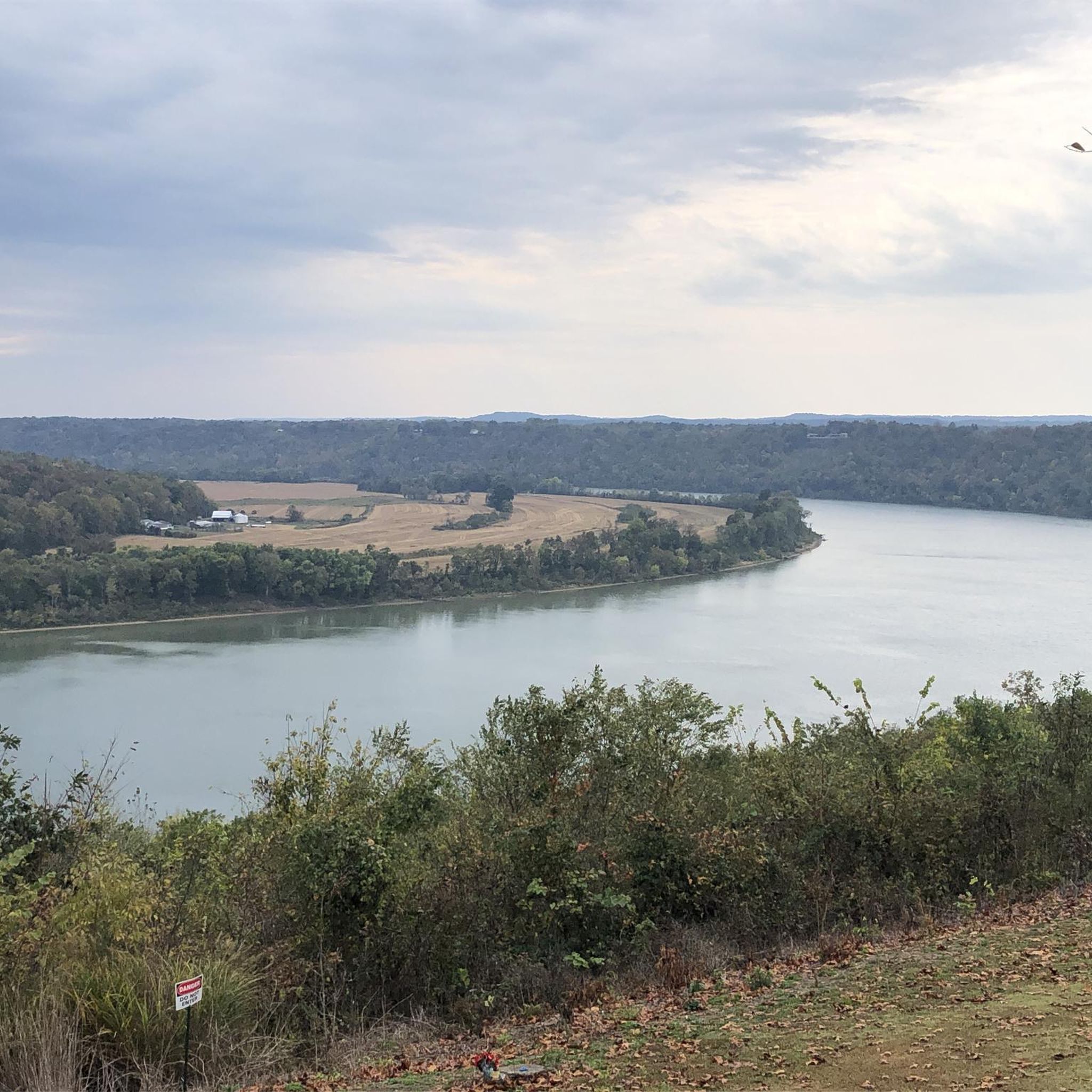
Sunset Park is a beautiful park on the banks of the Ohio River. There is a paved path that runs the length of the park and gives you a great view of the river the entire time. There is a picnic area but no restrooms or water.
0
0

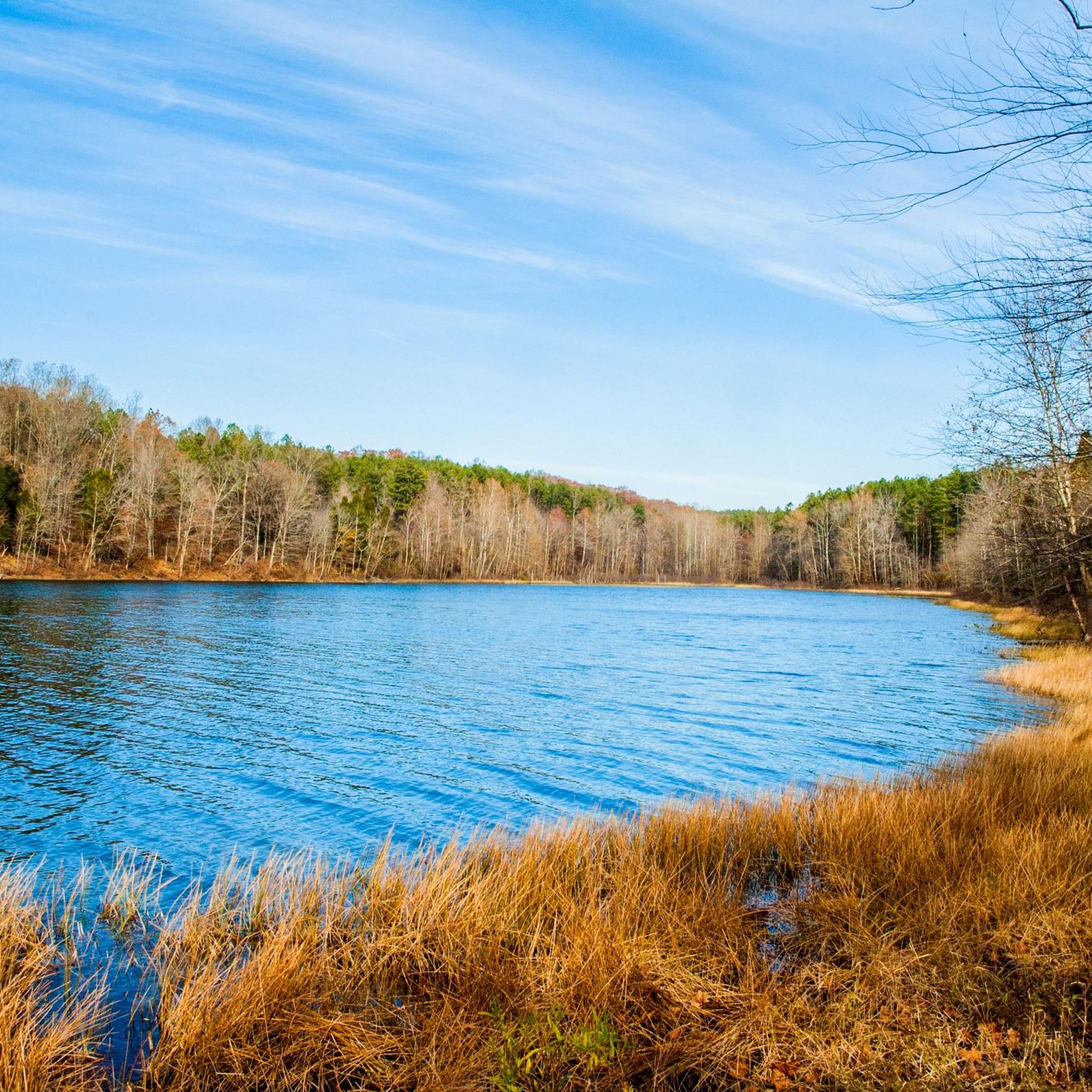
The lake offers opportunities for swimming and picnicking. The recreation area nearby is a great family-friendly area area that includes a beach.
0
0
Oriole Lake can be found just a 5-minute walk up the Oriole West Trail from the parking area. You cannot swim in the lake as it is technically a reservoir, so there is a danger of underwater machinery. Fishing is allowed on the lake, and it is a popular destination for anglers.
0
0
Carved from the natural sandstone in the region, these cliffs have been eroded over thousands of years by wind and water. They can be found alongside the trail and make for a great place to stop and have a picnic.
0
0
Tipsaw Lake is a popular recreation area in Perry County. There are 6 miles of trails for hiking and biking, campsites and picnic areas. The lake is also popular for fishing and boating.
0
0
Saddle Lake is less busy than other parts of Hoosier National Forest, and you can feel like you have it all to yourself. The area is a great place for a paddle or swim.
0
0
Carved from the natural sandstone in the region, these cliffs have been eroded over thousands of years by wind and water. They can be find alongside the trail and make for a great place to stop and have a picnic.
0
0
Frequently Asked Questions
How many running trails are available in Perry County?
Perry County offers a selection of 9 diverse running trails, catering to various fitness levels. These routes traverse the region's characteristic narrow valleys, steep ridges, and extensive forests, providing a scenic backdrop for your run.
Are there easy or beginner-friendly jogging routes in Perry County?
Yes, Perry County has several easy running routes perfect for beginners or those seeking a relaxed pace. For instance, the Saddle Lake Trail is a pleasant 2.6-mile path around the lake, and the Tell City Riverwalk offers a gentle 2-mile experience. Another easy option is the Windy Creek Trail, which is just over a mile long.
Can I find challenging running routes with significant elevation in Perry County?
Absolutely. For experienced runners looking for a challenge, Perry County's terrain with its steep ridges provides excellent options. The Mogan Ridge Trail Loop is a demanding 15.1-mile route with substantial elevation gain. Another difficult option is the Two Lakes Loop Trail, spanning over 12 miles with significant climbs.
Are there any running routes that offer scenic viewpoints or natural landmarks?
Yes, many routes in Perry County showcase the region's natural beauty. The Appalachian Trail, which traverses the county, features overlooks like Hawk Rock, providing spectacular valley views. While not a specific komoot route in this guide, the region's extensive forests and rolling hills ensure picturesque scenery on most trails. You can also explore the Glacial Boulders on German Ridge Trail for a unique natural landmark.
Are there any circular running routes in Perry County?
Many of the running routes in Perry County are designed as loops, offering a continuous and varied experience. Examples include the challenging Mogan Ridge Trail Loop and the scenic Two Lakes Loop Trail. The Tipsaw Lake Trail also offers a pleasant loop around the lake.
What kind of natural areas can I explore while running in Perry County?
Perry County is rich in natural areas, with nearly 90% of its land protected. You can run through sections of the vast Tuscarora State Forest, which includes unique spots like the Hemlocks Natural Area, a virgin forest designated as a National Natural Landmark. Little Buffalo State Park also offers wooded trails and the picturesque Holman Lake. The Susquehanna and Juniata Rivers provide scenic backdrops along the county's edges.
Are there any running routes near lakes or rivers in Perry County?
Yes, several routes offer beautiful lakeside scenery. The Tipsaw Lake Trail provides a pleasant run around Tipsaw Lake, while the Saddle Lake Trail runs alongside Saddle Lake. The Tell City Riverwalk also offers a route along the Ohio River, which forms part of the county's natural boundaries.
What is the terrain like on Perry County's running trails?
The terrain in Perry County is quite varied, reflecting its diverse landscape. You'll encounter narrow valleys, steep ridges, and extensive forests. Routes can range from mostly flat, paved surfaces near lakes and rivers to challenging, unpaved trails with significant elevation changes through rolling hills and wooded areas. This variety ensures options for all preferences, from gentle jogs to strenuous runs.
What do other runners enjoy most about the trails in Perry County?
Runners often praise the extensive forests, rolling hills, and river valleys that define the running experience in Perry County. The region's uncrowded nature, with nearly 90% protected public or farmland, contributes to a peaceful and immersive outdoor experience. The variety of trails, from easy lakeside paths to challenging ridge routes, is also highly appreciated by the komoot community.
Are there any specific trails within Tuscarora State Forest for running?
Tuscarora State Forest, a vast 96,000-acre area, offers numerous trails suitable for running. While specific komoot routes in this guide might not be exclusively within its boundaries, the forest's diverse terrain and extensive trail network provide ample opportunities for exploration. A notable feature within the forest is the Hemlocks Natural Area, a 140-acre virgin forest with three miles of trails, offering a unique running environment. For more information on the natural areas within Tuscarora State Forest, you can visit pa.gov.
Can I find running routes that are less crowded in Perry County?
Given that nearly 90% of Perry County is protected public or farmland, the region generally offers a less crowded outdoor experience compared to more urban areas. Trails within the vast Tuscarora State Forest or along less-trafficked sections of the Appalachian Trail are good options for those seeking solitude. Even popular routes like the German Ridge Trail provide ample space to enjoy nature without feeling overwhelmed.
Most popular attractions in Perry County

Get inspired with the komoot mobile app


Explore more
Browse the best Running Trails & Routes in other regions.
