The best walks and hikes in Roanoke city
4.2
(15)
336
hikers
30
hikes
Hiking in Roanoke city offers access to an extensive network of trails within Virginia's Blue Ridge Mountains. The region is characterized by diverse terrain, including forested hills, river valleys, and prominent peaks. Hikers can explore a variety of landscapes, from urban greenways to mountain trails with significant elevation changes. This area provides numerous opportunities for outdoor activity, catering to different skill levels.
Best hiking trails in Roanoke city
- The most popular hiking route is Mill Mountain & Roanoke Star loop…
Last updated: October 10, 2026
5.0
(1)
7
hikers
7.36km
02:14
300m
180m
Hike the moderate 4.6-mile Monument, Big Sunny and Star Trail in Roanoke, Virginia, gaining 1000 feet to see the Roanoke Star.
1
hikers
3.05km
00:49
40m
40m
Easy 1.9-mile loop hike through verdant forests on Chestnut Ridge, offering a quick and accessible outdoor escape near Roanoke.

1
hikers
49.9km
12:52
250m
270m
Hike the difficult 31.0-mile Roanoke River Greenway, offering diverse scenery along the river and through parks in Roanoke Valley Greenways.
3.04km
00:47
10m
20m
The Roanoke River Greenway from Vic Thomas Park offers a delightful, easy hike along the river, perfect for a relaxed outing. This 1.9-mile (3.0 km) route, with only 34 feet…
3.62km
00:58
40m
50m
The Murray Run Greenway and Hillside Trail Loop offers a refreshing blend of urban convenience and natural beauty, making it one of the top rated loop hikes in Roanoke, VA.…
4.5
(4)
38
hikers
5.58km
01:43
210m
220m
Hike the easy 3.5-mile Star and Monument Trail Loop in Mill Mountain Park to see the iconic Roanoke Star and panoramic valley views.
14
hikers
6.74km
01:43
20m
20m
The Roanoke River Greenway offers a delightful and accessible hiking experience, winding alongside the Roanoke River with continuous views. You'll traverse predominantly paved paths, encountering a diverse landscape that blends…
7
hikers
9.77km
02:51
260m
260m
Hike the moderate 6.1-mile Mill Mountain Park Loop for panoramic views of Roanoke and the Blue Ridge Mountains from the iconic Roanoke Star.
4
hikers
6.72km
01:52
130m
130m
Hike the easy 4.2-mile Chestnut Ridge Trail in Roanoke, Virginia, offering forest paths, mountain views, and diverse wildlife.
2.76km
00:43
10m
10m
Embark on a pleasant urban exploration with the Downtown Roanoke loop, an easy 1.7-mile (2.8 km) hike that guides you through the city's vibrant core. With only 41 feet (13…
Get access to more routes and recommendations from other explorers.
Already have an account?
Our route recommendations are based on thousands of hikes, rides, and runs completed by other people on komoot.
Start today with a free account
Your next adventure awaits.
Tips from the Community

Parking area at the bottom is closed (Near Dollar General). We parked across the street and walked the gravel up to Star Trail Trailhead.
0
0

The Memorial Bridge of Roanoke supports the Roanoke River Greenway and has wide sidewalks on both sides of the car lanes that bikes use. The bridge has two-lane traffic and spans 785 feet across the Roanoke River. While riding here, pay attention and find all five plaques, with quotes from Patrick Henry, Theodore Roosevelt, Stonewall Jackson, and Thomas Jefferson. The last plaque has the names of World War I victims.
0
0
Wasena Park is a green space along the Roanoke River. The Roanoke River Greenway bike-friendly path runs through the park, and the park offers a playground, two picnic shelters, the Roanoke Skate Park, a baseball diamond, a basketball court, ADA-accessible picnic shelters with tables, lights at night, electrical outlets, and grills, as well as ADA-accessible restrooms.
0
0

The Taubman Museum of Art began as a temporary exhibit at the Hotel Roanoke in 1947. The current 81,000 square foot museum was designed by famed architect Randall Stout. The museum houses both a permanent collection and rotating exhibitions throughout the year. The best part...general admission is free!
0
0
The Market Square Walkway was built in 1995 to connect the newly renovated Hotel Roanoke with Historic Downtown Roanoke. Trainspotters will enjoy the panoramic view over one of the most active railway corridors in the US.
0
0
Roanoke's City Market is the oldest continuously operating markets in Virginia, getting its start in 1882. In addition to the excellent food on offer the surrounding historic district is home to other attractions such as the Roanoke Pinball Museum.
0
0
The historic Hotel Roanoke & Conference Center was first built in 1882. Since then it has been rebuilt, expanded, and updated multiple times. Its distinctive Tudor Revival style has made it a landmark of Roanoke.
0
0
Chestnut Ridge offers wide, well graded trails just off of the Mill Mountain Parkway. The hiking isn't too strenuous and makes for a good family outing.
0
0
Frequently Asked Questions
How many hiking trails are available in Roanoke city?
Within Roanoke city, you can find around 14 distinct hiking routes, ranging from easy strolls to more challenging moderate ascents. The wider Roanoke region, nestled in Virginia's Blue Ridge Mountains, boasts over 700 miles of trails, including a significant portion of the Appalachian Trail.
Are there any easy, family-friendly hiking options in Roanoke city?
Yes, Roanoke city offers several easy trails suitable for families. The Roanoke River Greenway — Roanoke is a flat and accessible path following the river, perfect for a leisurely walk. Another great option is the Mill Mountain & Roanoke Star loop, which is an easy 3.5-mile trail offering views of the iconic Roanoke Star.
Where can I find scenic viewpoints or landmarks along the trails?
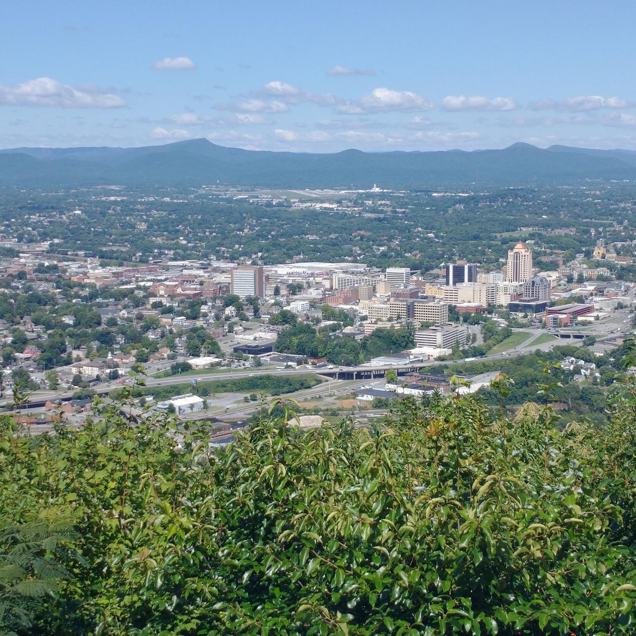
Many trails in Roanoke city lead to rewarding views. The Mill Mountain & Roanoke Star loop takes you to the famous Roanoke Star on Mill Mountain, offering panoramic vistas of the city and surrounding mountains. Mill Mountain Park itself provides 20-60 mile views. For a different perspective, the View of Roanoke Mountain – Roanoke Mountain Loop Road loop from Southern Hills also offers excellent scenic opportunities.
Are there any circular or loop hikes available?
Absolutely. Many of Roanoke's trails are designed as loops, providing varied scenery without retracing your steps. Popular choices include the Mill Mountain & Roanoke Star loop, the Mill Mountain loop via Monument Trail — Roanoke, and the Chestnut Ridge loop from Fern Park — Roanoke. These offer diverse experiences from urban views to forested paths.
What do other hikers enjoy most about hiking in Roanoke city?
The hiking trails in Roanoke city are highly regarded by the komoot community, with an average rating of 3.3 stars. Hikers frequently praise the accessibility of trails that offer both urban convenience and stunning natural beauty, particularly the rewarding views from Mill Mountain and the serene experience of the greenways.
Are there any trails that feature waterfalls or unique natural attractions?
While the immediate city trails focus more on mountain views and greenways, the wider Roanoke region is rich in natural wonders. A short drive will take you to destinations like Bottom Creek Gorge Preserve, home to Virginia's second-highest waterfall, or Falls Ridge Natural Preserve, which features an 80-foot spring-fed travertine waterfall and intriguing caves. Carvins Cove Natural Reserve also offers extensive trails around its reservoir.
What are some longer or more challenging hiking options in Roanoke city?
For those seeking a longer or more challenging hike within the city, consider the Stone Mountain loop from Carilion Roanoke Memorial Hospital, which is over 11 km and moderate in difficulty. Another good option is the Roanoke City Market – Mill Mountain Star loop from Roanoke, a 10 km moderate route that combines urban exploration with a climb up Mill Mountain.
Is public transport available to reach hiking trailheads in Roanoke city?
Many trails in Roanoke city, especially those closer to downtown or along the greenways, are accessible by public transport or are within walking distance of urban areas. For specific routes like the Roanoke River Greenway or trails on Mill Mountain, local bus services may provide convenient access. It's advisable to check the Roanoke Valley Metro website for current routes and schedules.
Where can I find parking for hiking trails in Roanoke city?
Parking is generally available at or near many trailheads. For trails on Mill Mountain, there are designated parking areas. Greenways often have access points with parking lots. For routes starting in downtown areas, public parking garages and street parking are options. Always check local signage for any parking restrictions or fees.
Are there any urban walks or trails that explore downtown Roanoke?
Yes, you can explore the city's urban landscape on foot. The Downtown Roanoke loop is an easy 2.7 km walk that takes you through the heart of the city. Another option is the Hotel Roanoke & Basilica of Saint Andrew loop — Roanoke, offering a shorter, easy stroll past notable city architecture.
What is the best time of year to go hiking in Roanoke city?
Roanoke offers great hiking opportunities year-round. Spring brings blooming wildflowers and mild temperatures, while autumn showcases spectacular fall foliage in the Blue Ridge Mountains. Summer is popular, but be prepared for warmer weather. Winter hiking can be beautiful, especially after a fresh snowfall, though some higher elevation trails might require appropriate gear.
Are there any trails that connect to the Blue Ridge Parkway?
While the trails listed here are primarily within Roanoke city, the Blue Ridge Parkway is a major feature of the wider Roanoke region, known as 'America's Favorite Drive.' It provides access to hundreds of miles of hiking trails and numerous overlooks. Many regional trails, including those leading to the Virginia Triple Crown, can be accessed via the Parkway, offering extensive options for longer excursions outside the immediate city limits.
Most popular routes in Roanoke city
Most popular attractions in Roanoke city

Get inspired with the komoot mobile app


Explore more
Browse the best Hikes in other regions.
