The best road cycling routes in Caldwell County
4.0
(1)
47
riders
8
rides
Road cycling routes in Caldwell County are situated in the foothills of the Blue Ridge Mountains, offering a diverse landscape for cyclists. The region features mountainous terrain, including Hibriten Mountain, and is bordered by the Pisgah National Forest. Rivers such as the Catawba and Yadkin, along with Lake Rhodhiss, contribute to the varied topography. The area also includes established greenways providing paved paths for cycling.
Best road cycling routes in Caldwell County
- The most popular road cycling route is Wimberley…
Last updated: July 15, 2026
18
riders
58.9km
03:04
520m
520m
Moderate road ride. Good fitness required. Mostly well-paved surfaces and easy to ride.
71.8km
02:56
200m
200m
Moderate road ride. Good fitness required. Mostly well-paved surfaces and easy to ride.

Sign up for free
12
riders
43.6km
01:52
190m
190m
Easy road ride. Great for any fitness level. Mostly well-paved surfaces and easy to ride.
4
riders
96.5km
04:13
720m
720m
Moderate road ride. Good fitness required. Mostly well-paved surfaces and easy to ride.
6
riders
33.4km
01:46
200m
200m
Easy road ride. Great for any fitness level. Mostly well-paved surfaces and easy to ride.
4.0
(1)
3
riders
33.8km
01:38
140m
140m
Easy road ride. Great for any fitness level. Mostly well-paved surfaces and easy to ride.
4
riders
40.1km
02:00
290m
290m
Moderate road ride. Good fitness required. Mostly well-paved surfaces and easy to ride.
Our route recommendations are based on thousands of hikes, rides, and runs completed by other people on komoot.
Start today with a free account
Your next adventure awaits.
Login or Signup



Tips from the Community

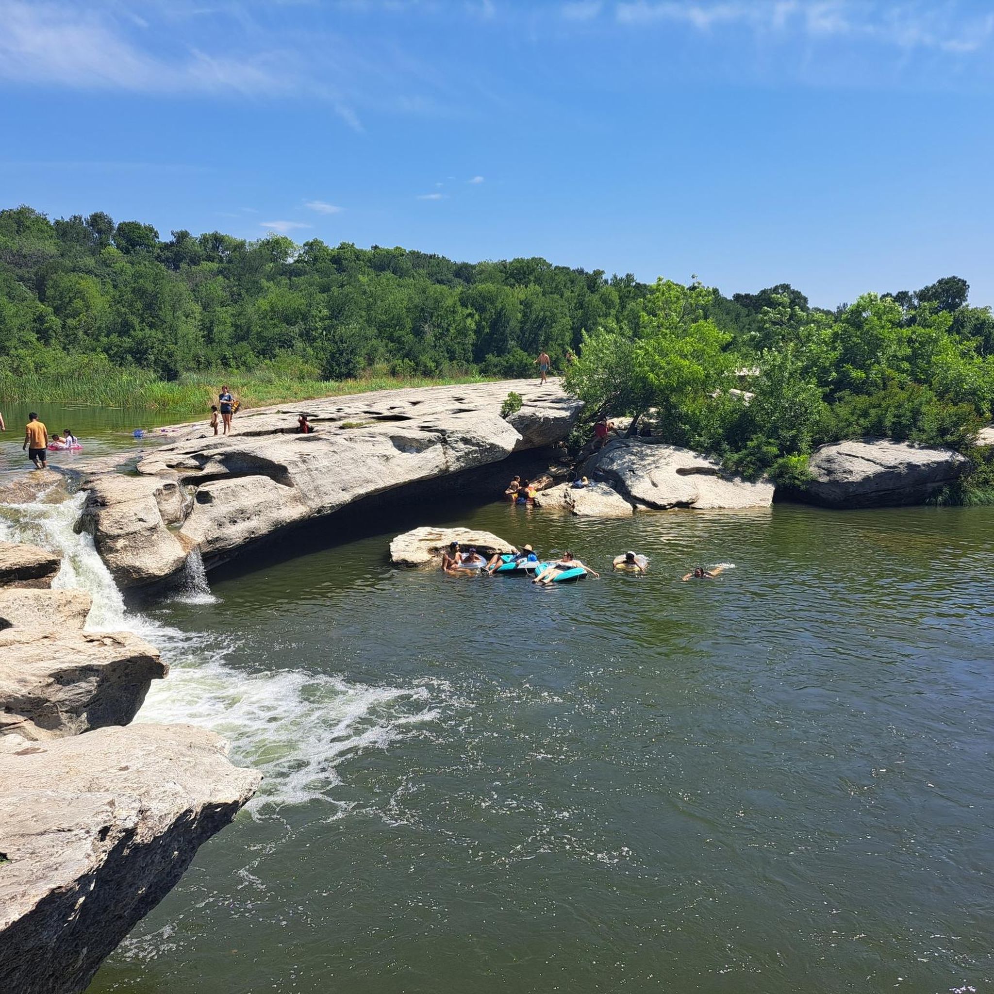
By the bridge to the park there are giant stone steps leading down to the azure water of the San Marcos River. This is a popular spot for swimming, tubing, and other outdoor activities. Once you cross the bridge into the park you have access to some partially shaded dirt paths which take you through the trees and down to the water.
0
0
This trailhead has great access to Purgatory Creek and views of Five Mile Dam. Some of trails are packed singletrack and some have room for multiple people to walk side by side. You have access to a variety of trails with both nontechnical terrain and rock gardens.
0
0

Wimberley is on the list of "America's Ten Best Small Towns" due to its picturesque beauty and charming small-town atmosphere. There is plenty of adventure with hiking trails, swimming holes, caves, and ziplines. Wimberley also offers wineries, breweries, and a variety of restaurants and bars.
0
0

Canyon Lake was created by damming the Guadalupe river, and is now a brilliant place for locals to go and swim, fish and sail. A fine place to stop mid ride for a break.
0
0

The best sausages in town at Smitty's BBQ. Old style building with the vibe of Texas.
0
0
Side roads to Kyle from downtown Austin are really cool and the way back is worth the effort. This road makes for a beautiful low traffic ride.
0
0
Frequently Asked Questions
How many road cycling routes are available in Caldwell County?
Caldwell County offers a selection of 9 road cycling routes on komoot, catering to various skill levels. These routes range from easy rides to more challenging ascents through the region's diverse terrain.
What are some easy road cycling routes in Caldwell County?
For those seeking a more relaxed ride, Caldwell County has 4 easy road cycling routes. A good option is the Red Hill loop from Luling, which covers 33.3 km with a manageable elevation gain of 197 meters. Another easy choice is the Smitty's Market BBQ loop from Lockhart, a 33.8 km route with 140 meters of elevation gain.
Are there any challenging road cycling routes in Caldwell County?
Yes, Caldwell County features routes with significant elevation changes for experienced cyclists. The region's mountainous terrain, including the Blue Ridge Mountains, provides a challenging backdrop. While specific routes with extreme elevation are not detailed in the guide, you can expect climbs on routes like the River Road – Canyon Lake loop from San Marcos Station, which covers 92 km with over 725 meters of ascent.
What kind of terrain can I expect on road cycling routes in Caldwell County?
Road cycling in Caldwell County offers a mix of terrain. You'll find routes winding through the foothills of the Blue Ridge Mountains, offering scenic vistas and elevation changes. The region also features river valleys and established greenways, providing smoother, often flatter paved paths for a different cycling experience.
What natural features or landmarks can I see while road cycling in Caldwell County?
Caldwell County is rich in natural beauty. You can expect views of the Blue Ridge Mountains and potentially distant glimpses of Hibriten Mountain. Routes may pass near rivers like the Catawba and Yadkin, or offer views of Lake Rhodhiss. While specific routes aren't tied to every landmark, the general area is close to attractions like Wilson Creek Wilderness Area with its waterfalls, and the expansive Pisgah National Forest.
Are there any loop trails for road cycling in Caldwell County?
Yes, many of the road cycling routes in Caldwell County are designed as loops. For instance, the River Road – Canyon Lake loop from San Marcos Station and the Red Hill loop from Luling are excellent examples of circular routes that allow you to start and finish at the same point.
What do other road cyclists say about the routes in Caldwell County?
The road cycling routes in Caldwell County are highly regarded by the komoot community, holding an average rating of 4.0 stars from over 40 visitors. Cyclists often appreciate the varied terrain, which includes both challenging climbs and scenic, more relaxed sections.
Are there family-friendly road cycling options in Caldwell County?
For family-friendly cycling, the established greenways in Caldwell County are ideal. The City of Lenoir Greenway offers over 9 miles of paved paths, including the T.H. Broyhill Walking Park, which are suitable for cyclists of all ages. The Yadkin River Greenway also provides a 7-mile paved trail with scenic views, perfect for a relaxed family ride.
What is the best time of year for road biking in Caldwell County?
Caldwell County's location in the foothills of the Blue Ridge Mountains suggests pleasant cycling conditions during spring and fall, when temperatures are moderate and the scenery is vibrant with blooming flowers or autumn foliage. Summer can be warm, while winter may bring colder temperatures and potential for icy conditions at higher elevations.
Are there any road cycling routes that offer significant elevation gain?
Yes, for those looking for a workout, routes like the Eagle Mountain – Wimberley loop from San Marcos Station offer substantial elevation gain, with nearly 700 meters of ascent over 81.5 km. The region's mountainous character ensures plenty of opportunities for climbing.
Where can I find longer road cycling routes in Caldwell County?
If you're looking for longer rides, Caldwell County has several options. The River Road – Canyon Lake loop from San Marcos Station is one of the longest, stretching over 92 km. Another extended route is the Eagle Mountain – Wimberley loop from San Marcos Station, which covers 81.5 km.
Are there any greenways suitable for road cycling in Caldwell County?
Absolutely. Caldwell County offers excellent greenway options for road cyclists. The City of Lenoir Greenway provides over 9 miles of paved paths, including the main greenway and the T.H. Broyhill Walking Park. Additionally, the Yadkin River Greenway features a 7-mile paved trail, offering smooth surfaces and scenic views for a comfortable ride.
Most popular routes in Caldwell County

Get inspired with the komoot mobile app


Didn’t find what you were looking for?
Check out more Road cycling routes throughout Caldwell County below and find the perfect route in your destination.
Explore more
Browse the best Road cycling routes in other regions.
