The best running trails in Schuylkill County
37
runners
11
runs
Jogging in Schuylkill County offers diverse landscapes for runners. The region features rolling hills, dense forested areas, and riverside paths, providing varied terrain and elevation. An extensive network of trails, including sections of the Appalachian Trail and the Schuylkill River Trail, caters to different fitness levels. State parks like Locust Lake and Swatara also contribute to the numerous running opportunities.
Best jogging routes in Schuylkill County
- The most popular jogging route is River of Rocks and Skyline Trail Loop, a 6.3 miles (10.1 km) trail that takes 1 hour 27 minutes to complete. This challenging route features unique boulder fields and offers expansive views.
- Another top favourite among local runners is Pulpit Rock and Appalachian Trail Loop, a difficult 6.1 miles (9.8 km) path. This trail provides panoramic views over the Lehigh Valley and follows a section of the renowned Appalachian Trail.
- Local runners also love the Hamburg Reservoir loop via Appalachian Trail, a 7.9 miles (12.7 km) trail leading through forested areas and past the Hamburg Reservoir, often completed in about 1 hour 45 minutes.
- Jogging in Schuylkill County is defined by forested mountains, river valleys, and sections of the Appalachian Trail. The network offers options for different ability levels, from moderate riverside paths to difficult mountain trails.
- The guide includes highly-rated routes that showcase the best of the region's landscape. More than 30 runners have used komoot to explore Schuylkill County's varied terrain.
Last updated: July 2, 2026
2
runners
10.1km
01:27
410m
410m
Prepare for a challenging jogging experience on the River of Rocks and Skyline Trail Loop. This difficult route stretches for 6.3 miles (10.1 km) and demands a significant climb of 1357 feet (414 metres). You will navigate through the distinctive "River of Rocks" boulder fields, a unique geological feature that defines part of the terrain. The journey, estimated to take around 1 hour and 27 minutes, offers a vigorous workout as you traverse varied landscapes within Hawk Mountain Sanctuary. Expect a dynamic environment that keeps your run engaging from start to finish.
When planning your visit, you will find that the River of Rocks and Skyline Trail Loop is generally accessible within Hawk Mountain Sanctuary. Parking is usually available directly at the sanctuary's trailhead, making it convenient to start your jogging adventure. While the trail is rated difficult, the paths themselves are well-defined, which helps with navigation. Consider starting early in the day to make the most of your time and avoid potential crowds, especially during peak seasons. Always check the sanctuary's official website for any specific operating hours or visitor guidelines before you head out.
This trail stands out for its unique geological formations, particularly the "River of Rocks" boulder fields, which are a natural wonder to observe. These ancient rock flows create a distinctive landscape unlike typical forest trails. The route also incorporates sections of the Skyline Trail, offering diverse views and a comprehensive experience of Hawk Mountain Sanctuary's natural beauty. It's an excellent choice if you are seeking a trail that combines a strenuous physical challenge with remarkable natural features.
2
runners
12.7km
01:45
440m
440m
Prepare for a challenging jogging experience on the Hamburg Reservoir loop via Appalachian Trail, a difficult route spanning 7.9 miles (12.7 km). You will gain 1437 feet (438 metres) in elevation, which typically takes about 1 hour and 44 minutes to complete. As you jog, you will pass the serene Hamburg Reservoir and navigate varied terrain, from gravel roads to rocky ascents, all within a great forest setting.
When planning your visit, be aware that this route features a mix of surfaces, including dirt paths and notably rugged, rocky sections, especially on the climbs. Due to the uneven ground and substantial elevation gain, proper footwear with sturdy ankle support is highly recommended for your safety and comfort. Good fitness and sure-footedness are essential to navigate the steep grades effectively.
This challenging loop is located within Pennsylvania State Game Lands Number 110, offering a unique blend of natural beauty and demanding terrain. As you ascend, you will be rewarded with spectacular panoramic views of Pennsylvania farmlands and the distant city of Reading from popular viewpoints like Pulpit Rock and The Pinnacle. Keep an eye out for wildflowers and local wildlife as you explore this notable regional trail.

Sign up for free
1
runners
9.77km
01:20
320m
320m
The Pulpit Rock and Appalachian Trail Loop offers a true taste of Pennsylvania's rugged beauty, often called 'Rocksylvania' for good reason. You'll navigate significant rocky sections and boulder fields, especially on the initial climb to Pulpit Rock and The Pinnacle, which reward your effort with stunning panoramic views of the Lehigh Valley and surrounding farmland. After these premier overlooks, the trail softens, transitioning to less rocky fire roads that wind through peaceful wooded areas, providing a varied and engaging landscape for experienced trail runners.
This difficult 6.1-mile (9.8 km) jogging route, with its 1047 feet (319 metres) of elevation gain, is estimated to take around 1 hour and 20 minutes. It's a popular spot, so arriving early on weekends is a smart move to secure parking and enjoy the trail before it gets too crowded. Proper footwear with excellent ankle support is non-negotiable for tackling the technical terrain, and always be mindful of potential wildlife, including venomous snakes, especially on warm, sunny rocks.
Beyond the challenging terrain and incredible vistas, this loop offers a chance to experience a section of the iconic Appalachian Trail. You'll encounter interesting geological features, including rock formations and boulder fields, and even a small tectonic cave near The Pinnacle. It's a fantastic choice for those seeking a demanding trail run with high scenic payoff, providing a memorable outdoor adventure in Berks County, Pennsylvania.
15.8km
02:06
420m
420m
Tackle The Pinnacle via Appalachian Trail, a difficult 9.8-mile route with 1384 feet of elevation gain and panoramic views.
8
runners
This challenging loop from Hamburg Reservoir takes you on a journey through diverse landscapes, from serene forest paths to rugged, rocky sections. The highlight is undoubtedly the breathtaking panoramic views from both Pulpit Rock and The Pinnacle, offering expansive vistas of the Lehigh Valley and distant farmland. You'll navigate steep ascents and boulder fields, especially along the Appalachian Trail portion, making for a truly engaging experience.
To tackle this difficult 12.0-mile (19.3 km) route with 2254 feet (687 metres) of elevation gain, plan for about 2 hours and 40 minutes of jogging. The trail starts from the Hamburg Reservoir parking lot. Sturdy footwear is essential due to the rocky terrain, and be prepared for sections where you may need to slow down or walk. It's a rewarding effort for those seeking a technical run with big views.
This loop is notable for featuring two of the most spectacular viewpoints along the Pennsylvania section of the Appalachian Trail. The trail passes through State Game Lands Number 106, offering a connection with the natural environment, including hemlocks and rhododendrons. Keep an eye out for potential wildlife, including venomous snakes, particularly during warmer months.
8
runners
18.3km
01:55
150m
150m
Hard run. Very good fitness required. Mostly paved surfaces. Suitable for all skill levels.
4
runners
7.67km
00:49
50m
50m
Moderate run. Good fitness required. Mostly paved surfaces. Suitable for all skill levels.
6
runners
19.1km
01:58
60m
60m
Hard run. Very good fitness required. Mostly paved surfaces. Suitable for all skill levels.
4
runners
8.29km
00:52
50m
50m
Moderate run. Good fitness required. Mostly paved surfaces. Suitable for all skill levels.
Get access to more routes and recommendations from other explorers.
Sign up for free
Already have an account?
Our route recommendations are based on thousands of hikes, rides, and runs completed by other people on komoot.
Start today with a free account
Your next adventure awaits.
Login or Signup



Tips from the Community

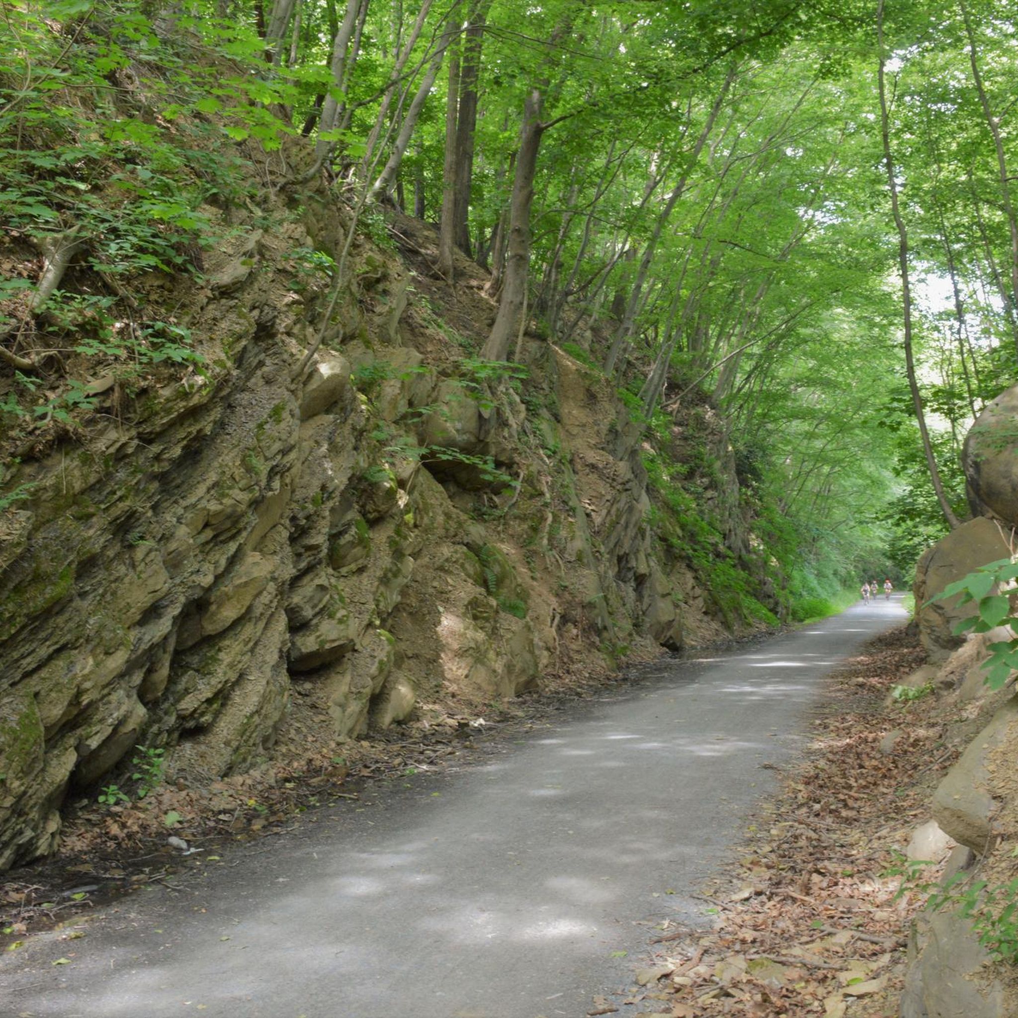
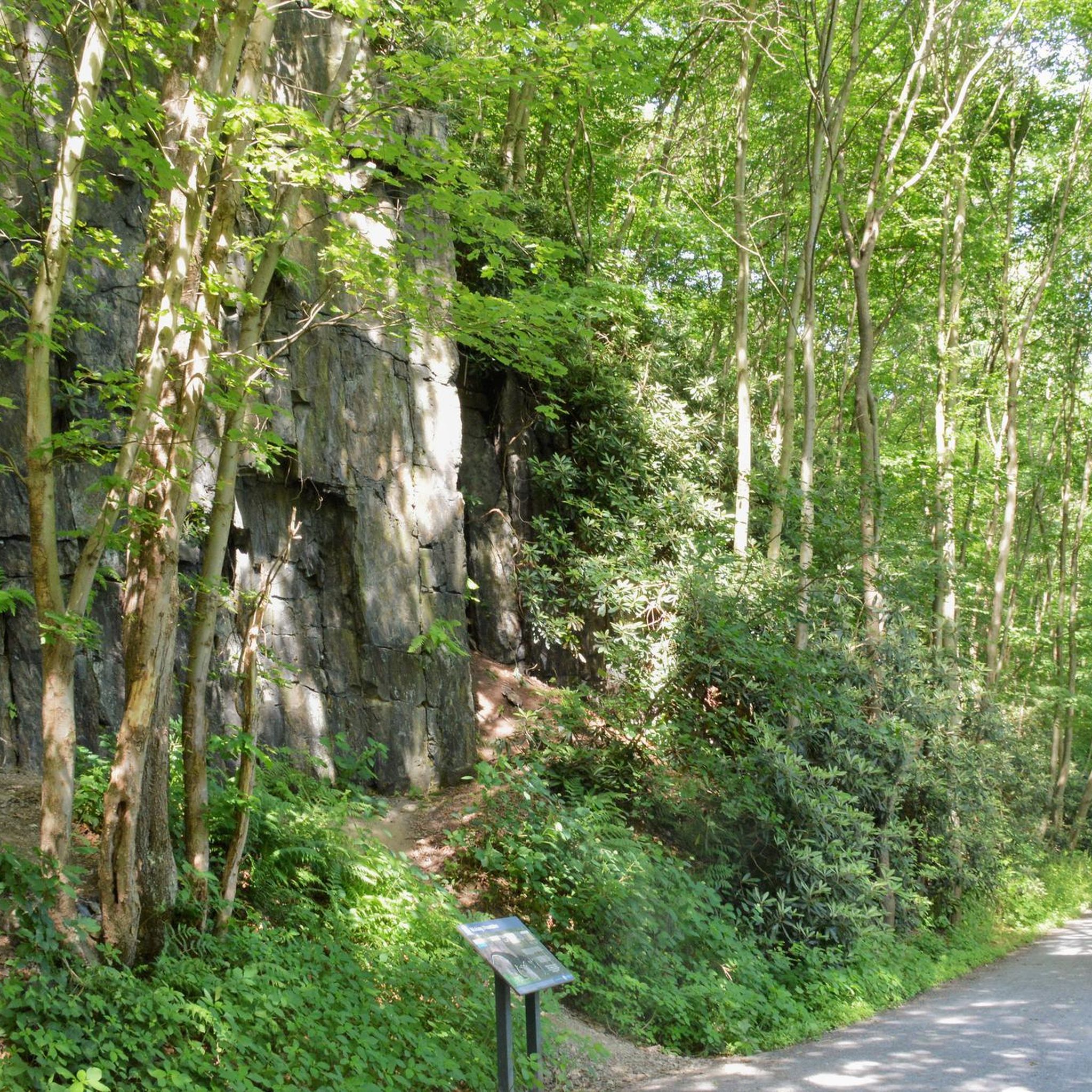
The Schuylkill River Trail spans 75 miles, divided into six main sections, all winding alongside the Schuylkill River. This particular segment goes through State Game Lands Number 110, stretching from Port Clinton to Auburn on a hard-packed gravel trail through a lush green forest.
1
0
Pinnacle Trail is a segment of the 2,190-mile-long Appalachian National Scenic Trail, stretching along the northern border from The Pinnacle to State Games Land Road. This section guides you through a lush forest on a well-maintained dirt trail.
0
0
To reach this point, you'll gain about 600 feet of elevation in a little less than a miles, making it a challenging hike. The last section includes some rocky points, so sturdy shoes are recommended. However, the views of the Hawk Mountain area are worth the extra effort.
1
0

The Swatara State Park is a great place for mountain biking with over 28 miles of trails. The trails include a lot of narrow singletrack, creek crossings, and log obstacles. There is the Swatara Rail Trail that runs through the park and a small section of the Appalachian Trail crosses the park.
0
0

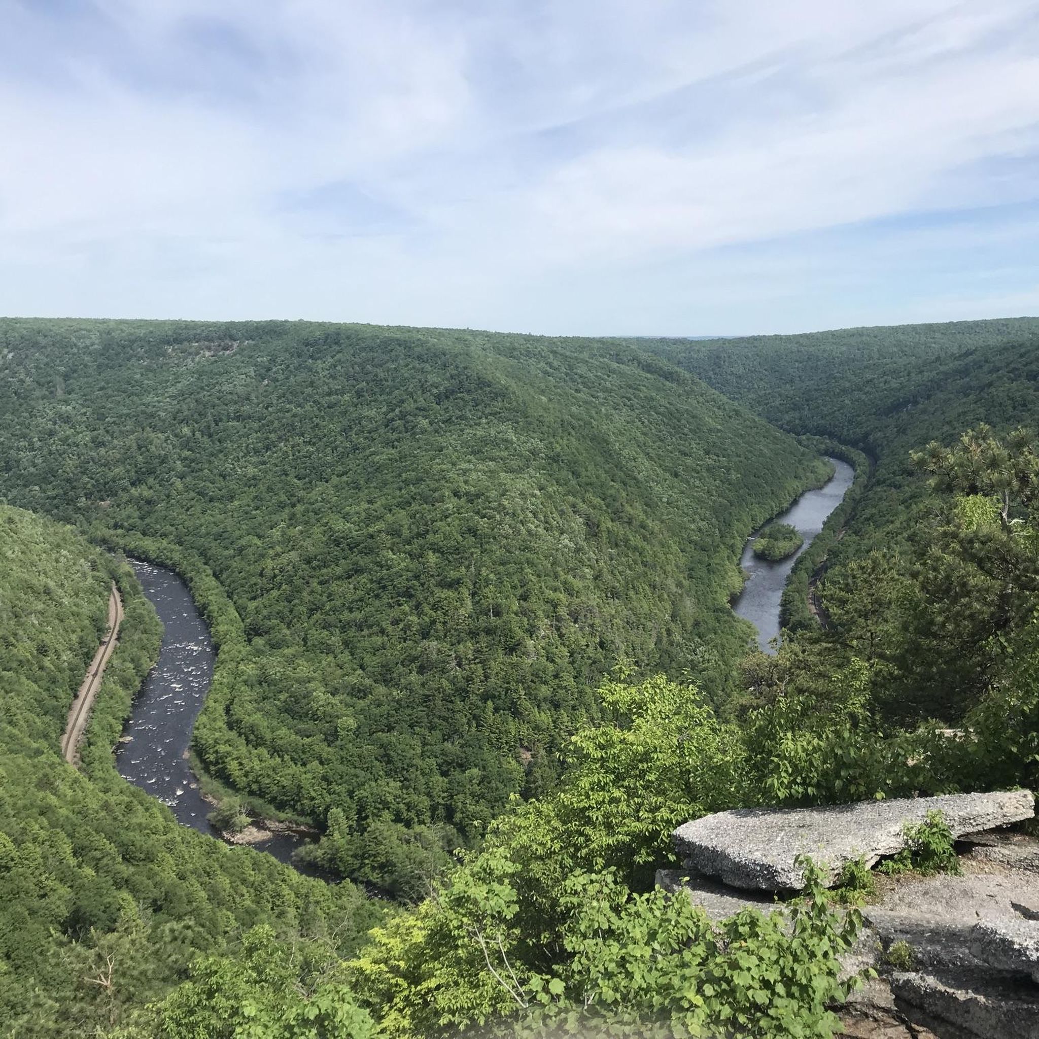
The Skyline Trail is a popular trail for runners, walkers and birdwatchers. There are several spots that give you great viewpoints onto the Little Schuylkill River and valley in the distance.
1
0
The Hamburg Reservoir is a beautiful lake right off the Appalachian Trail. It is a great place to take a break during your run to enjoy the relaxing surroundings.
1
0
Pulpit Rock, along with the Pinnacle, are the two popular viewing points in Berks County, right off the Appalachian Trail. Pulpit Rock gives you a great view into the nearby valley and Reading in the distance.
1
0
The Pinnacle is one of the highest point in Berks County. It is reached via a short trail off the Appalachian Trail and is regarded as one of the best views in Pennsylvania.
1
0
Frequently Asked Questions
How many running routes are available in Schuylkill County?
Komoot features 10 running routes in Schuylkill County. These routes offer a variety of experiences, from moderate paths to more challenging trails, catering to different fitness levels.
What kind of terrain can I expect on running trails in Schuylkill County?
Schuylkill County offers diverse terrain for runners, including rolling hills, dense forested areas, and scenic riverside paths. You'll find a mix of paved sections, crushed stone, and natural dirt trails. Many routes feature varied elevation gains, from relatively flat paths to more demanding mountain trails.
Are there any easy running routes for beginners in Schuylkill County?
While many routes in Schuylkill County are rated moderate to difficult, some sections of trails like the Schuylkill River Trail or Albright's Woods Walking Path offer flatter, more accessible surfaces ideal for beginners. For a moderate option, consider the Running loop from Swatara State Park, which has minimal elevation gain.
Which running routes offer the best scenic views in Schuylkill County?
For breathtaking views, consider routes that incorporate elevated points. The Pulpit Rock and Appalachian Trail Loop offers panoramic views over the Lehigh Valley. Similarly, the River of Rocks and Skyline Trail Loop provides expansive vistas and unique boulder fields. You can also enjoy views from the Skyline Trail Lookout.
Can I bring my dog on the running trails in Schuylkill County?
Many trails in Schuylkill County, especially those in state parks and natural areas, are generally dog-friendly. However, it's always recommended to check specific park regulations or trail signage before heading out with your furry friend, and always keep them on a leash.
Are there family-friendly running options in Schuylkill County?
Yes, for families, trails with gentler slopes and well-maintained surfaces are ideal. Sections of the Schuylkill River Trail, such as the Schuylkill River Trail near Port Clinton, and paths like Albright's Woods Walking Path, offer a more relaxed experience suitable for all ages. State parks like Locust Lake and Swatara also provide diverse trail systems.
Are there circular running routes in Schuylkill County?
Yes, several routes in Schuylkill County are designed as loops, allowing you to start and finish at the same point. Examples include the challenging River of Rocks and Skyline Trail Loop, the Pulpit Rock and Appalachian Trail Loop, and the Hamburg Reservoir loop via Appalachian Trail.
What are some notable landmarks or points of interest along the running trails?
Along the running routes, you can discover several interesting points. The River of Rocks and Skyline Trail Loop features unique boulder fields. The Pulpit Rock and Appalachian Trail Loop leads to the scenic View from Dan's Pulpit. You'll also find sections of the historic Schuylkill River Trail, such as the stretch from Port Clinton to Auburn, offering glimpses into the region's coal mining history.
Is parking available near the running trails in Schuylkill County?
Yes, parking is generally available at trailheads, state parks, and access points for major trails like the Schuylkill River Trail and the Appalachian Trail. For specific routes, it's advisable to check the route details on komoot for designated parking areas.
What is the best time of year for running in Schuylkill County?
Schuylkill County offers great running opportunities throughout the year. Spring and fall provide pleasant temperatures and beautiful foliage, making them ideal. Summer can be warm, so early morning or late evening runs are best. Winter running is possible, but some trails may be icy or snow-covered, requiring appropriate gear.
Are there challenging running routes for experienced runners?
Absolutely. Schuylkill County is home to several difficult routes that will test experienced runners. The River of Rocks and Skyline Trail Loop and the Pulpit Rock and Appalachian Trail Loop are both rated difficult, featuring significant elevation gains and varied terrain. The The Pinnacle via Appalachian Trail is another demanding option for those seeking a longer, more strenuous run.
What do other runners say about the trails in Schuylkill County?
The komoot community frequently praises the diverse landscapes and challenging terrain of Schuylkill County's running trails. Runners often highlight the scenic views from elevated points like Pulpit Rock and the unique experience of navigating boulder fields. The extensive network, including sections of the Appalachian Trail, is also a popular draw.
Most popular attractions in Schuylkill County

Get inspired with the komoot mobile app


Didn’t find what you were looking for?
Check out more Running Trails & Routes throughout Schuylkill County below and find the perfect route in your destination.
Explore more
Browse the best Running Trails & Routes in other regions.
