The best running trails in Tuolumne County
5.0
(1)
170
runners
26
runs
If you've ever tried planning a jogging trip to Tuolumne County, you know how quickly the sheer number of options can feel overwhelming. With so many trails and stunning landscapes, it's tough to figure out which routes are genuinely worth your time and effort, and which are just filler. We get it, and we're here to cut through the noise.
That's where komoot comes in. Our community has mapped, run, and reviewed countless routes here, so we've done the legwork to bring you a curated shortlist of the best jogging trails in Tuolumne County. This guide isn't a recycled highlights reel; it's a collection of routes we truly believe are worth your legs, saving you the guesswork and getting you straight to the good stuff.
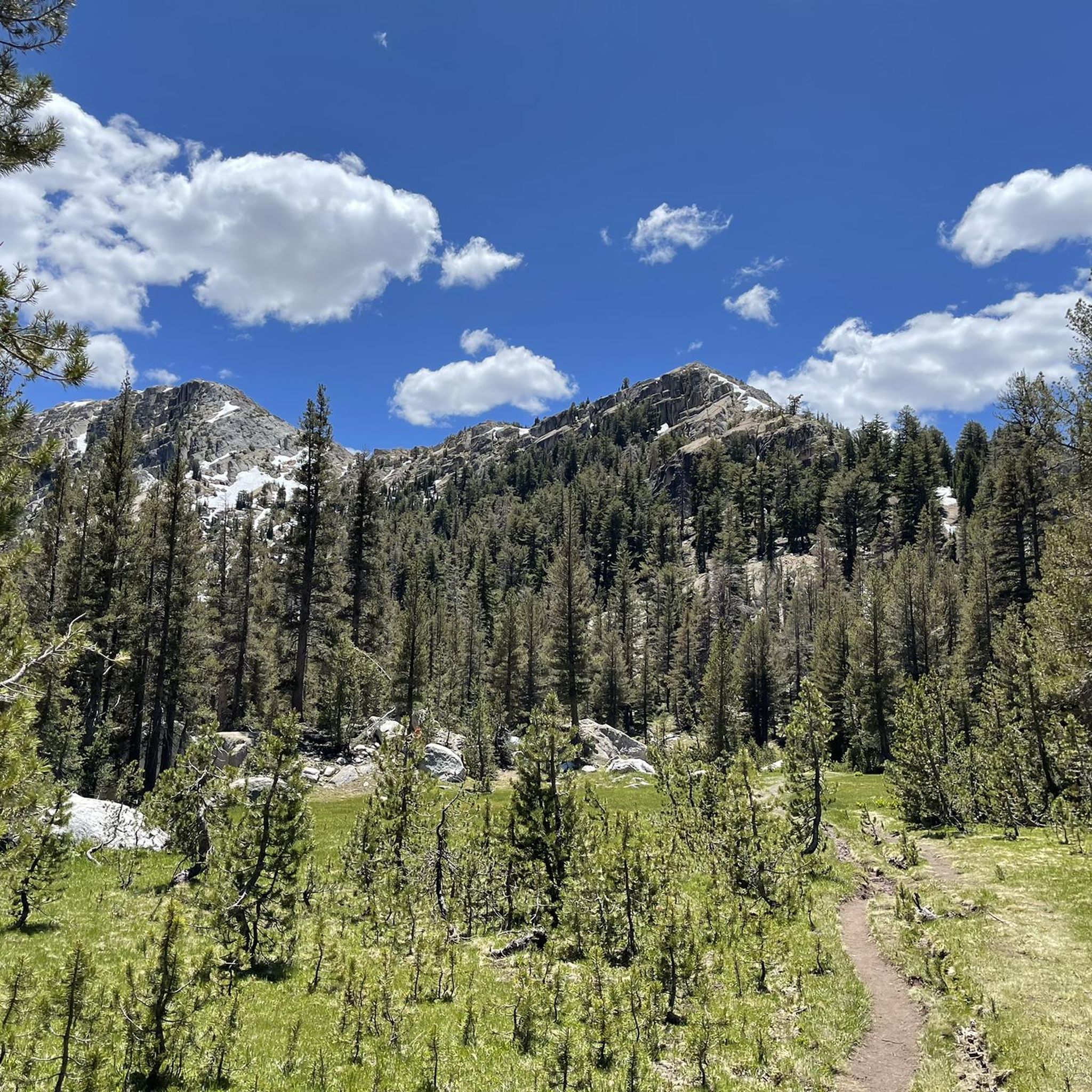
Jogging in Tuolumne County is an experience defined by its incredible diversity. You'll find everything from towering granite formations and high alpine passes to ancient groves of giant sequoias and peaceful oak woodlands. The region splits beautifully between the iconic northern half of Yosemite National Park and the vast Stanislaus National Forest, offering a range from easy lakeside paths to challenging mountain trails. Just remember that many of the higher elevation routes, especially those in Yosemite's high country, are typically only accessible during the warmer months when the snow has cleared.
If you only do one route, we'd start with the Wapama Falls Trail, a moderate 4.7-mile (7.7 km) out-and-back that delivers incredible waterfall views with a manageable climb. For those seeking a bigger challenge and truly epic high-country scenery, the Tenaya Lake and May Lake Loop is a difficult 10.9-mile (17.5 km) route that offers breathtaking alpine vistas. With more than 260 runners having already explored these trails with komoot, you're in good company. Now, lace up and get ready to discover your new favorite jogging route!
Last updated: May 10, 2026
13
runners
7.65km
01:02
260m
260m
Escape the crowds and discover the raw beauty of Yosemite's Hetch Hetchy Valley on the Wapama Falls Trail. This moderate 4.8-mile (7.7 km) jogging route, with 866 feet (264 metres) of elevation gain, leads you past the expansive Hetch Hetchy Reservoir and offers continuous views of geological features like Kolana Rock. You'll traverse varied terrain, from fire roads to rocky paths and granite steps, culminating in a close-up encounter with the powerful Wapama Falls, often shrouded in mist.
Planning your visit requires some foresight. The trail can be wet and slippery near the falls, and during peak runoff, the footbridge might even be submerged, making passage impossible. Much of the route is exposed, so bring ample water and sun protection. While day use typically only requires park entrance, arriving early is advisable for parking, especially during busy seasons. Be mindful of potential rattlesnakes and poison oak along the way.
This trail offers a quieter alternative to Yosemite Valley's more frequented spots, providing a peaceful experience that John Muir himself believed rivaled Yosemite's main attractions. You'll pass through an old train tunnel, a relic from the O'Shaughnessy Dam's construction, and in spring, you might even spot the seasonal Tueeulala Falls. It's a rewarding journey for those seeking dramatic waterfalls and diverse landscapes.
4
runners
37.6km
06:34
1,820m
1,820m
The Half Dome Loop via Clouds Rest from Tenaya Lake is an exceptionally challenging route that takes you through some of Yosemite's most iconic and demanding terrain. You'll begin with serene wooded groves and alpine meadows near Tenaya Lake, then face a tortuous series of rocky switchbacks before reaching the dramatic granite ridgeline of Clouds Rest, which offers panoramic 360-degree views superior to Half Dome itself.
This difficult 23.4-mile (37.6 km) jogging route, with a massive 5961 feet (1817 metres) of elevation gain, is estimated to take around 6 hours and 33 minutes. While Clouds Rest doesn't require a permit, combining it with Half Dome means you'll need to secure a Half Dome permit. This trail is best suited for experienced trail runners or fast hikers comfortable with high altitudes and technical terrain, especially given the significant sun exposure and steep sections.
What makes this route truly notable is the opportunity to experience two of Yosemite's most famous summits in one epic day. The views from Clouds Rest are often considered superior to Half Dome, providing a broader perspective of the valley and high country. It's a significant physical accomplishment that rewards participants with an exhilarating adventure and a unique perspective on Yosemite's grandeur.

Sign up for free
3
runners
17.5km
02:28
480m
480m
The Tenaya Lake and May Lake Loop offers a spectacular journey through Yosemite's high country, showcasing shimmering alpine lakes and dramatic granite landscapes. You'll traverse mixed pine forests, open alpine areas, and challenging granite slabs, with highlights like the expansive Tenaya Lake and the serene May Lake, nestled beneath Mount Hoffmann. While the scenery is breathtaking, be ready for rocky and uneven footing, especially on the steeper sections near May Lake, which can make pure jogging difficult.
Planning your trip requires checking the Tioga Pass Road opening dates, as access to the trailhead is seasonal, typically from late May or early June through October or November. The 10.9-mile (17.5 km) route involves a significant 1578 feet (481 metres) of elevation gain, making it a difficult trail that takes approximately 2 hours and 27 minutes to complete. Tenaya Lake is a popular spot for day visitors, while May Lake offers a quieter experience with toilet access at its High Sierra Camp.
This loop uniquely connects two classic Yosemite alpine lakes, offering a contrast between the lively Tenaya Lake area and the more tranquil May Lake. It's an excellent choice for experienced hikers or trail runners seeking a substantial workout with high-reward views, particularly in late spring or early summer when snowmelt enhances the landscape. The varied terrain and elevation gain provide a true test of endurance and offer a deep immersion into Yosemite's stunning high-country environment.
3
runners
11.6km
01:28
190m
190m
The Lakes Basin Loop Trail offers a delightful jogging experience through the scenic Hoover Wilderness, where you'll navigate natural paths alongside stunning water views. This route guides you past several beautiful alpine lakes, including the serene Greenstone Lake, Steelhead Lake, and Shamrock Lake, providing a refreshing atmosphere for your run. The varied terrain and continuous visual rewards make it an engaging journey for those seeking a moderate outdoor workout.
Planning your visit to this popular jogging trail is generally easy, as parking is usually available right at the trailhead. However, it's always a good idea to check local conditions before heading out, especially concerning snowmelt or any potential road closures that might affect access. This ensures you'll have a hassle-free and enjoyable time on the trail.
This particular Lakes Basin Loop Trail is known for its pristine alpine setting in Mono County, California, making it a standout option among scenic loop trails for jogging in the region. It's a 7.2-mile (11.6 km) route with a moderate difficulty, featuring 627 feet (191 metres) of elevation gain, and typically takes about 1 hour and 28 minutes to complete. Its combination of accessibility and natural beauty makes it a favored spot for a peaceful escape.
1
runners
9.62km
01:39
630m
630m
The Lundy Canyon Trail offers a truly immersive experience into the Eastern Sierra's wild beauty, especially during the fall when aspens ignite the canyon with brilliant yellow and gold. You'll traverse diverse terrain, from lush meadows dotted with wildflowers to rugged granite sections and past multiple cascading waterfalls along Mill Creek. Keep an eye out for active beaver dams early on, adding a unique wildlife element to this challenging route.
This is a difficult jogging route, covering 6.0 miles (9.6 km) with a substantial 2066 feet (630 metres) of elevation gain, typically taking around 1 hours and 38 minutes. The trail features rocky sections and steep ascents, and can be difficult to follow in places. Be prepared for potential snow and ice if visiting earlier in the year or after snowfall, as conditions can be slippery.
Lundy Canyon is celebrated as one of the Eastern Sierra's premier destinations for both wildflowers and spectacular fall colors, showcasing remarkable ecological diversity within the Inyo National Forest. For the adventurous, the trail also provides access to further exploration towards Lake Helen, the 20 Lakes Basin, and Saddlebag Lake, connecting you to the eastern edge of Yosemite.
1
runners
6.51km
00:49
100m
100m
The Saddlebag Lake Loop Trail offers a captivating journey through the high Sierra Nevada, circling the beautiful Saddlebag Lake. As you jog, you'll pass through varied terrain, from rocky shores and old mining roads to verdant meadows and wooded sections, all set against a backdrop of towering peaks like Mount Conness. The route provides a fantastic opportunity to experience the stunning alpine scenery, with its distinctive Sierra Nevada granite and mineral-rich, turquoise-colored lakes.
Planning your visit to this popular route is straightforward, though conditions can vary. The trailhead is easily accessible, and while parking is available, it's wise to arrive early during busy periods. Keep in mind that snow can linger at higher elevations even into late summer, so checking trail conditions is always recommended. For a different experience, a water taxi service is available from Saddlebag Lake Resort, allowing you to shorten your jog or explore other parts of the lake.
This moderate 4.0 miles (6.5 km) loop, with 328 feet (100 metres) of elevation gain, is typically completed in about 48 minutes, making it a great option for a quick, scenic workout. It serves as a gateway to the more expansive Twenty Lakes Basin, offering further exploration for those seeking additional challenges. The trail is also family-friendly and dog-friendly, making it a versatile choice for enjoying the Eastern Sierra's natural beauty.
13.9km
02:20
910m
910m
The Bloody Canyon Trail offers a raw, high-alpine jogging experience through a landscape shaped by history and geology. You'll navigate rugged, rocky terrain, passing pristine spots like Lower Sardine Lake, and be rewarded with expansive views of Mono Lake as you traverse the dramatic red rock canyon walls. This difficult 8.6-mile (13.9 km) route, with its 2996 feet (913 metres) of elevation gain, is a serious undertaking for experienced trail runners.
Planning your visit requires attention to detail; snow can linger at higher elevations, and creek crossings can be tricky depending on water levels. The trail's eastern ascent is notably steep and rocky, so be prepared for a challenging climb. Always check for permit requirements, especially since the route crosses into Yosemite National Park, and consider an early start to make the most of the estimated 2 hours and 20 minutes of jogging time.
This historic trail follows an ancient trans-Sierra passage, once used by Native Americans and early explorers, and its name hints at the tough journey it presented. Much of the route lies within the Ansel Adams Wilderness, offering a truly remote feel. The distinctive dark red rock walls of the canyon itself are a geological marvel, adding to the trail's unique character and making it a standout for those seeking both natural beauty and a connection to the past.
34
runners
20.2km
02:55
790m
790m
Hard run. Very good fitness required. Mostly paved surfaces. Suitable for all skill levels.
12
runners
5.01km
00:35
40m
40m
Moderate run. Good fitness required. Mostly paved surfaces. Suitable for all skill levels.
8
runners
7.16km
00:59
240m
240m
Moderate run. Good fitness required. Mostly accessible paths. Some sure footedness required.
Get access to more routes and recommendations from other explorers.
Sign up for free
Already have an account?
Our route recommendations are based on thousands of hikes, rides, and runs completed by other people on komoot.
Start today with a free account
Your next adventure awaits.
Login or Signup
Popular around Tuolumne County
Running Trails in Stanislaus National Forest

John Muir Trail – Along the legendary trail through the magical Sierra Nevada

The Sierra High Route — Solitude in California's alpine country
Hiking in Tuolumne County
Cycling in Tuolumne County
Road Cycling Routes in Tuolumne County
MTB Trails in Tuolumne County


Tips from the Community

Here the long distance Pacific Crest Trail, on its way between Mexico and Canada, crosses Tioga Road, with popular and convenient break options to hitchhike and explore the more developed portions of Yosemite National Park, and resupply on food and gear.
1
0

This is a very busy location during the summer season. You can get here by car, bicycle and via foot. Most of the PCT thruhikers walk to Tuolumne Meadows Store & Grill to get a resupply, eat well and often pickup a resupply package. There is also a campground close by. nps.gov/yose/planyourvisit/tmcamp.htm NOTE: Tuolumne Meadows Campground will be closed until 2024 or 2025 due to reconstruction. The backpackers campground will also be closed. The store and post office are open! To resupply, you can also take the bus into Lee Vining or Yosemite Valley from mid June through mid September.
0
0

Wapama Falls offers a quieter alternative to the more famous Yosemite Falls, with stunning views of its three distinct sections. The trail is less crowded, giving you a peaceful experience as you approach the base of the falls. While water flows year-round, the spring runoff provides the most spectacular sights—just be cautious, as crossing the footbridge during peak flow can be hazardous.
0
0

Tuolumne Meadows is one of the crown jewels of Yosemite National Park. The picturesque meadows are surrounded by the iconic granite domes that Yosemite is known for. The most notable being Lembert Dome that looms over the eastern edge of the meadows.
0
0

Nestled between giant granite domes and the clear skies of the Sierra Nevada, Tenaya Lake is the largest lake in Yosemite's frontcountry. Due to its remarkable scenic qualities, inviting blue waters, and proximity to Tioga Road, Tenaya Lake is one of the most popular destinations for summer visitors to Yosemite. It is very popular for picnicking, swimming, and canoeing. Tenaya Lake was named after Chief Tenaya, the last chief of the Yosemite Indians.
3
0
Nestled between giant granite domes and the clear skies of the Sierra Nevada, Tenaya Lake is the largest lake in Yosemite's frontcountry. Due to its remarkable scenic qualities, inviting blue waters, and proximity to Tioga Road, Tenaya Lake is one of the most popular destinations for summer visitors to Yosemite. It is very popular for picnicking, swimming, and canoeing. Tenaya Lake was named after Chief Tenaya, the last chief of the Yosemite Indians.
3
0


This trail accesses Lembert Dome and Dog Lake. To continue to Dog Lake, you want to hike straight at the junction where the Lembert Dome Trail goes left. If you want to add a few miles and a little adventure, you can combine Lembert Dome with Dog Lake.
0
0
Frequently Asked Questions
How many running routes are available in Tuolumne County?
Tuolumne County offers a wide selection of running routes, with over 29 trails documented on komoot. These range from easy paths to challenging mountain runs, catering to various fitness levels.
Are there any easy or beginner-friendly jogging paths in Tuolumne County?
Yes, Tuolumne County has several easy running options. For instance, the Tenaya Lake – Tenaya Lake Beach loop from Tenaya Lake is an easy 3-mile path with minimal elevation gain, perfect for a relaxed run. Another gentle option is the Running loop from Rush Creek Lodge, which is just over 2.5 miles.
What are some scenic loop running routes in the area?
For those who enjoy circular routes, the Viewpoint for Giant Sequoias loop from Tuolumne Grove offers a moderate 2.7-mile run through ancient groves. Another scenic loop is the Tuolumne Meadow – Lembert Dome loop from Parsons Memorial Lodge, a moderate 4.4-mile trail with beautiful views.
Can I find running trails with waterfalls in Tuolumne County?
Absolutely. The Wapama Falls Trail is a popular moderate 4.7-mile route that leads directly to a scenic waterfall within the Yosemite Wilderness Area, offering a rewarding view during your run.
Are there any running routes that pass by significant natural landmarks or points of interest?
Many routes in Tuolumne County offer stunning natural landmarks. The Viewpoint for Giant Sequoias loop from Tuolumne Grove takes you through impressive ancient sequoia groves. You can also explore areas near Hetch Hetchy Reservoir or discover the serene Middle Gaylor Lake and Dog Lake, which are accessible via various trails.
What do other runners enjoy most about the trails in Tuolumne County?
The running routes in Tuolumne County are highly rated by the komoot community, with an average score of 5.0 stars. Reviewers often praise the diverse and stunning natural landscapes, from towering granite formations and high alpine passes to ancient groves and picturesque lakes, offering a scenic backdrop for any run.
Are there any challenging running routes for experienced runners?
Yes, for experienced runners seeking a challenge, the Tenaya Lake and May Lake Loop is a difficult 10.9-mile path. This route features significant elevation gain and offers picturesque views of high alpine lakes, providing a strenuous yet rewarding experience.
What is the best season for running in Tuolumne County?
Tuolumne County offers year-round outdoor recreation. While high-elevation trails in Yosemite National Park and the Emigrant Wilderness are best enjoyed from late spring through early fall, lower elevation routes in areas like the oak woodlands around Sonora are accessible throughout the year, even offering pleasant winter running conditions.
Are there any running routes that follow old railroad grades?
Yes, Tuolumne County features trails built on historic railroad grades, which often provide relatively flat and wide paths. The Sugar Pine Trail, for example, from Twain Harte to Lyons Reservoir, is a family-friendly option with a wide gravel path and ample shade, built upon an abandoned railroad grade.
Where can I find less crowded running spots in Tuolumne County?
For a sense of solitude away from more popular areas, consider exploring trails within the Emigrant Wilderness, which borders Yosemite National Park. These trails feature placid lakes and stunning views, offering a more tranquil running experience. The Stanislaus National Forest also provides extensive public lands with hundreds of miles of trails that are often less crowded.
Are there any running routes with good parking access or near trailheads?
Many running routes in Tuolumne County have designated parking areas at their trailheads. For detailed information on specific trailheads and parking, you can consult resources like the Tuolumne County trailheads map, which can be found on the Visit Tuolumne County website.
Most popular routes in Tuolumne County
Most popular attractions in Tuolumne County

Get inspired with the komoot mobile app


Didn’t find what you were looking for?
Check out more Running Trails & Routes throughout Tuolumne County below and find the perfect route in your destination.
Explore more
Browse the best Running Trails & Routes in other regions.
