The best walks and hikes in Grayson County
4.8
(14)
380
hikers
47
hikes
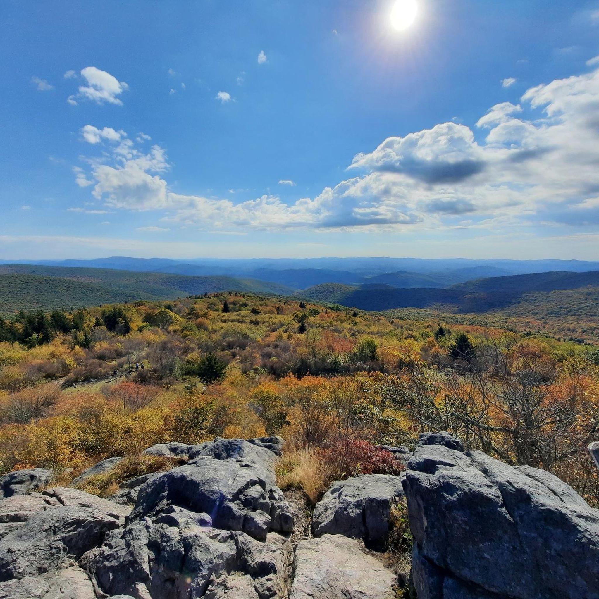
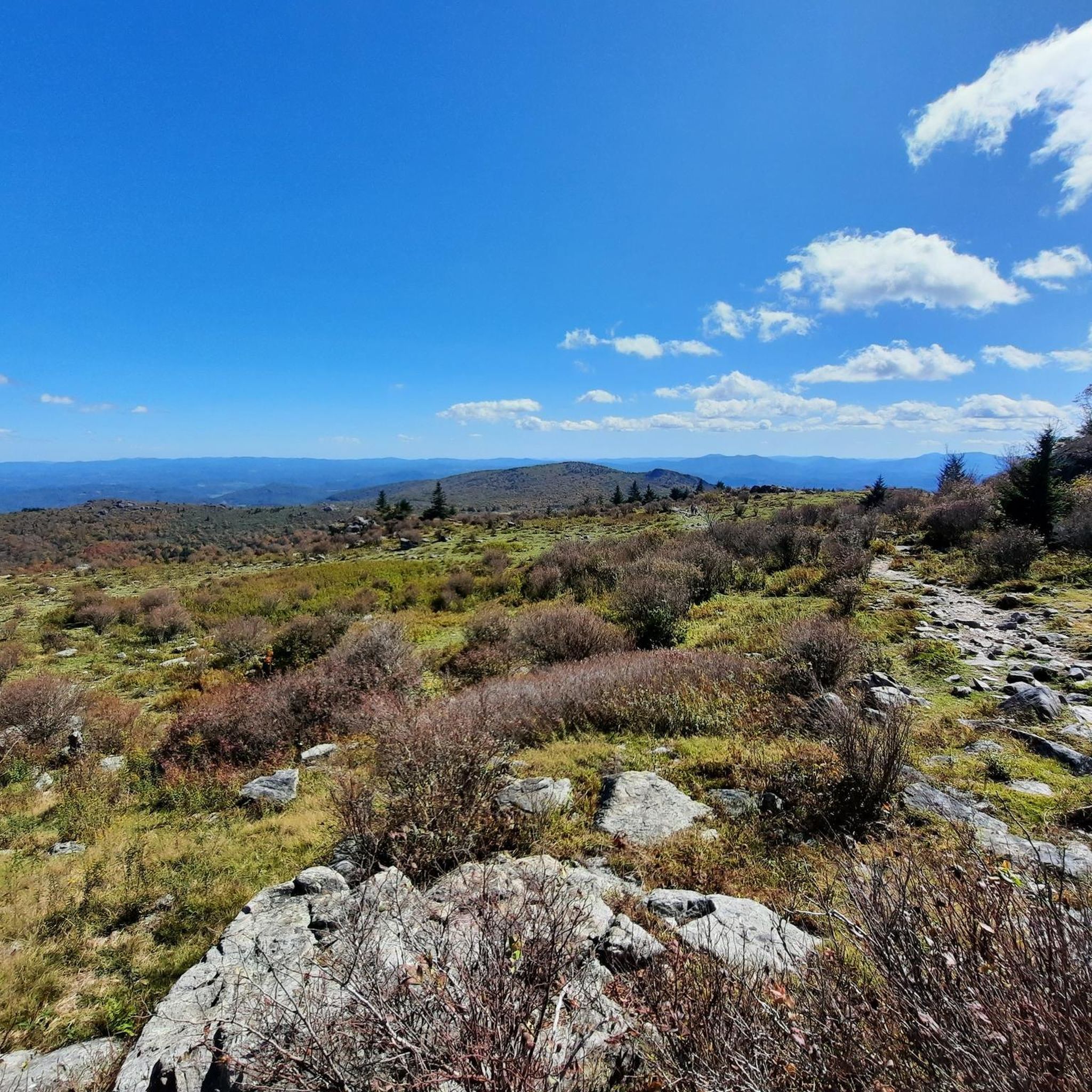
Hiking in Grayson County, Virginia, offers diverse natural landscapes, characterized by high peaks, expansive forests, and river valleys. The region is home to Mount Rogers, Virginia's highest mountain, and features a significant portion of the Appalachian Trail. Wild ponies roam freely, particularly within Grayson Highlands State Park. Hikers can explore varied terrain, from mountain trails and open meadows to paths alongside historic rivers.
Best hiking trails in Grayson County
- The most popular hiking route is Mount Rogers via Appalachian Trail, a 4.6 miles (7.4 km) trail that takes 2 hours 15 minutes to complete. This route offers access to a section of the renowned Appalachian Trail.
- Another top favourite among local hikers is Mount Rogers and Appalachian Trail Loop, a difficult 9.8 miles (15.8 km) path. This loop provides an ascent towards Mount Rogers, Virginia's highest peak, through varied mountain terrain.
- Local hikers also love the Haw Orchard Mountain and Twin Pinnacles Loop, a 2.2 miles (3.6 km) trail leading through woodlands to a small waterfall, often completed in about 1 hour 5 minutes.
- Hiking in Grayson County is defined by high peaks, expansive forests, and river trails, with opportunities to encounter wild ponies and diverse flora. The network offers options for different ability levels, from easy walks to challenging mountain treks.
- The routes in Grayson County are highly rated by the komoot community with an average score of 4.7 stars from over 10 reviews. More than 300 hikers have used komoot to explore Grayson County's varied terrain.
Last updated: August 18, 2026
5.0
(1)
19
hikers
27.1km
07:57
660m
960m
The Mount Rogers and Appalachian Trail Loop offers a truly unique hiking experience, guiding you through dense forests, expansive highland meadows, and a rare high-altitude spruce-fir forest. You'll encounter diverse terrain, from rocky sections around Wilburn Ridge to lush grassy balds, all while gaining 2172 feet (662 metres) over 16.9 miles (27.1 km). The highlight for many is spotting the wild ponies that freely roam these scenic landscapes, making this a memorable and challenging adventure.
This difficult route typically takes around 7 hours and 57 minutes to complete as a day hike, though many hikers choose to backpack it over several days. The trail is located within the Mount Rogers National Recreation Area, offering various access points. Be prepared for potentially muddy and rocky conditions, especially after rain, and always check weather forecasts for higher elevations before you go.
Beyond the stunning scenery, this loop is notable for incorporating a significant section of the iconic Appalachian Trail and leading to Mount Rogers, Virginia's highest point. The unique ecosystems, including the spruce-fir forest, provide a glimpse into a rare natural world. It's one of the best loop trails Mount Rogers AT has to offer for those seeking a substantial and rewarding backcountry experience.
5.0
(1)
6
hikers
45.4km
13:26
1,330m
1,450m
Embark on the Mount Rogers Loop Trail, a difficult hiking route that takes you through diverse landscapes, from dense pine and rhododendron forests to expansive mountain meadows. This challenging 28.2 miles (45.4 km) journey includes a significant 4364 feet (1330 metres) of elevation gain, leading you to Virginia's highest point. You can expect to spend around 13 hours and 26 minutes on the trail, experiencing unique rock formations, especially around Wilburn Ridge, and enjoying spectacular mountain views.
When planning your visit, consider that spring and fall generally offer the most favorable conditions for hiking. While very fit hikers might attempt this as a long day hike, many choose to complete the route as a 2-3 day backpacking trip, utilizing the numerous backcountry camping options available. Trekking poles are often recommended to help you navigate rocky sections and steep ascents along the way.
This loop trail is nestled within Virginia's Jefferson National Forest and Grayson Highlands State Park, an area renowned for its open, grassy highlands often compared to the Scottish Highlands. These unique ecosystems are home to beloved wild ponies that roam freely, adding a special charm to your outdoor adventure. The Mount Rogers Summit itself is tree-covered, but the surrounding ridgelines provide ample opportunities for breathtaking vistas.

Sign up for free
11
hikers
21.0km
06:08
590m
510m
Embark on the Grayson Highlands and Mount Rogers Loop, a difficult hiking adventure spanning 13.1 miles (21.0 km) with a significant elevation gain of 1935 feet (590 metres). You can expect to spend around 6 hours and 7 minutes traversing varied terrain, from open grassy balds where wild ponies roam freely to dense, shaded forests. While the Mount Rogers summit itself is tree-covered, you will be rewarded with expansive ridgeline vistas from Wilburn Ridge, offering breathtaking views of the surrounding landscape.
Before you head out, remember that this route is popular for both day hikes and overnight backpacking. While day use typically does not require permits, it is wise to check with Grayson Highlands State Park or the Mount Rogers National Recreation Area for any specific requirements, especially if you plan an overnight stay. Trekking poles are highly recommended to help navigate the rocky sections, and be prepared for potentially muddy spots, particularly after rain.
This trail takes you through Virginia's highest peaks, offering a unique opportunity to experience the state's elevated wilderness. The presence of the iconic wild ponies adds a distinctive charm, making the journey through the diverse ecosystems of the park truly memorable. Consider this route if you are looking for a challenging hike with unique wildlife encounters and rewarding views.
5.0
(1)
9
hikers
9.32km
02:47
420m
90m
Set out on the Mount Rogers via Appalachian Trail, a moderate hike leading you to Virginia's highest point. This 5.8-mile (9.3 km) route involves a steady climb of 1372 feet (418 metres), typically completed in about 2 hours and 47 minutes. You will experience varied terrain, starting with gentle ascents through open meadows before the path becomes more rugged and rocky, especially along Wilburn Ridge. Near the summit, you enter a unique high-altitude spruce-fir forest, often described as mossy and ethereal. Expect sweeping views of the surrounding highlands and dramatic rocky outcrops as you make your way up.
To plan your visit, remember that the trail is located within Grayson Highlands State Park. Check the park's official website for current operating hours, any potential entrance fees, and parking information before you go. While the trail is generally accessible, weather conditions can change rapidly at higher elevations, so be prepared for cooler temperatures and possible rain, even in summer. Starting your hike earlier in the day is always a good idea to allow ample time and avoid afternoon crowds, especially on weekends.
The Mount Rogers area is renowned for its distinctive natural environment, featuring a unique ecosystem that transitions from open grasslands to dense, high-elevation forests. This trail offers a chance to explore a significant section of the famous Appalachian Trail, providing a glimpse into its diverse landscapes. Keep an eye out for the wild ponies that often graze freely in the open areas of Grayson Highlands State Park, adding a memorable element to your hiking experience.
5.0
(1)
6
hikers
23.7km
07:02
740m
710m
Embark on the challenging Mount Rogers and Grayson Highlands Loop, a difficult hike spanning 14.7 miles (23.7 km) with an elevation gain of 2420 feet (738 metres). This route offers a diverse landscape, from open, grassy meadows to dense forests and unique rock formations. As you traverse sections like Wilburn Ridge, you will experience expansive mountain views that can feel reminiscent of the American West, making the estimated 7 hours and 1 minute journey a rewarding experience.
To begin your adventure, head to Grayson Highlands State Park, which serves as the primary starting point for this popular loop. Parking is typically available within the park, providing convenient access to the trailhead. Given the trail's difficult rating, it is wise to plan for a full day of hiking and ensure you start early, especially during peak seasons. Always check park conditions and weather forecasts before you set out.
What truly sets this trail apart are the famous wild ponies that roam freely throughout Grayson Highlands State Park, adding a unique charm to your hike. While the summit of Mount Rogers itself is densely wooded, reaching Virginia's highest peak is a significant achievement for any hiker. The combination of varied terrain, panoramic vistas, and distinctive wildlife makes this loop a standout experience in the region.
4
hikers
19.3km
05:59
720m
620m
Embark on the Haw Orchard Mountain and Twin Pinnacles Loop for a challenging hike through diverse terrain. This difficult route spans 12.0 miles (19.3 km) and involves a significant elevation gain of 2374 feet (723 metres), taking approximately 5 hours and 58 minutes to complete. As you ascend, you'll navigate dirt paths and rocky sections, some requiring scrambling, leading you to the park's highest points. From Big Pinnacle, you are rewarded with expansive 360-degree views across the Blue Ridge Mountains. The trail also guides you through unique forest zones, where you might encounter ancient-looking ferns or wind-sculpted red spruce trees.
To begin your adventure, you can access the Haw Orchard Mountain and Twin Pinnacles Loop from either Massie Gap or the Grayson Highlands Visitor Center. Starting from the Visitor Center might offer a slightly easier initial ascent, bypassing some of the steeper climbs. Parking is conveniently available at both access points. Be prepared for potentially intense winds on the exposed rocky crests at the pinnacles, so remember to dress in appropriate layers.
This trail stands out for its journey through distinct transition zones, where northern hardwood forests meet spruce and fir boreal ecosystems. You'll experience the unique geology of the region as you traverse varied landscapes. The route offers a comprehensive exploration of Grayson Highlands State Park, showcasing its natural beauty and providing a rewarding experience for those seeking a substantial day out in the mountains.
6
hikers
12.1km
03:30
320m
330m
The Scales and Appalachian Loop Trail offers a moderate hiking experience through varied terrain, including rocky sections, open high meadows, and dense forest. As you hike this 7.5-mile (12.1 km) route, you'll enjoy continuous panoramic views of the Mount Rogers area. Keep an eye out for wild ponies roaming the memorable vistas of Wilburn Ridge and the Pine Mountain area. With an elevation gain of 1040 feet (317 metres), this loop typically takes around 3 hours and 30 minutes to complete.
Accessing the Scales and Appalachian Loop Trailhead requires navigating Forest Road 613, a very rough dirt road where high-clearance vehicles are often necessary. The trailhead itself provides restrooms and a camping area for your convenience. Be prepared for rocky sections, especially near Wilson Creek, and a significant elevation gain as you depart from the Scales area.
This loop is a highlight within Grayson Highlands State Park in Grayson County, Virginia, known for its unique natural environment. A significant portion of the route follows the iconic Appalachian Trail, offering a taste of this legendary long-distance path. The presence of wild ponies adds a distinctive charm to the landscape, making it a memorable outing.
5
hikers
11.4km
03:24
380m
370m
The hike from Elk Garden to Buzzard Rock on the Appalachian Trail offers a delightful journey through varied landscapes, transitioning from dense, fern-lined woodlands to expansive, grassy balds. As you ascend, you'll be treated to increasingly open views, culminating in the impressive Buzzard Rock viewpoint, which provides sweeping panoramas of Mount Rogers and Whitetop Mountain. The trail's blend of forest paths and open meadows makes for a visually engaging experience, perfect for those who appreciate diverse natural beauty.
This moderate 7.1-mile (11.4 km) out-and-back route involves a steady 1231 feet (375 metres) of elevation gain, typically taking around 3 hours and 23 minutes to complete. Parking is available at the Elk Garden trailhead, but arriving early is recommended, especially on weekends. Be prepared for cooler temperatures at higher elevations, and note that a reliable spring is located about 2.5 miles into the trail for water refills.
This section of the Appalachian Trail is renowned for its spectacular vistas and unique geological features, including the ancient Rhyolite rock of Buzzard Rock. It's an excellent way to experience a scenic part of the AT, offering a taste of its famous high meadows and open balds. You can even extend your adventure with an optional, short but steep climb to Elk Garden Peak for even more expansive views.
4
hikers
15.1km
04:29
430m
500m
Embark on the Massey Gap to Elk Garden hike, a moderate route that takes you through diverse landscapes in the Mount Rogers National Recreation Area. You will cover 9.4 miles (15.1 km) and ascend 1420 feet (433 metres), with an estimated duration of 4 hours and 28 minutes. Along the way, expect to traverse open sections offering expansive vistas and unique conifer forests at higher elevations; keep an eye out for the iconic wild ponies grazing in the balds.
To begin your adventure, you can access the trail from either Massey Gap or Elk Garden, both serving as popular trailheads. Parking is generally available at these starting points, making it convenient to plan your visit. Consider starting early to make the most of your time on the trail and enjoy the serene atmosphere.
This route is particularly notable for its connection to the wider region, providing panoramic views towards Mount Rogers and Whitetop Mountain. From this area, you can also access the Mount Rogers Summit, offering an additional challenge for those interested. The trail also borders Grayson Highlands State Park, known for its wild ponies, which you might encounter during your hike.
2
hikers
16.6km
04:47
430m
400m
Embark on the Pine Mountain and Wilburn Ridge Loop for a moderate hiking adventure through diverse landscapes. This 10.3-mile (16.6 km) route takes you across arid mountain-top meadows and through lush forests, with sections dense with rhododendrons. You will gain 1396 feet (425 metres) in elevation over approximately 4 hours and 46 minutes of hiking. Expect continuous grand views and sweeping 360-degree vistas from rocky summits. Keep an eye out for wild ponies often seen roaming the high country as you traverse the trail.
When planning your hike, be ready for challenging terrain, particularly on the Wilburn Ridge Trail, which features rocky sections and potential rock scrambles. Weather conditions on the exposed ridges can change quickly, so pack layers to prepare for high winds or sudden thunderstorms. Careful footing is essential throughout the entire hike to navigate the varied surfaces safely.
This loop is notable for its expansive "southern balds" and the unique opportunity to encounter wild ponies in their natural habitat. You will also pass the Junction of Five Trails at Scales, a significant point along the route. The trail offers a rewarding experience for those seeking a blend of scenic beauty and a good workout in Grayson Highlands State Park.
Get access to more routes and recommendations from other explorers.
Sign up for free
Already have an account?
Our route recommendations are based on thousands of hikes, rides, and runs completed by other people on komoot.
Start today with a free account
Your next adventure awaits.
Login or Signup
Popular around Grayson County



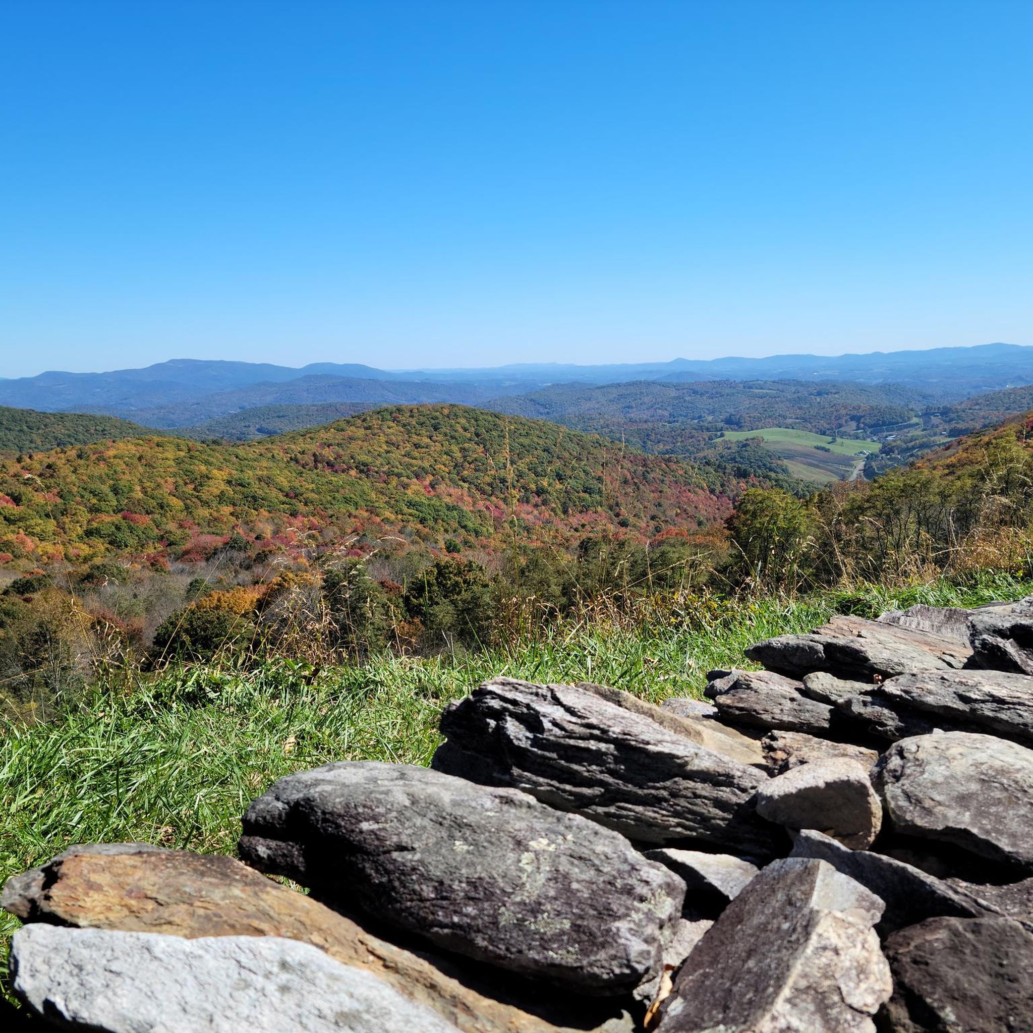
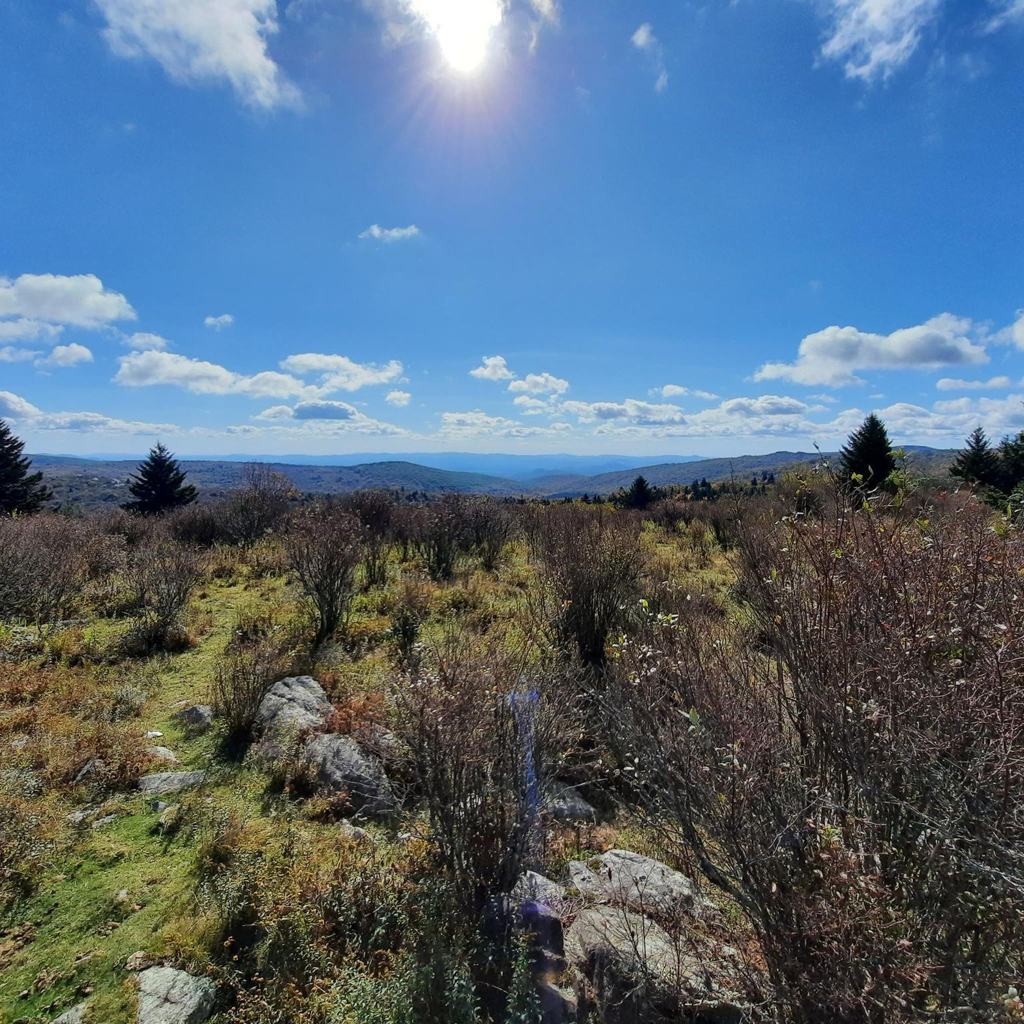
Tips from the Community

One of two Peaks of the “Two Pinnacles Trail” with a beautiful view of Massie Gap, Wilburn Ridge and Mt Rogers.
0
0
Nice Visitor Center with Picnic Area, Rocking Chairs, Souvenir Shop and small Exhibit about farm life of the past.
0
0

Highest mountain in Verginia on the Appalachian Trail without view due to dense forest
0
1

Mount Rogers is not only right on the famous Appalachian Trail, it is also the highest mountain in the state of Virginia at 5,729 feet. The detour to the summit is only half a mile, with just 240 feet of ascent. But you can't expect a grand view because of the dense forest.
0
0

Great view of Whitetop Mountain from Buzzard Rock and the Appalachian Trail. It is a good place for a break to enjoy the wonderful vista.
0
0

This parking area is great for bikers as well as overnight hikers. There is a restroom here and a convergence of trails, including the Appalachian Trail, Elk Garden Trail, Virginia Highlands Horse Trail, Whitetop Road, and the county line. There is also a historical marker for the tallest mountain in Virginia, Mount Rogers.
0
0
Grayson Highland Visitor Center has ample parking and is a great spot to stop on a ride around the park. This park is famous for its stunning landscapes, woods, featuring open, grassy open areas, panoramic views, and the local wild ponies. These ponies are known as the Grayson Highlands ponies, and there is no better place to learn more than at the Grayson Highland Visitor Center.
0
0
Grayson Highland Visitor Center has ample parking and is a great spot to start a ride around the park. This park is famous for its stunning landscapes, woods, featuring open, grassy open areas, panoramic views, and the local wild ponies. These ponies are known as the Grayson Highlands ponies, and there is no better place to learn more than at the Grayson Highland Visitor Center.
0
0
Frequently Asked Questions
How many hiking trails are available in Grayson County?
Grayson County offers a diverse network of nearly 30 hiking trails. These routes cater to various skill levels, including 6 easy, 15 moderate, and 7 difficult options, ensuring there's a suitable path for every hiker.
What is the best time of year to go hiking in Grayson County?
The spring and fall seasons are particularly popular for hiking in Grayson County. Spring brings vibrant rhododendron blooms and lush greenery, while fall offers stunning foliage. Summer can be pleasant, especially at higher elevations, but be prepared for warmer temperatures. Winter hiking is also possible, though some trails may be more challenging due to snow or ice.
Are there any family-friendly hiking trails in Grayson County?
Yes, Grayson County has several options suitable for families. For an easy walk, consider the Cabin Creek Trail loop, which is 2.2 miles long and leads to a small waterfall. The New River Trail State Park also offers a relatively flat, multi-use path along the river, perfect for a leisurely family outing.
Are dogs allowed on the hiking trails in Grayson County?
Most trails in Grayson County, including those within Grayson Highlands State Park and Mount Rogers National Recreation Area, are dog-friendly, provided your dog is kept on a leash. Always check specific park regulations before you go, as rules can vary. For example, the New River Trail is a great option for walking with your canine companion.
Which trails offer the best views in Grayson County?
For breathtaking vistas, head to Grayson Highlands State Park, where many trails provide expansive views of the Blue Ridge Mountains. The routes leading to Whitetop Mountain, such as Whitetop Mountain via Mud Creek Lane, offer views of three different states from its 5,525-foot summit. The Mount Rogers via Highlands Horse Trail & Appalachian Trail loop also provides varied mountain terrain and scenic overlooks.
Are there any hikes with waterfalls in Grayson County?
Yes, you can find beautiful waterfalls along some trails. The Cabin Creek Trail loop is known for its small, picturesque waterfall with a refreshing pool at the bottom. Additionally, the Lundy Trail, part of the Grayson County Parks and Recreation system, features the scenic Powerhouse Falls (also known as Peach Bottom Falls).
Are there any circular hiking routes in Grayson County?
Yes, several circular routes allow you to experience diverse landscapes without retracing your steps. A popular option is the Mount Rogers via Highlands Horse Trail & Appalachian Trail loop, which offers an ascent towards Virginia's highest peak. Another great loop is the Thomas Knob Shelter – Mount Rogers Summit loop from Grayson Highlands State Park, providing a challenging and rewarding experience.
What interesting landmarks or attractions can I see along the trails?
Grayson County's trails are rich with natural and historical landmarks. You can encounter wild ponies in Grayson Highlands State Park, reach the highest point in Virginia at Mount Rogers Summit, or visit Whitetop Mountain, the second-highest peak. The Wilburn Ridge via Appalachian Trail offers access to the famous AT and views of Wilburn Ridge itself. Don't miss the Cabin Creek Waterfall on its namesake trail.
What do other hikers enjoy most about hiking in Grayson County?
The hiking experiences in Grayson County are highly rated by the komoot community, with an average score of 4.7 stars. Reviewers often praise the diverse landscapes, from high peaks and expansive forests to river valleys, and the unique opportunity to encounter wild ponies. The well-maintained trails and stunning mountain views are frequently highlighted as favorite aspects.
Are there any less crowded hiking options in Grayson County?
While popular spots like Grayson Highlands State Park can draw crowds, especially on weekends, you can find quieter experiences. Consider exploring trails in Matthews State Forest, which offers nearly 8 miles of challenging mountain trails. The Rowland Creek Trail in Mount Rogers National Recreation Area is another excellent option for a more secluded hike, offering a longer, moderate challenge.
Is public transport available to reach trailheads in Grayson County?
Public transport options directly to trailheads in Grayson County are limited. Most visitors typically rely on personal vehicles to access the various parks and trail entry points. Parking is generally available at popular trailheads like those in Grayson Highlands State Park, Elk Garden, and along the New River Trail.
What is the elevation gain like on trails in Grayson County?
Grayson County's diverse terrain means elevation gains vary significantly. Easy trails like the Cabin Creek Trail loop have modest gains around 110 meters. Moderate routes, such as Whitetop Mountain via Buzzard Rock, can involve around 160 meters of ascent. For challenging hikes, expect significant climbs; for instance, Mount Rogers via Crest Trail features over 750 meters of elevation gain.
Most popular routes in Grayson County
Most popular attractions in Grayson County

Get inspired with the komoot mobile app


Didn’t find what you were looking for?
Check out more Hikes throughout Grayson County below and find the perfect route in your destination.
Explore more
Browse the best Hikes in other regions.
