The best MTB trails in Faulkner County
5.0
(4)
234
riders
16
rides
Mountain biking in Faulkner County, Arkansas, offers diverse trail systems set within scenic landscapes. The region, located northwest of Little Rock, features a blend of challenging and beginner-friendly options. Riders can expect varied terrain, including wooded sections, rolling hills, and areas near lakes and rivers. This central Arkansas county provides a range of natural attractions that complement its mountain bike trails.
Best mountain bike trails in Faulkner County
- The most popular mountain bike trail is Dickson Overlook loop from Little…
Last updated: June 29, 2026
42
riders
15.6km
01:29
260m
260m
The Jackfork Loop provides a difficult mountain biking challenge, spanning 9.7 miles (15.6 km) with an elevation gain of 847 feet (258 metres). You will encounter a mix of fast,…
18
riders
16.0km
01:26
220m
220m
Tackle the difficult Rattlesnake Ridge loop, a 9.9-mile mountain biking trail in Little Rock, Arkansas, with views of Lake Maumelle.

Sign up for free
33
riders
14.2km
01:18
240m
240m
Hard mountain bike ride. Great for any fitness level. Advanced riding skills necessary. Some portions of the route may require you to push your bike.
5.0
(2)
9
riders
51.5km
02:42
170m
170m
Moderate mountain bike ride. Good fitness required. Suitable for all skill levels.
10
riders
12.6km
00:55
130m
130m
Hard mountain bike ride. Great for any fitness level. Advanced riding skills necessary. Some portions of the route may require you to push your bike.
5.0
(1)
11
riders
21.8km
01:25
170m
170m
Easy mountain bike ride. Great for any fitness level. Suitable for all skill levels.
6
riders
14.3km
00:53
180m
180m
Easy mountain bike ride. Great for any fitness level. Suitable for all skill levels.
5
riders
22.6km
01:37
270m
270m
Hard mountain bike ride. Great for any fitness level. Advanced riding skills necessary. Some portions of the route may require you to push your bike.
Get access to more routes and recommendations from other explorers.
Sign up for free
Already have an account?
Our route recommendations are based on thousands of hikes, rides, and runs completed by other people on komoot.
Start today with a free account
Your next adventure awaits.
Login or Signup



Tips from the Community

The Two Rivers Park Bridge is a modern design combining concrete and steel, creating a sturdy and attractive structure. The bridge has a considerable length, allowing pedestrians and cyclists to easily move between the two banks of the river. https://spacewaves.io
0
0

The Arkansas River Trail is pretty much the perfect bike trail, although active efforts are underway to make it even better and more accessible to all users. In the meantime, though, it remains part of a more than 80-mile loop that traverses both banks of the Arkansas River, including a couple of lovely pedestrian bridges and access to walkable parts of downtown.
0
0

Big Dam Bridge was Originally planned to be called the Murray Bridge, but that name did not stick. The bridge streches over the Arkansas River and Murray Lock and Dam, connecting Little Rock and North Little Rock. Open exclusively to pedestrians and cyclists, it spans 4,226 feet, making it the longest pedestrian/bicycle bridge in North America never used by trains or vehicles. Rising up 90 feet above the river, the bridge gives great views and connects Murray Park to Cook's Landing Park. Opened in 2006, it cost about $12.8 million to build and hosts popular races, earning awards for its design and contribution to the community's health and economy.
0
0

The Arkansas River Trail is a great trail that runs on both sides of the river. In total, the trail is almost 16-miles long. This section is on the North Little Rock section and runs along the river, with views of Little Rock in the distance.
0
0

This fountain is located in the centerpiece of the grounds of the William J. Clinton Library and Museum, the Celebration Circle. A time capsule is buried in the center of the paved circle.
0
0
The Arkansas River Trail is a 15.6-mile paved multi-use trail that forms a long loop along the shores of the Arkansas River through the city of Little Rock.
0
0
The Big Dam Bridge is the longest bridge built specifically for pedestrians and cyclists in North America, spanning 4,226 feet across the Arkansas River.
0
0

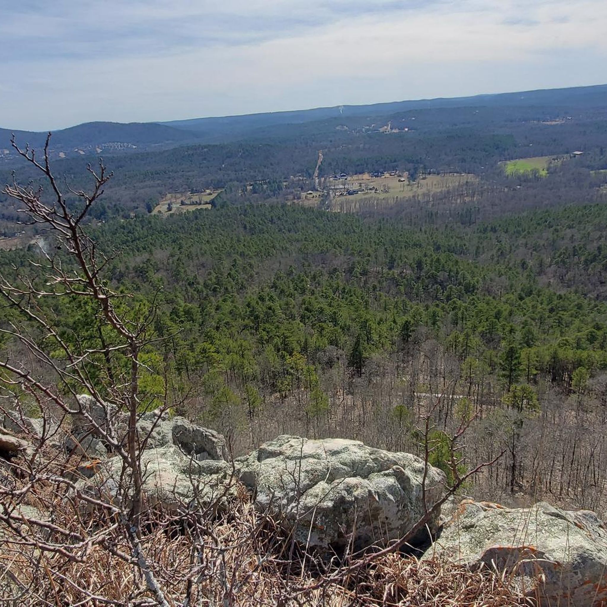
Popular overlook in the park easily accessed from the Dynamite trail. Great views of the Maumelle River and the terrain of the park.
0
0
Frequently Asked Questions
How many mountain bike trails are available in Faulkner County?
Faulkner County offers nearly 20 mountain bike trails, catering to various skill levels. You'll find a good mix of easy, moderate, and difficult routes to explore.
Are there mountain bike trails suitable for beginners in Faulkner County?
Yes, Faulkner County has several beginner-friendly mountain bike trails. For an easy ride, consider the Main Current MTB Trail loop from Crystal Hill, which is about 13.8 km long. Another option is the Pinnacle Mountain State Park loop, a shorter 3.7 km route ideal for practicing flat cornering, similar to the 'Bunny Slope' mentioned in regional information.
What are some challenging mountain bike trails in Faulkner County?
For experienced riders seeking a challenge, the Dickson Overlook loop from Little Maumell River is a difficult 48.3 km trail with significant elevation gain. Another demanding option is the Jackfork Loop, a 15.5 km difficult route with varied terrain.
Are there any mountain bike trails with scenic views in Faulkner County?
Many trails in Faulkner County offer scenic views, often passing near lakes and rivers. The region's diverse landscapes, including wooded sections and rolling hills, provide picturesque backdrops for your ride. Trails around Pinnacle Mountain State Park, such as the Fulk Mountains loop, offer natural landscapes to enjoy.
Are there any loop mountain bike routes in Faulkner County?
Yes, many mountain bike routes in Faulkner County are loops, providing a convenient way to start and end your ride at the same point. Examples include the Main Current MTB Trail loop from Crystal Hill and the Mountainbike loop from Rattlesnake Ridge Natural Area.
What do other mountain bikers say about the trails in Faulkner County?
The mountain bike trails in Faulkner County are highly regarded by the komoot community, with an average rating of 5.0 stars. Riders often praise the diverse trail systems and the blend of challenging and beginner-friendly options available within scenic landscapes.
What natural attractions can I explore near the mountain bike trails in Faulkner County?
Faulkner County offers several natural attractions. You can visit Lake Conway, one of the largest man-made lakes, or Beaverfork Park Lake for swimming and fishing. Hendrix Creek Reserve also provides walking trails and boardwalks with views of local wildlife and diverse greenery.
Are there any historical sites or parks near the mountain biking areas?
Yes, Cadron Settlement Park is a 150-acre park on the National Register of Historic Places, offering hiking trails, picnic areas, and historical exhibits with views of the Arkansas River. It's a great spot to visit after your ride.
Are there any multi-use trails in Faulkner County that mountain bikers can use?
Yes, the Tucker Creek Trail offers a less popular but accessible green difficulty singletrack that is multi-use. Mountain bike trails also run alongside the paved Tucker Creek Trail for much of its length, providing options for different types of rides.
Where can I find more information about cycling in Conway, Arkansas?
For additional information about cycling routes and resources in the Conway area, you can visit the official tourism website: visitconway.org.
Are there any moderate mountain bike trails in Faulkner County?
Yes, there are moderate options for mountain bikers. The Fulk Mountains loop from Pinnacle Mountain State Park is a popular moderate 20.2 km path, offering a balanced challenge. Another moderate route is the Arkansas River Trail – Big Dam Bridge loop, which spans 42.9 km.
What kind of terrain can I expect on mountain bike trails in Faulkner County?
Faulkner County's mountain bike trails feature diverse terrain. You can expect wooded sections, rolling hills, and areas near lakes and rivers. Some trails, like Enders Fault North Loop, have technical, rocky sections and creek crossings, while others, like Pompe Park Flow Trail, are designed with flow, berms, rollers, and jumps.
Most popular routes in Faulkner County

Get inspired with the komoot mobile app


Explore more
Browse the best MTB trails in other regions.
