The best walks and hikes in Wood County
4.7
(11)
100
hikers
25
hikes
Hiking in Wood County, Ohio, features a network of trails primarily characterized by easy to moderate terrain. The region offers routes through metroparks and along river systems, providing accessible outdoor experiences. Elevation gains are generally minimal across the available hiking trails. The landscape often includes wooded sections and riverside paths.
Best hiking trails in Wood County
- The most popular hiking route is Swan Creek Walk & Bike Path loop — Swan Creek Preserve Metropark, a 3.4 miles (5.4 km) trail that takes 1 hour 23 minutes to complete. This easy route features gentle elevation gain through a preserve setting.
- Another top favourite among local hikers is Bend View Overlook via Towpath Trail — Farnsworth Metropark, a moderate 6.3 miles (10.1 km) path. This trail follows the Towpath Trail, offering views of the river.
- Local hikers also love the Side Cut Metropark loop, a 2.6 miles (4.3 km) trail leading through parkland, often completed in about 1 hour 4 minutes.
- Hiking in Wood County is defined by accessible metropark trails, riverside paths, and wooded areas. The network offers options for different ability levels, with a focus on easy to moderate routes.
- The routes in Wood County are highly rated by the komoot community with an average score of 4.6 stars from over 10 reviews. More than 100 hikers have used komoot to explore Wood County's varied terrain.
Last updated: July 8, 2026
1
hikers
1.37km
00:21
0m
0m
Embark on an easy hike through Middlegrounds Metropark, a peaceful urban oasis offering tranquil views of the Maumee River. As you walk, you can watch freighters glide by and enjoy close-up perspectives of the downtown Toledo skyline, including the iconic Anthony Wayne Bridge. This short route covers 0.8 miles (1.4 km) with a minimal elevation gain of just 11 feet (3 metres), making it perfect for a quick outing. The well-maintained, paved paths ensure a smooth and enjoyable experience, taking approximately 20 minutes to complete.
Middlegrounds Metropark is highly accessible, making it an excellent choice for families and those with strollers. The paved paths are easy to navigate, ensuring a comfortable experience for everyone. You can bring your furry companions along, as the park features a dedicated off-leash dog area. Consider visiting during daylight hours to fully appreciate the river and city views. Parking is generally available on-site, providing convenient access to the trailhead.
This park stands out as an urban sanctuary, providing a unique blend of natural beauty and cityscapes. It offers a quiet escape right in the heart of Toledo, allowing you to connect with nature without leaving the city. The park's design thoughtfully integrates lush greenery with its industrial surroundings, creating a harmonious environment for all visitors.
9.81km
02:29
20m
10m
Towpath Trail offers an easy 6.1-mile hike through historical sites like Providence Park and along the Maumee River.

Sign up for free
26.8km
06:45
40m
20m
Hike the 16.6-mile Wabash Cannonball Trail North Fork: Monclova - Delta, a difficult route through Oak Openings Preserve Metropark.
4.26km
01:05
20m
0m
The Maumee River Trail offers a refreshing escape into nature, tracing the banks of the State Scenic Maumee River. You'll experience a mix of terrain, from paved paths in park areas to crushed stone and dirt sections that wind through a healthy, forested corridor. The continuous river views are a highlight, and the tree-lined paths provide ample shade, making it a pleasant experience for a casual walk or a family outing.
This easy hiking route covers 2.6 miles (4.3 km) with just 63 feet (19 metres) of elevation gain, typically taking about 1 hour and 5 minutes to complete. Many access points are available through various Metroparks, which often include parking and basic amenities. It's a great option for a relaxed hike any time of day, though mornings can be particularly serene.
The Maumee River area is rich in history, with trails often traversing segments of the former Miami & Erie Canal, where you might spot old locks or dams. The region's designation as a State Scenic River in 1974 underscores its natural beauty and ecological importance, providing a habitat for diverse wildlife within the broader Oak Openings Region.
22.8km
05:44
20m
10m
Hike the 14.2-mile Slippery Elm Trail in Wood County, Ohio, a challenging route through diverse rural landscapes and natural oases.
881m
00:13
0m
0m
Hike the easy 0.5-mile St. John's Meadow and Wetland Loop through diverse wetland and meadow habitats, perfect for a quick nature escape.
12
hikers
4.25km
01:04
10m
10m
The Side Cut Metropark loop offers a delightful and easy hiking experience, perfect for a relaxed outing. This 2.6-mile (4.3 km) route features a minimal 19 feet (6 metres) of elevation gain and takes about 1 hour and 4 minutes to complete. You'll journey through varied scenery, from tranquil pine plantations and vibrant open prairies to lush floodplain forests, often with picturesque views of the Maumee River. The highlight for many is encountering the historic Side Cut Canal Locks, which add a unique cultural dimension to your walk.
Planning your visit to Side Cut Metropark is straightforward, with ample parking available at the trailheads. This is a fantastic option for family friendly hiking, as the park provides amenities like restrooms, picnic tables, and a playground. Consider visiting in late summer for the best wildflower displays in the prairies, or during spring and fall for prime birdwatching, making it a great choice for a pleasant afternoon outdoors.
Side Cut Metropark holds significant historical value as the oldest Metropark in the Toledo area, preserving three original locks from the Miami and Erie Canal. Beyond its history, the park is a haven for wildlife, particularly known for birdwatching, especially during migration, and you might even spot deer. The diverse ecosystems, including rare alvar habitats along the Maumee River Ledges, make it a unique natural gem in the region.
5.0
(1)
11
hikers
10.1km
02:34
20m
20m
Hike the moderate 6.3-mile Towpath Trail in Farnsworth Metropark, enjoying river views and natural scenery, with a gentle 63 feet of elevati
5
hikers
6.07km
01:32
10m
10m
Hike the easy 3.8-mile Buckeye Trail Loop in Providence Metropark, exploring historic towpaths and sites like the Isaac Ludwig Mill.
12
hikers
5.32km
01:22
20m
20m
Easy hike. Great for any fitness level. Easily-accessible paths. Suitable for all skill levels.
Get access to more routes and recommendations from other explorers.
Sign up for free
Already have an account?
Our route recommendations are based on thousands of hikes, rides, and runs completed by other people on komoot.
Start today with a free account
Your next adventure awaits.
Login or Signup





Tips from the Community


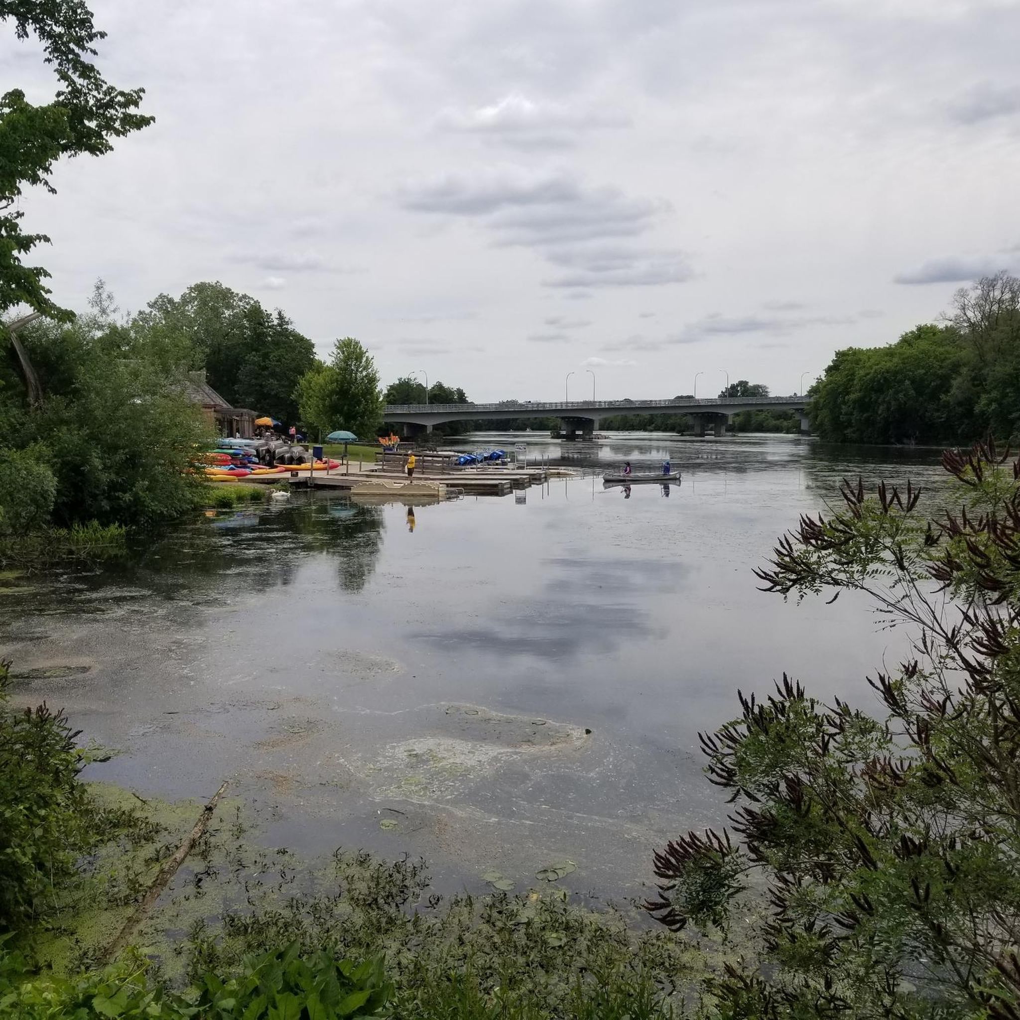
The Maumee River starts at the confluence of the St. Joseph and St. Mary's rivers in Fort Wayne, Indiana, and empties into Maumee Bay at Lake Erie, covering over 6,500 square miles. It is the largest drainage basin in the Great Lakes Watershed and was named an Ohio State Scenic River on July 18, 1974. During springtime, the largest migrations of river-bound walleyes east of the Mississippi make their way up the river, attracting thousands of anglers from all over the country.
0
0

Monclova is a small town on the outskirts of Toledo, Ohio. It is home to the Fallen Timbers Battlefield Metropark, and is the meeting point of the north and south forks of the Wabash Cannonball Trail.
0
0

This dam made the river upstream more navigable. The trail between the Metro Parks was originally built for miles pulling canal boats.
1
0
Nestled at the base of the Anthony Wayne Bridge, this park is an urban oasis. The 28 acres of green space, in combination with a half mile of riverfront shoreline, creates a breathtaking and tranquil setting in the heart of the city.
0
0
The Maumee River is the focal point of downtown Toledo and is what makes its riverfront so fantastic. Not only is it a vital part of port shipping in the city, but its beauty and size also set the stage for many restaurants, hotels, parks, trails, and water recreation activities. This impressive river is worth stopping to admire its beauty.
0
0
This unique park is steeped in history, offering visitors a chance to step back in time to the canal days of 1876. The park is situated along the original section of the Miami and Erie Canal, featuring a museum and an authentic canal boat with trails to explore in a charming riverside setting.
0
0
The Towpath Trail runs from Providence Metropark to South River Road near Missionary Island. The views are beautiful, with several picnic areas, parks, restrooms, and water fountains along the path. If you want to extend your hike, Bend View Metropark is four miles from here along this route, with an exceptional overlook boasting panoramic views of the Maumee River.
0
0
Frequently Asked Questions
How many hiking trails are there in Wood County?
Wood County offers a selection of 14 hiking routes, primarily located within its metroparks and along river systems. These trails provide accessible outdoor experiences for various fitness levels.
What is the typical terrain like for hiking in Wood County?
Hiking in Wood County generally features easy to moderate terrain with minimal elevation changes. You'll find paths winding through metroparks, wooded areas, and along river systems, offering a mix of natural and managed landscapes.
Are there any family-friendly hiking options in Wood County?
Yes, Wood County is very family-friendly, with 13 out of its 14 routes rated as easy. Trails like the Swan Creek Walk & Bike Path loop or the Side Cut Metropark loop are excellent choices for outings with children, offering gentle paths through parkland.
Can I bring my dog on the hiking trails in Wood County?
Many metroparks in Wood County are dog-friendly, typically requiring dogs to be on a leash. It's always best to check specific park regulations before you go, but generally, you'll find opportunities to enjoy the trails with your canine companion.
Are there any circular hiking routes available?
Yes, many of the trails in Wood County are designed as loops, making them convenient for hikers. Examples include the Swan Creek Walk & Bike Path loop and the Providence Metropark loop, allowing you to start and end at the same point.
What kind of natural features or viewpoints can I expect to see?
Wood County's trails often feature wooded sections and riverside paths. For example, the Bend View Overlook via Towpath Trail offers scenic views of the river, while other routes provide tranquil experiences within preserve settings.
What is the best time of year to go hiking in Wood County?
Hiking in Wood County is enjoyable throughout the year. Spring brings blooming flora, summer offers lush greenery, and autumn provides beautiful fall foliage. Winter hiking can also be pleasant, especially on well-maintained paths, though conditions may vary.
What are the typical lengths of hikes in Wood County?
Hikes in Wood County vary in length, with many routes falling into the 2.5 to 6.5-mile range. For instance, the Side Cut Metropark loop is about 2.6 miles, while the Bend View Overlook via Towpath Trail extends to 6.3 miles.
What do other hikers say about the trails in Wood County?
The trails in Wood County are highly rated by the komoot community, with an average score of 4.6 stars from 10 reviews. Hikers often praise the accessibility, well-maintained paths, and the peaceful natural settings found within the metroparks.
Are there any easy trails suitable for beginners?
Absolutely. The vast majority of trails in Wood County are rated as easy, making them ideal for beginners or those seeking a relaxed walk. Routes like the Glass City Metropark loop or the Middlegrounds Metropark loop are excellent starting points.
Are there amenities like cafes or restrooms near the trails?
Many metroparks in Wood County offer amenities such as restrooms and picnic areas. While specific cafes or pubs might not be directly on every trail, the parks are often located near towns like Bowling Green or Toledo, where you can find various dining options and facilities.
Where can I find parking for the hiking trails?
Most metroparks in Wood County provide designated parking areas for trail access. It's advisable to check the specific park's website or komoot tour details for precise parking locations before your visit.

Get inspired with the komoot mobile app


Didn’t find what you were looking for?
Check out more Hikes throughout Wood County below and find the perfect route in your destination.
Explore more
Browse the best Hikes in other regions.
