The best walks and hikes around Area A (Malaspina/Toba)
4.7
(19)
196
hikers
14
hikes
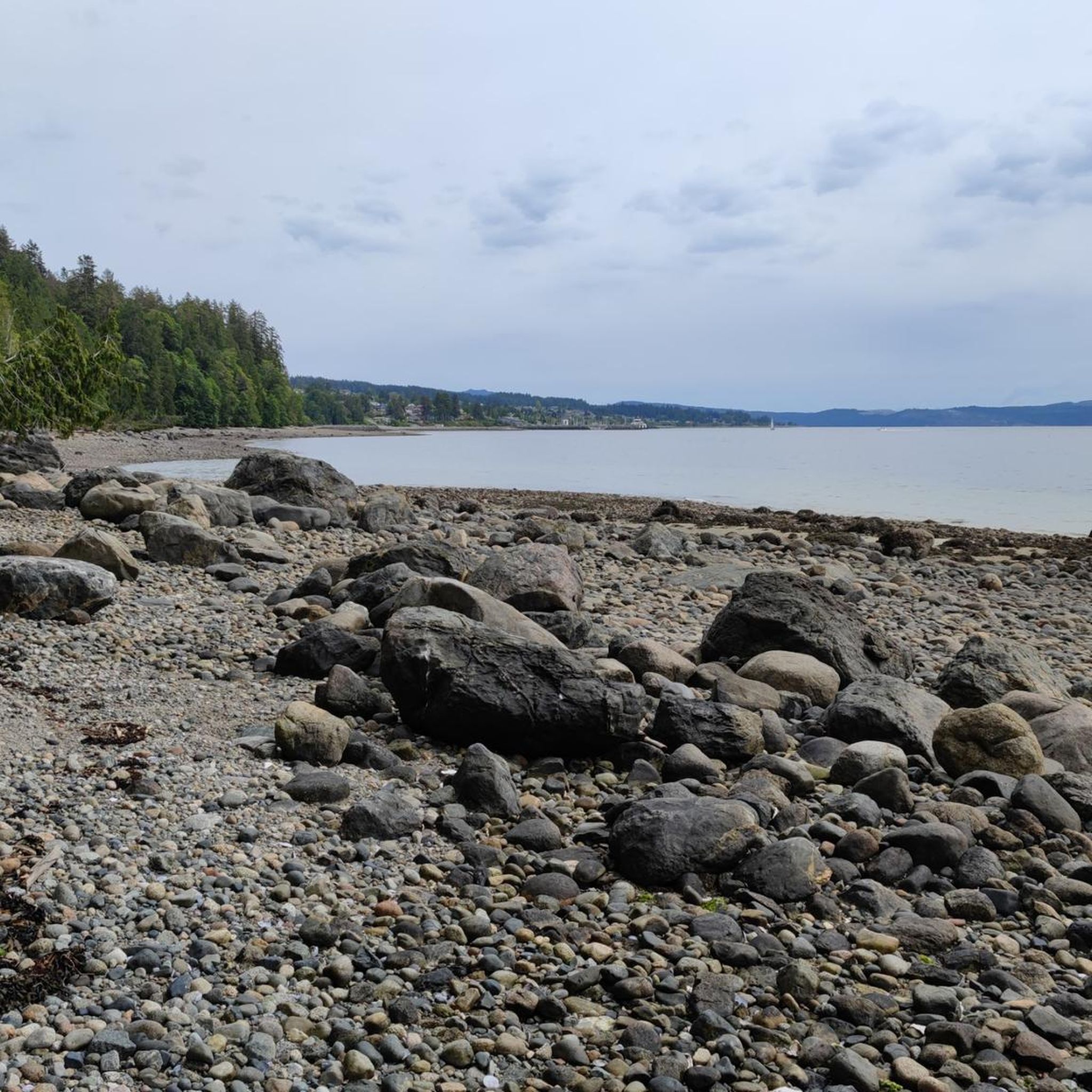
Hiking around Area A (Malaspina/Toba) offers diverse landscapes, from coastal environments to dramatic fjord-like terrain. The Malaspina Peninsula features shore pines, arbutus trees, and old-growth forests, with low-elevation coastal trails providing views of Desolation Sound. Further north, Toba Inlet is characterized by towering glacier peaks, steep mountain slopes, and cascading waterfalls feeding into turquoise waters. This region within the Coast Mountain Range includes subzones of Coastal Western Hemlock, Mountain Hemlock, and Alpine Tundra.
Best hiking trails around Area A (Malaspina/Toba)
…Last updated: October 6, 2026
13
hikers
18.4km
06:32
1,070m
1,070m
Hard hike. Very good fitness required. Easily-accessible paths. Suitable for all skill levels.
15
hikers
4.96km
01:20
60m
60m
Easy hike. Great for any fitness level. Easily-accessible paths. Suitable for all skill levels.

3.5
(2)
8
hikers
1.05km
00:19
40m
40m
Easy hike. Great for any fitness level. Easily-accessible paths. Suitable for all skill levels.
2
hikers
2.61km
00:47
90m
90m
Easy hike. Great for any fitness level. Easily-accessible paths. Suitable for all skill levels.
1
hikers
7.41km
02:10
210m
210m
Moderate hike. Good fitness required. Easily-accessible paths. Suitable for all skill levels.
Get access to more routes and recommendations from other explorers.
Already have an account?
Our route recommendations are based on thousands of hikes, rides, and runs completed by other people on komoot.
Start today with a free account
Your next adventure awaits.
Popular around Area A (Malaspina/Toba)
Tips from the Community

The very start of this trail seems innocent enough, heading into the woods on a dirt footpath — but it gets serious quickly. Although the trail isn't technical, it's steep enough that most people will be happy to have the occasional rope or handrail for support.
0
0
It's a short, steep haul to the plentiful viewpoints atop Valentine Mountain. Here, you'll have unparalleled views looking out over Powell River and the Salish Sea.
0
0

On the Kingfisher Trail, this narrow wooden bridge through the forest is a lovely spot to pause and enjoy the quiet, enclosed feel of the trees. It adds a bit of adventure to the walk, with a boardwalk-style crossing.
0
0
At this spot on the Kingfisher Trail, you'll find several picnic benches nestled in the shade of the woodland, perfect for taking a relaxing break.
0
0

Tin Hat Hut sits at the halfway point of the Sunshine Coast Trail on the summit of Tin Hat Mountain, with 360-degree views of Powell Lake, the Coast Mountain range, the Strait of Georgia, and Vancouver Island to the west. The hut, built by volunteers in 2011, sleeps 10 and includes a pellet stove, an outhouse, picnic tables, and a fire pit. It’s free to stay on a first-come, first-served basis with no permits required, making it a great overnight destination whether you are doing a day hike or a longer section of the trail.
0
0
This is the former site of the old Fiddlehead Farm, a remote rainforest retreat that people from around the world once visited before it was logged and demolished in 2002. The meadow and a still-functioning orchard are all that remain of this once-thriving community, and in the fall, you may even find some tasty apples on the trees if you beat the local bears to them. It’s a great place to take a break, walk through the meadow, and enjoy the surroundings before continuing on the trail.
1
0

The Appleton Creek Recreation Site is home to hiking trails, backcountry huts, a well-known swimming hole, picnic tables, and access to multiple waterfalls nearby. The forest is comprised of towering trees, giving cool shade, and the sound of water from the creeks and rivers.
2
0
This is the junction where the Sunshine Coast Trail splits off to a spur trail where, 518 meters away, sits the Appleton Creek Campsite. The campsite is simple and surrounded with old-growth Douglas firs, offering a handful of tenting spots, a picnic table, and a pit toilet.
1
0
Frequently Asked Questions
How varied are the hiking trails in Area A (Malaspina/Toba)?
Area A offers a diverse range of hiking experiences, from coastal paths with ocean views to rugged backcountry and fjord-like mountain landscapes. You'll find trails suitable for various skill levels, including 3 easy routes and 5 moderate routes. The region features low-elevation coastal trails, old-growth forests, and more challenging sections with steep inclines and roots, particularly on the Malaspina Peninsula and within the Coast Mountain Range.
Are there any trails that feature lakes or scenic viewpoints?
Yes, several trails offer beautiful lakes and scenic viewpoints. The Inland Lake loop is a moderate 13.2 km trail that navigates around the tranquil Inland Lake. Another popular option is the Wednesday Lake – Manzanita Bluffs and Shelter loop, which passes by Wednesday Lake and provides views from the Manzanita Bluffs and Shelter.
What do other hikers enjoy most about Area A (Malaspina/Toba)?
The hiking trails in Area A are highly rated by the komoot community, with an average score of 4.9 stars from over 10 reviews. Hikers often praise the diverse landscapes, from the coastal beauty of the Malaspina Peninsula to the dramatic fjord scenery of Toba Inlet, and the opportunity to experience pristine wilderness.
When is the best time of year to go hiking in Area A?
The best time to hike in Area A is generally during the warmer months, from late spring through early fall. This period offers more stable weather conditions, making coastal trails and higher elevation routes more accessible. Toba Inlet's glacial melt waters create spectacular turquoise colors in summer. Winter hiking conditions can be challenging, especially in the more rugged, higher elevation areas of the Coast Mountain Range.
Are there family-friendly hiking options in Area A?
Yes, there are family-friendly hiking options, particularly among the easier and moderate trails. The Powell Hill loop from Scout Mountain is an easy 4.5 km trail that can be completed in about 1 hour 26 minutes, making it suitable for families. The Inland Lake loop is also a moderate option that many families enjoy.
Can I bring my dog on the hiking trails in Area A?
While many trails in British Columbia are dog-friendly, it's always best to check specific regulations for each park or trail, especially within provincial parks or protected areas. Generally, dogs are permitted on leash on many trails in the Malaspina Peninsula, but Toba Inlet's remote wilderness and significant grizzly bear population might make it less suitable for dogs, particularly in certain seasons. Always practice responsible pet ownership and be aware of wildlife.
Are there options for backcountry camping or huts along the trails?
Yes, backcountry camping is available. Malaspina Park, located in the Desolation Sound area, offers marine-accessible backcountry camping with designated campsites like Sarah Point and Anthony Island Campsite. These are part of a larger system of 11 designated campgrounds. Additionally, you can find huts such as the Manzanita Bluffs and Shelter and the Tin Hat Hut, which can provide shelter on longer routes like the Sunshine Coast Trail.
What kind of wildlife can I expect to see while hiking?
The region is rich in wildlife. Along the Malaspina Peninsula, you might spot sea lions, seals, bald eagles, ravens, and herons. Toba Inlet is particularly known for its significant grizzly bear population, especially along riverbeds. Other wildlife in Toba Inlet includes killer whales, sea lions, seals, dolphins, deer, mink, raccoons, and black bears. Always maintain a safe distance and be bear-aware.
Are there any circular walks available in Area A?
Yes, several trails in Area A are designed as circular walks, offering a complete loop experience. The Inland Lake loop is a popular 13.2 km circular route. Another option is the Wednesday Lake – Manzanita Bluffs and Shelter loop, which is a 12.0 km circular path. For a shorter option, consider the Powell Hill loop from Scout Mountain, an easy 4.5 km loop.
What are the typical landscapes and natural features I'll encounter?
You'll encounter a striking contrast of landscapes. The Malaspina Peninsula features coastal environments with shore pines, arbutus trees, and old-growth forests of Douglas Fir and giant western red cedar. Further north, Toba Inlet offers dramatic fjord-like scenery with towering glacier peaks, steep mountain slopes, and numerous cascading waterfalls plunging into turquoise waters. The region is part of the Coast Mountain Range, including subzones of Coastal Western Hemlock, Mountain Hemlock, and Alpine Tundra.
Are there any waterfalls to see in Area A?
Yes, Toba Inlet is particularly known for its dramatic waterfalls. The fjord-like landscape is distinguished by steep mountain slopes from which numerous cascading waterfalls plunge into the emerald waters below. These are fed by glacial melt, creating a spectacular sight, especially during the summer months.
How accessible are the trailheads by public transport or car parking?
While specific public transport options to all trailheads might be limited due to the region's wilderness character, many popular trailheads, especially on the Malaspina Peninsula, offer parking facilities. For instance, trails around Inland Lake Provincial Park or near Powell River generally have designated parking areas. Toba Inlet, being more remote, is largely inaccessible by car, often requiring boat or floatplane access for deeper exploration.
Most popular routes around Area A (Malaspina/Toba)
Most popular attractions around Area A (Malaspina/Toba)

Get inspired with the komoot mobile app


Explore more
Browse the best Hikes in other regions.
